
Where Flight Simulation Enthusiasts Gather from Around the World!
AVSIM Library - Search Results

| Category: Flight Simulator 2004 - Scenery | |
| Greece SRTM Mesh Part 2 |

|
File Description:
This terrain mesh scenery covers Greece, including all Aegean sea islands, plus most parts of Albania and Macedonia up to 41°50'N. Some parts of Bulgaria and Turkey are also included in northern and eastern boundaries of the mesh. The greek island of Crete isn't part of this mesh because SRTM data isn't yet released for the whole island.
Based on SRTM Data (3 arcsec, 90m), generated with Matthew Styles's program "SRTM To BGL v1.04", sampled to LOD9 resolution (76m). While only tested with Fs2004, this mesh should also run with FS2002.
This part contains all bgl files except Greece-N.bgl, Greece-NE1.bgl and Greece-NE2.bgl. See Greece_Mesh_Part2-1.jpg for details.
| Filename: | Greece_SRTM_Mesh_Part_2.zip |
| License: | Freeware |
| Added: | 10th November 2003, 02:09:45 |
| Downloads: | 10,928 |
| Author: | Yohann Baptiste |
| Size: | 18.54 MB |
| Category: Flight Simulator X - Scenery | |
| FSX British Columbia Airfields 1-3 For Default Scenery |
|
File Description:
60 British Columbia airfields/seaplane bases with surrounding scenery like lakes, landclass etc.. These sceneries are for the FSX default scenery, i.e. a scenery that does not have enhancements like Ultimate Terrain or ORBX which correct or add e.g. lakes, towns etc.
However, I do use additional freeware mesh sceneries, which are the "FSX Canada 19M Terrain Mesh" parts 1 and 2 by Raimundo Taburet (LOD 11) and the North America/Canada mesh from "FreeMesh X Global 1.0" (LOD 10). But in principle my sceneries should work with any mesh.
All files are named by their ICAO ID, so you can easlily remove any airfiled that you don't need or don't like.
| Filename: | FSX_British_Columbia_Airfields_13_For_Default_Scen.zip |
| License: | Freeware |
| Added: | 20th November 2020, 05:32:29 |
| Downloads: | 178 |
| Author: | Detlev J. Rohmer |
| Size: | 196.16 KB |
| Category: Flight Simulator 2004 - Aircraft Repaints, Textures and Modifications | |
| Lansa Airlines Fokker / Fairchild Friendship F-27A (Old Colors) |
|
Images related to this file:
File Description:

Old F-27A, of Lansa Airlines, with the colors of the 80s, before being absorbed by Islena Airlines in the 90s. In 2009 reappears again but with a slight change in the step of being original name "Linea Aerea Nacional SA" to "Linea Aerea Nacional de Honduras SA" this occasion with smaller planes like the Cessna 402C and maintaining their base at the airport of La Ceiba.
| Filename: | Lansa_Airlines_Fokker__Fairchild_Friendship_F27A_O.zip |
| License: | Freeware |
| Added: | 5th April 2010, 23:48:29 |
| Downloads: | 123 |
| Author: | Luis A. Flores |
| Size: | 157.31 KB |
| Category: Flight Simulator 2004 - AI Flight Plans | |
| TACA Regional |
|
File Description:
dustEagle's AI Traffic - TACA Regional group (winter 2003). Almost perfect AI schedule for Aeroperlas (Panama), INTER (Guatemala), Islena (Honduras), La Costeña (Nicaragua) and Sansa (Costa Rica). These airlines operate regional flights within their respective countries. The fleet consists of ATR-42's, Shorts, Twin Otters and Cessna 208B's. In total flights for 26 aircraft are included.
In addition there are AfCAD's for several of the served airstrips.
| Filename: | TACA_Regional.zip |
| License: | Freeware, limited distribution |
| Added: | 7th March 2004, 18:08:30 |
| Downloads: | 2,730 |
| Author: | Daan Callaerts |
| Size: | 24.21 KB |
| Category: Flight Simulator 2004 - Scenery | |
| Centre Bush Aerodrome - NZCB |
|
Images related to this file:
File Description:
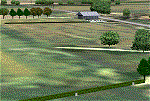
Small New Zealand aerodrome, 22nm north of Invercargill, Southland. Made to fit Christian Stock's NZ 20m mesh.
| Filename: | Centre_Bush_Aerodrome__NZCB.zip |
| License: | Freeware |
| Added: | 17th April 2012, 22:13:32 |
| Downloads: | 162 |
| Author: | Godfrey Tier |
| Size: | 476.1 KB |
| Category: Flight Simulator 2002 - Scenery | |
| Seattle, WA - High Resolution Terrain Mesh |
|
File Description:
Seattle, Washington area. The modest terrain in the Seattle area provides a nice example of a less obvious benefit of high resolution terrain mesh. The rendering of many small features missing entirely in the default mesh provides much richer detail and a greater sense of realism. (30m source -> 38.2m final).
| Filename: | Seattle_WA__High_Resolution_Terrain_Mesh.zip |
| License: | Freeware, limited distribution |
| Added: | 4th July 2002, 13:32:39 |
| Downloads: | 3,621 |
| Author: | Steve Greenwood |
| Size: | 3.75 MB |
| Category: Flight Simulator 2004 - Scenery | |
| Brazil MESH Flatten Correction SBBH |
|
File Description:
Mesh correction at Pampulha Lake at Belo Horizonte SBBH. This Flatten BGL correct aproach at Runway 13, a big slope in front of runway 13. Now you can land safe. Just for use with Brazil Mesh Scenery. Don't use with FS default scenery! Enjoy your VFR flight. By Cesar Marinho
| Filename: | Brazil_MESH_Flatten_Correction_SBBH.zip |
| License: | Freeware |
| Added: | 25th October 2005, 14:03:49 |
| Downloads: | 2,090 |
| Author: | Cesar Marinho |
| Size: | 2.62 KB |
| Category: Flight Simulator 2004 - Scenery | |
| Masterton, New Zealand vs.2 |
|
File Description:
Version 2. 07July 08. Added windsocks, radio-controllers meet, aerial & shack, holding points,lights on main taxiway, fence by aero club. This replaces previous version.
Made to fit Christian Stock's NZ 20-mesh and Topo. Don't know what it would be like with the 75-mesh - probably hopeless with default scenery.
| Filename: | Masterton_New_Zealand__vs2.zip |
| License: | Freeware |
| Added: | 6th July 2008, 20:24:15 |
| Downloads: | 559 |
| Author: | Godfrey Tier |
| Size: | 3.54 MB |
| Category: Flight Simulator 2004 - Scenery | |
| Alps LOD10 Topo Mesh - Switzerland and France |
|
Images related to this file:
File Description:
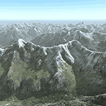
Yet another terrain mesh package of the European Alps? Well, this one is different in that it is NOT primarily based on the Shuttle Radar (SRTM) data with their incomplete coverage of prominent peaks and ridges. Instead, most of the source data for this project were developed over many months by Jonathan de Ferranti using detailed topographic maps. While Jonathan's work is unrelated to flight simulation he kindly gave me permission to compile his data for use in FS. The result is a wonderful improvement in detail and accuracy over any existing SRTM- or DTED-based mesh file, freeware or commercial (a link to an extensive set of screenshot comparisons is included in the read-me file).
I've compiled the source data at LOD10 (38-m) grid resolution because the coverage area is smaller than most existing mesh files. Thus, anyone can use these files without having to first uninstall their current mesh set. Also included are LOD9 and LO8 buffer mesh files. Note: if you own Switzerland Professional with its high-resolution terrain mesh then you don't need this package, at least not the Switzerland files!
| Filename: | Alps_LOD10_Topo_Mesh__Switzerland_and_France.zip |
| License: | Freeware, limited distribution |
| Added: | 30th May 2010, 09:51:03 |
| Downloads: | 59,010 |
| Author: | Holger Sandmann, Jonathan de Ferranti |
| Size: | 50.03 MB |
| Category: Flight Simulator 2004 - Scenery | |
| Alps LOD10 Topo Mesh - Austria and Italy |
|
Images related to this file:
File Description:
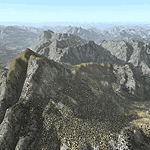
Yet another terrain mesh package of the European Alps? Well, this one is different in that it is NOT primarily based on the Shuttle Radar (SRTM) data with their incomplete coverage of prominent peaks and ridges. Instead, most of the source data for this project were developed over many months by Jonathan de Ferranti using detailed topographic maps. While Jonathan's work is unrelated to flight simulation he kindly gave me permission to compile his data for use in FS. The result is a wonderful improvement in detail and accuracy over any existing SRTM- or DTED-based mesh file, freeware or commercial (a link to an extensive set of screenshot comparisons is included in the read-me file).
I've compiled the source data at LOD10 (38-m) grid resolution because the coverage area is smaller than most existing mesh files. Thus, anyone can use these files without having to first uninstall their current mesh set. Also included are LOD9 and LO8 buffer mesh files. Note: if you own Austria Professional 2004 with its 1:50,000 scale terrain mesh then you don't need this package!
| Filename: | Alps_LOD10_Topo_Mesh__Austria_and_Italy.zip |
| License: | Freeware, limited distribution |
| Added: | 30th May 2010, 09:46:58 |
| Downloads: | 62,965 |
| Author: | Holger Sandmann, Jonathan de Ferranti |
| Size: | 73.32 MB |


© 2001-2026 AVSIM Online
All Rights Reserved
Privacy Policy |