
Where Flight Simulation Enthusiasts Gather from Around the World!
AVSIM Library - Search Results

| Category: Prepar3D V5 - Scenery | |
| ETM12m v2 AO - Enhanced Terrain Mesh 12m v2 for ANGOLA vol.07 |

|
Images related to this file:
File Description:
This is an Enhanced Terrain Mesh SRTM 0,41 arc sec (12,50 meters) resampled at LOD 11 (FSX/P3D SDK). This replaces all my previous one terrain meshes. Mainly the area covered by this terrain mesh is related to the Angola. Scenery Add-On for FSX/P3D (All versions).
| Filename: | ETM12m_v2_AO__Enhanced_Terrain_Mesh_12m_v2_for_ANG.zip |
| License: | Freeware |
| Added: | 3rd October 2020, 17:05:56 |
| Downloads: | 134 |
| Author: | Giovanni Miduri |
| Size: | 152.31 MB |
| Category: Prepar3D V5 - Scenery | |
| ETM12m v2 AO - Enhanced Terrain Mesh 12m v2 for ANGOLA vol.08 |
|
Images related to this file:
File Description:
This is an Enhanced Terrain Mesh SRTM 0,41 arc sec (12,50 meters) resampled at LOD 11 (FSX/P3D SDK). This replaces all my previous one terrain meshes. Mainly the area covered by this terrain mesh is related to the Angola. Scenery Add-On for FSX/P3D (All versions).
| Filename: | ETM12m_v2_AO__Enhanced_Terrain_Mesh_12m_v2_for_ANG.zip |
| License: | Freeware |
| Added: | 3rd October 2020, 17:06:09 |
| Downloads: | 65 |
| Author: | Giovanni Miduri |
| Size: | 142.05 MB |
| Category: Prepar3D V5 - Scenery | |
| ETM12m v2 AO - Enhanced Terrain Mesh 12m v2 for ANGOLA vol.09 |
|
Images related to this file:
File Description:
This is an Enhanced Terrain Mesh SRTM 0,41 arc sec (12,50 meters) resampled at LOD 11 (FSX/P3D SDK). This replaces all my previous one terrain meshes. Mainly the area covered by this terrain mesh is related to the Angola. Scenery Add-On for FSX/P3D (All versions).
| Filename: | ETM12m_v2_AO__Enhanced_Terrain_Mesh_12m_v2_for_ANG.zip |
| License: | Freeware |
| Added: | 3rd October 2020, 17:06:17 |
| Downloads: | 55 |
| Author: | Giovanni Miduri |
| Size: | 128.3 MB |
| Category: Prepar3D V5 - Scenery | |
| ETM12m v2 AO - Enhanced Terrain Mesh 12m v2 for ANGOLA vol.10 |
|
Images related to this file:
File Description:
This is an Enhanced Terrain Mesh SRTM 0,41 arc sec (12,50 meters) resampled at LOD 11 (FSX/P3D SDK). This replaces all my previous one terrain meshes. Mainly the area covered by this terrain mesh is related to the Angola. Scenery Add-On for FSX/P3D (All versions).
| Filename: | ETM12m_v2_AO__Enhanced_Terrain_Mesh_12m_v2_for_ANG.zip |
| License: | Freeware |
| Added: | 3rd October 2020, 17:06:24 |
| Downloads: | 68 |
| Author: | Giovanni Miduri |
| Size: | 147.98 MB |
| Category: Prepar3D V5 - Scenery | |
| ETM12m v2 AO - Enhanced Terrain Mesh 12m v2 for ANGOLA vol.11 |
|
Images related to this file:
File Description:
This is an Enhanced Terrain Mesh SRTM 0,41 arc sec (12,50 meters) resampled at LOD 11 (FSX/P3D SDK). This replaces all my previous one terrain meshes. Mainly the area covered by this terrain mesh is related to the Angola. Scenery Add-On for FSX/P3D (All versions).
| Filename: | ETM12m_v2_AO__Enhanced_Terrain_Mesh_12m_v2_for_ANG.zip |
| License: | Freeware |
| Added: | 3rd October 2020, 17:06:30 |
| Downloads: | 72 |
| Author: | Giovanni Miduri |
| Size: | 153.9 MB |
| Category: Prepar3D V5 - Scenery | |
| ETM12m v2 AO - Enhanced Terrain Mesh 12m v2 for ANGOLA vol.12 |
|
Images related to this file:
File Description:
This is an Enhanced Terrain Mesh SRTM 0,41 arc sec (12,50 meters) resampled at LOD 11 (FSX/P3D SDK). This replaces all my previous one terrain meshes. Mainly the area covered by this terrain mesh is related to the Angola. Scenery Add-On for FSX/P3D (All versions).
| Filename: | ETM12m_v2_AO__Enhanced_Terrain_Mesh_12m_v2_for_ANG.zip |
| License: | Freeware |
| Added: | 3rd October 2020, 17:06:37 |
| Downloads: | 77 |
| Author: | Giovanni Miduri |
| Size: | 175.11 MB |
| Category: Flight Simulator 2002 - Scenery | |
| Quebec Terrain Mesh (1/5) |
|
File Description:
Re-uploaded file. New resolution (76m) terrain mesh of province of Quebec, Canada, covering longitude W58 to W80 and latitude N45 to N53. This resolution terrain mesh is based on SRTM-3 (90m) digital elevation models, resampled to LOD of 09 (76m). Five parts: qclod09a.zip, qclod09b.zip, qclod09c.zip, qclod09d.zip, qclod09e.zip.
| Filename: | Quebec_Terrain_Mesh_15.zip |
| License: | Freeware, limited distribution |
| Added: | 11th May 2010, 21:26:59 |
| Downloads: | 6,752 |
| Author: | Gilles Gauthier |
| Size: | 18.26 MB |
| Category: Flight Simulator 2004 - Scenery | |
| SKMZ La Nubia Airport - Manizales, Colombia |
|
File Description:
SKMZ La Nubia airport, Manizales, Colombia. Based on pictures and videos. Use of a mesh (e.g. 2002/2004 Colombia mesh by Raimondo Taburet available at flightsim.com) is highly recommended as the airport is in a mountaineous region and difficult to approach, but scenery should also work with default scenery.
| Filename: | SKMZ_La_Nubia_Airport__Manizales_Colombia.zip |
| License: | Freeware |
| Added: | 4th February 2012, 18:19:18 |
| Downloads: | 1,142 |
| Author: | Detlev J. Rohmer |
| Size: | 16.05 MB |
| Category: Flight Simulator 2004 - Scenery | |
| Polikhnitos |
|
File Description:
The default Polikhnitos airport isn't placed correctly and causes "plateaus" problems with high resolution mesh. A plateaus problems is when you have a default airport badly placed and mesh installed that has a higher resolution than the default mesh you will have airports at the bottom of a crater or on a "Ayers rock". This scenery fixes the problem and allows you to use meshes up to 38m. Not tested with higher resolution, I don't think meshes of 19m exist for that region.
| Filename: | Polikhnitos.zip |
| License: | Freeware |
| Added: | 14th July 2007, 10:20:16 |
| Downloads: | 619 |
| Author: | Jean-paul Marchetti |
| Size: | 896.7 KB |
| Category: Flight Simulator X - Scenery | |
| Northeast New Jersey 5 Meter Mesh Terrain |
|
Images related to this file:
File Description:
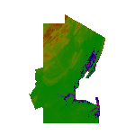
High Resolution Northeast New Jersey 5 Meter Mesh Terrain by Wally-Bob represents a significant improvement over FSX default 38 meter mesh terrain. The results are also dramatic compared to 10 meter compressed payware mesh as lossless compression compilation (read no data loss) is used. Lossless compiling produces renderings that have the Crispness of the Real World Terrain. Fly the Hudson River and view the Palisades as they are in real life, see the screen shots enclosed. High Quality 5 meter mesh terrain is a must have for mountainous areas especially where photo scenery is also used to render the virtual world. Manual includes FSX configuration and scenery installation tips. USGS LiDAR 1/9 Arc-Second source data.
| Filename: | Northeast_New_Jersey_5_Meter_Mesh_Terrain.zip |
| License: | Freeware, limited distribution |
| Added: | 26th February 2011, 21:35:52 |
| Downloads: | 1,101 |
| Author: | Walter Roberts |
| Size: | 135.89 MB |


© 2001-2026 AVSIM Online
All Rights Reserved
Privacy Policy |