
Where Flight Simulation Enthusiasts Gather from Around the World!
AVSIM Library - Search Results

| Category: Prepar3D V1-4 - Scenery | |
| Airport Kassel EDVK |

|
Images related to this file:
File Description:
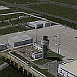
The 5th version of this Add-On for P3Dv4 approaches the reality with photo-realistic ground textures, accurate buildings, runways, taxiways and the official approaches with waypoints, localizers and glide paths. More than 1200 objects, 60 individual scenery-models, approx. 100 custom ground polygons and lines have been created. One big problem was to adopt the terrain mesh to fit the new airport. The actual state of January 2019 has been adapted to the scenery. Photorealistic ground textures have been reworked. High resolution textures you find at the aprons and the vehicle parking areas at the General Aviation and Business Terminals. Accurate Night Lighting and winter textures have been added. All buildings, Hangars and a lot of objects have been designed individually (no library objects). Even the taxiway and apron markings are hand-made. For FSX and P3Dv1 a different version can be downloaded. Works with VFR Germany and ORBX Northern Germany,
| Filename: | Airport_Kassel_EDVK.zip |
| License: | Freeware, limited distribution |
| Added: | 9th February 2019, 19:40:06 |
| Downloads: | 2,798 |
| Author: | Albert Claudi |
| Size: | 105.16 MB |
| Category: Flight Simulator 2002 - Scenery Design | |
| Ground2K for Beginners |
|
File Description:
Newly revised for Ground2K version 4
Ground2K version 4 by Christian Fumey is a very easy to use design tool for Flight Simulator terrain scenery. With it, you can create and modify coasts, roads, rivers, lakes, islands, land and water class, altitude mesh, and textured ground polygons.
This short user guide is meant for beginners, and presents some basic concepts concerning Flight Simulator terrain, and a step-by-step explanation of some of the principal functions of Ground2K.
No technical terms are used here, for ease of comprehension.
An HTML document for universal compatibility.
New sections include:
- expanded coverage of basic concepts and functions;
- common problems and errors with solutions;
- glossary of terms
Very sorry - no support is offered for this guide. For any questions, please consult the AvSim forum dedicated to Flight Simulator scenery design.
| Filename: | Ground2K_for_Beginners.zip |
| License: | Freeware |
| Added: | 24th July 2003, 15:24:13 |
| Downloads: | 5,659 |
| Author: | Luis, Scenery Design Fourm |
| Size: | 1.3 MB |
| Category: Flight Simulator 2004 - Scenery | |
| Fascene Airport - Nosy Be Island, Madagascar |
|
Images related to this file:
File Description:
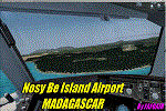
In Italy the poltical situation is very caotic! what is better of an exotic place for a time of relax? :-) With this scenery, I wanted to recreate as much as possible the area of the airport "Fascene" located in Nosy Be Island in Madagascar. To do it, i used the srtm mesh Madagsacar by Mr Jean laurent gabriel that you will find already in the scenery. If you have already installed these meshes need to remove them. The scenery, faithfully recreates the terminal, and therefore there is a generic airport using the Bgl Mr. Visan. for the rest, using the real video and real photo, I tried to recreate the atmosphere of the island, which is certainly very exciting to work with a landing jetliner. If so you're tired of the usual ILS landing in mega hub of Europe, a nice Visual land in Nosy Be, is for you!
Best regards from Italy by Fabio "Fafo Air" Ferrari
| Filename: | Fascene_Airport__Nosy_Be_Island_Madagascar.zip |
| License: | Freeware |
| Added: | 26th February 2013, 06:49:34 |
| Downloads: | 1,639 |
| Author: | Fabio Ferrari |
| Size: | 40.42 MB |
| Category: Flight Simulator 2004 - Scenery | |
| MNPC Puerto Cabezas, Nicaragua |
|
Images related to this file:
File Description:
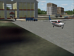
Googly scenery for MNPC Puerto Cabezas - a small international
airport in Nicaragua for which no facilities are provided in Microsoft Flight
Simulator 2004. These scenery files create the airport and add taxiways, aprons,
buildings and other airport features, so that you and your "AI" traffic can land,
taxi, park and take off in a realistic manner.
The airport, with its new Rigoberto Cabezas terminal opened in 2000, serves the
city of Puerto Cabezas and is surrounded by beautiful beaches and lush scenery.
Unfortunately, the country of Nicaragua has been embroiled in civil unrest almost
continuously since it became an independent republic in 1838, most of which is funded and fuelled by other countries seeking to interfere with Nicaragua's politics. For this reason, the country has no national airline or international flights of its own - the major powers refuse to accept its currency - and commercial traffic is confined to local flights operated by small craft from adjoining countries like those of Atlantic Airlines de Honduras and TACA Regional.
Fortunately, in Flight Simulator you do not need to worry about world politics
and you will be assured of a "virtual" welcome when you call in here. Please
say a small prayer for world peace when you do.
The scenery does not purport to be ultra-accurate. Based on high-detail satellite
imagery from Google Earth, the layout is proportionally correct but the added
airport features, such as buildings, are built from default Microsoft objects
and add-on libraries so will not look exactly like the real thing.
You are not obliged to download and install any additional scenery libraries,
but to enjoy this scenery in its entirety, you may wish to. It will work fine,
with or without. [File re-uploaded at request of AVSIM]
| Filename: | MNPC_Puerto_Cabezas_Nicaragua.zip |
| License: | Freeware |
| Added: | 28th May 2010, 20:36:10 |
| Downloads: | 1,150 |
| Author: | John Hinson |
| Size: | 67.63 KB |
| Category: Flight Simulator X - Miscellaneous Files | |
| US & Canadian Coast Guard AI Boat Traffic V1 |
|
Images related to this file:
File Description:
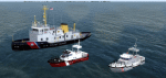
This is a paint and traffic file addition to go along with Henrik Nielsen's Global AI Ship Traffic.
These files have been tested to operate properly in FSX and P3Dv3. The textures are in .dds format for FSX and P3D.
The routes have been made with the consideration of using ORBX Vector, ORBX NA landclass and Pilots 2008 mesh products.
9 of the US Coast Guard's Bay Class icebreaker tugs are represented.
21 Canadian Coast Guard 47 foot motor life boats from the Quebec\Atlantic sectors and the British Columbia sector, along with 13 motor life boats of the US Coast Guard First District (New England) are represented.
4 ship traffic files allow all vessels to appear in the scenery.
Hendrik Nielsen's USCG Bay Class model and Jean-Pierre Fillion's Motor Life Boat model are included. Both Hendrik Nielsen and Jean-Pierre Fillion have given permission to include their ship/boat models with the project and I thank them greatly.
Four ship traffic files allow all vessels to appear in the scenery.
Please see the 'ReadMe' file first.
| Filename: | US__Canadian_Coast_Guard_AI__Boat_Traffic_V1.zip |
| License: | Freeware |
| Added: | 12th February 2019, 22:27:55 |
| Downloads: | 925 |
| Author: | Joe Bowers |
| Size: | 11.07 MB |
| Category: Flight Simulator X - Scenery | |
| NZOP- Opotiki Aerodrome (VectorLandClass, New Zealand) |
|
Images related to this file:
File Description:
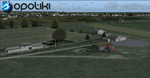
Opotiki aerodrome (ICAO: NZOP) is a small airstrip outside the township of of Opotiki, the gateway to the beautiful East coast of the North Island of New Zealand. Opotiki itself sits at the confluence of the Waioeka and Otara rivers and is surrounded by dairy farmland and Kiwifruit orchards with large areas of native bush to the south and east.
This scenery accompanies Tim Barnes'�� series of other small Bay of Plenty aerodromes (Whakatane,
Galatea, Waihi Beach) for use with VectorLandClass- It features custom modelled and textured buildings, large coverage of beautiful 0.5m aerial photography (fully auto-genned and including seasonal and night variations) and extensive use of high quality objects from the free VLC library. Installation of the library V1.1+ is required for this scenery to work properly and can be downloaded from the VectorLandClass website (www.vectorlandclass.co.nz)
This release, although not requiring it, works best with VectorLandClass topographic mesh and landclass addon covering all 268676 square kilometers of New Zealand. If you'��re not a VLC customer, you'��ll notice when the photoreal coverage runs out!
| Filename: | NZOP_Opotiki_Aerodrome_VectorLandClass_New_Zealand.zip |
| License: | Freeware, limited distribution |
| Added: | 21st February 2013, 13:52:47 |
| Downloads: | 969 |
| Author: | Tim Barnes |
| Size: | 146.68 MB |
| Category: Flight Simulator X - AFCAD Files | |
| PAOT - Wien Meml - Kotzebue, Alaska |
|
Images related to this file:
File Description:
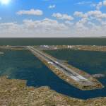
This AFCAD of the airport Wien Meml - Kotzebue (PAOT), Alaska, fixes some issues for Scenery Solution's UTX Alaska users who want to use mesh and texture resolutions better than 38 m and 1 m, respectively. Unfortunately this discloses some additional problems with lagoons surrounding runway 09/27. Some of the ponds had been elevated over apron level, the fence Microsoft had drawn around the airport ran through (elevated) water and so on. Runway 27 has no direct connection to the mainland like it is realized by UTX and furthermore a lot of water polygons (including the lagoons) had 'forgotten' shore line vectors. Included corrections are: fixed main waterpolygons around the airport (according to Google Maps), fixed airport layout, including aprons, GA parking, additional airport buildings (default FSX objects), fixed Runway designators (now 09/27 resp. 18/36 instead of 08/26 and 17/37, Nov. 2013), added shoreline vectors (compatible to UTX textures) and some more.
Again, THIS AFCAD IS INTENDED FOR USERS OF UTX ALASKA ONLY and will likely look horrible in other environments as it partially amends missing features only.
| Filename: | PAOT__Wien_Meml__Kotzebue_Alaska.zip |
| License: | Freeware, limited distribution |
| Added: | 3rd February 2014, 14:30:10 |
| Downloads: | 410 |
| Author: | Axel Birsul |
| Size: | 1.09 MB |
| Category: Flight Simulator X - AFCAD Files | |
| Coombs Airport (7NJ7), NJ |
|
File Description:
Located 04 miles NE of Elmer, New Jersey, Coombs Airport is a private turf field 2000' in length wilth clear 20:1 approach and departure at each end of the runway. You'll find some surrounding buildings but they are all located several hundred yards from the runway. This is a good strip to keep in mind for emergencies if you're in the area. You will be landing on terrain so having your mesh complexity set as high as possible is recommended. This airport is not lit at night, daytime VFR operations only are suggested. There are no transient services offered.
Scenery constructed with use of satellite images/streetview/aerial photos - the author has not been there in person.
This scenery is meant to be used in conjunction with MegaScenery Earth New Jersey/Delaware 004. It is not required, but apron use is minimized to allow satellite scenery to show through as much as possible, and objects are placed based on the MSE textures - lack of it may make scenery look out of place.
| Filename: | Coombs_Airport_7NJ7_NJ.zip |
| License: | Freeware |
| Added: | 16th February 2011, 00:03:55 |
| Downloads: | 191 |
| Author: | Drew Sikora |
| Size: | 756.22 KB |
| Category: Flight Simulator X - AFCAD Files | |
| Rainbow's End Airport (JY39), NJ |
|
File Description:
Located 07 miles S of Salem, New Jersey on 20 acres of land, Rainbow's End Airport is a private turf strip 2200' in length. There are no services for transient aircraft and the airport is not lit at night, so daytime VFR operations only are recommended. If you have an aircraft with 40' or less of wingspan you can start at one of the parking spaces east or west of the runway by the hangars. Otherwise it is suggested you start on the runway. There is no hard surfaced runway so set your terrain mesh as high as possible.
Scenery constructed with use of satellite images/streetview/aerial photos - the author has not been there in person.
This scenery is meant to be used in conjunction with MegaScenery Earth New Jersey/Delaware 005 & New Jersey/Delaware 004. It is not required, but apron use is minimized to allow satellite scenery to show through as much as possible, and objects are placed based on the MSE textures - lack of it may make scenery look out of place.
| Filename: | Rainbows_End_Airport_JY39_NJ.zip |
| License: | Freeware |
| Added: | 12th May 2011, 00:58:29 |
| Downloads: | 173 |
| Author: | Drew Sikora |
| Size: | 626.46 KB |
| Category: Flight Simulator 2002 - Scenery | |
| Alaska Bush Scenery: Stony River Bend & Old Stony |
|
File Description:
Here's your big chance to take-off and land using a curved airstrip. Stony River Bend is located just west of Merrill Pass, very close to Tom Fica's cabin at Two Lakes (part of his 'Merrill Pass' scenery add-on). The bumpy dirt runway - becoming slightly overgrown and prone to waterlogging - is marked out with wooden posts (lit at night) and presents a unique challenge: one that I haven't really sorted out just yet! There's a small settlement just up a log-lined trail from the airfield with a gravel service track connecting with a basic NDB/DME facility to help out with night or low visibility approaches. Although Stony River Bend is fictional, it has been based loosely on a real life runway at Elk City in Idaho. Three miles downstream is another simple backwoods strip called Old Stony - the narrow gravel runway here is conventional, but it's probably in an even worse state of repair. Designed for use with Eddie Denney's FS2002 mesh of Alaska, but the scenery is usable without it.
| Filename: | Alaska_Bush_Scenery_Stony_River_Bend__Old_Stony.zip |
| License: | Freeware, limited distribution |
| Added: | 31st March 2003, 13:09:28 |
| Downloads: | 1,873 |
| Author: | James Belk |
| Size: | 2.04 MB |


© 2001-2026 AVSIM Online
All Rights Reserved
Privacy Policy |