
Where Flight Simulation Enthusiasts Gather from Around the World!
AVSIM Library - Search Results

| Category: Flight Simulator 2004 - Scenery Design | |
| ResampleTools V.095Beta |

|
File Description:
ResampleTools is a great little utility that helps you automate the import of Mesh or Photo Real scenery into
Flight Simulator 200x. The interface is a simple 4 or 6 step wizard depending
on what you are importing and the information you have about your source files.
FS Resample Tools can help you determine the extents of your bitmap source if
you don't already know them (all four corners in degrees) and will also
determine the CellX and CellY sample or pixel width from those corner extents among others.
This is a beta version and there will be no more updates as work on this tool stoped a while ago but the author has been kind enough to allow distribution to all who might enjoy using it,(note: this may have been replaced by Elronds "imagetool" also available soon in this library).
Works with FS2000/FS2002 and FS2004.
| Filename: | ResampleTools_V095Beta.zip |
| License: | Freeware, limited distribution |
| Added: | 21st September 2003, 18:50:03 |
| Downloads: | 1,621 |
| Author: | Elrond Elvish |
| Size: | 728.39 KB |
| Category: Flight Simulator 2004 - Scenery | |
| The Victoria Falls of the Zambezi River, Zambia/Zimbabwe |
|
File Description:
One of the main landmarks of Africa, the spectacular Victoria Falls of the Zambezi River are missing in out-of-the-box FS. With a local SRTM LOD9 mesh as a base (included) and the help of satellite imagery, maps, Ground2K4, and GMax, we did our best to model a realistic representation of the falls, the river, and the gorge, complete with custom waterfall and spray effects. The portion of the Zambezi covered in this project extends from E25 to E26.5 (more than 100km), with the falls at its center. Also included is a replacement landclass file for an area of about 20km on either side of the Zambezi River and an optional AI boat (by Lynn and Bill Lyons) cruising on the Zambezi above the falls. Tested with FS2004 only but most scenery enhancements (not the AI boat) should work just as well in FS2002.
| Filename: | The_Victoria_Falls_of_the_Zambezi_River_ZambiaZimb.zip |
| License: | Freeware, limited distribution |
| Added: | 8th May 2004, 02:45:30 |
| Downloads: | 19,147 |
| Author: | Holger Sandmann and Johan van Wyk, Aeroworx |
| Size: | 3.5 MB |
| Category: Flight Simulator 2004 - Scenery | |
| BFU Brooks |
|
File Description:
With BFU Brooks, BFU enters the faraway bush country of northern Alaska. Located at Coldfoot in the southern foothills of the Brooks mountains, this base will cater to the needs of visitors to the area, and of sportsmen who indulge in hunting and fishing. This scenery package consists of three sceneries: our new northern base BFU Brooks, Moose Camp and Moose Lodge. The camp sits in the mountains on a small lake, whereas the lodge is situated on the shore of a large lake. Visitors are flown into Coldfoot from Fairbanks, then on to the camp or lodge as desired. Moose Camp and Moose Lodge will not show on the GPS, and of course do not have an NDB or similar to guide you. You'd better start in the camp/lodge, and fly toward Coldfoot to get to know the area. The sceneries have only been tested with the default mesh.
| Filename: | BFU_Brooks.zip |
| License: | Freeware |
| Added: | 30th September 2003, 15:17:31 |
| Downloads: | 5,318 |
| Author: | Naji Chehabeddine |
| Size: | 2.96 MB |
| Category: Flight Simulator 2004 - Scenery | |
| Airstrips of Southern Germany |
|
Images related to this file:
File Description:
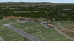
The next my Western Europe airstrips project, herewith about 170 small airfields, mostly in Baden-Wurttemberg and Bavaria, each enhanced with buildings, taxiways, parking spaces and aprons as appropriate, to further facilitate the generation of lightweight AI traffic in the area, without overloading the more major airfields.
Again, there's no photo-realism here, just a selection of basic 'generic' buildings, more or less accurately sized and placed to reflect the airfield layout as seen on on-line satellite imagery and aerial photography. These buildings have minimal effect on frame-rates, so are ideal for this kind of job. The airfields are aligned as well as possible with the roads etc. in UT Europe and the Genesis Europe mesh, but should mostly be fine in a default installation or other configuration.
Please read the rest of this "blurb" in the included text file. There may be some details of note or interest.
| Filename: | Airstrips_of_Southern_Germany.zip |
| License: | Freeware |
| Added: | 25th December 2024, 20:54:30 |
| Downloads: | 131 |
| Author: | Chris Eve |
| Size: | 2.84 MB |
| Category: Flight Simulator X - Scenery | |
| Airport Kassel EDVK |
|
Images related to this file:
File Description:
The 5th version of this Add-On for FSX approaches the reality with photo-realistic ground textures, accurate buildings, runways, taxiways and the official approaches with waypoints, localizers and glide paths. More than 1200 objects, 60 individual scenery-models, approx. 100 custom ground polygons and lines have been created. One big problem was to adopt the terrain mesh to fit the new airport. The actual state of January 2019 has been adapted to the scenery. Photorealistic ground textures have been reworked. High resolution textures you find at the aprons and the vehicle parking areas at the General Aviation and Business Terminals. Accurate Night Lighting and winter textures have been added. All buildings, Hangars and a lot of objects have been designed individually (no library objects). Even the taxiway and apron markings are hand-made. For P3D a different version can be downloaded. Works with VFR Germany and ORBX Northern Germany.
| Filename: | Airport_Kassel_EDVK.zip |
| License: | Freeware, limited distribution |
| Added: | 30th June 2019, 16:37:37 |
| Downloads: | 11,929 |
| Author: | Albert Claudi |
| Size: | 105.46 MB |
| Category: Flight Simulator 2004 - Scenery | |
| Revised East Vancouver Islands - compatible with vicenh05 |
|
File Description:
These files are a revision of the default Vancouver Island shorelines and landclass textures from Chemainus to Campbell River, British Columbia. Included are the islands from the Southern Gulf Islands to Texada Island and inland to Cowichan Lake. Most of the smaller lakes within 20 km of the shoreline have been redrawn as well. In this version shorelines have been revised to match Jon Patch & Holger Sandman's vicenh05.zip. As well major corrections for the shorelines in LOD5 area 117-114, Comox, have been made so that the shorelines now conform to the 38.2m mesh and to Vern Opperman's CFB - Comox version 042. Shoreline types are changed to look more like the Pacific Northwest courtesy of Holger Sandman's who made his shoreline textures for vicenh05 available. Also in this version no roads are included since complete British Columbia roads in bcroadsys.zip are now available.
| Filename: | Revised_East_Vancouver_Islands__compatible_with_vi.zip |
| License: | Freeware, limited distribution |
| Added: | 8th October 2005, 20:17:46 |
| Downloads: | 3,928 |
| Author: | Harvey Janszen |
| Size: | 346.85 KB |
| Category: Flight Simulator 2004 - Scenery | |
| Tokyo Bay 2005 |
|
Images related to this file:
File Description:
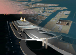
FS2004 Scenery Tokyo Bay Scenery 2005 Ver. 5.0
This add-on scenery improves specific scenerys (Tokyo Bay, Japan) of FS2004.
There are a lot of reclaimed land in Tokyo Bay.
They form an artificial peculiar coastline. This scenery reproduces these coastlines precisely.
And, this scenery reproduces the Keihin industrial area and the Keiyo industrial area in Tokyo Bay located west and east. In this scenery design, the coastline was reproduced as exactly as possible, following the specification of FS2004.
Moreover, 90m mesh geographical data is reproduced by using SRTM 3arc/sec.
The range of detailed coastline and 90m digital elevation data is as follows:
** [detailed coastline] N33:45 E138:45 to N36:55 E141:05 (included Izu Islands)
** [90m digital elevation data] N33:00 E138:00 to N37:00 E141:00 --
The Tokyo Wan AquaLine is arranged in the exact location. By Kazuo Kawamura
| Filename: | Tokyo_Bay_2005.zip |
| License: | Freeware, limited distribution |
| Added: | 3rd December 2011, 23:51:31 |
| Downloads: | 11,794 |
| Author: | Kazuo Kawamura |
| Size: | 9.74 MB |
| Category: Flight Simulator 2004 - Scenery | |
| Kerkira Airport Enhancement |
|
File Description:
This is old scenery which has been updated for FS2004 and enhances the visual environment of Ionian sea island airport of Kerkira, also known as Corfu. Its part of my “Greek Airfields” package that currently is not fully compatible with FS2004 since MS decided to move the airports in Greece and elsewhere to adjacent positions and ASD, which I use for placing these objects, is not compatible with FS2004. Here you will find airport & terrain enhancements for Hellenic airport of Kerkira LGKR that make it look closer to the real one; hotels, runway turning bay, perimeter fences, windsocks, radio antennae, new approach radar antenna to the southwest and most importantly, an exclusion of autogen scenery that is wrongfully generated on each side of the runway. A big difference is attributed to Babis Peribolas’s Kerkira mesh terrain that is included in this scenery. Scenery includes the necessary ASD 2.1 textures.
| Filename: | Kerkira_Airport_Enhancement.zip |
| License: | Freeware, limited distribution |
| Added: | 4th September 2003, 02:23:06 |
| Downloads: | 12,183 |
| Author: | Kyprianos Biris |
| Size: | 1.94 MB |
| Category: Flight Simulator 2004 - Scenery | |
| South West Islands, Japan and Taiwan Ver.3.0 |
|
Images related to this file:
File Description:
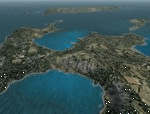
FS2004 Scenery SWIJT2004 Ver 3.0 (South West Islands, Japan and Taiwan)
These files improve specific scenerys (South West Islands of Japan and Taiwan, Asia) of FS2004. Included islands: Ohsumi Islands, Tokara Islands, Amami Islands, Okinawa lands, Kerama-Kume Islands, Miyako Islands, Yaeyama Islands and Taiwan Island.
In this scenery design, the coastline was reproduced as exactly as possible, following the specification of FS2004. Moreover, 90m mesh geographical data is reproduced by
using SRTM 3arc/sec. Correction of missing holes is perfect.
==NOTAM== I exhibited "SWIJ2k4.zip" on August 26, 2004.
However, it became clear that some of files of "SWIJ2k4" are infringing on the opyright of Microsoft. Then, I stopped public presentation of "SWIJ2k4". I apologize for having
made you trouble to those who already downloaded "SWIJ2k4.zip". New "SWIJT2k4.zip" is vast scenery which covered South West Islands, Japan and Taiwan Island. Please install new "SWIJT2k4".
By Kazuo Kawamura
| Filename: | South_West_Islands_Japan_and_Taiwan_Ver30.zip |
| License: | Freeware, limited distribution |
| Added: | 4th December 2011, 00:05:05 |
| Downloads: | 7,750 |
| Author: | Kazuo Kawamura |
| Size: | 20.5 MB |
| Category: Prepar3D V1-4 - Scenery | |
| Square Kilometre Array (MeerKAT) – South Africa |
|
Images related to this file:
File Description:

This scenery is of the MeerKAT radio telescope site (originally the Karoo Array Telescope – KAT but was changed to MeerKAT, meer=more) when the project was expanded to 64 dishes. It forms part of an international Square Kilometre Array (SKA) project. It is situated in the Karoo near the town of Carnarvon. The scenery includes the landing strip just North East of the biggest concentration of dishes. I could not find a code for this strip and called it FAKA (MeerKAT SKA), or take off from Carnarvon (FACN) and fly a heading of 320 degrees for 73 km. The scenery was designed and tested for P3D V5 to work with the ORBX Africa LC and Pilots NG2020 mesh products. I am not sure what the actual site would look like at night, but I included some night lighting to make the array visible after dark.
| Filename: | Square_Kilometre_Array_MeerKAT__South_Africa.zip |
| License: | Freeware |
| Added: | 14th August 2020, 22:53:38 |
| Downloads: | 101 |
| Author: | Johan Pienaar |
| Size: | 20.33 MB |


© 2001-2026 AVSIM Online
All Rights Reserved
Privacy Policy |