
Where Flight Simulation Enthusiasts Gather from Around the World!
AVSIM Library - Search Results

| Category: Flight Simulator 2004 - Scenery | |
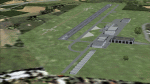
| Fort St James CYJM in British Columbia Canada |

|
Images related to this file:
File Description:
Fort St James is a small town of around 1,600 folks at the southeastern end of Stuart Lake, at the head of the Stuart River, and around 360 miles north of Vancouver and 220 miles inland from the coast. It was a long-established trading post for furs, with a permanent presence there from 1806 onwards. The airfield is 3 miles south of the town and is called "Fort St James (Perison)" in the Nav Canada listings. I presume that this is part of their trend towards calling airfields by their location rather than by their name. Makes sense as it is difficult to find information by searching for an airfield that is listed under a name you don't know. The field has an asphalt runway of 4,000 feet aligned 10-28 and at 2,364 feet ASL. There is no lighting. The main user of the airfield is Interior Helicopters Ltd. who are based there as operators, and at Williams Lake as helicopter dealers. For the AI helicopters, there is a screenshot (01) of the AS350 helicopter installation folder when it has been transformed into an AI helicopter. The process is to download and install the Ecuriel AS 350, along with the additional textures, as normal; this is straightforward. Then you download the software shown in screenshot 02 and add it as instructed and as shown in 01 so that the helicopter now operates as AI, with a different air file and a modified config file. I should have included this with the Pemberton post. I have posted this as Fort St James CYJM, but I suggest that you just add it to your previously created "BC airfields" and avoid the inevitable doubling up of common textures etc. Up to you. If you find a defect, email me.
| Filename: | Fort_St_James_CYJM_in_British_Columbia_Canada.zip |
| License: | Freeware, limited distribution |
| Added: | 23rd November 2020, 20:14:04 |
| Downloads: | 150 |
| Author: | Roger Wensley |
| Size: | 2.62 MB |
| Category: Flight Simulator 2004 - Scenery | |
| Ballina, New South Wales, Australia (YBNA) |
|
File Description:
A very attractive small airport approximately 120 nautical miles from Coffs Harbour and a slightly shorter distance to Grafton and Lismore. This makes a good stopover for hopping down the east coast of Australia. The airport handles around 11 flight a day from Sydney and is also a busy GA aiport. Airlines REX and Qantas link fly into Ballina. The size of the airport has allowed me to put in that extra detail which makes to terminal and surrounds very much "as in real life". Photographic textures are used throughout for the buildings and even the trees and shrubs are hand made macros from photographs at the airport. Thanks to the cooperation of Northern Airline Services - Mr Bruce Beesley the MD and Graeme from Ballina Council the relative position of all of the buildings are exactly to scale as shown on scale drawings of the airport. AFCAD and Traffic Tools files are included to add extra AI traffic. For that reason and because of limited apron space no static planes have been used. In addition a landclass is included to make the airport ground texture resemble the real thing and also to widen the river behind runway 24. The scenery concentrates on adding a realistic terminal to the airport and hangars which are as close as possible to the real thing. Many other details have been added all authentically Ballina. The default runway detail remain unchanged with the exception of VASI placement. Other than that the airport merges into the default scenery without the usual "green oasis" effect. Full night lighting is included plus a rather dubious attempt to model the inside of the terminal (strictly not to be taken too seriously)
| Filename: | Ballina_New_South_Wales_Australia_YBNA.zip |
| License: | Freeware |
| Added: | 25th January 2004, 19:16:25 |
| Downloads: | 5,909 |
| Author: | John Ross |
| Size: | 6.8 MB |
| Category: Flight Simulator 2004 - Scenery | |
| Kuujjuarapik CYGW in northern Quebec, Canada |
|
Images related to this file:
File Description:
Kuujjuarapik is in northern Quebec at the southern end of Hudson Bay, 90 miles east of James Bay and on the north shore of the Great Whale River; Kuujjuarapik means Small Great River in Inuktitut. Once again the Hudson Bay trading post that opened (in 1820) was the catalyst for the establishment of first a seasonal encampment and then the beginnings of a town in the late 1930's.
The two adjacent villages that now form the town have a total population (mainly Cree and Inuit) of around 1,500. When the Quebec hydo-electric project was under construction in the early 1980's a large portion of the Inuit population voted to move to a new settlement called Umiujaq (my post) 100 miles to the north.
The airport is to the west of the town, between the town and the sea. The gravel and sand runway (which I have made as gravel as there is no convincing way to mix the two) is 5,500 feet long, 150 feet wide, and aligned 17/35, which is approximately parallel to the coast. There is fuel available, both 100LL and JetA, delivered by truck. The AI included here is for Air Inuit and Wasaya, with Air Inuit making three flights per day plus a fourth flight by the Air Inuit Twotter C-GNDO that is based at the airport, and private flights by various aircraft. Yes, there really is a golf course to the south of the airport, and the last thing to note is that Kuujjuarapik has a mandatory radio frequency and that taking into consideration the scheduled flights I have included the tower radio frequency that makes this a controlled airport in FS9.
| Filename: | Kuujjuarapik_CYGW_in_northern_Quebec_Canada.zip |
| License: | Freeware, limited distribution |
| Added: | 16th February 2013, 00:33:20 |
| Downloads: | 305 |
| Author: | Roger Wensley |
| Size: | 2.8 MB |
| Category: Flight Simulator 2004 - Scenery | |
| Knight Inlet CF36 float base in British Columbia, Canada |
|
Images related to this file:
File Description:
Knight Inlet is a floating lodge that organises "nature experiences", ranging from close encounters with local grizzly bears to fishing. Knight Inlet is to the north of "the narrows" where the Inside Passage gets squeezed between the mainland and Vancouver Island, and there is a chart section attached with a pointer to the location. At the bottom of the chart is Campbell River floatbase, and to the west is Port Hardy. Knight Inlet initially runs east-west, and the lodge is tucked into a smaller north-south offshoot, close to where the main inlet turns north. The water runway here is in the middle of the north-south offshoot, though of course in reality the "runway" is wherever the wind dictates it to be. The names highlighted in green on the chart are float bases to be renovated and posted with working AI. The buoyed log boom next to the lodge is to keep escaped logs from drifting in and colliding with boats; float plane pilots keep their eyes peeled too. Because of large hills adjacent to the lodge the landing of the AI may or may not take place, depending on wind direction and whether or not they fly into rock before landing. Take off and departure are far more reliable, particularly if the wind is from the south. Most of the AI is from Vancouver Harbour, Harbour Air Otters and West Coast Air Beavers, plus a SeAir Beaver from Campbell River and a private Cessna from the nearby Minstrel Island. This is the second in a series of new and renovated float bases in BC (the first being Sproat Lake) and to cope with the AI demands FSAddon have authorised the inclusion here of a bunch of AI Otters and Beavers that were originally part of a payware scenery for the area. Thanks are due there.
| Filename: | Knight_Inlet_CF36_float_base_in_British_Columbia_C.zip |
| License: | Freeware, limited distribution |
| Added: | 23rd December 2016, 08:16:24 |
| Downloads: | 218 |
| Author: | Roger Wensley |
| Size: | 16.95 MB |
| Category: Flight Simulator 2004 - Scenery | |
| Airstrips of North-West Europe |
|
Images related to this file:
File Description:
The sales blurb for FS2004 announced the inclusion of over 23,000 airfields ... unfortunately a significant number of those consisted of little or nothing more than a runway on a flatten with a rectangular background polygon.
To enable the addition of an amount of lightweight GA AI traffic, without overloading those airfields that were designed with parking spaces and taxi-ways, (and are probably already busy), I herewith include over 140 small sceneries, of mostly default airfields, from NW France, up the English Channel and the North Sea coast through Belgium, the Netherlands and NW Germany to Denmark, all with added taxiways and parking spots, aprons, generic buildings and background polygons as appropriate, to enable AI traffic to be generated without interrupting things at the more major airports.
A few of the French airfields are "new", not included originally with FS2004, and a couple have been updated to suit more recent developments :- for example, LFES "Scaer Guiscriff" is now LFES "Bretagne Atlantique", LFOR "Chartres Champhol" is now LFOR "Chartres Metropole", EHSE "Seppe" is now EHSE "Breda International" and EKVH "Vesthimmerlands" was previously EKVH "Aars".
There's no photo-realism here, just a selection of basic 'generic' buildings, more or less accurately sized and placed to reflect the airfield layout as seen on on-line satellite imagery and aerial photography. These buildings have minimal effect on frame-rates, so are ideal for this kind of job.
The airfields are aligned as well as possible with the roads etc. in UT Europe and the Genesis Europe mesh, but should mostly be fine in a default installation or other configuration.
Please read the rest of this "waffle" in the included text file ... it might save some confusion ;)
Enjoy :)
| Filename: | Airstrips_of_NorthWest_Europe.zip |
| License: | Freeware |
| Added: | 14th June 2024, 13:44:58 |
| Downloads: | 285 |
| Author: | Chris Eve |
| Size: | 9.95 MB |
| Category: Flight Simulator 2004 - Scenery | |
| Lismore Regional Airport (YLIS) |
|
File Description:
A very attractive small airport approximately 130 nautical miles from Coffs Harbour and a slightly shorter distance to Grafton and Ballina. This makes a good stopover for hopping down the east coast of Australia. The airport handles around 7 flight a day from Sydney and is also a busy GA aiport. A new terminal is a major feature of the airport with a very modern design. This terminal was opened on Dec 9 2000 and replaces an older style building to be found in the general aviation area. The terminal is at the northern end of the aiport and the GA area the furthest south.
The size of the airport has allowed me to put in that extra detail which makes the terminal and surrounds very much "as in real life". Photographic textures are used throughout for the buildings, trees and shrubs. Thanks to the cooperation of the airport manager and Lismore Council, the owners of the airport, a very accurate model of the airport has been produced from over 250 photographs taken on site. AFCAD and Traffic Tools files are included to add extra AI traffic. For that reason and because of limited apron space few static planes have been used. In addition a landclass is included to make the airport ground texture resemble the real thing and also to widen the river and show the lake to the east of the airport..
The scenery concentrates on adding a realistic terminal to the airport and hangars which are as close as possible to the real thing. Many other details have been added all authentically Lismore.
Some night lighting is included including some very distinctive airport lights in the car park.
| Filename: | Lismore_Regional_Airport_YLIS.zip |
| License: | Freeware |
| Added: | 11th April 2004, 06:31:42 |
| Downloads: | 3,676 |
| Author: | John Ross |
| Size: | 4.21 MB |
| Category: Flight Simulator 2004 - Scenery | |
| Echo Bay CAA7 in British Columbia, Canada |
|
Images related to this file:
File Description:
This is the fifth in a series of new and renovated float bases in BC. Echo Bay is a floating marina on the northwest coast of Gilford Island, just 6 miles northwest of Health Bay (the previous post in this series). It is run by a beard called Pierre and his wife, and the food seems to attract crowds. Watch the video, and others about the marina; some of the more interesting buildings are replicated here, others are representative. There is no fuel or oil available but you can post a letter as there is a post office in the store that sells food etc to boaters. The AI is a further adaptation of the CF36 AI and involves a Baxter Beaver flying from Port Hardy on a round trip in the area through Port McNeill, Health Bay, Echo Bay, and Sullivan Bay, plus Harbour Air from Vancouver, and small GA. At Echo Bay the AI appears to work for both landing and takeoff for the Beaver and sometimes for the Otter, depending on wind direction. All of these float bases can be installed together in the same folders, with a saving in duplicate textures. So a series called BC Floats (or whatever you want to call it) or individually installed float bases; your choice. The next in the series will be Sullivan Bay, another floating marina. I have used what was a RWY12 boat here, but my RWY12 no longer includes the "Port and Sea" part that included this and other boats. Somewhere I must still have the textures as they are showing up as required, but I cannot find them to include them here. Hopefully your installation will find them on your hard drive and use them. If not, complain to me and I will attempt to demonstrate diligence.
| Filename: | Echo_Bay_CAA7_in_British_Columbia_Canada.zip |
| License: | Freeware, limited distribution |
| Added: | 18th January 2017, 17:09:19 |
| Downloads: | 203 |
| Author: | Roger Wensley |
| Size: | 6.92 MB |
| Category: Flight Simulator X - Aircraft Repaints, Textures and Modifications | |
| Consolidated PBY-5A VB-126 #20 |
|
Images related to this file:
File Description:
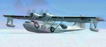
A repaint for the Aerosoft PBY-5a Catalina in the colors of PBY-5a #20 (BuNo 7277) of VB-126 as it looked during a rescue operation on the Greenland ice cap in 1943. On 5 november 1942, a C-53 en route from Iceland to Greenland was reported missing off Greenland's east coast. Four days later, a B-17F, en route for England was aked to to keep a lookout for the missing plane, but it crashed on the ice cap. The crew of suffered only minor injuries, and they soon received food and other supplies that were dropped on the ice. Unfortunately, they had landed in a heavily crevassed part of the icecap, making an evacuation difficult. On 28 november, a USCG Grumman Duck, flown by Lt Pritchard, managed to make a wheels-up landing on the ice and brought out two of the crew. The next day, a ground rescue team arrived on the dite as well, and things looked good....
One crew member and a rescuer died when their sled disappeared in a crevasse, and later the same day, Lt. Pritchard's Duck disappeared as well, with a crew of three. On 6 december, an attempt was made to evacuate the B-17's navigator, Lt. O'Hara, who suffered from gangrene in his feet. One member is the rescue party fell into an crevasse, and the motorsled they were using broke down, so the men had to dig in and wait for help. The days continued until over christmas, but morale was kept high with airdrops whenever the weather permitted. A rescue by sled became impossible however due to bad conditions and heavy snows. Lt.Col Balchen, who had used a PBY the previous summer to rescue the members of the B-17 'My Gal Sal' (currently under restoration in Ohio) of the ice, and was now in charge of the rescue operation, proposed to try the same here. The last summer, the PBY landed on a melt water lake on the icecap however, this time he wanted to belly land the PBY, and nobody knew if the hull could withstand such a battering. In the meantime, a ski-equipped T8P1 aircraft tried the same, but dispappeared over the east coast. The crew members were found five days later in a rubber dinghy. The Navy finally gave permission to try an attempt with the PBY. and two PBY-5a"s were send to airfield BW-8, to wait for the right weather. On 5 febuary 1943, Lt Bernard Dunlop succesfully bellylanded BuNo 7277 / 20 (the above paintjob) at the motorsled camp, and the three survivors were taken on board. It has frozen solid in the ice, but after two hours of hard labor, the crew managed to free the PBY and it took off. Now only the three crew members still at the original site needed to be rescued. A ground rescue party was sent to the wreck to transport the survivors to a spot where the PBY could land, but bad weather prevented any flying until 17 march. On that day, Lt. Dunlop landed on the ice, dropping off Lt.Col Balchen and the rescue party, who reached the wreck the following day. The weather closed in again until finally, on april 5th, Lt Dunlop landed his PBY for the third time on the ice cap. All hands were taken on board, but after five attempts to take off, the starboard engine caught fire. The blaze was extinguished, but repairs were necessary. The next day, they managed to take off, but without the rescue party, to lighten the load. 149 days after their crash, the B-17 crew was finally clear of the ice. It wasn't until 18 may that the last member of the rescue party was finally evacuated, making this a six and a half month rescue operation...
Repaint by Jan Kees Blom, based on the paintkit by Aerosoft
| Filename: | Consolidated_PBY5A_VB126_20.zip |
| License: | Freeware |
| Added: | 13th July 2018, 20:33:17 |
| Downloads: | 135 |
| Author: | Jan Kees Blom |
| Size: | 10.19 MB |
| Category: Flight Simulator 2004 - Panels | |
| Golovin N93 and Solomon AK26 in Alaska |
|
Images related to this file:
File Description:
Golovin is a coastal fishing village 70 miles east of Nome and around 20 miles west of Elim, with a population of under 200. The village is a check point on the Iditarod race and the name originates from a Russian admiral in the far distant past. The airfield has a gravel runway which is over 4,000 feet long; the older runway amid the village housing is still visible but not usable. The majority of flights to and from the airfield originate in Nome, but there are also others to and from nearby fields such as Elim, Unalakleet, Shaktoolik, and Koyuk. The AI includes a daily ERA flight. Most flights to villages of this size are in fact not "scheduled", but are "air taxi" being used by three or four villagers to go supermarket shopping in a larger neighbouring town, which in this case is Nome. In many cases the numbers of flights to and from a village in a year average out to one a day. There is a further scenery included here, which is Solomon AK26. Solomon is around 40 miles west of Golovin and from 1898 was suppporting a gold mining operation on the Fish and Niukluk rivers further inland at Council. Solomon, and the airfield which obviously came later, gradually faded from use in competition with Nome, leaving almost nothing behind at Solomon by the 1980's except a gravel runway and the nearby Solomon roadhouse. There are other buildings near the airfield which appear to be new and in good condition, but their function is unknown to me. The Solomon terrain modifications and grass deletion bgl's did not function until loaded in a "Top" folder; this is unusual, and may be required only in my FS9 setup or in all situations. I have no way of knowing as I can only design for my situation. A note here about my scenery making. This is post number 503 and there will not be many more to follow this as I am almost at the end of the photos I either took or found for scenery purposes. There is a limit to what can be located online and I have already been making use of the little there is; eg Unalakleet. Post 520 is unlikely. So, if you are near an airport (preferably Canadian or Alaskan) and have a camera..... Let me know.
| Filename: | Golovin_N93_and_Solomon_AK26_in_Alaska.zip |
| License: | Freeware, limited distribution |
| Added: | 5th August 2019, 16:19:07 |
| Downloads: | 82 |
| Author: | Roger Wensley |
| Size: | 4.23 MB |
| Category: Flight Simulator 2004 - Scenery | |
| Nenana Municipal Airport PANN in Alaska |
|
Images related to this file:
File Description:
Nenana is a village on the river of the same name around 40 miles west of Fairbanks, which is the second largest urban area in Alaska after Anchorage. Nenana, as a result of this proximity, is served by road and railway and unlike other Alaskan villages is not reliant on air cargo for necessities. The current population is just under 400, which is way down from its peak of 5,000 in the 1920's when gold was being mined and the railroad being built. Nenana's main claim to fame is as the starting point for the 1925 mushing delivery to Nome of the serum to combat an outbreak of diphtheria. Any Nenana Municipal Airport history is difficult to find, even the date of construction. It has two runways 3L-21R and 3R-21L, the first being asphalt and just under 5,000 feet with PAPI at both ends, the second grass and 1,800 feet. Both are lit. It also has a further water runway similarly aligned and 3,000 feet long. Maintenance is available and there is also fuel at the end of the northern apron, close to the crashed and stripped DC4 that sits among other unwanted items that are too large to make it worth the cost of moving them off the site. There are no regular scheduled flights to the airport, with air taxi or owner operated being in the majority. The scenery, in addition to the terrain, town, bridges, and airport items also modifies the terrain in an area further south where FS9 depicted as a city an Air Force base that is mainly concerned with radar and communications and in fact has very few buildings. The AI includes some Beavers on floats that were used in previous BC scenery with the kind permission of FSAddon. As I have already posted them I have not included them again here. The float plane AI uses the same radio frequency as the land based planes, but they fly to PANX and not to PANN as FS9 has problems with getting floats and wheels separated. Or maybe I just haven't worked out how to cope with FS9. A note here about my scenery making. There will not be many more to follow this as I am almost at the end of the photos I either took or found for scenery purposes, plus I expect to move on from FS9 at some point during next year.
| Filename: | Nenana_Municipal_Airport_PANN_in_Alaska.zip |
| License: | Freeware, limited distribution |
| Added: | 2nd December 2019, 18:12:42 |
| Downloads: | 154 |
| Author: | Roger Wensley |
| Size: | 7.36 MB |
© 2001-2026 AVSIM Online
All Rights Reserved
Privacy Policy |