
Where Flight Simulation Enthusiasts Gather from Around the World!
AVSIM Library - Search Results

| Category: Flight Simulator 2004 - AI Flight Plans | |
| TUI Airlines Belgium - Summer 05 (corrected 2nd version) |

|
File Description:
::: Corrected version ::: Representative and accurate charter flight plans for the summer 2005 period, which have been compiled according to the company information for the week of 4th July, 2005.
TUI Airlines Belgium (TUB) is the most important charter airline based in Belgium, flying with its own fleet which includes: 1 Fokker 100 (OO-TUF), 3 Boeing 737-400 (OO-TUA, OO-TUB, OO-TUI), 2 Boeing 737-800W (OO-VAC, OO-VAS), and 1 Boeing 767-300ER (OO-TUC).
In addition for the summer, TUB is wet leasing two 737's from Futura International Airways, also operating under the "Beauty" callsign.
As for all charter company, flights differs from one week to one another but this file comprises its main destinations regularly visited throughout the summer period.
They are currently flying from its main base Brussels-National (as well as from the belgian regional airports of Liège and Oostende) to many various medium- and long-haul destinations:
Agadir, Alicante, Almeria, Araxos, Athens, Burgas, Cagliari, Cairo, Cancun, Catania, Chania, Chios, Djerba, Dubrovnik, Faro, Fuerteventura, Funchal, Girona, Gran Canaria, Hurghada, Ibiza, Iraklion, Jerez, Kerkira, Kos, Lanzarote, La Palma, Luxor, Mahon, Malagà, Malta, Marrakech, Marsa Alam, Mitilini, Monastir, Montego Bay, Murcia, Mykonos, Napoli, Pafos, Palermo, Palma de Mallorca, Puerto Plata, Punta Cana, Rhodos, Samos, Santorini, Sharm-el-Sheikh, Tabarka, Tanger, Tarbes, Tenerife-Sur, Toulon, Tunis, Varadero, Varna, and Zakinthos.
Other destinations such as Corsica, Tunisia and Turkey are jointly operated with partner airlines such as SN Brussels Airlines, MNG, Thomas Cook, Karthago and Tunis Air, but not included here.
Schedule files fully compatible with Traffic Tools by Lee Swordy (available on this site). Enjoy...
| Filename: | TUI_Airlines_Belgium__Summer_05_corrected_2nd_vers.zip |
| License: | Freeware |
| Added: | 3rd June 2005, 17:58:36 |
| Downloads: | 2,248 |
| Author: | Jean-Philippe DELWICHE |
| Size: | 10.03 KB |
| Category: Flight Simulator X - Scenery | |
| YKBR Kalbarri, Western Australia (VERSION 3) and townsite |
|
File Description:
YKBR Kalbarri includes a townsite where there was none in FSX and the entire mouth of the estuary and immediate coastline - The airport was rebuilt in 2001 replacing the old Kalbarri Strip. The Kalbarri Airport, 10km east of Kalbarri on the Kalbarri-Ajana Road, is a jointly owned by the Shires of Northampton and Greenough. The Airport was funded by both Shires, the State Government and significant contributions were also received from Arkona Holdings and Westralia Airports Corporation. The total cost of the construction is approximately $1.7 million. The Airport was officially opened on the 22nd September 2001 by the Hon. Michelle Roberts. The fee to land at the Kalbarri Airport is $15.00. This can be paid at the airport or Shire office in Kalbarri at the Allen Centre on Grey Street. Private aircraft can be parked permanently at the airport. There is a fee of $264.00 per annum and is payable in lieu of any landing fee. Skywest provide RPT services������������ from Perth������������ and Carnarvon������������ on Friday, Saturday and Sunday. REQUIRES Blencowe_LibraryKit.zip
REQUIRES blencowe_librarykit_309494.zip (Available HERE)
| Filename: | YKBR_Kalbarri_Western_Australia_VERSION_3_and_town.zip |
| License: | Freeware |
| Added: | 28th February 2013, 13:51:38 |
| Downloads: | 270 |
| Author: | Alan Blencowe |
| Size: | 4.95 MB |
| Category: Flight Simulator 2004 - Scenery | |
| Dervio scenery - Como lake Italy |
|
Images related to this file:
File Description:

Scenery homage to a beautifull little town in north of Como lake of Italy; builded-up mainly with some existing objects and some buildings sintax made. It DOES NOT INCLUDE any airport, but represents only some pictures of Dervio town, reachable from Como Idroscalo floating airport or Samolaco or Sondrio Caiolo airports (closest ones); this is one of the moorings of Navigazione del Lago di Como. Informations: Dervio is one of the beautiful towns on north east area of Como lake, on a handland created by Varrone river. North and closed to the town, you can find Corenno Plinio old castle and in the opposite side of the lake the S. Bernardo church; you can also have some fireworks, obviously suggested with the night. Contents:
Mooring pier at snack bar, with awning and tables; Ferryboat in the lake with some sailbots in race between two buoys; Walk alongside the shore of the lake, with benches and some fisher piers; Main church with related church house and footbal soil; Several buildings, parking area, factories, bar and restaurant with tables chairs and gazebos, gas station and cars; Rail station with a small train and road gates; Sailbots on ground inside Centro Vela Dervio area and slipway with dinghy; Little marina with boats; Public park with entering gate, covered stand and tables; Residence La Boldona bloks with buildings, swimmin pool and tennis facilities, fenced; Campsite with campers, roulottes and tents; Corenno Plinio castle with tower and S. Bernardo little church; Spread of trees in all the scenery; (night scenery)two floating platforms wiht fireworks; six wood bonfires on shore of lake and on the mountains; One big ship with some other sailboats and speedboats
| Filename: | Dervio_scenery__Como_lake_Italy.zip |
| License: | Freeware |
| Added: | 22nd February 2011, 22:59:46 |
| Downloads: | 949 |
| Author: | Aldo Della Vedova |
| Size: | 12.71 MB |
| Category: Microsoft Flight Simulator (2020) - Utilities | |
| Random Flight Database 3.5.2 |
|
File Description:
Random Flight Database is a simple and easy to use application.
​
It will allow you to randomly choose one or more VFR, IFR flights according to your criteria (type of plane, flight time, company, distance, departure airport, .....).
​
These flights are chosen at random from a default database, a user base created by yourself or according to the world aviation POIs.
​
A default database is already included, but also the possibility for each user to create his own database.
​
But that's not all, you can also extract the flights of the day for an airport, or extract the flights for a whole week.
Why Use RFD ?
The advantage of RANDOM FLIGHT DATABASE:
Extracted from FlightRadar but also from other databases, it chooses randomly among those where these databases according to your choices.
You can also make many other possible combinations, such as leaving each time from the arrival airport for each flight generated, but also selecting your favorite planes and airports.
Simply choose the departure airport, he chooses the arrival airport for you, choose the arrival airport, he chooses the departure airport for you and all this according to the real data of the airlines.
A tab for generating non-real flights is available, it will allow you to generate random flights from over 58,000 global aviation POIs.
​
Full of possibilities, including the possibility to choose the flight time but also to generate several flights while leaving the arrival airport.
You also have the option of creating your own data for inclusion in this software.
And one of the most important is that once the flight (s) are generated, you can send them to SIMBRIEF or PFPX to schedule this.
https://www.youtube.com/channel/UC8y3mSeP-gj-h2MbMT59AOw
| Filename: | Random_Flight_Database_352.zip |
| License: | Freeware |
| Added: | 28th December 2020, 18:47:26 |
| Downloads: | 148 |
| Author: | mikoulprostgrandprix |
| Size: | 181.97 MB |
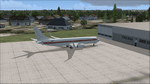
| Category: Flight Simulator 2004 - AFCAD Files | |
| Birmingham International Airport, Birmingham, Alabama (KBHM) |
|
File Description:
An extremely accurate rendition of the KBHM airport with appropriate gate, cargo and general aviation parkin. I've decided to make it a habit to do airports that one doesn't really see much on FS. Everyone does 300 AFCADs of KORD and there's nothing wrong with that it's a great airport but I figured I didn't need to add another KORD or KLAX to the pile unless I'd be providing something the others lack and I can't seem to find it. So, again, I'll be continuing to do AFCADs I feel are lacking or unavailable or not done well. The BHM airport is definetely not a bustling international port of call and it only receives mainline service from a few carriers but it has a decent amount of traffic and I thought it would be good to represent the airport. Thankfully this time MS did a reasonably good job with terminal space and I was able to include every gate in the two concourses. The great BHM website made my job a breeze by indicating which airlines park at which specific gate(s). Every airline is exactly where they should be as is cargo. A ramp for you VFR general aviation buffs is also available. The only time you might notice some craziness is if you start your flight super early in the morning and you have traffic at 95% +. It seems MS doesn't really "turn" planes in a realistic manner so you end up having more planes parked at the gate in the early morning hours then would be there in real life if they adheared to real world turn around times. Nothing I can do about that. Hope you enjoy your virtual trips in and out of the Birmingham International Airport.
| Filename: | Birmingham_International_Airport_Birmingham_Alabam.zip |
| License: | Freeware |
| Added: | 29th June 2004, 19:31:34 |
| Downloads: | 2,317 |
| Author: | Jason Diaz |
| Size: | 137.07 KB |
| Category: Flight Simulator 2004 - Scenery | |
| Brevoort CWOB and BAF-3 radar plus Cartwright LAB-6 radar Canada |
|
Images related to this file:
File Description:
Brevoort airstrip and the BAF-3 radar it serves is on Brevoort Island, off one of the southeastern tips of Baffin Island and 140 miles east of Iqaluit. This scenery includes the BAF-3 buildings on the hilltop and those on the airstrip below, plus the roads connecting them and down to the beach landing area on the rocky coast. This scenery is made for the FSGenesis 76m terrain mesh for northern Canada, and there will be a repost of all my northern Canada airfields to suit this; I cannot think now why I never installed this mesh before. The AI reflects the use of civil airlines for resupply and transportation of personnel. Given the terrain the wind should be from the north so that ai lands using the 02 runway. Landing from the north will involve a terrain clash while take off towards the north will not as the climb out clears the hilltop. The video shows the 600 foot cliff at the runway threshold and an Air Tindi plane on the apron. Cartwright CYCA is on the Labrador coast and has been posted by Flight Ontario as part of their Goose Bay and Labrador Regional Airports sceneries. The nearby LAB-6 radar site is included here, connected to CYCA by an extended road. The site uses the same buildings as Brevoort and Saglek (posted recently) and although I have included them here as separate sceneries the contents can be placed in the same folders as Saglek with a saving in duplicated textures. The textures here are more accurate than Saglek so say yes to over-write; a downloader with personal experience of Brevoort noted that in reality they are lighter.
| Filename: | Brevoort_CWOB_and_BAF3_radar_plus_Cartwright_LAB6_.zip |
| License: | Freeware, limited distribution |
| Added: | 20th August 2017, 15:46:36 |
| Downloads: | 175 |
| Author: | Roger Wensley |
| Size: | 4.37 MB |
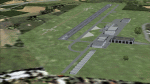
| Category: Flight Simulator X - AFCAD Files | |
| MHRO - Juan Manuel Galvez International Airport / Roatan, Honduras (version 1.1) |
|
Images related to this file:
File Description:

MHRO - Juan Manuel Galvez International Airport / Roatan, Honduras (version 1.1)
This airport update was made with the latest version of ADE (Airport Design Editor) and made for FSX as a replacement for the stock (default) airport. I found that most stock airports in FSX lack a decent amount of character and realism and this area in particular was dreadful! The stock airport file for Roatan was completely devoid of any life. There were absolutely no parking spots for commercial aircraft and no terminal buildings; the nearby areas of Colonia/Loma Linda were completely barren. I've done major reworking to this airport and added the small terminal building as well as renumbered the runway to the correct designation and length. The nearby town has been rendered complete with a variety of vessels small and large in the ocean. I hope you enjoy. Below is a list of changes/additions. All these enchancements are as close to the real airport as I can get with stock library objects. I've used satellite images, terminal photos and maps throughout the whole process so building locations are as accurate as possible. Happy landings in Honduras!
Features:
*Expanded parking apron
*Terminal building with parking for commercial traffic (Delta and United fly to Roatan from the US with regular service)
*Renumbered runways to correct designations and modified runway length and lighting accurately
*Nearby neighborhoods modeled complete with marinas and cruise ship port (cruise ship parked at the pier visible on approach)
*Diving, fishing, cargo and recreational vessels visible in the ocean surrounding the airport v1.1
*Several hotels dotting the area near the airport as well as West End/Gibson Bight
*Roads with static vehicles near the airport
*Corrected taxiway signs v1.1
| Filename: | MHRO__Juan_Manuel_Galvez_International_Airport__Ro.zip |
| License: | Freeware |
| Added: | 15th July 2012, 06:47:04 |
| Downloads: | 686 |
| Author: | Jaison Diaz |
| Size: | 6.85 KB |
| Category: Flight Simulator X - Original Aircraft | |
| "Janet Airways" Boeing 737-600 BBJ-ER |
|
Images related to this file:
File Description:
A highly classified small fleet of passenger aircraft known as "Janet" is operated for the United States Air Force to transport military and contractor employees. It mainly serves the Nevada National Security Site (most notably Area 51 (AR51) and Tonopah Test Range (TNX), from their terminal at Las Vegas' McCarran International Airport (KLAS). The planes are also used to fly to/from Air Force Plant 42 (KPMD), Naval Air Weapons Station China Lake (KNID), Hill Air Force Base (KHIF), and Edwards Air Force Base (KEDW). I encourage you to locate, download, and install the AFCAD files or scenery add-ons associated to these airports from any source you desire, but make sure they are designed for FSX. The fleet's "Janet" call sign, from which its de facto name comes, is said to stand for "Just Another Non-Existent Terminal", or more likely "Joint Air Network". Everything is realistic in this model, now, and most simmers know how inaccurate the original FSX 737-800 was. However, this aircraft simulates the accuracy of a 737-600 BBJ-ER, if there ever was one built. I modified everything to fit that aspect, except for the visual model. The engine characteristics are correct as well as all weight/balance and MOI. I even fixed the wheels to be accurate in base, track and pressure size. Everything I've done here is for educational purposes without any expectation of any monetary gain, and offered publicly for free. Read the Readme.txt file for installation and details. All persons involved with this and the original design are credited, unless they are unknown and have offered no credit details. Sounds by: Christoffer Petersen, Panel by: Pasquale Rinaldi, Redirected Texture by: Microsoft (Unknown Staff Member Names), Real World Engine/Aerodynamics by: Douglas E. Trapp, FS Flight Dynamics Engineer [email protected] July 2017
| Filename: | Janet_Airways_Boeing_737600_BBJER.zip |
| License: | Freeware |
| Added: | 8th July 2017, 20:04:30 |
| Downloads: | 1,916 |
| Author: | Douglas E. Trapp |
| Size: | 39.16 MB |
| Category: Flight Simulator 2004 - Scenery | |
| Airstrips of North-West Europe |
|
Images related to this file:
File Description:
The sales blurb for FS2004 announced the inclusion of over 23,000 airfields ... unfortunately a significant number of those consisted of little or nothing more than a runway on a flatten with a rectangular background polygon.
To enable the addition of an amount of lightweight GA AI traffic, without overloading those airfields that were designed with parking spaces and taxi-ways, (and are probably already busy), I herewith include over 140 small sceneries, of mostly default airfields, from NW France, up the English Channel and the North Sea coast through Belgium, the Netherlands and NW Germany to Denmark, all with added taxiways and parking spots, aprons, generic buildings and background polygons as appropriate, to enable AI traffic to be generated without interrupting things at the more major airports.
A few of the French airfields are "new", not included originally with FS2004, and a couple have been updated to suit more recent developments :- for example, LFES "Scaer Guiscriff" is now LFES "Bretagne Atlantique", LFOR "Chartres Champhol" is now LFOR "Chartres Metropole", EHSE "Seppe" is now EHSE "Breda International" and EKVH "Vesthimmerlands" was previously EKVH "Aars".
There's no photo-realism here, just a selection of basic 'generic' buildings, more or less accurately sized and placed to reflect the airfield layout as seen on on-line satellite imagery and aerial photography. These buildings have minimal effect on frame-rates, so are ideal for this kind of job.
The airfields are aligned as well as possible with the roads etc. in UT Europe and the Genesis Europe mesh, but should mostly be fine in a default installation or other configuration.
Please read the rest of this "waffle" in the included text file ... it might save some confusion ;)
Enjoy :)
| Filename: | Airstrips_of_NorthWest_Europe.zip |
| License: | Freeware |
| Added: | 14th June 2024, 13:44:58 |
| Downloads: | 285 |
| Author: | Chris Eve |
| Size: | 9.95 MB |
| Category: Flight Simulator X - Scenery | |
| VOHS-VOBL package for FSX and FSX-SE |
|
Images related to this file:
File Description: Rajiv Gandhi International Airport (IATA: HYD, ICAO: VOHS) is an international airport that serves Hyderabad,
the largest city in the Indian state of Telangana. It is located in Shamshabad, about 24 kilometres (15 mi) south of Hyderabad.
The airport is operated by GMR Hyderabad International Airport Ltd, a public–private venture.
It was opened in March 2008 to replace Begumpet Airport as the primary commercial airport for Hyderabad.
It is named after Rajiv Gandhi, former Prime Minister of India. _______________________________________________________________________________________ Kempegowda International Airport (IATA: BLR, ICAO: VOBL) is an international airport serving Bangalore, the capital of the Indian state of Karnataka.
Spread over 4,000 acres (1,600 ha), it is located about 40 kilometres (25 mi) north of the city near the village of Devanahalli.
It is owned and operated by Bangalore International Airport Limited (BIAL), a public–private consortium.
The airport opened in May 2008 as an alternative to increased congestion at HAL Airport,
the original primary commercial airport serving the city. It is named after Kempe Gowda I, the founder of Bangalore.
Kempegowda International Airport became Karnataka's first fully solar powered airport developed by CleanMax Solar.[2][3] As of 2016, Kempegowda Airport is the third-busiest airport by passenger traffic in the country,
behind the airports in Delhi, Mumbai and is the 35th-busiest airport in Asia. It handled over 22.2 million passengers in 2016 with little less than 500 aircraft movements a day.
The airport also handled about 314,060 tonnes (346,190 short tons) of cargo. By 2020, it is expected to handle at least 40 million passengers per year,
with 45 international airlines and more than 1000 aircraft movements per day.
| Filename: | VOHSVOBL_package_for_FSX_and_FSXSE.zip |
| License: | Freeware |
| Added: | 28th January 2018, 17:03:17 |
| Downloads: | 4,442 |
| Author: | morten thomas van der linden |
| Size: | 171.62 MB |
© 2001-2026 AVSIM Online
All Rights Reserved
Privacy Policy |