
Where Flight Simulation Enthusiasts Gather from Around the World!
AVSIM Library - Search Results

| Category: Flight Simulator X - Flight Plans | |
| When The Land Trembles |

|
File Description:
At 8:46 A.M. a 6.2 in the Richter Scale Earthquake hit the western mountains of Guatemala, Central America.
Two Flight Routes have been set up by the Civil Defence and SAR authorities. They use
two airports to reconnoiter their respective areas. It has been reported that two mines
in the western Pine Mountains have been heavely hit and in Mine 1( Socrates Fer Coal Ltd ) there are some
wounded miners which must be picked up. Mine 2 (Ductil Ltd.Mine No.33) has been totally abandoned and
must be looked at for important documentation pertaining to security (?)
You can choose RED FLIGHT, where you will use a good transport aircraft, since you must pick up
the wounded and others---- or BLUE FLIGHT which is a " reconnaissance" flight out to a lake area and access
the damage as well as land and bring radio communications equipment to the communities.
Either way, this is dangerous stuff-----are your wits ready for such flying tasks?????----By the way, Dr. Lalita
Mazsis is counting on you to fly her safely....OH Boy!!!!!!!!------
| Filename: | When_The_Land_Trembles.zip |
| License: | Freeware, limited distribution |
| Added: | 19th October 2007, 21:11:11 |
| Downloads: | 675 |
| Author: | Gera Godoy C |
| Size: | 449.4 KB |
| Category: Civil Flight Simulators - Looking Glass Flight Unlimited 3 | |
| Channel Islands (add on region) |
|
File Description:
This is a kit to build a new region for the Flight Unlimited 3 game. You have just to move the /channel folder into the /region folder of the game but
the /maps folder has just the blank water tiles and no texture maps due to copyright restrictions. You will have to download the maps by yourself using Maps2BGL and building the tiles using the included automated script. The region includes Jersey, Guernsey and Alderney with 3 prepared airports.
No building or trees are placed, this is left to you and I hope to see a package uploaded at avsim a bit later. To fly in the Channel region you must use a copy of FU3 without the Seattle region or temporarily move the /Seattle folder out of the game (not delete, just move !!!)
This kit also demonstrate how to build a minimal region (8x8 tiles, 131kmx131km. You must learn to handle Maps2BGL to finish the Channel region installation.
A fast Internet connection is needed to download the maps also.
Tool references:
maps2bgl.zip (DLID=120356)
maps2bgl__how_to_.zip (DLID=121257)
| Filename: | Channel_Islands_add_on_region.zip |
| License: | Freeware, limited distribution |
| Added: | 22nd May 2008, 11:31:31 |
| Downloads: | 257 |
| Author: | André Meystre |
| Size: | 22.91 MB |
| Category: Flight Simulator X - Flight Plans | |
| Flying For Furs.....A Danger in the Mountain Gorges, Ravines, and Canyons of The Canadian West... |
|
File Description:
Joshua Buckhorn is getting ready for his trip into the Canadian Wester Fur Route. As a trader of furs and FBO owner things up here in North Washington
are hard in this year of 1949. Just 5 years ago he was flying a huge B-17 over Germany. Now a new life has brought him into the dangers on Bush Flying.
As always before these flights, new oil and spark plugs must be placed in the plane, tyres must be just right and the fuel tanks got to be full to the top.
It is 5:45 AM and a big breakfast is a must before the flight, eggs, grits, potatoes, ham, bacon and NO beans since the gas they produce will disrupt the fligh. And don´t forget the "P" Bottle.----I hope you know how to balance a plane with all those furs and hides you will acquire in this trip full of danger in approaches and take offs from, indeed, very dangerous fields. ( Bonus you get 4 new airports for future flights if the business pays off)..:)
| Filename: | Flying_For_FursA_Danger_in_the_Mountain_Gorges_Rav.zip |
| License: | Freeware, limited distribution |
| Added: | 22nd August 2008, 23:09:46 |
| Downloads: | 1,079 |
| Author: | Gera Godoy Canova |
| Size: | 365.52 KB |
| Category: Flight Simulator 2004 - AI Aircraft | |
| Isles of Scilly Skybus de Havilland Canada DHC-6 Twin Otter |
|
File Description:
This is a repaint of the excellent de Havilland DHC-6 Twin Otter AI Model V.2 by Henry Tomkiewicz. Isles of Scilly Skybus is a British airline which operates seasonal and year round domestic scheduled services to the Isles of Scilly from various airports in south west England. The airline's main operating base is Land's End Airport (LEQ), whilst their head office is located in nearby Penzance, both in the county of Cornwall. The airline was established in March 1984 and started operations in August 1984. Isles of Scilly Skybus originated as an air charter operator at Land's End aerodrome which operated high frequency services to the Isles of Scilly. Following the withdrawal of Brymon Airways routes to and from the islands the operator stepped in, initially operating services to Plymouth. This route was later dropped but with the addition of Twin Otter aircraft the route network expanded to its current make-up. It is wholly owned by Isles of Scilly Steamship Company who also run the passenger ferry, Scillonian III, and freight services from Penzance to the Islands.
| Filename: | Isles_of_Scilly_Skybus_de_Havilland_Canada_DHC6_Tw.zip |
| License: | Freeware |
| Added: | 13th October 2008, 14:52:24 |
| Downloads: | 584 |
| Author: | John O'Leary |
| Size: | 676.07 KB |
| Category: Flight Simulator 2004 - Scenery | |
| Tel Aviv Lod Airport Scenery 1961 |
|
File Description:
Lod Airport, now called Ben Gurion International Airport started out in 1936 as Lydda Airport, an airstrip of four concrete runways on the outskirts of the Arab town of Lydda. By the mid-1960s, 14 international airlines were landing at Lod Airport.
I have backdated Lod airport back to 1961, when it was much smaller than today. Lod was and is Tel Aviv's major airport, used for all airline flights in 1961, and most international flights today. I have used GMAX to create the terminal and many of the hangars and other buildings at the airport, and have also used many library objects to increase the detail around the airport. Landclass files are included to reduce the city area back to their sizes in the 1960's. I have also backdated 4 other airports: Eilath (LLET), Sde Dov (LLSD), Mahanaim (LLIB), and Beer Sheeba (Teyman LLBS). These use library objects to increase the airport detail as well. These cities constituted the entire route network of Arkia, the local airline of Israel, in 1961.
| Filename: | Tel_Aviv_Lod_Airport_Scenery_1961.zip |
| License: | Freeware, limited distribution |
| Added: | 30th October 2008, 20:30:22 |
| Downloads: | 2,854 |
| Author: | Mike Stevens |
| Size: | 699.82 KB |
| Category: Flight Simulator 2004 - Scenery | |
| Sioux Lookout CYXL in northwest Ontario Canada |
|
File Description:
Sioux Lookout is a small town of some 5,000 folks in northwest Ontario, towards the Manitoba border, and a regional centre for surrounding villages. The airfield is some two miles east of the town. It originally had two runways but the smaller was abandoned recently as part of a planned long term improvement of the field, leaving just 34/16 with its 5,300 feeet of asphalt. Both Wasaya and Bearskin fly to Sioux Lookout; on the field there are two maintenance companies, Eagle and Allen, and hangers for the Ministry of Health, Bearskin Airlines, Wasaya, and the Nishnawbe Aski Police Service (NAPS). I think there is now another company too, but I have no information on them so I pretended this was two years ago. As well as the airfield scenery there is also a landclass file an "AFCAD" file for your AI aircraft. You should also download and install Northwest Ontario Airports by Eric O'Link, and preferably also have Ultimate Terrain; I have not tested this without UT and there is a small lake nearby.
| Filename: | Sioux_Lookout_CYXL_in_northwest_Ontario_Canada.zip |
| License: | Freeware |
| Added: | 26th November 2008, 13:08:04 |
| Downloads: | 853 |
| Author: | Roger Wensley |
| Size: | 2.66 MB |
| Category: Flight Simulator 2004 - Scenery | |
| FHSH - St. Helena Island & Airport - St. Helena, South Atlantic |
|
Images related to this file:
File Description:
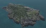
This project is a port of my FSX release of the the new airport (FHSH) on St. Helena Island. This scenery provides more accurate coastlines and roads, as well as corrected landclass based on the latest available satellite imagery. Flight plans are provided for the proposed commercial service to St. Helena, and some additional GA and military flights to the island are added as well.
The FS2004 St. Helena (FHSH) airport was created by aligning master plans for the airport with current satellite data and by studying many of the pictures that have been posted as the airport has taken shape. The official opening of the real airport on May 21, 2016, has been pushed back for more field tests due to challenging crosswinds. Updates were created or rebuilt in a manner which carefully aligns airport data with current satellite imagery. Scenery was created using Airport Design Editor 9 v1.67.5684 and SBuilder. Scenery objects were added and modified from stock FS9 scenery to resemble as closely as possible the actual airports.
| Filename: | FHSH__St_Helena_Island__Airport__St_Helena_South_A.zip |
| License: | Freeware |
| Added: | 5th May 2016, 07:44:38 |
| Downloads: | 2,235 |
| Author: | Carlyle Sharpe |
| Size: | 1.62 MB |
| Category: Flight Simulator 2004 - Scenery Design | |
| Airport Restaurants 1.1 scenery object library |
|
Images related to this file:
File Description:
[Version 1.1 adds thumbnail images and proper installation instructions for users of Sbuilder. If you have installed the previous version of this object library and are not using Sbuilder to place objects in your scenery, you do not need to install version 1.1.]
You'll finally have a place to get one of those $150 hamburgers when you arrive at your destination. This is a collection of Gmax restaurant scenery objects for use with FS9. They are intended for smaller airports that don't have the usual food court inside the terminal building. Some of the restaurants have an aviation theme, some don't. Most of them are also available with the signage removed so you can use them as small terminal buildings or whatever else you want. Also included are some outdoor chairs, tables and table umbrellas, and a variety of vending machines. Should work with just about any payware or freeware program that is able to place scenery library objects in FS9, including RWY12, Instant Scenery, EZ-Scenery, Airport Design Editor, etc.
| Filename: | Airport_Restaurants_11_scenery_object_library.zip |
| License: | Freeware |
| Added: | 9th November 2009, 15:20:37 |
| Downloads: | 3,133 |
| Author: | Sidney Schwartz |
| Size: | 7.43 MB |
| Category: Miscellaneous Files - Demos from Commercial Vendors | |
| Punta Cana 2006 |
|
File Description:
Punta Cana, one of the world's favorite airport its unique design make this airport one of the few, as some say, one of the most "beautiful" airports in the world. Arriving at Punta Cana Airport is arriving in paradise, and the airport is a great example of what Punta Cana is.
Punta Cana for many years has consolidated its place for one of the caribbean´s top destination from Europe and North America, receiving hundreds of flights a week, making it one of the most busiest touristsm airport in the Caribbean Basin.
This scenery package contains:
Punta Cana International Airport, with all of its buildings, carefully detailed as accurate as possible made with photo realistic pictures.
All passenger Stairs and Catering trucks fully animated by NAV frequency setting -Marshaller in every parking position.
Numerous static objects, service trucks, cars, airport staff, etc.
Static aircraft
Ready for use with ProjectAI©, MyTraffic© or UltimateTraffic©.
Users Manual
All major resorts, Bavaro and Punta Cana, including 2 helipads.
Landclass of the entire Higuey (Punta Cana) Area.
And much more!!
| Filename: | Punta_Cana_2006.zip |
| License: | Freeware |
| Added: | 12th February 2006, 23:57:31 |
| Downloads: | 11,097 |
| Author: | Dominican Aerodromes |
| Size: | 6.34 MB |
| Category: Prepar3D V1-4 - Aircraft Repaints, Textures and Modifications | |
| VASP 1998 AI Package |
|
File Description:
VASP was the 2nd largest airline in Brazil, but was scaling down by 1998. VASP still had a great international network stretching to ATH/KIX/ICN/LAX/YYZ/JFK/BCN/ZRH ect. A fleet of 10 MD-11s did all the long haul flying, as well as plenty of domestic flights. 3 A300s and a large 737-200/300 fleet served the domestic routes. While VARIG was based in GIG, VASP was based in GRU and the planes tend to hang out there. There was only 1 special livery, which was a named MD-11, so not much variation unlike VARIG. VASP did serve SDU and CGH with mainline equipment, however, so these plans will help populate those airports. Included are repaints by Raphael Rodrigues for the FAIB 737-200, 737-300, FSPX MD-11, and TFS A300B4. Flightplans by Chasen Richardson. Part of the 1998 Flight Simulator Project. Follow us on Facebook at facebook.com/flightsim98 and on instagram as @bayviationsim. For more Retro AI, check out the forums at: http://retroai.proboards.com/
| Filename: | VASP_1998_AI_Package.zip |
| License: | Freeware, limited distribution |
| Added: | 29th October 2019, 07:18:35 |
| Downloads: | 308 |
| Author: | Raphael Rodrigues, Chasen Richardson/Bayviation |
| Size: | 4.51 MB |


© 2001-2026 AVSIM Online
All Rights Reserved
Privacy Policy |