
Where Flight Simulation Enthusiasts Gather from Around the World!
AVSIM Library - Search Results

| Category: Flight Simulator X - Scenery | |
| California Central Coast with Megascenery Earth and FSGenesis Mesh |

|
Images related to this file:
File Description:
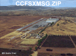
California Central Coast Scenery for FSX with Megascenery Earth and FSGenesis mesh. CCFSXMSG.ZIP covers the California coastal region from N36° 10' (Coalinga) to N34° 25' (Santa Barbara) and from the coast East to W119° 40'. It is a version of my previously created California Central Coast scenery redesigned and expanded to work with FSX MegaScenery Earth and FSGenesis USA Terrain Mesh for FSX V2 by Justin Tyme. Airstrips in the area covered by this scenery have been added for a total of 27 airports and airstrips. 6 imaginary water runways are also added for AI float plane traffic. Several other areas of interest such as the Santa Barbara marina, Morro Bay, etc. are included for a total of 41 points of interest. All airports, airstrips and related structures have been adjusted and realigned to conform to actual positions and dimensions as indicated by the MegaScenery Earth satellite textures. Megascenery Earth California-13, -14 and -15 are required and -12, -28 and -29 are recommended. By Al Wheeler 9/25/09.
| Filename: | California_Central_Coast_with_Megascenery_Earth_an.zip |
| License: | Freeware |
| Added: | 7th January 2010, 19:54:57 |
| Downloads: | 870 |
| Author: | Al Wheeler |
| Size: | 8.13 MB |
| Category: Flight Simulator 2004 - Scenery | |
| WIID 1962 Jakarta Kemayoran V2 |
|
Images related to this file:
File Description:
We have produced this scenery to provide taxiways and details
as they were around 1962 in Jakarta, Yogyakarta, Juanda and Denpasar.
We have also included new parking to allow the AI aircraft to taxi
correctly at the new (old!) airports.
Kemayoran airport was Jakarta’s and Indonesia’s first international airport.
It was gradually forgotten after the Indonesian government opened
two new airports, Halim Perdanakusuma and Soekarno-Hatta.
In late 1920’s early 1930’s the Dutch turned the area into an airport
and built several military camps to house their soldiers at what is
now Garuda Street.
Kemayoran airport was officially opened for international flights
on 8 July 1940.
The airport was managed by KNILM
(Koninklijke Nederlands Indische Luchtvaart Maatschappy),
a subsidiary of KLM, the official airline of the Netherlands.
Kemayoran Airport was officially closed on 31 March 1985
because the location was deemed no longer appropriate,
and the government wanted to convert it into a commercial area.
Now including along with WIID Jakarta Kemayoran:
WIIJ Yogyakarta ( Java )
WRSJ Surabaya ( Java )
WRRR Denpasar ( Bali )
| Filename: | WIID_1962_Jakarta_Kemayoran_V2.zip |
| License: | Freeware, limited distribution |
| Added: | 17th December 2017, 20:31:20 |
| Downloads: | 594 |
| Author: | Wolfgang Gersch, Mike Stevens |
| Size: | 2.35 MB |
| Category: Flight Simulator 2004 - AI Flight Plans | |
| AI Flightplans for 910 Tanker air carrier DC-10-10 - v2 |
|
File Description:
Here is a simple flight plan to be used with AI Malcontent's brand new DC-10-10 fire fighter based at Victorville (KVCV).
I used RPP FP Gen v1.0 and the flight plan covers different airports in California (most of the destinations are generic, as this aircraft is shown in just a few airports on the photos available on Airliners.net).
I'm not able to read flight plans, but there are lots of legs and I think the stopovers during the week are very short.
So keep in mind that this is just something to see the aircraft in the sim and not aiming at extreme realism, to be used until someone makes something more decent.
A user kindly wrote me and suggested to remove flights to KACV, whose runway is too short. Instead of modifying the flight plan I preferred to redo it completely. Check the readme file for more info.
This file replaces the old version (10_tanker_air_carrier_dc-10_ai_flightplans.zip), which is not available anymore. If you down loaded it, please recompile the .txt files included in this zip.
| Filename: | AI_Flightplans_for_910_Tanker_air_carrier_DC1010__.zip |
| License: | Freeware |
| Added: | 1st March 2010, 23:28:25 |
| Downloads: | 1,007 |
| Author: | Giacomo Gramazio |
| Size: | 28.48 KB |
| Category: Flight Simulator 2004 - Scenery | |
| CYYN Swift Current Municipal Airport |
|
File Description:
Swift Current Municipal airport is situated approximately 8 km east of the City of Swift Current. It is one of those tiny airports where the default flightsim scenery has no resemblance to the real world airport. CYYN was constructed using GMAX and represents the airport as it was in the Summer of 2007. It includes nearly all the buildings at the airport, runway signs, the addition of fencing, and a rotating beacon. CYYN also includes a landclass file to better represent the terrain around the airport, at least as far as the limits of the default landscape will allow. The airport has a long history, being built in 1937, as one of the hundred-mile airports on the Trans Canada airway. It was greatly expanded as an RCAF / RAF station during world war II. Many of the wartime structures still exist but many are in poor shape. Two of the original three runways remain in service. The airfield is often used by 15 Wing aircraft of CFB Moose Jaw to practice approaches.
| Filename: | CYYN_Swift_Current_Municipal_Airport.zip |
| License: | Freeware |
| Added: | 30th August 2008, 03:25:36 |
| Downloads: | 1,342 |
| Author: | Gregory Putz |
| Size: | 5.28 MB |
| Category: Flight Simulator X - Scenery | |
| North Victoria v2 for ORBX v2 YBLA Benalla YECH Echuca YYWG Yarrawonga |
|
Images related to this file:
File Description:
'North Victoria v2' is made to match ORBX Australia v2 scenery. Use 'YBLA Benalla' 'YECH Echuca' 'YYWG Yarrawonga' for ORBX v1 or no ORBX. There are 3 airports YBLA Benalla YECH Echuca YYWG Yarrawonga. ORBX has done these as they have done every airport included with FSX in Australia to a reasonable standard. If I had not already done them for ORBX V1 I would not have bothered. However these are better than ORBX because the surroundings have been modified to match real life. Towns have been added or shifted. Forests cut down or added. There are also custom accurate versions of the actual terminal buildings/hangers. In short a lot more time spent. ORBX had to do every airport has in Australia! Orbx have AI traffic files that cover all 3 airports. These files are for Flight Simulator X. Made using Airport Design Editor using some objects borrowed from Robert Budd's excellent Baccus Marsh and 'Static aircrafts' by Jean-Pierre Fillion. REQUIRED The scenery is designed to interface with ORBX FTX_AU V2 scenery for Australia (payware).
| Filename: | North_Victoria_v2_for_ORBX_v2___YBLA_Benalla_YECH_.zip |
| License: | Freeware |
| Added: | 2nd November 2019, 18:57:53 |
| Downloads: | 325 |
| Author: | Colin Jeffery |
| Size: | 10.01 MB |
| Category: Flight Simulator X - Utilities | |
| AI Cull Traffic Density Tool for FSX/P3D (Version 1.1) |
|
Images related to this file:
File Description:

The AICull.exe utility provides intelligent traffic density for AI aircraft. The user enters the ICAO(s) of the airports the user (typically) departs from and arrives at. AICull then removes AI that is not departing from or arriving at these ICAO(s) in order to boost frame rate, but still maintain an immersive AI experience for the user. That is, the user will perceive normal traffic density at the airports the user departs or arrives at, however all other AI in the area will be deleted saving frame rates and memory. The user may also enter an unlimited number of ICAO(s) to monitor. The user may also update the list of ICAO(s) while the program is running. AICull.exe requires SimConnect and the latest, registered version of FSUIPC ver. 4.9x (or later version). For best results, use with traditional bgl-based AI traffic (e.g., default, Word of AI, My Traffic X, etc.) although the program does work to lesser effect with the simconnect-based Ultimate Traffic 2 (see the included ReadMe). Revision: fixed "Problem Opening FSUIPC Link" for P3D.
| Filename: | AI_Cull_Traffic_Density_Tool_for_FSXP3D_Version_11.zip |
| License: | Freeware |
| Added: | 22nd March 2014, 00:16:44 |
| Downloads: | 3,122 |
| Author: | Roland Foster |
| Size: | 306.83 KB |
| Category: Flight Simulator 2004 - Miscellaneous Files | |
| Some Curved or Angled Approaches, Beirut, Washington Reagan, Lugano and Swiss valleys |
|
File Description:
This little project started from my Air Glaciers package when I noticed how indifferent the AI pilots were to terrain. Intrigued by the work of Jim Vile on his "active approach" series I have experimented with interesting approaches that FS9 has not implemented. Using XML files I created curved approaches for Beirut Runway 21 ILS (inbound flights arc across the city), the visual turn to final for Washington Reagan's Runway 19, the circling approach for runway 19 at Lugano in Switzerland (just an arc in this case) and valley approaches for airports in Switzerland at Sion, Samedan and Locarno. Due to AI limitations in FS9 these have all needed to be created as ILS approaches, even at airports without an ILS. Note that your AFCAD layouts do not need to have ILS added to airports that don't have it. In some cases the approach will be called an ILS by the controller, if you can live with that, you might like these. Note that I've included the source XML for each of the approaches so that you can improve upon them if you wish. Note also that they have been tested with the default Microsoft mesh and an addon mesh might alter the proximity of terrain to aircraft. AI aircraft FDEs will, in some cases, be stretched to (and beyond?) their limits. In the case of Beirut I have included two approaches (BOB NDB and "Wide Arc"), the latter less demanding than the former, in case your AI can't fly the BOD NDB approach.
Note that although the approaches are designed for AI, I have built full procedures for Lugano and Sion for the user to fly.
| Filename: | Some_Curved_or_Angled_Approaches_Beirut_Washington.zip |
| License: | Freeware, limited distribution |
| Added: | 8th April 2005, 03:19:33 |
| Downloads: | 2,760 |
| Author: | Matthew Ministry |
| Size: | 478.08 KB |
| Category: Flight Simulator 2004 - Gauges | |
| FS2004 GPS Map View Gauge v3.0 |
|
File Description:
The ultimate gauge. The Map will show: Airports details (Runways ID's, length & ILS), VOR's and NDB's frequencies,
Intersections and waypoints, Airspaces, Approaches and flight routes. You can toggle the view
you require for your flight. Also you can zoom in/out to see the nearest airports, vor's and
ndb's. The map will indicate A/C heading flightplan title and waypoints ID's.
Version 3 includes more enhancements such as the ability to input the ICAO code or name of any airport and the map will
show all the frequencies of that airport including ATIS, ILS, AND COM. In addition, the map will show the active
runway designations, length and width.
You can also input ICAO code of any VOR/NDB and the map will show their frequencies.
There was a bug in v2.0, in which if you enter ( click on ENT )the ICAO code of an airport, you will lose the flight
plan loaded. Now you can go back to the flight plan and with the NEXT/PREV buttons you have the choice of where to start
your FP.
The gauge will show Flight Plan Title, originating and destination airports, active waypoint, waypoint index and FP
crusing altitude.
I addition, the gauge will show various useful information, such as, Runway IDs, lenght, width and approach magnetic heading,
Airport name, city, and type. NAV1/2 names, codes, distances and ETA's, ADF1/2 names and codes.
Finally, the gaugee will show other information, such as, magvar, indicated airspeed, mach, ground velocity, ambient
wind velocity and direction, bank angle , and a/c altitude ( radio height ).
All the information above and much more on a single gauge window.
| Filename: | FS2004_GPS_Map_View_Gauge_v30.zip |
| License: | Freeware, limited distribution |
| Added: | 14th September 2005, 14:19:46 |
| Downloads: | 10,837 |
| Author: | Talal Alhaj |
| Size: | 710.05 KB |
| Category: Flight Simulator 2004 - AFCAD Files | |
| CYEG Edmonton International Airport V1.0 |
|
File Description:
I remade all the gates to make a layout similar to the real world using a Canada Air Pilot chart of the parking. I added a couple more GA parking spots. All the gates are assigned to the proper airline between the North and South Terminals. I used the Edmonton Airports Authority website to find out which airlines were where.
Just a note, the "Ontario Northern" 737 is a repaint for my Virtual Airline and is not part of the scenery.
| Filename: | CYEG_Edmonton_International_Airport_V10.zip |
| License: | Freeware, limited distribution |
| Added: | 11th November 2003, 00:27:08 |
| Downloads: | 2,075 |
| Author: | David Voogd |
| Size: | 215.02 KB |
| Category: Flight Simulator X - Aircraft Repaints, Textures and Modifications | |
| Aena Boeing 727-200 Adv |
|
Images related to this file:
File Description:
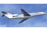
Aena, S.A. It is a Spanish corporation that manages the airports and heliports in the general interest of the State in Spain. B727 One of the few that can still be seen in Spain. This, preserved by AENA in a place away from the slopes. I hope so, although the last pictures I've seen of him I think this almost scrapped. Full aircraft, addon FMC, Callouts, V-Speeds, GPWS. Model by Thomas Ruth, texture by Juan Villamor. See more at http://simrepaints.envaldemoro.com.
| Filename: | Aena_Boeing_727200_Adv.zip |
| License: | Freeware |
| Added: | 2nd December 2015, 21:16:25 |
| Downloads: | 974 |
| Author: | Juan Villamor |
| Size: | 34.99 MB |
© 2001-2026 AVSIM Online
All Rights Reserved
Privacy Policy |