
Where Flight Simulation Enthusiasts Gather from Around the World!
AVSIM Library - Search Results

| Category: Flight Simulator X - Scenery | |
| Virac Airport RPUV with Photoreal Scenery |

|
Images related to this file:
File Description:
This is my reworked version of RPUV Airport. Now with Photorealistic Scenery, latest colors and updated terminal.
Virac Airport (IATA: VRC, ICAO: RPUV) is the only airport serving the island province of Catanduanes in the Philippines. It is located in the capital, Virac. The airport is classified as a Class 1 principal (major domestic) airport by the Civil Aviation Authority of the Philippines, a body of the Department of Transportation and Communications that is responsible for the operations of not only this airport but also of all other airports in the Philippines except the major international airports.
On October 27, 2013, Cebu Pacific launched the first ever Airbus flight in Virac.
| Filename: | Virac_Airport_RPUV_with_Photoreal_Scenery.zip |
| License: | Freeware |
| Added: | 26th November 2018, 16:20:24 |
| Downloads: | 830 |
| Author: | Aeron M. Tumanut |
| Size: | 35.35 MB |
| Category: Flight Simulator 2004 - Scenery | |
| X9AN - Andreas Airfield, Isle of Man |
|
Images related to this file:
File Description:
This is a basic (semi-realistic) scenery for Andreas airfield on the Isle of Man (X9AN). This scenery can be used "as-is" and includes scratchbuilt buildings (based on those found at the existing airfields on the island) and afcads. This scenery also makes extensive use of the RWY12 tree libraries so, for best results, please ensure you have these installed. This file is not compatible with the getmapping terrain although afcads are included for those using the photo-scenery only.
Re-uploaded due to corrupt zip - replaces 'andreas.zip', previous versions used older version of winzip that appears to be causing problems once uploaded to the server.
| Filename: | X9AN__Andreas_Airfield_Isle_of_Man.zip |
| License: | Freeware |
| Added: | 23rd July 2010, 08:26:16 |
| Downloads: | 863 |
| Author: | Andy Kewley |
| Size: | 17.03 MB |
| Category: Flight Simulator 2004 - Scenery | |
| Pacific Northwest Airports 1960 |
|
File Description:
We've produced this scenery to provide new GMAX terminals, taxiways, buildings and details as they were around 1960 for Seattle, Washington and Portland and Salem, Oregon. I've also created 34 smaller classic airports in Idaho, Oregon, and Washington then served by airlines. These do not include custom GMAX terminals but use instead a default or addon library object for the terminal, since I did not have photos. Many thanks to Jason, who provided most of the photos and information used in this project, as well as the Jantzen Beach amusement park on an island in the river and most of KPDX except the terminal. Tom created the rest.
| Filename: | Pacific_Northwest_Airports_1960.zip |
| License: | Freeware, limited distribution |
| Added: | 6th May 2008, 03:52:32 |
| Downloads: | 4,515 |
| Author: | Tom Gibson and Jason Krogmann |
| Size: | 10.21 MB |
| Category: Flight Simulator 2004 - Scenery | |
| Toronto Downtown Airport CYTZ Ontario, Canada |
|
Images related to this file:
File Description:
CYTZ is on an island in Lake Ontario and immediately adjacent to downtown Toronto. This updates the version made by Flight Ontario as there have been major changes since Porter Airlines purchased the airport. The obvious and main new item is the terminal, made with photo textures and with ten gates sized to accomodate the Dash 8-400 they currently use. The terminal has a passenger entrance and a vehicle setdown point as part of the link to the ferry terminal that wraps around the west side of the original and preserved terminal building. The ferry terminal is included here, along with a ferry. Also new are the car parking, road routing, gate and taxi markings, taxiways, taxiway signage, taxiway lighting, runway lighting, aprons, apron lighting (from Sid Schwartz and you will need to install his "lights_ss_v2"), fences, fuel tanks, tanker trucks, access roads to navigation equipment, ai parking, static parked planes, parked cars, apron equipment, and the useable floatplane ramp. The AI includes Porter, Jazz, several GA aircraft, and a helicopter. Only 3 of these require downloads. The Lake Ontario AI includes three large ships, typical of the traffic to be seen on all the Great Lakes. CYTZ has three runways and there is an airport diagram included. 08-26 has ILS and is the only runway actually long enough to be used by Porter; FS9 atc will ignore this. There is fuel available and it is dispensed from a truck. The longer projection from the front of the terminal building is a covered ramp that leads up from the terminal basement level, used by towed luggage trolleys. The gates are not powered in any way except for the weather cover that protects passengers as they cross the small area of asphalt between plane and gate. I did not try to reproduce this in FS9.
| Filename: | Toronto_Downtown_Airport_CYTZ_Ontario_Canada.zip |
| License: | Freeware, limited distribution |
| Added: | 23rd October 2012, 12:52:14 |
| Downloads: | 1,806 |
| Author: | Roger Wensley + Flight Ontario |
| Size: | 12.43 MB |
| Category: Flight Simulator 2004 - Scenery | |
| Kugaaruk CYBB and DEW Pelly Bay CWPB in Nunavut, Canada |
|
Images related to this file:
File Description:
Kugaaruk is on the coast of northern mainland Canada on the Boothia Peninsula, 60 miles into a deep north-south fjord-like inlet called Pelly Bay. The name was changed from Pelly Bay in 1999, and the population is around 800. Gjoa Haven is 150 miles to the west, and Hall Beach just over 200 miles to the east. Six miles south of the village, and connected by a gravel road, there is a NWS station and what remains of a DEW Auxiliary Site; the DEW site was closed in 1992, a year after the NWS station became operational. There is also a 3,350 feet long gravel runway beside Barrow Lake 2 miles east of the site, Pelly Bay CWPB. Kugaaruk airfield is adjacent to the village and the 5,000 feet of 100 feet wide gravel runway is aligned 049T/229T where T stands for "true" as opposed to magnetic. There are flights by First Air and Canadian North and the AI includes a daily flight of each from Yellowknife via Gjoa Haven (as per real life) plus a cargo visit by Buffalo. Although the runway is long enough to accomodate a 737 it is not licensed for regular scheduled jet flights; the reason for this is that the approach lighting is "inadequate". Included here is a new .bgl for Gjoa Haven which will remove the small hold short line from the gravel; my mistake.
| Filename: | Kugaaruk_CYBB_and_DEW_Pelly_Bay_CWPB_in_Nunavut_Ca.zip |
| License: | Freeware, limited distribution |
| Added: | 25th November 2012, 00:43:07 |
| Downloads: | 427 |
| Author: | Roger Wensley |
| Size: | 6.1 MB |
| Category: Flight Simulator 2004 - Scenery | |
| CYVP - Kuujjuaq - Quebec, Canada |
|
Images related to this file:
File Description:
Kuujjuaq is in northern Quebec at the southern end of Ungava Bay, and 30 miles up the Koksoak River. Kuujjuaq has a population of around 2,400; it was previously called Fort Chimo and in 1830 there was a Hudson Bay trading post established close by, but on the other bank of the river. A nursing station and a school were established in 1948 and the Hudson Bay post moved across the river to the current location. The airport is to the south of the town and, unusally for northern airfields, has two runways. The asphalt runway is 6,000 feet long and aligned 07/25, and the gravel runway is 5,000 feet long and aligned 13/31; 07 has ILS. There is fuel available, both 100LL and JetA, but the 100LL will be in drums and you are required to have your own pump. There are numerous flights that stop at Kuujjuaq; the AI included here has Air Creebec, First Air, Wasaya Airways, and Air Inuit (Kuujjuaq is a maintenance centre for Air Inuit) plus private flights by various aircraft. There is also a flight by my poor representation of a Helicopter Transport Services chopper. There is a float base on the nearby Stewart Lake during the summer months. The base is within the Kuujjuaq control zone, and normally you would talk to the tower and inform them of your intentions, but in FS9 this cannot be replicated.
| Filename: | CYVP__Kuujjuaq__Quebec_Canada.zip |
| License: | Freeware, limited distribution |
| Added: | 11th February 2013, 06:22:50 |
| Downloads: | 812 |
| Author: | Roger Wensley |
| Size: | 5.92 MB |
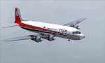
| Category: Flight Simulator 2004 - Original Aircraft | |
| Avro Lancastrian II |
|
File Description:
A close derivative of the war-time Lancaster bomber, the Lancastrian was
fitted with streamlined nose and tail cones. Lancastrians were used as
long-range freighters, VIP transports, and jet engine test beds by the
RAF, as fast long-range airliners and mailplanes by Trans Canada Air
Lines, BOAC, BSAA, QUANTAS, and Alitalia, and as tankers by Flight
Refuelling Ltd. Charter operators were Skyways and Silver City.
Eighty-two aircraft were build, but most of them had vanished in
scrapyards by the early nineteen-fifties. In the immediate post-war
years, TCA offered twice-weekly Lancastrian flights from Dorval, Canada,
to Prestwick and London, while BOAC and BSAA (under chief pilot D.C.T.
Bennett) operated flights to Australia and South America, all based on a
rather uneconomical ratio of five crew to up to fourteen passengers. The
outbound leg from Hurn to Learmouth, Australia, took three days and well
over fifty hours flying time, with Lydda, Karachi, and Ceylon serving as
staging posts. BSAA's London to Buenos Aires flight took 56 hours.
Either way, one needs to have plenty of time on one's hands to recreate
these epic journeys. Gmax exterior model and textures by Manfred Jahn,
FDE and 2D panel by Paul Edwards (based on a panel by Phil Perrott of
Alphasim). The three texture sets included represent VM734 of 246
Squadron RAF, G-AGLY ("Norfolk") of BOAC, and G-AKFG of Flight
Refuelling Ltd.
| Filename: | Avro_Lancastrian_II.zip |
| License: | Freeware |
| Added: | 20th May 2007, 10:45:54 |
| Downloads: | 6,646 |
| Author: | Manfred Jahn and Paul Edwards |
| Size: | 5.23 MB |
| Category: Flight Simulator 2004 - Scenery | |
| Aasiaat BGAA on the west coast of Greenland |
|
Images related to this file:
File Description:
I wrote that Qikiqtarjuaq, on the east coast of Baffin Island, was the jumping off airfield for ferry flights for small planes from Canada to Europe via Greenland. Aasiaat is the airfield in Greenland that they jump to, 300 miles across the Davis Strait. The airfield is on the northern coast of Aasiaat Island, and the town of the same name is just two miles to the west. The runway is 2,600 feet of asphalt almost 100 feet wide and lit, at 74 feet ASL, aligned 12/30, with the apron and terminal building at the western end. Air Greenland run regular flights with a Dash-7 or 8, & Twin Otters, and the markings for the taxiway and parking spot in front of the terminal are exactly as they were six years ago. I have seen video since then that has further taxiway and parking spot markings added in, but I like the simplicity of the original. Unfortunately, given the limitations of FS and the single runway and simple taxiway routing there was no way to replicate both the parking facing away from the terminal AND the "through" taxiing to complete the circle back to the runway; after parking correctly the AI Air Greenland Dash-8 will reverse before heading out to take off. There is both JetA and 100LL fuel available. The surrounding area is rocky, and there is no grass around the runway; the airfield has compacted gravel instead.
| Filename: | Aasiaat_BGAA_on_the_west_coast_of_Greenland.zip |
| License: | Freeware, limited distribution |
| Added: | 26th March 2012, 11:01:16 |
| Downloads: | 690 |
| Author: | Roger Wensley |
| Size: | 2.73 MB |
| Category: Flight Simulator X - Aircraft Repaints, Textures and Modifications | |
| FSX/P3D/FS2004 Trinidad and Tobago Air Services DC-6B 1978 |
|
Images related to this file:
File Description:
This is a repaint of the Douglas DC-6B in Trinidad and Tobago Air Services - TTAS colors. The freeware CalClassic DC-6B by Greg Pepper and Tom Gibson is needed for this repaint. Trinidad and Tobago is an island nation of the southeastern West Indies, in the Caribbean. It consists of two main islands — Trinidad and Tobago — and several smaller islands. Caribbean United Airlines Ltd. was the main carrier operating a service from Trinidad, the main island, to Tobago, which is off to the North of Trinidad. However, Caribbean United Airlines - established in 1970, failed as an airline and stopped operations in 1974. The government of Trinidad and Tobago consequently formed TTAS at Port of Spain on June 12, 1974 to take over the Port of Spain to Tobago service suspended upon the failure of Caribbean United Airlines. With a pair of Douglas DC-6Bs, TTAS, became the second national carrier, and undertook air bridge flights to Tobago, as well as routes to Grenada, Martinique, and St. Lucia. The DC-6Bs were replaced between 1977 and 1978 by HS-748s. After a short lifespan of 6 years, TTAS was taken over and merged into the main Trinidad and Tobago national carrier - British West Indies Airways, in 1980. Textures are 32bit bmp. This repaint was tested on FSX-SE and should work on FSX & P3D v1-3. It should also work on FS2004.
| Filename: | FSXP3DFS2004_Trinidad_and_Tobago_Air_Services_DC6B.zip |
| License: | Freeware |
| Added: | 24th June 2019, 16:57:14 |
| Downloads: | 106 |
| Author: | Ted Giana |
| Size: | 7.53 MB |
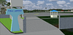
| Category: Prepar3D V1-4 - Scenery | |
| TNCC - Curaçao International Airport |
|
File Description:
This is my first scenary, any problem or sugestion send-me an e-mail ([email protected]). The scenery was made using the Airport Design Editor, SketchUp 2017 an others.
Curaçao International Airport (IATA: CUR, ICAO: TNCC), (Dutch: Hato Internationale luchthaven) also known as Hato International Airport (formerly Dr. Albert Plesman International Airport), is the only airport for the island of Curaçao.
The airport is located on the north coast of Curaçao, 12 kilometres (7.5 mi) from the capital Willemstad. Curaçao International Airport services flights from the Caribbean region, South America, North America and Europe and has the third longest commercial runway in the Caribbean region after Rafael Hernández Airport in Puerto Rico and Pointe-à -Pitre International Airport in Guadeloupe.
The airport serves as a main base for Divi Divi Air, Jetair Caribbean as well as EZAir; it formerly served as a main base for ALM, KLM, DCA, DAE and Insel Air.
Located on the Dutch Caribbean island of Curaçao, connects Europe, the Americas and the Caribbean. Curaçao International Airport is served by several airlines.
The Curaçao International Airport has one of the longest runways in the Caribbean, accommodating up to a Boeing 747. In the early fall of 2014, Curaçao International Airport opened a new General Aviation Center offering premier service in a separate building with a private entrance and exit and special amenities.
| Filename: | TNCC__Curaao_International_Airport.zip |
| License: | Freeware |
| Added: | 8th March 2021, 19:00:36 |
| Downloads: | 553 |
| Author: | Eduardo Puelker |
| Size: | 7.24 MB |
© 2001-2026 AVSIM Online
All Rights Reserved
Privacy Policy |