
Where Flight Simulation Enthusiasts Gather from Around the World!
AVSIM Library - Search Results

| Category: Flight Simulator X - Scenery | |
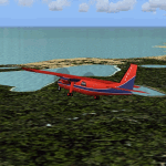
| KHAF - Half Moon Bay Airport - San Mateo County, California - USA |

|
Images related to this file:
File Description:
FSX Scenery - Half Moon Bay Airport (IATA: HAF, ICAO: KHAF, FAA LID: HAF) is a county-owned public use airport in San Mateo County, California, United States. It is located five nautical miles (9 km) northwest of the central business district of Half Moon Bay, California. The airport is on the Pacific Coast, south of San Francisco. The Half Moon Bay Airport is located approximately 20 miles south of San Francisco. It was constructed by the California State Highway Department for the U.S. Army in 1942 as an auxiliary airfield for Salinas Army Air Base. Following the end of World War II, San Mateo County acquired the airport from the Navy in 1947. The airport has served a variety of roles over the years and is currently an important business, transportation and emergency service asset to the community. For your flying pleasure by John B. Loney, Jr.
| Filename: | KHAF__Half_Moon_Bay_Airport__San_Mateo_County_Cali.zip |
| License: | Freeware, limited distribution |
| Added: | 5th August 2015, 18:57:47 |
| Downloads: | 916 |
| Author: | John B. Loney, Jr. |
| Size: | 10.69 MB |
| Category: Flight Simulator X - Scenery | |
| Hawes Aerial Operations Facility |
|
Images related to this file:
File Description:

Hawes Aerial Operations Facility is a reimagined version of an abandoned World War II auxiliary airstrip formerly known as Hawes AAF Aux #1. It was built in the mojave desert, just east of Edwards AFB (then Muroc AAF) during WWII as one of 4 satellite fields for Victorville AAF. After the war, Hawes as used as a private civilian airfield until it's closure in the early 1960's. It is now reborn in FSX as a UAV base by Nevada Systems. Due to it's location in the Mojave desert and the presence of many thermals in FSX, it was also used in production of the Aeroworks ARX-1 civilian glider concept. This scenery uses many custom macros as well as default macros from the Acceleration Expansion Pack, which is required for best performance. Scenery and custom macros by Joshua B. Nyhus and Jason L. Terry
| Filename: | Hawes_Aerial_Operations_Facility.zip |
| License: | Freeware |
| Added: | 7th December 2012, 15:58:27 |
| Downloads: | 538 |
| Author: | Jason L Terry and Josh Nyhus |
| Size: | 5.91 MB |
| Category: Flight Simulator X - Scenery | |
| KXWA Williston Basin International Airport + Photoscenery 2019 V2.0 |
|
Images related to this file:
File Description:

THIS FILE REPLACES THE EARLIER KXWA_2019.zip. STANDALONE FILE, NO OTHER DOWNLOADS NEEDED. Compatible for FSX & FSX:SE. Not tested in P3D, but I expect it should work there as well. Opened in October 2019, Williston Basin International Airport replaces Sloulin Field as Williston, ND's primary airfield. Previously unavailable in flight sims, this scenery now brings this airport within flying distance. Current as of December 2019. FEATURES: Properly aligned runway, taxiways and aprons perfect for flying online // Correct ILS for Runway 32 // VOR on airport grounds as in real life // Correct designation of taxiways with appropriate taxi signs // 4 gates as well as GA Apron // Accurate-to-size passenger terminal & hangars // Apron lighting // Optional night and day photoreal textures from early 2019 // Custom waterclass meaning that bodies of water use native sim water // Autogen exclusion around airport // New in V2.0 - bug fixes and tweaks + new ground poly.
| Filename: | KXWA_Williston_Basin_International_Airport__Photos.zip |
| License: | Freeware |
| Added: | 17th December 2019, 03:32:14 |
| Downloads: | 416 |
| Author: | Matt Lock |
| Size: | 122.1 MB |
| Category: Flight Simulator 2004 - Scenery | |
| PGUA - Andersen AFB, Guam (V3) **UPDATE** |
|
Images related to this file:
File Description:

FS2004 scenery for Andersen AFB on the island of Guam. Andersen AFB started life as one of many airfields constructed in 1944 for the final aerial assault on the Japanese islands. Originally designed as a long range bomber base, Andersen has grown in scale to keep pace with the newest U.S. Air Force ships. Andersen remained busy during the Korean and Vietnamese conflicts hosting the 19th Bomb Wing as well as various SAC units for combat, refueling, and logistical/material support. The base is hosted by the 36th Wing and provides support services for all visiting and transient aircraft from numerous allied nations. This scenery contains all-new custom objects for Andersen AFB as well as photo-realistic ground cover for the airfield. MY SINCERE APOLOGIES TO ALL WHO HAVE PREVIOUSLY DOWNLOADED THIS SCENERY. PLEASE DELETE ANY EXISTING INSTALLATION AND REPLACE WITH THIS FINAL VERSION 3.
| Filename: | PGUA__Andersen_AFB_Guam_V3_UPDATE.zip |
| License: | Freeware, limited distribution |
| Added: | 27th April 2013, 22:29:34 |
| Downloads: | 2,309 |
| Author: | John Stinstrom |
| Size: | 2.58 MB |
| Category: Flight Simulator 2004 - Scenery | |
| Repost of Dryden Regional CYHD in Ontario Canada |
|
File Description:
This repost is first to deal with some lighting problems on the runways (though I still couldn't get rid of the taxiway lights that head off across the grass) and also to provide the right AFCAD file.
Dryden is in northwest Ontario on the shore of Wabigoon Lake. The airfield is some five miles northeast of the town. It has two runways, one 2,000 feet long and sand, the other 11/29 and 6,000 feet of asphalt 150 feet wide. There is a terminal building, a hangar for Thunder Airlines, and some GA hangars at and near the western apron, and in the Summer there is a flock of fire-fighting Canadair CL415 amphibs at the eastern apron together with the Ministry of Natural Resources Ontario fire fighting headquarters establishment, accomodation, and maintenance facilities. Among others Bearskin Airlines fly there, a wonderful punning name.
| Filename: | Repost_of_Dryden_Regional_CYHD_in_Ontario_Canada.zip |
| License: | Freeware |
| Added: | 15th February 2009, 15:34:49 |
| Downloads: | 597 |
| Author: | Roger Wensley |
| Size: | 4.51 MB |
| Category: Flight Simulator 2004 - Scenery | |
| CYQV Yorkton Municipal Airport Saskatchewan Version 2 |
|
Images related to this file:
File Description:

Yorkton Municipal Airport is situated approximately three kilometers north of the City of Yorkton, Saskatchewan, Canada. The airfield was built in 1940 for the Royal Canadian Air Force, as a British Commonwealth Air Training Plan station. Today, only a few of the wartime buildings remain and only two of the orginal four runways remain in operation. The airport continues, however, as the prinicipal hub of general aviation services for the east-central region of Saskatchewan.
CYQV was constructed using GMAX and represents the airport as it was in the Summer of 2008. It includes custom models of all the buildings at the airport, runway signs, refueling facilites,garages, weather station, fencing and trees, and a rotating beacon. CYQV includes custom ground textures to replicate the decommissioned runways and taxiways.
Version 2 replaces the original lost in the AVSIM hack and includes a number of improvements (see readme).
| Filename: | CYQV_Yorkton_Municipal_Airport_Saskatchewan_Versio.zip |
| License: | Freeware |
| Added: | 7th May 2010, 12:52:18 |
| Downloads: | 1,994 |
| Author: | Gregory Putz |
| Size: | 6.72 MB |
| Category: Flight Simulator 2004 - Scenery | |
| Loring Air Force Base - Maine, USA |
|
Images related to this file:
File Description:

This expansive airfield was built to serve as a home to over 100 of the Air Force's then-new B-36 Peacemaker. It's strategic location made it a natural location for a SAC (Strategic Air Command)base and so it has served for over 40 years. However the B-36 itself was destined to be short-lived in Air Force service and Loring replaced its B-36s with new jet B-52 bombers in 1956. This scenery attempts to capture the base during it's cold-war years of the 1970's. Scenery contains all-new custom objects for Loring Air Force Base as well as utilizing some common objects from the standard scenery libraries used by MAIW. Although there are no aircraft included with this package, the separate instruction sheet will guide users in easily obtaining quality AI aircraft that are appropriate to the period.
| Filename: | Loring_Air_Force_Base__Maine_USA.zip |
| License: | Freeware, limited distribution |
| Added: | 28th January 2014, 13:59:45 |
| Downloads: | 1,399 |
| Author: | John Stinstrom |
| Size: | 4.91 MB |
| Category: Flight Simulator 2004 - Scenery | |
| Airstrips of the Falkland Islands |
|
Images related to this file:
File Description:
Inspired by Jim Keir's Falkland Islands mesh, coastlines and landclass, herewith a couple of dozen little strips from around the area, to give the opportunity to generate a bit of GA AI (and possibly a few scheduled flights) in an otherwise relatively ignored area in the South Atlantic. Please do note, other than Stanley, most of these airstrips are just that, a cleared strip of land in an otherwise empty landscape, (just as they are in real life), simply to provide a variety of destinations for the occasional aircraft to or from Stanley.
Most of the airfield locations are listed on WikiPedia and the layout confirmed using on-line satellite imagery. Other than the two main airports, none of these airstrips seem to have "official" ICAO codes, so I've generated a selection of alpha-numeric codes in the SF0* configuration, (as Stanley Airport has the ICAO code of SFAL), so the FS9 AI engine has some codes to work with and the airfields can be found on the map. Hopefully these pseudo-codes won't clash with anything else.
As with my other sceneries, the files for each airstrip can be easily identified by the ICAO code, even if the airfield names vary slightly, so you can pick and choose and mix and match to suit any sceneries you already have, should you so wish. There is no requirement for any other download. Each airstrip will exist as a stand-alone entity should you only want a few of them.
Having said that, Paul Denton's AFCAD and scenery for EGYP Mount Pleasant (available on AVSIM and possibly elsewhere) might be considered a worthwhile addition, especially if you want to see the twice-weekly scheduled RAF flights from Brize Norton (via Ascension Island), and the Saturday LATAM flight from Chile. Suitable AFCADs for EGVN Brize Norton and SCCI Punta Arenas may also be required. Appropriate traffic files and aircraft/texture suggestions are provided.
Please read the remainder of this "blurb" in the included text file, there may be a couple of details of interest.
| Filename: | Airstrips_of_the_Falkland_Islands.zip |
| License: | Freeware |
| Added: | 30th March 2025, 18:55:33 |
| Downloads: | 86 |
| Author: | Chris Eve |
| Size: | 295.87 KB |
| Category: Flight Simulator 2004 - Scenery | |
| Monument Valley UT25 and Oljato 05UT in Utah USA |
|
Images related to this file:
File Description:
Monument Valley is an impressive sight in south Utah but not, unfortunately, in FS9. Unless you invest in a detailed terrain mesh there are no stacks of rocks reaching for the sky and the lasting overall impression is just of a desert. But I had already downloaded the land textures so I ended up making the Monument Valley UT25 airfield and the nearby Oljato 05UT, which has no buildings of any sort. Maybe I was bored. There is a lodge close to the field with dozens of cabins, but I had insufficient information so this is for the airfield only. The 4,000 feet of new tarmac is aligned 16-34 and is single ended with a large chunk of rock at the southern end; 16 is only used for landing and 34 is only for take off. The runway is not lit. Do not be surprised when you ask to select a runway for take off and FS9 only gives you 16 as a choice, even though you know this is the wrong one. When you accept it FS9 will quickly switch it to 34; apart from a possible sense of humour I have no idea why it does this. Nothing much to say about Oljato. What do you need? You actually don't need Ultimate Terrain as there are other land textures used here, so you will definitely need to have downloaded and installed the land textures "cny_south3west_2010 lr" and "cny_south3west2_2010 lr" by Gottfried Razek, as these land textures showed the runways in the correct positions. Look in the scenery library here or at the other place. A note here about my scenery making. There will not be many more to follow this (unless you count 4 as many) as I am almost at the end of the photos I either took or found for scenery purposes, plus I expect to move on from FS9 at some point during next year.
| Filename: | Monument_Valley_UT25_and_Oljato_05UT_in_Utah_USA.zip |
| License: | Freeware, limited distribution |
| Added: | 22nd January 2020, 20:13:54 |
| Downloads: | 217 |
| Author: | Roger Wensley |
| Size: | 2.91 MB |
| Category: Flight Simulator X - Aircraft Repaints, Textures and Modifications | |
| George Bush N2S-1 Stearman (N50061) |
|
Images related to this file:
File Description:
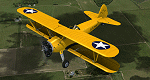
This is a repaint only, for the payware Vertigo Studios Stearman Vol.1 set. This repaint depicts the restored Stearman N2S-1, N50061, owned/operated by Paul Ehlen and based at the Wings of the North Museum at Flying Cloud Airport, Eden Prairie, Minnesota. The aircraft, originally manufactured as U.S. Navy BuNo. 3347, is one of five Stearmans known to still exist that were flown by President George H. W. Bush as a cadet in the Navy. He flew this aircraft while training in the cold Minnesota winter at Wold-Chamberlain Airfield, Naval Air Station Minneapolis (modern-day KMSP), in January and early February 1943. The aircraft was sent to AirCorps Aviation for ground-up restoration in 2014, and emerged in 2015 as one of, if not the most period-authentic restored Stearmans to-date, restored to just as it was in 1943 (no electric starter (only hand-crank start) and no radios of any sort). The aircraft won "Best Stearman" at Oshkosh 2015.
| Filename: | George_Bush_N2S1_Stearman_N50061.zip |
| License: | Freeware |
| Added: | 22nd January 2017, 04:10:24 |
| Downloads: | 213 |
| Author: | John Terrell |
| Size: | 25.25 MB |
© 2001-2026 AVSIM Online
All Rights Reserved
Privacy Policy |