
Where Flight Simulation Enthusiasts Gather from Around the World!
AVSIM Library - Search Results

| Category: Flight Simulator 2004 - Scenery | |
| Hope Field near Ottawa Ontario, Canada |

|
Images related to this file:
File Description:
The field is newly included in the Canada Flight Supplement. Unusually for a grass field the runway has the numbers marked out in white; given that this is a private airfield that does not invite unexpected guests and has only one plane based there, and presuming that the owner can remember his own runway headings, it is unlikely that these will still be there in a year's time. There is no hangar as yet. To the west is highway 416 and to the east is the Rideau River, both of which run north-south. Lke Rockcliffe (which is to the north) the airfield is right on the edge of the Ottawa control zone, so you should already be below 1,500 feet ASL when approaching from the south and talking to Ottawa tower when arriving from the north. The runway is 07/25 and 2,800 feet long, which should be enough for almost anybody, and the field is at 315 feet ASL. Manotick is a mile to the north east on the Rideau River and the Rideau Valley Airpark CPL3 is six miles south in the bend of the Rideau where it turns west.
| Filename: | Hope_Field_near_Ottawa_Ontario_Canada.zip |
| License: | Freeware, limited distribution |
| Added: | 10th July 2010, 19:34:51 |
| Downloads: | 200 |
| Author: | Roger Wensley |
| Size: | 3.15 MB |
| Category: Flight Simulator 2004 - Scenery | |
| Alaska North Slope 5 - Nuiqsut PAQT |
|
Images related to this file:
File Description:
The town of Barrow is in the far north of Alaska, and these are coastal villages or radar installations to the west, south, and now east of Barrow. There will be further additions. Nuiqsut is a mainly Inuit community on the west side of the Colville River, around 20 miles south of the coast, and with a slowly declining population of around 420 or so. The airfield is just south of the town and has a gravel runway 5,000 feet long and aligned 04-22 in FS9. The airfield is the only year-round contact route to the rest of the world, though there are plans for a permanent road. The AI includes daily passenger flights early and late in the day, cargo deliveries, and some GA. It seems that the only photos I had of the airport were either of the old building or were not of Nuiqsut at all. The only pic I have seen (recently, which is why I now have doubts) of the new building is insufficient to model it, so I am sticking with the old or maybe incorrect version.
| Filename: | Alaska_North_Slope_5__Nuiqsut_PAQT.zip |
| License: | Freeware, limited distribution |
| Added: | 21st June 2016, 21:45:32 |
| Downloads: | 244 |
| Author: | Roger Wensley |
| Size: | 4.37 MB |
| Category: Flight Simulator 2004 - Scenery | |
| Alaska South Slope 2 - Noorvik ORV in AK US |
|
Images related to this file:
File Description:
The town of Kotzebue is in the far northwest of Alaska, and these are villages to the north and the east of Kotzebue on the South Slope of the Brooks Range of mountains. There will be further additions. Noorvik is a small village (population now around 670) on the bank of the Kobuk River, around 50 miles east of Kotzebue. The new airfield is 1 mile south of the village; there is a short runway immediately south of the town that is now closed but is not marked as such and appears to be usable; this will still be listed in FS9 when you are presented with a choice of runways but is not connected in any way to the new airfield so ignore it. The new ORV runway has 4,000 feet of lit gravel aligned 06-24. There are scheduled flights by Era (now renamed Ravn) and by Bering Air, both of them originating in Kotzebue and routing east to Noorvik, Kiana, Ambler, Shungnak, Kobuk, and then back again. The AI includes these flights (eventually) plus perhaps an Everts Air cargo flight and GA.
| Filename: | Alaska_South_Slope_2__Noorvik_ORV_in_AK_US.zip |
| License: | Freeware, limited distribution |
| Added: | 4th September 2016, 18:20:02 |
| Downloads: | 219 |
| Author: | Roger Wensley |
| Size: | 3.95 MB |
| Category: Flight Simulator 2004 - AFCAD Files | |
| Belfast Aldergrove (EGAA) |
|
File Description:
Belfast Aldergrove is a joint civil and military aerodrome 18 miles NW of Belfast. The civil airport (now known as Belfast International) is the main passenger airport in the Province and handles practically all air cargo. RAF Aldergrove is the only remaining military airfield in Ulster. Details at http://www.raf.mod.uk/rafaldergrove.
This AFCAD file corrects many of the inaccuracies of the FS2004 default airport. The corrections are based on information from the aerodrome chart, Google Earth, and personal observations. None of the changes are strictly accurate to scale. An apron area for helicopters and the occasional RAF transport aircraft has been provided for the military base. The cargo area has also been enlarged and parking provided for up to eight aircraft. Additional parking places have also been provided on the main passenger apron and on the GA apron off taxiway A. A holding area adjacent to taxiway C near the threshold of Rwy 17 has been removed. Various other improvements have been made to taxiways and holding areas on the military side of the airfield. Much of the original base is now disused hence the large number of closed taxiways.
| Filename: | Belfast_Aldergrove_EGAA.zip |
| License: | Freeware |
| Added: | 3rd April 2009, 18:54:38 |
| Downloads: | 513 |
| Author: | John Hubbard |
| Size: | 9.25 KB |
| Category: Flight Simulator 2004 - Scenery | |
| KPMD - Palmdale AF Plant 42 |
|
Images related to this file:
File Description:

FS2004 Scenery for KPMD Palmdale AF A huge 5,800 acres/23 km² airfield that has somehow been overlooked by addon developers. almost all hangers and buildings are custom built due to their uniqueness to KPMD. Most of the facilities are owned by private contractors and serve as a manufacturing plant
for aircraft used by the United States .Rockwell's Palmdale assembly facility is where Space Shuttle came together
and were assembled and tested. Upon completion, the Shuttles were turned over to NASA for transport overland
to Edwards Air Force Base, California.
The airfield was opened in the early 1930s.At the outbreak of the Korean War in 1950, the U.S. Air Force realized a need
for a location for use in final assembly and flight testing of military jet aircraft, away from major population centers but close enough to the major
centers of aircraft design and production .Year round excellent flying weather was also a prerequisite. The land which
became AF Plant 42 fit all these criteria. Therefore the USAF bought the facility in in 1951.In the 1960's Lockheed
relocated to Plant 42 from its original Burbank, Ca .
| Filename: | KPMD__Palmdale_AF_Plant_42.zip |
| License: | Freeware |
| Added: | 29th January 2015, 21:22:39 |
| Downloads: | 825 |
| Author: | Brian Sturrock |
| Size: | 1.43 MB |
| Category: Flight Simulator 2004 - Scenery | |
| Colville Lake CEB3 in Northwest Territories Canada |
|
Images related to this file:
File Description:
Colville Lake is a small village of around 150 Dene, located to the northwest of the Great Bear Lake and east of the Mackenzie River, 120 miles north of Norman Wells. The village and the airfield are next to each other and to the lake shore. I recently discovered which of the standard terminal buildings had been used there and this, along with information I already had, enabled me to now make the scenery, which is based on an approximate 2010 date. The gravel runway is lit and around 2,800 feet long, aligned 10-28. North Wright Air serves the village from it's headquarters at Norman Wells with daily flights by de Havilland Twin Otters, or "twotters" as they were quickly named among the northern Canadian airline personnel when they were first produced. The approximate time of this scenery is 2010. While testing this scenery I discovered that Tulita (previously called Fort Norman) which is another Mackenzie River airfield to the south of Norman Wells, needs to be reposted due to a terrain fault. If you find an error here then email me please, and note that my email address has been changed to rogwens at Gmail dot com.
| Filename: | Colville_Lake_CEB3_in_Northwest_Territories_Canada.zip |
| License: | Freeware, limited distribution |
| Added: | 31st July 2021, 18:23:48 |
| Downloads: | 68 |
| Author: | Roger Wensley |
| Size: | 4.51 MB |
| Category: Flight Simulator 2004 - Scenery | |
| Embrun CPR2 in Ontario Canada 2012 Revision |
|
Images related to this file:
File Description:
Embrun is in Ontario a few miles southeast of Ottawa, and southwest of my posted strips Russel Farm, Russellet Strip, and Indian Creek. It is a real airfield, used by Embrun Flying Club, and there is now fuel since the owner built a house on the field and moved in, and more hangars than there used to be. All in all a nice airfield with a grass runway 2,260 feet long, and in this REVISED version with a new windsock. There are electric cables strung along the road at the eastern end of the runway, marked by visibility balls; watch out for those. At the western end there are some old grain silos; these shouldn't be a problem, and if you are flying a taildragger give you something to aim at until the tail comes up. I did my first grass field landing and take off there when I was learning to fly, and it is just the right distance from Rockcliffe for a nice afternoon training flight. Look out for geese taking off from the fields to the west when you use 26; that departure from Embrun along with 50 geese was more entertaining than most.
| Filename: | Embrun_CPR2_in_Ontario_Canada_2012_Revision.zip |
| License: | Freeware, limited distribution |
| Added: | 9th February 2012, 01:31:31 |
| Downloads: | 302 |
| Author: | Roger Wensley |
| Size: | 3.8 MB |
| Category: Flight Simulator X - Scenery | |
| EKKL-Kalundborg Airport X VFR Photo Scenery |
|
File Description:
Kalundborg Airport – named Kaldred is a small regional field in a comfortable distance from my other FOTOREAL airport EKRK-Copenhagen Airport Roskilde. In the period 1964-76, airfield operations was yearly 15.000-20.000, and in 1976 the heavier aircrafts with retractable gear made it necessary to change the Runway surface from grass to asphalt. In 1981, the closure of Skovlunde Airfield in the Greater Copenhagen Area moved traffic to other locations like EKRK-Roskilde, and investments was made to improve service and facilities at EKKL to attract new customers, being a the perfect hub for aircraft operations to many of the small Danish islands. For many years post and News papers were daily transported by road from print in Copenhagen to Kaldred and flown to EKSS-Samsø (my last released airport).
Today six Air companies reside in Kaldred, together with Kalundborg Flyveklub. Visit Kaldred, and be sure you will get a warm welcome, and as they say in Kalundborg Flying Club, there are always coffee in the clubhouse. Included in the zip file is a version for Ultimate Terrain Europe and Dan-Vfr plus the Default scenery. Enjoy.
| Filename: | EKKLKalundborg_Airport__X__VFR_Photo_Scenery.zip |
| License: | Freeware |
| Added: | 22nd May 2008, 09:17:33 |
| Downloads: | 2,056 |
| Author: | Jens Peter Bruun-Hansen |
| Size: | 22.54 MB |
| Category: X-Plane - Scenery | |
| BR CE - SJCM Catuleve Fortaleza v1.0.0 |
|
Images related to this file:
File Description:
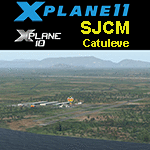
This is an X-Plane 11 & 10 scenery for Catuleve Airfiel (SJCM) in the metropolitan area of Fortaleza, Ceara, Brazil. In this private airfield is located a aeronautical sports facility, operating seceral small aircrafts and a bunch of new experimental models as well, for aeronautical leasure and sports. This scenery was tested and is operational (as of January 23, 2017) in "X-Plane 11 Public Beta #8 64 bit", Windows 10 Home. It was also tested and is operational (as of January 23, 2017) in "X-Plane 10.51 64 bit", Windows 10 Home.
| Filename: | BR_CE__SJCM_Catuleve_Fortaleza_v100.zip |
| License: | Freeware |
| Added: | 25th January 2017, 00:34:57 |
| Downloads: | 69 |
| Author: | Rui Mesquita |
| Size: | 1.77 MB |
| Category: Prepar3D V1-4 - Aircraft Repaints, Textures and Modifications | |
| Consolidated B-24J Liberator (#354) 307th BG "Louise Mary |
|
Images related to this file:
File Description:
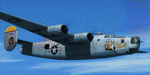
This folder contains a repaint for the Consolidated B-24J by Flight Replicas, adapted for use in P3Dv5. It shows B-24J-210-C0 44-41354" #354 "Louise Mary", which flew with the 372nd BS/ 307th BG, based at Kornasoren Airfield, Noemfoor Island, Schouten Islands, Indonesia in November 1944. The noseart was painted by pfc Joe Origlio, based on a Mutoscope Card by Gil Elvgren. After suffering severe damage, this aircraft was scrapped in the Philippines in 1945. Repaint by Jan Kees Blom, based on the paintkit by Flight Replicas.
| Filename: | Consolidated_B24J_Liberator_354_307th_BG_Louise_Ma.zip |
| License: | Freeware |
| Added: | 3rd May 2020, 22:31:42 |
| Downloads: | 42 |
| Author: | Jan Kees Blom |
| Size: | 54.42 MB |
© 2001-2026 AVSIM Online
All Rights Reserved
Privacy Policy |