
Where Flight Simulation Enthusiasts Gather from Around the World!
AVSIM Library - Search Results

| Category: Flight Simulator X - Scenery | |
| Alfs UK Airfields - Vol 1 and 2 Updates |

|
File Description:
REQUIRES: alf_s_uk__airfields.zip (available HERE) and alfs_uk_airfields_vol2.zip (available HERE)
Alf's UK airfields Vols.1 and 2 Updates *IMPORTANT* Cures Faults on other airfield ILS Glide Pathes. Old faulty AFX files replaced with ADEX ones. Culprits are Cosford/Dunsfold/Elstree/Netherthorpe/Old Warden v.1/Popham v.1
| Filename: | Alfs_UK_Airfields__Vol_1_and_2_Updates.zip |
| License: | Freeware |
| Added: | 23rd January 2015, 18:04:26 |
| Downloads: | 607 |
| Author: | Alf Denham |
| Size: | 27.36 KB |
| Category: Prepar3D V1-4 - AI Aircraft | |
| AI Calafia Airlines Cessna 208B Grand Caravan Fleet Pack |
|
Images related to this file:
File Description:

This is the pack of the mexican regional airline "Calafia Airlines" Cessna 208B Grand Caravan fleet pack with the registrations: XA-TWN & XA-UGI.
Calafia Airlines is a Mexican regional airline founded in 1993, based in the Cabo San Lucas International Airfield. It was formerly named "Aéreo Calafia" till mid 2016, that were renamed to "Calafia Airlines".
The model is Henry Tomkiewicz AI (HTAI) Cessna 208B Grand Caravan Basepack. This is my website: https://el-mundo-de-los-aviones-ai-traffic.jimdosite.com
I hope enjoy it!
| Filename: | AI_Calafia_Airlines_Cessna_208B_Grand_Caravan_Flee.zip |
| License: | Freeware |
| Added: | 7th September 2022, 06:20:10 |
| Downloads: | 43 |
| Author: | Jesus Gibran Soriano Solleiro |
| Size: | 49.23 MB |
| Category: Prepar3D V1-4 - AI Aircraft | |
| AI AereoCalafia Embraer ERJ-145 Fleet Pack |
|
Images related to this file:
File Description:
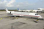
This is the pack of the mexican regional airline "AereoCalafia" Embraer ERJ-145 fleet pack with registrations: N183EC, XA-OVB, XA-FVT, and XA-UVX. Calafia Airlines is a Mexican regional airline founded in 1993, based in the Cabo San Lucas International Airfield. It was formerly named "Aéreo Calafia" till mid 2016, that were renamed to "Calafia Airlines". The model is AI Malcontent (AIM) Embraer 145 Basepack. This is my website: https://el-mundo-de-los-aviones-ai-traffic.jimdosite.com I hope enjoy it!
| Filename: | AI_AereoCalafia_Embraer_ERJ145_Fleet_Pack.zip |
| License: | Freeware |
| Added: | 15th September 2022, 04:22:54 |
| Downloads: | 29 |
| Author: | Jesus Gibran Soriano Solleiro |
| Size: | 28.95 MB |
| Category: Flight Simulator X - Scenery | |
| KOKC - Will Rogers World Airport - Oklahoma City, OK, USA |
|
File Description:
Will Rogers World Airport (IATA: OKC, ICAO: KOKC)is a joint use Civilian-Military airfield located in the southern part of Oklahoma City. The airport covers approximately 8,100 acres. The main terminal currently has 17 gates which supports 6 major airlines. The Federal Aviation Administration's Mike Monroney Aeronautical Center is located on the west side of the airport.
The scenery includes relocated taxiways, new and enlarged aprons, rebuilt terminals and air-bridges, and other buildings.
This scenery was designed to be used with the default FSX scenery.
| Filename: | KOKC__Will_Rogers_World_Airport__Oklahoma_City_OK_.zip |
| License: | Freeware |
| Added: | 30th January 2016, 12:28:00 |
| Downloads: | 1,197 |
| Author: | Bill Bridges |
| Size: | 28.38 KB |
| Category: Flight Simulator 2004 - Scenery | |
| VTBD 1961 Bangkok Intl. Don Muang |
|
File Description:
The airport was officially opened as a Royal Thai Air Force base
on March 27, 1914, although it had been in use earlier.
Commercial service to Don Mueang began in 1924.
The first commercial flight was an arrival by KLM.
The airfield was used by the Japanese during World War II,
and was bombed and strafed by Allied aircraft on several occasions.
During the Vietnam War, Don Muang Royal Thai Air Force Base was a
major command and logistics hub of the United States Air Force.
| Filename: | VTBD_1961_Bangkok_Intl_Don_Muang.zip |
| License: | Freeware |
| Added: | 16th March 2008, 05:42:06 |
| Downloads: | 3,397 |
| Author: | Wolfgang Gersch, Jaap de Baare and Tom Gibson |
| Size: | 2.26 MB |
| Category: Flight Simulator X - Scenery | |
| EKKL-Kalundborg Airport X VFR Photo Scenery |
|
File Description:
Kalundborg Airport – named Kaldred is a small regional field in a comfortable distance from my other FOTOREAL airport EKRK-Copenhagen Airport Roskilde. In the period 1964-76, airfield operations was yearly 15.000-20.000, and in 1976 the heavier aircrafts with retractable gear made it necessary to change the Runway surface from grass to asphalt. In 1981, the closure of Skovlunde Airfield in the Greater Copenhagen Area moved traffic to other locations like EKRK-Roskilde, and investments was made to improve service and facilities at EKKL to attract new customers, being a the perfect hub for aircraft operations to many of the small Danish islands. For many years post and News papers were daily transported by road from print in Copenhagen to Kaldred and flown to EKSS-Samsø (my last released airport).
Today six Air companies reside in Kaldred, together with Kalundborg Flyveklub. Visit Kaldred, and be sure you will get a warm welcome, and as they say in Kalundborg Flying Club, there are always coffee in the clubhouse. Included in the zip file is a version for Ultimate Terrain Europe and Dan-Vfr plus the Default scenery. Enjoy.
| Filename: | EKKLKalundborg_Airport__X__VFR_Photo_Scenery.zip |
| License: | Freeware |
| Added: | 22nd May 2008, 09:17:33 |
| Downloads: | 2,060 |
| Author: | Jens Peter Bruun-Hansen |
| Size: | 22.54 MB |
| Category: Flight Simulator 2004 - AFCAD Files | |
| Belfast Aldergrove (EGAA) |
|
File Description:
Belfast Aldergrove is a joint civil and military aerodrome 18 miles NW of Belfast. The civil airport (now known as Belfast International) is the main passenger airport in the Province and handles practically all air cargo. RAF Aldergrove is the only remaining military airfield in Ulster. Details at http://www.raf.mod.uk/rafaldergrove.
This AFCAD file corrects many of the inaccuracies of the FS2004 default airport. The corrections are based on information from the aerodrome chart, Google Earth, and personal observations. None of the changes are strictly accurate to scale. An apron area for helicopters and the occasional RAF transport aircraft has been provided for the military base. The cargo area has also been enlarged and parking provided for up to eight aircraft. Additional parking places have also been provided on the main passenger apron and on the GA apron off taxiway A. A holding area adjacent to taxiway C near the threshold of Rwy 17 has been removed. Various other improvements have been made to taxiways and holding areas on the military side of the airfield. Much of the original base is now disused hence the large number of closed taxiways.
| Filename: | Belfast_Aldergrove_EGAA.zip |
| License: | Freeware |
| Added: | 3rd April 2009, 18:54:38 |
| Downloads: | 513 |
| Author: | John Hubbard |
| Size: | 9.25 KB |
| Category: Flight Simulator 2004 - Scenery | |
| Ferndale 53U in Montana US |
|
Images related to this file:
File Description:
I have made this because I downloaded and tried the Glacier Park photo land-class scenery by Blue Sky Scenery and then rediscovered that the airfield runways are not correctly positioned or aligned in FS9. So I corrected the Ferndale runway and while I was there also added 33 hangars and some parked planes. Of course, as all I know about the hangars is the colour of the roof this isn't up to total realism. It is, however, better than nothing and as I have a large stock of hangars from other sceneries not much effort was involved.
Ferndale is an "airpark" type of airfield where folks build their houses and hangers around the field, plus it also has a bunch of hangars; it is the "bunch" that I have replicated, as I have no idea at all what the houses look like. The field is 20 miles southeast of Glacier Park International at 3,060 feet ASL and around 55 miles south of the Canadian border. There are no large towns close by; the nearest would be Missoula, which is some 70 miles further south.
| Filename: | Ferndale_53U_in_Montana_US.zip |
| License: | Freeware, limited distribution |
| Added: | 29th May 2010, 17:54:14 |
| Downloads: | 291 |
| Author: | Roger Wensley |
| Size: | 2.26 MB |
| Category: Flight Simulator 2004 - Scenery | |
| Aklavik CYKD in the Northwest Territories, Canada |
|
Images related to this file:
File Description:
Aklavik is a town of 650 or so inhabitants at N68 W135, which means 120 miles inside the Arctic Circle and on the West Channel of the Mackenzie River delta. It is 40 miles west of Inuvik and around 60 miles from where the Mackenzie meets the Beaufort Sea. There is only one airline serving the town on a regular basis and that is North Wright, which is headquartered in Norman Wells and also has a base in Inuvik. Aklavik village does not feature in FS9, so the first thing to do was to add it; not all the smaller streets are in place but it is the right shape and with around the right number of houses. The only building with (partly) correct textures is the school near the airfield. I couldn't begin to model 150+ houses, so think of it as a hand-made auto-generated village. I had to move the airfield over beside the river, so there is a DELETE file and a GRASS file, as well as an AFCAD for AI (the AI will follow later) and a scenery file.
| Filename: | Aklavik_CYKD_in_the_Northwest_Territories_Canada.zip |
| License: | Freeware, limited distribution |
| Added: | 10th October 2010, 03:02:19 |
| Downloads: | 630 |
| Author: | Roger Wensley |
| Size: | 1.91 MB |
| Category: Flight Simulator 2004 - Scenery | |
| Ivujivik CYIK in Hudson Bay, Quebec, Canada |
|
Images related to this file:
File Description:
Ivujivik is a village of 350 or so inhabitants at N62 25 W78 on the northeastern corner of Hudson Bay. The village does not feature in FS9 but is included in this scenery with approximately the right shape (the coast, even with UT, is not exactly right) so just think of it as a hand-made auto-generated village which gives the airfield a reason. The runway is 3,500 feet of gravel 100 feet wide, which should be enough. I also added the roads, deleted the stock airfield background and added a new background, plus of course there is the scenery file and the AFCAD and AI. You may note that the terminal has the elevation written on the sign as 126', while on the winter photo it is written on the older & bigger sign as 130'. I thought this is because satellite radar has fixed the elevations of all airfields more accurately than before, as Rockcliffe too has gone from 192' to 188'; the alternative explanation is that global warming has raised sea level by 4'. Wow! That's a thought. I presume the new sign was made smaller as a cost saving.
| Filename: | Ivujivik_CYIK_in_Hudson_Bay_Quebec_Canada.zip |
| License: | Freeware, limited distribution |
| Added: | 31st October 2010, 07:41:20 |
| Downloads: | 458 |
| Author: | Roger Wensley |
| Size: | 2.07 MB |


© 2001-2026 AVSIM Online
All Rights Reserved
Privacy Policy |