
Where Flight Simulation Enthusiasts Gather from Around the World!
AVSIM Library - Search Results

| Category: Flight Simulator 2004 - Scenery | |
| Portugal - LPFC Figueira de Cavaleiros |

|
Images related to this file:
File Description:
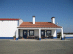
LPFC_FIGUEIRA DE CAVALEIROS (FERREIRA DO ALENTEJO) SCENERY 1.0
Figueira de Cavaleiros Airfield. LPFC is a fake I create, once it has no published ICAO.
This scenery is fully compatible with freeware Portugal Terrain from PTSIM (http://www.ptsim.com) and is based on digital pictures taken at the place, accurate real measures by Aerodromos de Portugal (http://www.pelicano.com.pt/zmapa.html).
Freeware. For Microsoft FS2004. NOT tested for FSX.
By Joao A. G. Ferreira.
| Filename: | Portugal__LPFC_Figueira_de_Cavaleiros.zip |
| License: | Freeware |
| Added: | 3rd December 2010, 15:23:56 |
| Downloads: | 522 |
| Author: | Joao Antonio Graca Ferreira |
| Size: | 1.54 MB |
| Category: Prepar3D V1-4 - Scenery | |
| LGBL Almiros ( only P3D4) |
|
File Description:
This is a Freware airport for Almros ( LGBL )
For P3D4 only !
I created this with A.D.E. v177_6986.
Included in this scenery is also the library "Airfield Essentials"and some static fighter models.
Nea Anchialos National Airport.
Amiros city in small city in central Greece (Thessaly) and this airport began operations somewhere around .. 1991, an airport for both, civilian and military as well,
using the same airport....but diferent runways of course.
| Filename: | LGBL_Almiros__only_P3D4.zip |
| License: | Freeware |
| Added: | 9th December 2019, 18:02:35 |
| Downloads: | 624 |
| Author: | Dimitris Mylonas |
| Size: | 14.93 MB |
| Category: Flight Simulator 2004 - Scenery | |
| Uppsala (ESCM) |
|
File Description:
This scenery makes Uppsala air base (ESCM) functional in FS2004 and FSX by adding taxiways, taxiway signs, aprons, parking stands, buildings and navaids.
From 1943 to 2003 the air base in Uppsala was home to the Royal Uppland Air Force Wing (F 16). Today the base is classified as a training airfield, but is also used for military transport operations and limited civil flying, mainly ambulance flights and a flying club.
| Filename: | Uppsala_ESCM.zip |
| License: | Freeware |
| Added: | 13th January 2010, 00:07:04 |
| Downloads: | 1,019 |
| Author: | Martin Loxbo |
| Size: | 21.92 KB |
| Category: Flight Simulator 2004 - AFCAD Files | |
| Omaha KOMA |
|
File Description:
FS9 AFCAD2 for Omaha Eppley Airfield KOMA. AFCAD is pre American take over of TWA and shows TWA at gates 5 & 6 in the South Terminal. American gates are shown as Gates 6, 7, & 8 also in the South Terminal. Gate 6 is shared with TWA; Gate 8 is shared with Midwest Airlines as well as US Air Express RJs. Cargo and General Aviation parking is also available.
| Filename: | Omaha_KOMA.zip |
| License: | Freeware |
| Added: | 4th November 2003, 05:14:10 |
| Downloads: | 1,123 |
| Author: | Steve Lewis |
| Size: | 6.26 KB |
| Category: Flight Simulator X - Scenery | |
| RAF Bradwell Bay |
|
File Description:
RAF Bradwell Bay is a former Royal Air Force station located 9.5 miles (15.3 km) east of Maldon, Essex, England and 3.1 miles (5.0 km) south west of West Mersea, Essex.
The airfield was first used as grass landing strip for the nearby firing ranges before being turned into a RAF station with concrete runways and hangars.The station is unique as it was the only fighter station where the Fog Investigation and Dispersal Operation (FIDO) was used.
Part of the site is currently being used by the Bradwell nuclear power station. Several of the hangars are still used as storage by the local farmers and the control tower is now a private house. Agricultural buildings, built in the '70s and '80s on runways one and two, are now home to several local businesses.
If you would like a more detailed history follow the following link. http://www.worldwar2heritage.com/en/page/9069/189/Bradwell-Bay-Airfield
| Filename: | RAF_Bradwell_Bay.zip |
| License: | Freeware |
| Added: | 26th January 2017, 20:05:03 |
| Downloads: | 138 |
| Author: | Terry Boissel |
| Size: | 18.06 MB |
| Category: Flight Simulator X - Scenery | |
| RAF Snetterton Heath - Norfolk, England |
|
File Description:
RAF Snetterton Heath is a former Royal Air Force station located south east of the A11, 6 miles (9.7 km) south west of Attleborough, Norfolk, England.
RAF Snetterton Heath airfield was constructed in 1942 to Class-A specifications. Originally thirty-six hardstandings of the "frying pan" type were constructed as when work started, the base was intended for Royal Air Force (RAF) use. When re-scheduled for the United States Army Air Forces (USAAF), the number was increased to fifty, all of them being on the south and eastern side of the airfield as a railway line and the A11 road restricted dispersed locations.
With the end of military control Snetterton Heath was closed and privately purchased in 1952 with a view to utilizing the runways and perimeter tracks as a motor racing circuit. The first motor cycle meeting was held in 1953 and the first motor races the following year. Source: Wikipedia.
| Filename: | RAF_Snetterton_Heath__Norfolk_England.zip |
| License: | Freeware |
| Added: | 22nd January 2016, 16:10:44 |
| Downloads: | 172 |
| Author: | Terry Boissel |
| Size: | 1.43 MB |
| Category: Flight Simulator X - Scenery | |
| RAF Ludford Magna |
|
File Description:
RAF Ludford Magna was a Royal Air Force airfield operated by Bomber Command during the Second World War and the Cold War. The station lay on agricultural farmland immediately south of the village of Ludford, Lincolnshire and was sited 21.4miles (34.4 km) north east of the county town of Lincoln, Lincolnshire, England. The remains of the station can be seen from the B1225 Caistor High Street, and the long distance footpath the Viking Way passes right next to the eastern perimeter track.
It was the highest bomber airfield in England at 428 feet (130 m) above sea level, and cost £803,000 to build.
All credit must go to the following authors without whose work I could not have made this scenery; all credit for the models contained in it is theirs I merely placed it. If you don't have any of the third party addons you will only see the runway and peri track: Ted Andrews - Ian Pearson - Mike Hudson
| Filename: | RAF_Ludford_Magna.zip |
| License: | Freeware |
| Added: | 5th October 2015, 20:07:32 |
| Downloads: | 339 |
| Author: | Terry Boissel |
| Size: | 20.9 KB |
| Category: X-Plane - Scenery | |
| BR CE - SBJU Juazeiro do Norte v1.1.0 |
|
Images related to this file:
File Description:

This is an X-Plane 11 and X-Plane 10 scenery package for Orlando Bezerra de Menezes Airport (IATA: JDO, ICAO: SBJU), also known as Cariri Regional Airport (Aeroporto Regional do Cariri), is the airport serving Juazeiro do Norte and the Cariri region, in Ceara, Brazil. It includes corrected aprons, ramps, taxiways, lighting system, city buildings, ortho photoscenery for the airfield area, and (XP11 only) ground services (like push back). This scenery was tested and is operational (as of March 22, 2017) in "X-Plane 11 Public Beta #15 64 bit", Windows 10 Home. It was also tested and is also operational (as of March 22, 2017) in "X-Plane 10.51 64 bit", Windows 10 Home. Only the default X-Plane 11 libraries, by Laminar Research, are needed. No third party libraries are used. v1.1.0 adds orthophoto scenery for the airfield area, adjusted ramps stands, city buildings, and now adds XP11 ground services (XP11 omnly).
| Filename: | BR_CE__SBJU_Juazeiro_do_Norte_v110.zip |
| License: | Freeware |
| Added: | 23rd March 2017, 05:19:07 |
| Downloads: | 88 |
| Author: | Rui Mesquita |
| Size: | 14.9 MB |
| Category: X-Plane - Scenery | |
| BR GO - SBGO Goiania v1.1.0 |
|
Images related to this file:
File Description:
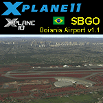
SBGO v1.1.0 - This is an X-Plane 11 and X-Plane 10 scenery package for Santa Genoveva/Goiânia Airport (IATA: GYN, ICAO: SBGO), in Goiania, GO, central area of Brazil. It includes corrected aprons, ramps, taxiways, the new terminal (2016), lighting system, city buildings, ortho-photo scenery for the airfield area, and (XP11 only) ground services (like push back) for SBGO/GYN airport. This scenery was tested and is operational (as of March 08, 2017) in "X-Plane 11 Public Beta #13 64 bit", Windows 10 Home. It was also tested is operational (as of March 08, 2017) in "X-Plane 10.51 64 bit", Windows 10 Home. Only the default X-Plane 11 libraries, by Laminar Research, are needed. No third party libraries are used. v1.1.0 adds the city buildings to Goiania, adds orthophoto scenery for the airfield area, and it is now also compatible with both XP 10.51 and XP11.
| Filename: | BR_GO__SBGO_Goiania_v110.zip |
| License: | Freeware |
| Added: | 9th March 2017, 04:46:47 |
| Downloads: | 121 |
| Author: | Rui Mesquita |
| Size: | 13.35 MB |
| Category: Flight Simulator X - Scenery | |
| RAF Moreton In The Marsh - Gloucestershire, England |
|
File Description:
RAF Moreton-in-Marsh was a Royal Air Force station near Moreton-in-Marsh, Gloucestershire. It was opened in November 1940 and closed for operational flying in early 1948. The base remained in use as a relief runway and for training. After a period of care and maintenance, the Station was handed over to the Home Office in 1955.
The town's environs are quite flat and low-lying although it is situated at the northern extremity of the Cotswold Hills range. During World War II, a large area of this flat land to the east of the town was developed as an airfield and became the base of 21 OTU (Operational Training Unit) RAF, flying mainly Vickers Wellington bombers. It is highly likely that the airfield inspired the title of the radio show Much Binding in the Marsh. After all, two of its stars, Kenneth Horne and Richard Murdoch, served there as flying instructors.
| Filename: | RAF_Moreton_In_The_Marsh__Gloucestershire_England.zip |
| License: | Freeware |
| Added: | 1st February 2016, 10:07:46 |
| Downloads: | 227 |
| Author: | Terry Boissel |
| Size: | 1.74 MB |
© 2001-2026 AVSIM Online
All Rights Reserved
Privacy Policy |