
Where Flight Simulation Enthusiasts Gather from Around the World!
AVSIM Library - Search Results

| Category: Flight Simulator 2004 - Scenery | |
| Bethel PABE in southwest Alaska |

|
Images related to this file:
File Description:
There are four main northwestern Alaska towns which have good airports and are serviced by Alaska Airlines. From these airports local flights connect to nearby villages, "nearby" in Alaska meaning up to 200 miles away. The northernmost is Barrow. Southwest of Barrow is Kotzebue, then Nome, and the furthest south is this one, Bethel. The town of Bethel has a population of just over 6,000 and is 50 miles from the sea on the Kuskowim River, that splits and forks into many tributaries. Bethel Airport is close to the town and provides the only contact with the rest of Alaska, as there is no connecting highway system. There are scheduled flights by Alaska Airlines, ERA (now called Ravn) and Grant Aviation, plus others such as Ryan Air. There are cargo flights by Everts, Northern, and Lynden, and redistribution onwards to nearby villages by the smaller locally-based planes; all of these are included in the AI. There are two main runways, one just under 6,400 feet and another just under 3,900 feet, both of them aligned 19-1. The third runway is around 1,800 feet and mainly gravel, aligned 11-29. Parking at PABE is on three aprons, the northern for smaller commercial planes of Grant, ERA, Ryan etc, the central for larger planes of Alaska, Northern, Everts, and Lynden, and the southern for a large collection of GA; each apron has further hangars for maintenance companies and smaller operators. There is also another separate apron for the local military and Coastguard. There is not much photographic information available for PABE, and I have never been there; as a result it was impossible to make detailed photographic textures for some of the buildings. However, for most hangars I have made textures of at least the right colour etc based on the information I assembled and if it is green with white trim and side windows then that is how it now appears here. The exceptions are the Alaska Airlines terminal building which has complicated curved elements, and the two military hangars and workshops where I had to settle for an Alaska terminal building from another airport and the same for the military. There are numerous small villages in the vicinity of Bethel, all of them being beside either a river tributary or the coast. There are two Google Earth screenshots to show the villages that are served by the flights from Bethel and that are (mostly) included in the AI. Some of these airfields were not included in FS9 but AI will still operate in and out of Bethel. The smaller area screenshot shows the villages that are close to Bethel, and of these eight I have so far made six and they are included in this post: Napaskiak PKA, Napakiak WNA, Kwethluk KWT, Atmautluak 4A2, Nunapitchuk 16A, and Kasigluk Z09. I will work my way through the rest of the area.
| Filename: | Bethel_PABE_in_southwest_Alaska.zip |
| License: | Freeware, limited distribution |
| Added: | 8th March 2019, 00:37:58 |
| Downloads: | 311 |
| Author: | Roger Wensley |
| Size: | 32.02 MB |
| Category: Civil Flight Simulators - Looking Glass Flight Unlimited 3 | |
| Stansted Professional version |
|
File Description:
This is version 3 of the UK-South airport Stansted (north of London) for FU3. Version two is improved by the addition of villages, models and some taxiways. This is an unsupported version which assumes you have installed previous UK-South packages, and makes extensive use of models from these packages, including Andre's IOW, Luc's Cardiff, Jon's model sets, Hans Petter's LCA, Gatwick and Heathrow. All models used are available through AVSIM. Contact me through the AVSIM forum if you have any problems with this package.
| Filename: | Stansted_Professional_version.zip |
| License: | Freeware |
| Added: | 7th October 2003, 01:33:16 |
| Downloads: | 180 |
| Author: | Robert Driscoll |
| Size: | 335.68 KB |
| Category: Flight Simulator 2004 - Aircraft Repaints, Textures and Modifications | |
| Iran Air Tours McDonnell Douglas MD-82 - FS2004 & FSX |
|
Images related to this file:
File Description:
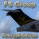
This Is Iran Air Tours MD-82 Livery For Leonardo SH - Maddog 2010 ----
Iran Air Tour Recenly Use This Aircraft - Registration : UR-BXL ----
Next Projects Are Textures For Aircrafts In FullHD 1080p Quality In Iranian Liveries And Also Airlines Around World Az Soon (Payware)----
Other Project Is IranFull Scenery Of : Cities , Villages , Plains and Forests , Mountains Of Iran And Etc (Payware) ---- All This Will Be Available In Www.IranAviation.ir & WwW.Flightshop.ir And World Shops Like AVSIM Store.
This File Is Copyrighted By FS Group Tehran/Shiraz Company And Uploaded To Avsim.
Have A Nice Fly , Thank You
| Filename: | Iran_Air_Tours_McDonnell_Douglas_MD82__FS2004__FSX.zip |
| License: | Freeware, limited distribution |
| Added: | 13th November 2010, 00:32:17 |
| Downloads: | 758 |
| Author: | Sayyed Mohammad Ali Raheminia |
| Size: | 9.94 MB |
| Category: Flight Simulator X - Scenery | |
| RAF Colby Grange |
|
File Description:
RAF Coleby Grange was a Royal Air Force station situated alongside the western edge of the A15 on open heathland between the villages of Coleby and Nocton Heath and lying 7.4 mi (11.9 km) due south of the county town Lincoln, Lincolnshire, England.
Opened in 1939 and operated as a fighter and night fighter airfield during World War II, it was occupied at various times by UK, US, Canadian and Polish fighter squadrons, the station briefly switched to a training role post-war before being placed on a care and maintenance basis.
| Filename: | RAF_Colby_Grange.zip |
| License: | Freeware |
| Added: | 21st October 2015, 20:43:24 |
| Downloads: | 272 |
| Author: | Terry Boissel |
| Size: | 11.28 KB |
| Category: Prepar3D V1-4 - Scenery | |
| Occhito Dam Foggia Italy N41.37.09 E14.58.25 |
|
Images related to this file:
File Description:
Occhito Dam Foggia Italy N41.37.09 E14.58.25 Born from the Fortore River barrage, Occhito dam originates from the second largest artificial water mirror in Italy. The dam rises in the territory of Carlantino, one of the small villages in the province of Foggia on the border with Molise, and was built at the end of the 1950s to meet the water needs of the province.
Important VFR point for approaching airport Foggia Gino Lisa.
Within the downloaded package you will find readme files for scenery installation. Good fly VFR. Pasquale Marrulli.
| Filename: | Occhito_Dam_Foggia_Italy_N413709_E145825.zip |
| License: | Freeware |
| Added: | 14th November 2017, 16:44:52 |
| Downloads: | 301 |
| Author: | Pasquale Marrulli |
| Size: | 1.47 KB |
| Category: Flight Simulator 2004 - Scenery | |
| Metropolitan Tel-Aviv Part 2 of Israel Scenery |
|
File Description:
FS2004 Scenery - Metropolitan Tel-Aviv. The second
part of Isreal Landclass covering 2,600 square km of
the central coastal area of Israel from Hadera to
Ashdod. Made in the highest detail, with all major
highways, all main roads and most of the secondary
roads, rail roads, coast lines, ports and marinas, all
cities and towns and villages from 500 residents and
above, rivers and water bodies, accurate vegetation,
sand dunes, quarries and other land uses needed for
VFR. The scenery is enhanced with night lighting to
enable easy VFR navigation by night.
| Filename: | Metropolitan_TelAviv_Part_2_of_Israel_Scenery.zip |
| License: | Freeware |
| Added: | 12th December 2003, 16:28:14 |
| Downloads: | 13,731 |
| Author: | Seev Kahn |
| Size: | 2.41 MB |
| Category: Flight Simulator X - Scenery | |
| Bushflight Northwest - updated |
|
File Description:
Bill and Phil thought that the "Top left hand corner" of Washington state looked a bit bare and decided to pep the scenery up a bit. Here is an addon package that adds airports, villages, shipwrecks, seaplane landings and even a rainbow, not to mention a lost mine and a "moonshiner's hideaway". It's nothing special, there's a fair bit of fiction here as well as some reality. This is a fun enhancement to the area around the Olympic National Park and Forest. Tested and working with UTX. Works with FSGenesis too - with the usual caveats about flattens.
| Filename: | Bushflight_Northwest__updated.zip |
| License: | Freeware |
| Added: | 19th October 2007, 07:53:41 |
| Downloads: | 1,385 |
| Author: | Bill Dick / Phil "Snowman" Cayton / Chris Brisland |
| Size: | 1.3 MB |
| Category: Flight Simulator X - Scenery | |
| RAF Metheringham - Lincoln, Lincolnshire, England |
|
File Description:
RAF Metheringham was a Royal Air Force station situated between the villages of Metheringham and Martin and 12.1 mi (19.5 km) south east of the county town Lincoln, Lincolnshire, England. Third party addons will be required - see Readme.txt file for details.
Operated as a bomber airfield during World War II the station opened in October 1943 and was decommissioned in the spring of 1946.
Although now mostly returned to agricultural and commercial uses the site retains one original runway, the eastern perimeter track and some contemporary buildings together with a No. 106 Squadron RAF memorial garden and a visitor centre.
Souce: Wikipedia
| Filename: | RAF_Metheringham__Lincoln_Lincolnshire_England.zip |
| License: | Freeware |
| Added: | 12th November 2015, 16:12:55 |
| Downloads: | 306 |
| Author: | Terry Boissel |
| Size: | 95.79 KB |
| Category: Flight Simulator X - Scenery | |
| Pietrapertosa and Castelmezzano - Potenza, Italy |
|
File Description:
I decided to make some Italian cities and small towns for FSX. In this package you will find two villages of the Basilicata-Lucania Castelmezzano (N40°, E16°.32.25, 3486 Ft) and Pietrapertosa (N40°, E16°.32.97, 3100Ft) attention lately the record for the "Flying angel" as referred to in the video links for notice https://youtu.be/1M69frANoAA
This scenario is an important point of reference VFR of Power and the Ionian Sea.
In the package Pietrapertosa.zip you will find two files file.bgl that will be placed in addon scenery folder and sub-folder of FSX scenery to the scenery will be installed automatically.
| Filename: | Pietrapertosa_and_Castelmezzano__Potenza_Italy.zip |
| License: | Freeware |
| Added: | 30th June 2016, 09:22:47 |
| Downloads: | 381 |
| Author: | Pasquale Marrulli |
| Size: | 3.19 KB |
| Category: Prepar3D V1-4 - Scenery | |
| Courchevel Airport and city France N45.24.27 E6.34.39 |
|
File Description:
Courchevel Airport and city France N45.24.27 E6.34.39 at high altitude allows you to get to 4 Bellecote villages, Courchevel 1550 1650 and Courchevel 1850 or the tallest village and is the one that gives shine to Courchevel in the world, generally recognized as the most exclusive land skiing destination, even before places such as St Moritz. The highest point is located at the top of Saulire (2738 m asl) where there is the weather station "Sommet de la Saulire" N45.23.00 E6.36.37.
Within the downloaded package you will find readme files for scenery installation. Good fly VFR. Pasquale Marrulli.
| Filename: | Courchevel_Airport_and_city_France_N452427_E63439.zip |
| License: | Freeware |
| Added: | 5th January 2018, 16:40:14 |
| Downloads: | 1,367 |
| Author: | Pasquale Marrulli |
| Size: | 5.03 KB |


© 2001-2026 AVSIM Online
All Rights Reserved
Privacy Policy |