
Where Flight Simulation Enthusiasts Gather from Around the World!
AVSIM Library - Search Results

| Category: Flight Simulator X - AFCAD Files | |
| Murtala Muhammed International Airport, Lagos (DNMM) Version 2 |

|
File Description:
Hi again fellow simmers....
This is an major update to my previous AFCAD on this famous West African airport.
Here are all its features:
- ILS offset fixed as well as some smaller details, like the fact that rwys 1L/1R are
permanently closed to take-off and landings.
- Corrected runway lightings/markings.
- DME on Rwy 19R now working.
- Right Hand Pattern Approach/Take-off only.
- Added correct amount of gates at the International Terminal with parking codes for airlines
that actually fly to DNMM (British Airways, Air France, KLM, Alitalia, Virgin Atlantic,
Virgin Nigeria, Sabena, Swiss, Afriqiya, Emirates, Qatar Airways, South African Airways and
more).
- Domestic Terminal fully laid out and functional with domestic airline parkinting codes
(Albarka, Chanchangi, ADC, Belleview, Kabo Air, etc).
- Cargo parking fully functional.
- Military parking (C130, MiG-21, MiG-29, Alpha Jet, Jaguar, Tornado).
To Install:
1. DELETE THE PREVIOUS 'AF2_DNMM.BGL' file from the 'Flight Simulator X/Addon
Scenery/scenery' folder.
2. Extract all files from the downloaded '.zip' file.
3. Now COPY the NEW 'AF2_DNMM.BGL' file and place it into 'Flight Simulator X/Addon
Scenery/scenery' folder.
4. Start up the Flight sim and the changes will be present.
READ THIS !!!
I've tried to the best of my ability to produce and much detail as possible but i'm sure
something has been left out (there always is).
I've used the latest Jeppesen charts and other materials at my disposal and even my own
eyesight at great risk to myself (yep, even pilots are restricted from certain places at
airports)
Also, lots of airports have changed drasticly on the past couple years like Abuja airport
(DNAA) and I would love to do justice to it as its fast becoming a major hub in the region. I
would be willing to join forces to with anyone that is good with AFCAD on this project.
Enjoy!
[email protected]
13:44 30/07/2007
| Filename: | Murtala_Muhammed_International_Airport_Lagos_DNMM_.zip |
| License: | Freeware |
| Added: | 30th July 2007, 19:44:57 |
| Downloads: | 3,283 |
| Author: | usman saleh |
| Size: | 7.38 MB |
| Category: Flight Simulator X - Aircraft Repaints, Textures and Modifications | |
| P-47D 324th FG/ 316th FS #86 "Black Sheep" |
|
File Description:
This folder contains a repaint for the Shockwave World War II Fighters P-47D Thunderbolt, representing the aircraft flown by Lt Jerry Wurmser of the 316thnd FS/324th FG, in France and Germany, between 6 march 1945 and the end of the war. He is still alive, and told me: "The name "Black Sheep" was already painted on the plane when it was assigned to me. It previously had been assigned to someone in Britain, and eventually ended up in France after either being shot down or having crashed and then repaired. It had a brand new engine in it when I received it on March 6, 1945. At this time I had already completed 39 missions, and finally was assigned my own airplane. My first flight in it was to break in the new engine, or "slow time" it. This required flying it about for a period of time at very low throttle settings, to break in the new engine. The plane had already seen a lot of action, and the "form 1" contained a long list of malfunctions that was written up by the previous flyers and dates of repairs. Several times I had to sign the "exceptional release" form before going up, acknowledging that I knew and understood what the previous pilot stated what was wrong with it. This plane was a razorback, with the tail assembly out of line, so that I had to apply rudder correction constantly. It got such bad gas mileage that I carried one less bomb and a gas tank instead. I hated that plane. I finally did get a new bubble canopy plane, but by this time the War was over!"
Repaint by Jan Kees Blom, based on two repaint kits, one by John Terrell and one by Shockwave. Included is a 1024 x 1024 bmp repaint, which should work in both FS9 and FSX.
| Filename: | P47D_324th_FG_316th_FS__86_Black_Sheep.zip |
| License: | Freeware |
| Added: | 24th January 2009, 18:52:28 |
| Downloads: | 283 |
| Author: | Jan Kees Blom |
| Size: | 5.05 MB |
| Category: Flight Simulator X - Scenery | |
| LYPG Podgorica Airport, Montenegro |
|
File Description:
Podgorica Airport (IATA: TGD, ICAO: LYPG) is an international airport located 11 km (6.8 mi) south of Podgorica, Montenegro. It is the main hub for Montenegro Airlines.
It is one of two public airports in Montenegro, the other being Tivat Airport. Both are operated by the state-owned company Airports of Montenegro. The airport is sometimes called Golubovci Airport by the locals, as the town of
Golubovci is in close proximity. Airports Council International awarded Podgorica the best airport under 1 million passengers in 2007.
The IATA code of the airport is still TGD because Podgorica was named Titograd (after Josip Broz Tito) from 1946 to 1992, during which time the airport opened.
The airport handles domestic flights within Montenegro as well as international flights. As Montenegro's two main airports are merely 80 km apart, there are no regular passenger domestic flights. Domestic flights have been reduced to
charter flights and general aviation, and all scheduled traffic is international.
There are daily scheduled flights to various European destinations. During the summer season, there are many charter flights and air connections to various major cities in the world. The flight to Belgrade airport has traditionally
accounted for majority of the traffic at the airport, but the percentage is decreasing.
VIP and taxi airlines Vektra Aviation, Di Air and OKI Air are based at the airport. Serbian VIP airlines Air Pink and Prince Aviation also use the airport.
Podgorica Airport served 538,477 passengers in 2008. However, due to global economic downturn, passenger numbers declined to 450,504 in 2009. In 2010, strong growth was recorded, so numbers passed the 600,000 mark.
Thanks to Serbia And Montenegro Virtual Area Control Center for the airport charts.
This file has the right coordinates, with the apron and characteristics of the airport, airport vehicles and buildings, also it is set to the correct altitude of 126 feet or 38 meters.
| Filename: | LYPG_Podgorica_Airport_Montenegro.zip |
| License: | Freeware |
| Added: | 29th October 2012, 21:41:37 |
| Downloads: | 4,659 |
| Author: | Anwar Gonzalez |
| Size: | 10.52 MB |
| Category: Flight Simulator X - Aircraft Repaints, Textures and Modifications | |
| Consolidated PBY Catalina C-FCRR |
|
Images related to this file:
File Description:
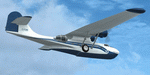
This folder contains a repaint for the Aerosoft PBY Catalina for FSX. It is shown here as C-FCRR, with Air France colors. Built by Boeing of Canada at Vancouver, it became RCAF Canso 9767 on March 4, 1943, and was allocated to Squadron 162, coded S, at Reykjavik, Iceland. In 1944, piloted by Flying Officers Thomas Charles Cooke and Eric Walter Wiskin, 9767 sank the German U-boat U-342 off the coast of Iceland on April 17. The amphibian was removed from the military service on April 1, 1946. The same year it was sold to Canadian Pacific Airlines, registered CF-CRR and assigned fleet number 233 (later 933), it was operated until 1959, thereafter by Northland Airlines (1960-1968), Midwest Airlines (1969-1970), and Ilford Riverton until 1973. The registration was changed to C-FCRR when Avalon Aviation acquired it as a water bomber in 1977, listed as Tanker number 791.
In 1995 the aircraft was bought by Powell Eorp. Of Parry Sound, Ontario, subsequently it was owned by the Canadian Air Legend. The French pilot Franklin Devaux bought C-FCRR in 1995 and converted it to a flying television studio, it was based at Le Bourget, Paris, France. During 1996 C-FCRR was the star of monthly French television programme Operation Okavango, while in September 1998 it was the eye catcher of the three-week Champs-Elysees (Paris) static air show. The following October the aircraft started an 8,078 mls (13,000 km) trip to Chile via Dakar (Senegal) and Natal (Brazil) to commemorate early Air France South Atlantic mail service, returning to France in June 1999. On January 19, 2002 the aircraft was stored at Orly Airport, Paris, and has not flown since. Its Canadian registration was cancelled on October 7, 2005. At present it seems to be registered as N9767, and in airworthy condition again. Here's a youtube movie on this aircraft: http://www.youtube.com/watch?v=s6jyzV8Gawc. Repaint by Jan Kees Blom, based on the repaint kit by Aerosoft.
| Filename: | Consolidated_PBY_Catalina_CFCRR.zip |
| License: | Freeware, limited distribution |
| Added: | 26th September 2010, 11:33:47 |
| Downloads: | 1,197 |
| Author: | Jan Kees Blom |
| Size: | 9.83 MB |
| Category: Prepar3D V1-4 - Aircraft Repaints, Textures and Modifications | |
| China Airlines 1998 AI Package |
|
File Description:
China Airlines had almost completely repainted the fleet by 1998, in these flightplans there is only 1 A300s left in the old livery. China Airlines rushed the repaint of their fleet as the Taiwanese flag on the old colors was not allowed in HKG after the 1997 hand over from England making Hong Kong a Chinese Territory. As such, the old colors were gone by 1998. The 737-400s were still very much active, but were very near the end of their lives with China Airlines retired by 1999 or so. The 737-400s do some regional international routes, and also high frequency KHH-TSA flights and a few TPE-KHH flights. Only 2 747-200s left, mostly flying to HND, and the A300-600R is the backbone of the fleet with a handful of A300B4s still flying. The 747SPs all were at Mandarin by 1998. At this time, and Mandarin aircraft often subbed for China Airlines 747-400s and MD-11s using the "DYNASTY" callsign. I have included an MD-11 in Mandarin colors operating China Airlines flights, I recommend you make a separate aircraft.cfg entry for the Mandarin MD-11 aircraft with the "DYNASTY" callsign and "CAL" parking code for realism. Repaints by Ranmori Scythe for the FAIB 737-400, 747-200, 747-400, FSPX MD-11, and TFS A300B4 and A300-600R are included. As a bonus, textures are also included for the FAIB 737-800(which entered the fleet in 1999) and the old colors on the FAIB 747-400(discontinued by 1997). Feel free to use the 737-400 instead of the 737-800 if you wish. All repaints were done by the very talented Ranmori Scythe and flightplans were done by the not-so-talented Chasen Richardson. Requires mandarin_airlines_1998.zip for the Mandarin textures. Part of the 1998 Flight Simulator Project. Follow us on Facebook at facebook.com/flightsim98 and on instagram as @bayviationsim. For more Retro AI, check out the forums at: http://retroai.proboards.com/
| Filename: | China_Airlines_1998_AI_Package.zip |
| License: | Freeware, limited distribution |
| Added: | 21st November 2019, 19:18:09 |
| Downloads: | 298 |
| Author: | Ranmori Scythe, Chasen Richardson/Bayviation |
| Size: | 13.92 MB |
| Category: Flight Simulator X - Scenery | |
| Carnes Farm |
|
Images related to this file:
File Description:
These are the files that I talked about in the Prepar3d forums. I created these objects for Fs9, then upgraded them to the scenery SDK for FSX. They were created 10 years ago in GMAX, and I have used them successfully ever since in Prepared 1.4 as well.
For some reason the individual farmhouse and other objects that I created are not showing up in Prepar3d version 2.0.
That's where you guys come in! These files are free to use in anyway you want as long as proper attribution is given, but, I would like you guys who have both Prepar3d 1.4 and 2.0 to try them out in both and report back to me as to whether you have the same problems that I do. That's your only fee. And I'd like you guys to give it a shot in both, or all four( I am not sure that they will work in FS9 anymore, but try it out. Unfortunately I can't recompile my FSX SDK Files back to FS9 if it doesn't work).
What's included:
1. Photo real scenery of Barbourville, 10 miles to the north west of stinking Creek where we live, and;
2. Photo real scenery of the farm area and stinking Creek, upon which I have placed my GMAX objects;
A. The farm house.Carnes Farm From the Bridge at 500 AGL.jpg
B. The barn, shed and the RV in back of the farmhouse.
C. A two-story long structure the top of which is an apartment but the bottom of which is a re-creation of Mama Carne's store, along with all the real wood floors shelves and original contents.. It is also o n Google earth in 3-D as it is here with further description .
... A little note on Gmax.. Mama Carne's store was one the first structures that I built in Gmax. It was just a box. Later, I added the true architectural features that you see including the steps and rails which took about as long to create as it would have to Saw and fit and hammer the real rails, risers and steps.
D. K-6, my little 2300 foot strip for runways 03 and 21. It has VOR - (117.55), ILS(110.1), and NDB(222).
E. Gerald Bingham's house, 1/4 mile up Warriors Path North from us.( mostly dirt road with gravel topping).
F. Dewitt Baptist Church.
Off property Knox county
G.Escoe's Store and Post Office complete with great prices for gas at the included pumps.
Escoes.jpg
H. Rex allen's killer corner...sheds and farm equipment on the sharpest bend on Stinking Creek...my son went off it with a flat tire, unscathed, but more than several have lost their lives on that curve... there may be several iterations of the sheds...just delete or rename the wrong ones...I was experimenting with ModelConverterX, Arno Gerretsen's wonderful model and object scenery tool.
I. sitting on top of the Barbourville Photo real scenery Barbourville PhotoReal over the shopping center.jpg is the Barbourville P3D Shopping Center2.jpg shopping center all the stores and all the storefronts ... it's on 25 E. as you head into Barbourville.
Recreated, is the entire shopping center with the now outmoded Wal-Mart sign. Probably my magnum opus.
note on the Gmax scenes.
All of the scenery was either directly measured and if not practical for a such a long measuring device, walked off, as in the Stinking Creek Bridge and shopping center. All of the objects were then photographed, in 360° where possible and saved as texture for inclusion in the Gmax model.
Enjoy!
...oh... how do you get there? Wellllll.... situate yourself at Middlesboro (1a6), and tune your Nav radio to K-69's VOR, 117.55, take off and climb to 3500 feet...grinnnnn
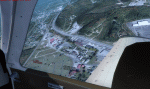
Welcome to Knox County Kentucky!
| Filename: | Carnes_Farm.zip |
| License: | Freeware |
| Added: | 2nd December 2013, 05:34:20 |
| Downloads: | 453 |
| Author: | Chas Honce |
| Size: | 91.13 MB |
| Category: Flight Simulator X - Scenery | |
| RAF Keevil |
|
File Description:
The airfield was built on a site previously ear-marked for the purpose in the mid-1930s. Consisting of 3 long concrete
runways the airfield was used by the Royal Air Force and the United States Army Air Forces Eighth and Ninth Air
Forces.
In 1942 Keevil airfield was provided to the USAAF and it was assigned USAAF designation 471 (KV). Squadrons based at
the unit transported military freight and supplies using C-47 and C-53 aircraft.
RAF Fighter Command use
Short Stirlings of Nos. 196 and 299 Squadrons RAF lining the runway at RAF Keevil on the evening of 5 June 1944 before
emplaning paratroops of the 5th Parachute Brigade Group for the invasion of Normandy With the departure of the
Americans, the RAF used Keevil beginning in March 1944 for 196 and 299 Squadron Short Stirling glider tugs of No. 38
Group RAF arrived followed by a large number of Horsa gliders, crewed by Army pilots of the Glider Pilot Regiment.
The RAF Stirling aircraft were crewed by RAF, RCAF, RAAF, RNZAF and SAAF personnel and were engaged in SOE and SAS
drops. largely in France, and in glider towing. Their involvement in the Normandy invasion of France and Operation
Market-Garden is well remembered by Keevil and Steeple Ashton villagers. Casualties of army and air force personnel
were heavy and a number of aircraft were lost.
With the end of military control, Keevil airfield is virtually complete with all of its runways, perimeter track and
many of the hardstands still in place. It is used occasionally for British Army and RAF exercises. The airfield is
still frequently used by the RAF for training purposes such as air drops and parachuting, the gate is always locked
and access is restricted to authorized key holders only. Ref ~ http://www.wdrcfc.org.uk/wp/about-2/clubrules/
Since 1992 it has been home to the Bannerdown Gliding Club, an RAF Gliding and Soaring Association Club, affiliated to
RAF Brize Norton since the closure of nearby RAF station at Lyneham. The airfield is also used as a motorsport circuit
for various events. It is also the home of the Warminster and District Radio Control flying club.
In September 1994 the Keevil Society, organised by Paul Vingoe, held a Commemorative Day to mark the 50th anniversary
of the D-Day and Arnhem operations and to dedicate a memorial to all who served at Keevil, especially those who flew
from there and lost their lives.
Source:Wikipedia
| Filename: | RAF_Keevil.zip |
| License: | Freeware |
| Added: | 5th February 2017, 19:55:43 |
| Downloads: | 174 |
| Author: | Terry Boissel |
| Size: | 24.39 KB |
| Category: Flight Simulator 2004 - Scenery | |
| St Lawrence Island AK: Gambell PAGM, Savoonga PASA, and Northeast Cape |
|
Images related to this file:
File Description:
St Lawrence Island is in Alaska, but "in" is slightly misleading as it is in fact in the Barents Sea and 120 miles from the Alaska mainland, and only 40 miles offshore of Russia. The island is around 100 miles long, with two villages and at the eastern end an old air force radar base that was cleared away some 25 years ago. Gambell is one of the two villages and is at the far western end of the island, with a population of around 700 living mainly from the sea. This northern airfield is unusual in that it has an asphalt runway and apron, the lit runway being aligned 16-34 and just over 4,500 feet long. The reason for the asphalt becomes apparent if you try walking in the vicinity, as underfoot there are rounded pebbles down to varying depths, and they are quite small and eventually slippery enough to trip you up. To base a flexible gravel runway on top of this would have been difficult, and when it was originally built it was for an air force base (closed long ago). The village is also fairly unique among northern settlements in that it has wind turbines and also solar panels. The second village is Savoonga and is around 40 miles east of Gambell with a similar population. The runway here is lit gravel aligned 5-23 and 4,900 feet long. This village also has wind turbines and solar panels. There are no vehicles (cars, pickups, trucks etc) on the island, mainly because there is nowhere far to go to and in the case of Gambell because roads as such would be difficult to create. ATV's are the standard way to go, along with small boats for fishing and whaling. At the eastern and of the island the remaining traces of the air force radar base are just the gravel runway and aprons, included with the Savoonga scenery. The AI included here is for daily flights from Nome by ERA and Bering Air, along with some GA. Also included here is the EZ library that includes the wind turbines, to save you looking for it. Installing this will also mean that a wind farm in my Cyprus scenery wii now be visible to the north of Larnaca, and there are other libraries in the series that include useful objects. The Lens_EZ_Animated library could go into your static objects folders, which is where I have it; up to you.
| Filename: | St_Lawrence_Island_AK_Gambell_PAGM_Savoonga_PASA_a.zip |
| License: | Freeware, limited distribution |
| Added: | 29th February 2020, 00:09:36 |
| Downloads: | 223 |
| Author: | Roger Wensley |
| Size: | 11.59 MB |
| Category: Flight Simulator X - Scenery | |
| Albany International Airport (KALB) Albany, New York |
|
Images related to this file:
File Description:
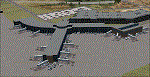
This airport was made using Airport Design Editor, Google Sketchup, and Instant Scenery 2. Albany International Airport, Is an airport located near Albany, New York. The airport has scheduled airline flights. Almost all of the buildings are custom made with photo textures to make it closer to real life. At the main terminal, I added more gates and put moving jetways. The gates have assigned parking codes. There is a parking lot next to the terminal full of cars. I put the airport access road in between the parking lot and the terminal. At the southwest ramp, I put hangars and some you can taxi inside of. If you choose to start off from the southwest DOCK gate, You will start off inside the Million Air Aviation FBO. I also put static aircraft on the ramp too. To the northwest, I put the New York Police hangar. You can start off inside this hangar by choosing the Northwest DOCK gate. Taxiing into or starting off inside a hangar will not cause a crash unless you touch the sides. To the Northeast, I put the cargo terminal with trucks. At the cargo section, I put three FedEx Cessna Caravans. I also put the control tower and the buildings. Tower views are from the roof of the control tower. To the southeast, I put small hangars and the Air National Guard Section with UH-60 helicopters. I extended runway 1/19 to the correct length of 8,500 feet. I also put red, blue, green, and purple Cessna 172s in different places around the airport. There will be more objects if your scenery complexity is set to normal (such as jetways, aircraft, and vehicles). This was all made based on Google Earth Imagery and Bing Maps. There are no night textures for the buildings. This will be added in a future version. An installer program is included to install the airport for you. There will be more versions of this that include night textures and static business jets. This is for Flight Simulator X only. By Tyler Lawrence.
| Filename: | Albany_International_Airport_KALB_Albany_New_York.zip |
| License: | Freeware |
| Added: | 2nd June 2012, 08:14:12 |
| Downloads: | 4,347 |
| Author: | Tyler Lawrence |
| Size: | 47.69 MB |
| Category: Flight Simulator X - Missions | |
| Discover FSX Flights (FMCH - FMCZ) 160 NM |
|
File Description:
Flight 12 (FMCH - FMCZ)
With all the many airports and various terrains on FSX, I have decided to contribute to the wonderful FSX flight community by providing pre-selected
Flight plans which i have created using pre-selected VOR's , NDB's and way points, with careful selection of realistic departure and arrival tracks.
Weather your flying commercial Jets, or props or cargo, I am sure there is something here for you..check it out (Just place the included PLN file in your
saved routes folder) and Load it from the FSX flight planner and it will show up on your aircraft GPS and Flight Managment display, Pilots are strongly
recommended to adhere to altitude and speed restrictions, as that will make the flight more comfortable for both pilots and passengers, and will allow for
the enjoyment of the scenery and flight. I have included a Paint version of the flight plan with notes. The route is designed to be as as realistic as
possible, so pilots and aircraft are expected to follow strict departure and arrival stations.
Included here is my first flight : (Prince Said Ibrahim international / Comoros islands (FMCH) - Pamandazi / mayotte (FMCZ) (169 - nm)
Recommended departure time (05:00 AM DAwn)
Recommended Aircraft CantuEMB120.zip by Mr.Eric Cantu availabe at Avsim.com
recommended Weather (fair on departure) (grey and rainy on arrival)
Recommended call sign (Yankee 1 Foxtrot)
Flight number 12
Flight Time 33 minutes
Situation orientation (Fictional) : A struggling Morani based aviation company makes its bucks on a single boeing 707 servicing mombasa,
as well as two Embraer120 servicing the adjacent islands and airports, Flight 12 is a twice a week flight to Pamandzi (160 nm South of Morani / 30 mins hop)
Due to the timing of the flight (4:45 AM), its infamous with the pilots and passangers who despise getting this flight,but work is work and life goes on.
The residents of Dzaoudzi (arrival airport)
always look forward for flight 12's arrival as it brings home relatives, friends, the once in a while tourists as well as mail and supplies.
Your the captain of this flight today , Flight 12 to Pamandzi is now boarding, please display your boarding slips at the door and walk directly to the
aircraft.Goodmorning captain, coffee?
| Filename: | Discover_FSX_Flights__FMCH__FMCZ__160_NM.zip |
| License: | Freeware |
| Added: | 24th September 2007, 13:06:33 |
| Downloads: | 3,498 |
| Author: | Ali Zied |
| Size: | 375.37 KB |


© 2001-2026 AVSIM Online
All Rights Reserved
Privacy Policy |