
Where Flight Simulation Enthusiasts Gather from Around the World!
AVSIM Library - Search Results

| Category: Flight Simulator 2004 - Miscellaneous Files | |
| Active ILS - KMSP (Minneaoplis-St Paul Intl Airport) |

|
File Description:
As most know initiating the ILS at certain airports for AI Traffic is not a function at this time when using AFCAD2. If you add a new ILS runway to an airport such as KMSP (17/35) only the user aircraft can use this runway when visibility falls below 3 miles. ATC will no longer use this runway for AI Traffic because FS9 sees it as a visual runway. There are many additional Scenery Buildings, Jetways and new Terminals (as per current Jeppesen Charts) added. See the readme.txt file for additional details. AFCAD also included with my crosswind runway technique.
| Filename: | Active_ILS__KMSP_MinneaoplisSt_Paul_Intl_Airport.zip |
| License: | Freeware, limited distribution |
| Added: | 9th January 2006, 05:20:36 |
| Downloads: | 691 |
| Author: | Jim Vile |
| Size: | 384.19 KB |
| Category: Navigation and ATC - Navigation | |
| St. Louis Sectional Chart Chunks for Aerosoft's FSMap |
|
File Description:
Sectional chart chunks made from the August 2009 Sectional charts at the original scale, formatted in the WGS84 lat/long geographic coordinate system for the FSMap, moving map application for flight simulation use. The chart chunks are the full sectional divided by 2 tiles (east/west) and converted to baseline 8bit tiffs with packbits compression applied. The images average 6,000x6,000 pixels at about 25mb each, also included is the FSMap fsm Calibration file for importing. No further calibration is needed, just import, save, and enjoy.
| Filename: | St_Louis_Sectional_Chart_Chunks_for_Aerosofts_FSMa.zip |
| License: | Freeware |
| Added: | 26th March 2010, 22:19:01 |
| Downloads: | 335 |
| Author: | David Myers |
| Size: | 27.18 MB |
| Category: Flight Simulator 2004 - AFCAD Files | |
| AFCAD update for St. Gallen / Altenrhein LSZR (Switzerland) |
|
File Description:
AFCAD update for St. Gallen / Altenrhein LSZR (Switzerland). This update contains both AFCAD modifications for the default FS scenery and also for AEROSOFT's GAP1. This update is very useful for my new People's Viennaline flightplan, also available here at AVSIM (fp_peo_summer_2011.zip - a call sign for this new airline is available too: Peoples_Viennaline_callsign.zip). PLEASE READ THE readme VERY CAREFULLY!
| Filename: | AFCAD_update_for_St_Gallen__Altenrhein_LSZR_Switze.zip |
| License: | Freeware |
| Added: | 8th April 2011, 10:08:08 |
| Downloads: | 426 |
| Author: | Hans-Juergen Merkel |
| Size: | 6.52 KB |
| Category: Flight Simulator 2004 - AFCAD Files | |
| TNCM - Princess Juliana, St. Maarten, Netherlands Antilles (FlyTampa) |
|
File Description:
This is part of the launch round of Afcads issued by Alpha India Group. AIG Ground aims to create high quality Afcads for both FS2004 and for FSX default and add on scenery airports. Our Afcads are created drawing on a number of resources and aim to simulate the real world airport as closely as possible but also to take account of FS constraints and ensure good levels of traffic and realistic traffic parking and flow around the airport. Visit us at www.alpha-india.net for more information.
| Filename: | TNCM__Princess_Juliana_St_Maarten_Netherlands_Anti.zip |
| License: | Freeware, limited distribution |
| Added: | 4th January 2009, 21:25:27 |
| Downloads: | 3,274 |
| Author: | Mariano Bonaccorso & Alpha India Group |
| Size: | 215.87 KB |
| Category: Flight Simulator X - Scenery | |
| KSTL Airport - St. Louis Lambert Intl, Missouri, USA |
|
Images related to this file:
File Description:
This is a reasonably accurate and up-to-date version of St. Louis Lambert Intl airport with two optional files made only for FSX users, do not use in P3D: There is one version with the Crosswind runway 6/24 activated where all 4 runways will be used for takeoff/landing and one version as the default airport runway operation: assigned parking as per their website with extra parking, taxiways and taxi signs updated to the latest charts, ILS approaches also updated to the latest charts where possible, extra fuel trucks, support vehicle roads rebuilt and many other scenery improvements and objects added, airport views are from inside the control tower (when in tower view) please view the readme before installation
| Filename: | KSTL_Airport__St_Louis_Lambert_Intl_Missouri_USA.zip |
| License: | Freeware, limited distribution |
| Added: | 26th March 2020, 21:22:30 |
| Downloads: | 38,771 |
| Author: | Ray Smith |
| Size: | 6.25 MB |
| Category: Flight Simulator 2004 - Scenery | |
| FS9 Fort St John CYXJ in BC Canada |
|
File Description:
Fort St John is close to the border between British Columbia and Alberta, around 40 miles north-northwest of Dawson Creek. The airport was originally a Royal Canadian Air Force base, associated with the wartime construction of the Alaska Highway. The airfield was part of this construction effort and the wartime ferrying of planes to Russia. It is currently named "North Peace Regional Airport", or "North Peace Airport"; apparently there has been no final decision?
The date for this scenery is around 2006. I was given an old video tape cassette which was filmed on an uncertain date, but which had to be before the terminal building was renovated in 2007 and totally changed in appearance. The only way to view the video was to play it in the camera and watch it on a small screen. After I had completed everything except the buildings I started to view the video to establish the building appearances and within an hour or so the camera died. It was so old there was no way to repair it, so I then made some new buildings from memory of the video and what was available online. I also used some that I had already made for other scenery but which were similar. I may replace the terminal building that is in this version with a build of the new one, as I know this one is not a very accurate reproduction. The replacement, if I do it, will be towards the end of this year.
The AI included here is for GA, Air Canada Jazz, and two helicopter companies that were (and still are?) based there. One is at the western end of the apron and the other is at the eastern end but separated from the apron. To gain access to the taxiways and runways (so that all airport users follow the same procedures, for safety reasons) the eastern end helicopters just taxi across the grass. The helicopters are used for maintenance trips to the oil and gas fields in the surrounding area. My screenshots show Westjet at the terminal; this is because I have later Canadian AI installed, while the AI included here is only for the time around 2000 to 2010, when Westjet were not flying to Fort St John.
The airport is square in plan, with the apron running along the northern side and two runways forming diagonals. The two runways are 11-29 (6,882 feet long and 200 feet wide, with ILS at the 29 end and PAPI at the other) and 02-20 (6,684 feet long and 200 feet wide, and with PAPI at each end). The eastern side taxiway that runs north-south is not used. The western side taxiway is in use but only as a race track for cars.
Please email me if you find faults, such as a plane without textures.
| Filename: | FS9_Fort_St_John_CYXJ_in_BC_Canada.zip |
| License: | Freeware, limited distribution |
| Added: | 10th October 2022, 14:03:38 |
| Downloads: | 209 |
| Author: | Roger Wensley |
| Size: | 37.49 MB |
| Category: Flight Simulator 2004 - AFCAD Files | |
| Val de Loire (St-Symphorien), Tours, France (LFOT) |
|
File Description:
Here's my latest AFCAD for use with Tony Mezieres scenery that can be found here. http://frenchairforce.fr/download.php?view.78. Also work with default scenery. Features: realistic parking assignement, realistic navaids and frequencies, realistic taxiways and runway lengths. I tried to do my best regarding the scenery limitations. Please Enjoy!
| Filename: | Val_de_Loire_StSymphorien_Tours_France_LFOT.zip |
| License: | Freeware, limited distribution |
| Added: | 25th February 2007, 15:58:23 |
| Downloads: | 586 |
| Author: | Guillaume Besnard |
| Size: | 5.78 KB |
| Category: Flight Simulator 2004 - AI Aircraft | |
| Azza Air Transport Antonov An-12 'ST-ARV' |
|
File Description:
Azza Air Transport (Sudan) SKJ Antonov An-12 'ST-ARV' repaint for AI traffic including representative cargo charter Flight Plans. This completes the Azza An-12 fleet, thanks to Bela Lugosi for sending me the only available photo on the net of this aircraft. Thanks also to Valeriy Storozshko (aka "ALFER") for adapting his paintkit for me. This one is quite different from the other two, it has white engines and wings, the tail logo is in a different position, also the "AZZA AIR TRANSPORT" font at the forward fuse appears thinner and larger. The aircraft also has a lighter grey belly and no Sudanese forward flag.
| Filename: | Azza_Air_Transport_Antonov_An12_STARV.zip |
| License: | Freeware |
| Added: | 3rd October 2008, 20:40:50 |
| Downloads: | 811 |
| Author: | Billy Rutherford |
| Size: | 877.56 KB |
| Category: Flight Simulator X - Scenery | |
| St. Simons Island, GA - Malcolm McKinnon Airport (KSSI) |
|
Images related to this file:
File Description:
Generic floating buildings have been replaced with custom and library objects. Landclass changes, roads, rework of runways, taxiways and aprons, placement of library objects and a library of new airport buildings are included. The control tower is unmanned, so the airport is uncontrolled. Scenery in this package is based on Virtual Earth (Bing) and Google Earth imagery.
| Filename: | St_Simons_Island_GA__Malcolm_McKinnon_Airport_KSSI.zip |
| License: | Freeware |
| Added: | 2nd November 2010, 01:25:57 |
| Downloads: | 827 |
| Author: | Art Poole |
| Size: | 1.36 MB |
| Category: Flight Simulator X - Scenery | |
| St. Helena, Ascension, and Tristan da Cunha Islands |
|
Images related to this file:
File Description:
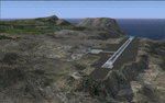
This project was begun to add the new airport (FHSH) to St. Helena Island and eventually was expanded to include a complete remake of Ascension Island (FHAW) and Tristan da Cunha (with an optional airport FHTC) and Gough Island with the actual weather station heliport (FHGH). Tested in both the default FSX/Acceleration and with FTX Global/Vector, accurate coastlines, lakes, road data, and SRTMGL1 (30m) mesh, as well as corrected landclass are provided based on the latest available satellite imagery. Flight plans are provided for the proposed commercial service to St. Helena, and some additional GA and military flights to the island are added as well.
The FSX St. Helena (FHSH) airport was created by aligning master plans for the airport with current satellite data and by studying many of the pictures that have been posted as the airport has taken shape. The official opening of the real airport on May 21, 2016, has been pushed back for more field tests due to challenging crosswinds. The Ascension Island (FHAW) airport was updated after I realized that Ascension could receive commercial service as a result of the new St. Helena airport. The entire airfield is redesigned to allow the volcanic terrain to display properly. The airbase, towns, BBC Atlantic relay station, and numerous satellite dishes, radomes, and wind turbines now appear in their real-world locations. Since I was already in the region, I added the Tristan da Cunha Islands (including Inaccessible, Nightingale and Gough Islands) and the Gough Island weather station maintained by the South African National Antarctic Programme. I also added an optional airport (and flight plans) to Tristan da Cunha (FHTC), which can be easily enabled/disabled. The FHTC airport is placed on the only part of the island that appears to be free of people or farmland, and the area is just long enough to accommodate a pared-down version of the St. Helena airport.
Updates were created or rebuilt in a manner which carefully aligns airport data with current satellite imagery. Scenery was created using Airport Design Editor X v1.67.5684, SBuilderX 3.13, and the FSX Object Placement Tool. Scenery objects were added and modified from stock FSX scenery to resemble as closely as possible the actual airports. The animated flag model is by Dietmar Loleit, the FSX apron lights included are from the set created by Jim Dhaenens, and the animated wind turbines and radomes are from the freeware package by Ray Porter.
| Filename: | St_Helena_Ascension_and_Tristan_da_Cunha_Islands.zip |
| License: | Freeware |
| Added: | 1st May 2016, 11:23:05 |
| Downloads: | 6,072 |
| Author: | Carlyle Sharpe |
| Size: | 10.52 MB |
© 2001-2026 AVSIM Online
All Rights Reserved
Privacy Policy |