
Where Flight Simulation Enthusiasts Gather from Around the World!
AVSIM Library - Search Results

| Category: Flight Simulator X - Scenery | |
| 9B1 - Marlboro Airport - Marlboro, MA |

|
File Description:
By request, here is an improved version of the stock Marlboro Airport. I adjusted and added aprons,roads and
taxiways to more closely match real life. I replaced most default buildings and added additional buildings.
I also added several buildings in the area, such as barns, houses, apartment buildings, and gas station. I added
static vehicles, aircraft, lightpoles, fences and other filler objects.
This is one of those small, interesting airports that are scattered all over the country. There is a road at one end
of the runway, and trees at the other. It can make for some challenging take-offs and landings. Works best with
Ultimate Terrain X.
| Filename: | 9B1__Marlboro_Airport__Marlboro_MA.zip |
| License: | Freeware |
| Added: | 10th February 2009, 01:21:15 |
| Downloads: | 1,103 |
| Author: | Jim Cook |
| Size: | 6.1 KB |
| Category: Civil Flight Simulators - Looking Glass Flight Unlimited 3 | |
| Solent Area kit |
|
File Description:
With this kit you can add 9 ground texture tiles to the UK-South region.
Covered Area is the Solent having the airports Southampton, Lee on the Solent, Bembridge and Isle of Wight. All needed tools included except Maps2BGL, see below.
There are no Ground texture maps included in this kit due to copyright restrictions.
This kit demonstrate how to build your own ground texture tiles.
You must learn to handle Maps2BGL to finish the Solent tiles.
A fast Internet connection is needed to download the maps also.
Tool references:
maps2bgl.zip
http://library.avsim.net/download.php?DLID=120356
maps2bgl__how_to_.zip
http://library.avsim.net/download.php?DLID=121257
| Filename: | Solent_Area_kit.zip |
| License: | Freeware, limited distribution |
| Added: | 28th March 2009, 18:25:31 |
| Downloads: | 55 |
| Author: | André Meystre |
| Size: | 2.28 MB |
| Category: Flight Simulator X - AFCAD Files | |
| CYZF - Yellowknife, NWT, Canada. |
|
File Description:
This airport was designed using the latest version of ADE (v1.45) and is made to replace the default FSX airport.
Yellowknife Airport (IATA: YZF, ICAO: CYZF) is located in Yellowknife, Northwest Territories, Canada. The airport is part of the National Airports System, and is operated by the government of the Northwest Territories. The airport has regular scheduled passenger service, and is also used as a forward operating base for the CF-188 Hornet. Yellowknife Airport is the busiest airport in Northern Canada. The Canadian Forces' CC-138 Twin Otter transport and utility aircraft are permanently based here, as 440 Squadron of 17 Wing Winnipeg.
| Filename: | CYZF__Yellowknife_NWT_Canada.zip |
| License: | Freeware |
| Added: | 5th November 2009, 02:16:48 |
| Downloads: | 5,613 |
| Author: | Robert Catherall |
| Size: | 948.97 KB |
| Category: Flight Simulator 2004 - Miscellaneous Files | |
| Icao2Airport |
|
File Description:
Icao2Airport is a a stand-alone Windows utility for Flight Simmers and ATC Controllers that allowing to find the name of an airport of the world inserting the icao code.
The Atc Controllers are often found to give the clearance for an airport and they are interdicted when they are found on the strip strange code icao.
From now no more problems.
This simple software finds the name of all the airports of the world.
You have to insert only the code ICAO.
This program doesn't need installation.
He remains in the foreground always and when positioned on the bar the name of the airport remains always on top.
| Filename: | Icao2Airport.zip |
| License: | Freeware |
| Added: | 9th December 2009, 10:35:45 |
| Downloads: | 302 |
| Author: | Carlo Chiappisi |
| Size: | 659.44 KB |
| Category: Flight Simulator X - Scenery | |
| Copalis State Airport, WA (S16) |
|
Images related to this file:
File Description:
Copalis State Airport in Grays Harbor County, Washington is listed in Popular Mechanics' 18 strangest airports in the world. It is a public airport consisting of beach sand available as a runway at low tide and has no other facilities. The airport "runway" occurs in the wrong location in FSX with UT-USA, and this package corrects that as well as adding some scenery. Look out for seagulls when landing and taking off. The dolphin playing offshore are as hard to spot as they are in real life. A campsite fire helps you locate the landing area, and two small GA parking spaces are available for AI traffic.
| Filename: | Copalis_State_Airport_WA_S16.zip |
| License: | Freeware |
| Added: | 2nd March 2010, 19:11:40 |
| Downloads: | 922 |
| Author: | Art Poole |
| Size: | 118.52 KB |
| Category: Flight Simulator X - AI Aircraft | |
| FS9/FSX - BC Regional AI (Update 1) |
|
Images related to this file:
File Description:
BC Regional AI implements the mid-2008 schedules of the regional airlines operating in British Columbia, Canada. It includes all the aircraft files you need to implement the AI scheme, together with the TTools-format source files and the compiled traffic files for both FS9 and FSX. Simply install BC Regional AI and, thanks to the efforts of a number of aircraft modelers and repainters, see CYYJ and most other BC airports come to life. Update 1 corrects a couple of problems in the original release that prevented certain AI aircraft from appearing. (This is a re-release of an earlier add-on that was corrupted during Avsim's "troubles".)
| Filename: | FS9FSX__BC_Regional_AI_Update_1.zip |
| License: | Freeware, limited distribution |
| Added: | 9th May 2010, 11:33:20 |
| Downloads: | 2,304 |
| Author: | Don Grovestine |
| Size: | 9.44 MB |
| Category: Fly! II - TerraScene | |
| Parkersburg (Ohio Project) TerraScene Project Pack |
|
File Description:
This is a TerraScene 2.1 Project pack for southeastern Ohio and portions of adjoining states. It covers all of global tile 198,158 with Parkersburg, WV in the west and Clarksburg (Benedum) in the east. The Ohio portion is in the NE area of the tile, above the Ohio River, including rolling hills, small towns like Marietta and a, number of small county airports. This pack includes updated Tiger Census (2000) shapefile data, adding new water areas, new highways, and other details. All scenery data files are included: USGS data, shapefiles, and a complete water mask. Requires TerraScene 2.1 and Fly!II patched to v230 or later.
| Filename: | Parkersburg_Ohio_Project_TerraScene_Project_Pack.zip |
| License: | Freeware |
| Added: | 11th May 2010, 00:52:03 |
| Downloads: | 312 |
| Author: | Randall Rocke |
| Size: | 62.89 MB |
| Category: Flight Simulator 2004 - Scenery | |
| KISP - Islip MacArthur Airport version 1.1 |
|
Images related to this file:
File Description:

New scenery for Islip/MacArthur Airport. This is a complete, ground up remake for the Long Island airport. Served mainly by Southwest Airlines, this mainline airfield is chock full of rich history and significance. It is also one of those neglected airports that could use some FS attention. The scenery is 100% accurate and very realistic. You will enjoy the experience.
Update: There was a typo in the readme file in the original download concerning correcting a texture issue with the terminal windows. If you have already downloaded version 1.0, and you are having no texture issues, you do not need this update. Only the readme file has been updated.
| Filename: | KISP__Islip_MacArthur_Airport_version_11.zip |
| License: | Freeware |
| Added: | 6th September 2012, 07:48:50 |
| Downloads: | 1,467 |
| Author: | FRF Studio / William Morgan |
| Size: | 23.27 MB |
| Category: Flight Simulator X - AFCAD Files | |
| UUEE - Sheremetyevo International - Moscow, Russia |
|
Images related to this file:
File Description:
UUEE - Sheremetyevo International - Moscow, Russia
Sheremetyevo International Airport is an international airport located in the Moscow Oblast, Russia, 29 km (18 mi) north-west of central Moscow. It is a hub for the passenger operations of the Russian international airline Aeroflot, and one of the three major airports serving Moscow along with Domodedovo International Airport and Vnukovo International Airport. It is now the 2nd largest airport in Russia after Domodedovo. In 2010, the airport handled 19,329,000 passengers and 184,488 aircraft movements.
Using ADEx 1.52, aeronautical maps and Google Earth the default AFCAD has been completely reworked to reflect today's situation including gate assignments.
| Filename: | UUEE__Sheremetyevo_International__Moscow_Russia.zip |
| License: | Freeware |
| Added: | 16th November 2012, 18:38:22 |
| Downloads: | 1,866 |
| Author: | Menno C. Robert |
| Size: | 4.61 MB |
| Category: Flight Simulator X - Scenery | |
| Greece - Chalkidiki Kassandra Photoreal |
|
Images related to this file:
File Description:
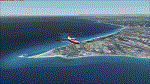
LOD15 photoreal scenery of Kassandra peninsula (a.k.a. first "leg"),part of Chalkidiki peninsula which is one of the greatest Summer destination for locals and foreigners alike.Night textures are also included although without any lighting,however works flawlessly with "Greece Night Environment" by Aerosoft). No airports or airfields or landing strips to land, however you can use float planes to go to the beaches.Nearest airport LGTS Thessaloniki Macedonia INTRNL airport.
The scenery has been designed for, and tested with FSX only. Full installation instructions, settings, hints and tips are included. Please enjoy and I hope you like my scenery as much as I enjoyed building it.
| Filename: | Greece__Chalkidiki_Kassandra_Photoreal.zip |
| License: | Freeware |
| Added: | 1st March 2016, 22:13:47 |
| Downloads: | 971 |
| Author: | Nick Konstantoulas |
| Size: | 150.86 MB |


© 2001-2026 AVSIM Online
All Rights Reserved
Privacy Policy |