
Where Flight Simulation Enthusiasts Gather from Around the World!
AVSIM Library - Search Results

| Category: Flight Simulator X - AFCAD Files | |
| EGUW Wattisham Army Air Base, Suffolk, England |

|
Images related to this file:
File Description:
Wattisham is a large Army Air Corps base in Suffolk, England. The stock airport on my version of FSX showed only a runway with a control tower in the middle of it, not good for fixed wing aircraft.
I have used Airport Design Editor (ADE) and Google Earth to rework the airfield. The ILS did not work on my version so I have added a new one, I had to "orphan" the stock ILS, so it will look odd on your GPS, but it works well. See the ReadMe file for the other things I have done to make EGUW more realistic and Download Jim Dhaenens great light package for the apron lights.
If you have other *.bgl files for EGUW then remove them before installing this design.
Just copy the two .bgl files into C: ...../Microsoft Games/Microsoft Flight Simulator X/Addon Scenery/scenery
Any problems contact me at [email protected]
| Filename: | EGUW_Wattisham_Army_Air_Base_Suffolk_England.zip |
| License: | Freeware |
| Added: | 17th August 2013, 11:37:52 |
| Downloads: | 297 |
| Author: | Mike Major |
| Size: | 10.87 KB |
| Category: Flight Simulator 2004 - Scenery | |
| VAUD Udaipur/Dabok, India |
|
Images related to this file:
File Description:
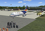
Googly scenery for VAUD Udaipur/Dabok, (also sometimes referred to as VAID) a small domestic airport in
India served by about six flights a day by jets and propeller aircraft from
airlines such as Alliance Air, Jagson Airlines and Jet Airways. These
scenery files improve/add aprons, taxiways, buildings and other airport
features to Flight Simulator's basic representation.
The scenery does not purport to be ultra-accurate. Based on high-detail satellite
imagery from Google Earth, the layout is proportionally correct but the added
[File re-uploaded at request of AVSIM]
airport features, such as buildings, are built from default Microsoft objects
and add-on libraries so will not look exactly like the real thing.
You are not obliged to download and install any additional scenery libraries,
but to enjoy this scenery in its entirety, you may wish to. It will work fine,
with or without.
[File re-uploaded at request of AVSIM]
| Filename: | VAUD__UdaipurDabok_India.zip |
| License: | Freeware |
| Added: | 23rd May 2010, 01:22:29 |
| Downloads: | 1,425 |
| Author: | John Hinson |
| Size: | 67.47 KB |
| Category: Flight Simulator X - Scenery | |
| A85 - Kwigillingok Airport - Alaska, USA |
|
Images related to this file:
File Description:
Kwigillingok Airport (IATA: KWK, ICAO: PAGG, FAA LID: GGV, formerly A85) is owned by the Native Village of Kwigillingok and is a public-use airport located one mile (two kilometres) northwest of the central business district of Kwigillingok, in the Bethel Census Area of the U.S. state of Alaska. There is also a nearby seaplane landing area known as Kwigillingok Seaplane Base (FAA LID: KWK).Runway 15/33 was increased from 1,835 feet and 40 feet wide to 3,300 feet and 60 feet wide. Runway 4/22 was added along with custom models. All changes were made based on the 2014 construction plans.
Created with Airport Design Editor 9x by ScruffyDuck Software using current FAA documentation and Google Earth measurements, this package offers a replacement for FSX's stock airport. All these enhancements are as close to the real airport as I can get with stock library objects and custom buildings.
| Filename: | A85__Kwigillingok_Airport__Alaska_USA.zip |
| License: | Freeware |
| Added: | 5th January 2015, 00:26:44 |
| Downloads: | 710 |
| Author: | Wayne Roberts |
| Size: | 358.61 KB |
| Category: Prepar3D V1-4 - Miscellaneous Files | |
| Locator for Henrik Nielson's Global AI ship traffic as July 2017 |
|
Images related to this file:
File Description:
This is a program that can help you find the many vessels in Henrik Nielsens' wonderful "Global A.I. Ship Traffic".
It covers the latest download, Version 2 and all updates up to July 2017..
It displays the routes on Google Earth, the route number and a list of the ships that can be found on that route.
There is a separate file containing their departure and arrival times on each of the routes, with instructions on how you can locate them. There is also a full list of the names and types of all the ships that are in the program.
For best results I recommend using my program with the "Little Navmap" program. Little Navmap displays all the AI ships and more in an approximate forty mile area around your aircraft. It is a navigation program all by its self.
See "Installation" doc for details where to find it.
This download was created by Carl Vokes.
| Filename: | Locator_for_Henrik_Nielsons_Global_AI_ship_traffic.zip |
| License: | Freeware |
| Added: | 18th July 2017, 03:54:08 |
| Downloads: | 608 |
| Author: | Carl Vokes |
| Size: | 9.72 MB |
| Category: Flight Simulator 2004 - Scenery | |
| SWUY Coari/Urucu, Brazil |
|
File Description:
Googly scenery for SWUY Coari/Urucu, Brazil, a small domestic airport
located near Brazil's largest inshore gas source and serving the city
of Coari (some distance away), one of the largest cities in the Amazonas
state. The airport is served about four times daily by ATR aircraft of
Total Linhas Aereas on domestic flights, plus general aviation traffic.
Flight Simulator 2004 has made no provision for traffic with only a runway
provided and this scenery seeks to redress the situation.
The scenery does not purport to be ultra-accurate. Based on high quality
satellite imagery from Google Earth, the layout is proportionally correct but the
added airport features, such as buildings, are built from default Microsoft objects
and add-on libraries so will not look exactly like the real thing.
You are not obliged to download and install any additional scenery libraries,
but to enjoy this scenery in its entirety, you may wish to. It will work fine,
with or without.
| Filename: | SWUY_CoariUrucu_Brazil.zip |
| License: | Freeware |
| Added: | 16th April 2008, 19:26:04 |
| Downloads: | 1,208 |
| Author: | John Hinson |
| Size: | 61.58 KB |
| Category: Flight Simulator 2004 - Scenery | |
| LTBM Isparta, Turkey |
|
Images related to this file:
File Description:
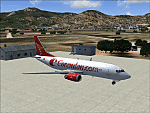
Googly scenery for LTBM Isparta, Turkey - a small airport for which nothing more than a runway has been provided in Flight Simulator 2004. These scenery files add the apron, taxiways, buildings and other airport features so that you and your "AI" traffic can land, taxi, park and take off in a realistic manner.
The airport appears to used mainly for occasional tourism flights, particularly traffic to and from Iran.
The scenery does not purport to be ultra-accurate. Based on high-detail satellite imagery from Google Earth, the layout is proportionally correct but the added airport features, such as buildings, are built from default Microsoft objects and add-on libraries so will not look like the real thing.
You are not obliged to download and install any additional scenery libraries, but to enjoy this scenery in its entirety, you may wish to. It will work fine, with or without.
[File re-uploaded at request of AVSIM]
| Filename: | LTBM_Isparta_Turkey.zip |
| License: | Freeware |
| Added: | 26th June 2010, 13:53:59 |
| Downloads: | 1,559 |
| Author: | John Hinson |
| Size: | 88.64 KB |
| Category: Flight Simulator X - Scenery | |
| KVC - King Cove Airport - Alaska, USA |
|
Images related to this file:
File Description:
King Cove Airport (IATA: KVC, ICAO: PAVC, FAA LID: KVC) is a state-owned public-use airport located four miles (6 km) northeast of the central business district of King Cove, a city in the Aleutians East Borough of the U.S. state of Alaska.
King Cove Airport has one runway (7/25) with a gravel surface measuring 3,500 x 75 ft. (1,067 x 23 m). For the 12-month period ending December 31, 2005, the airport had 1,030 aircraft operations: 71% air taxi and 29% general aviation.
Changes: Increased parking apron and turn arounds at both ends of the runway. Also added additional parking and custom models. Changes were based on 2014 construction plans.Created with Airport Design Editor 9x by ScruffyDuck Software using current FAA documentation and Google Earth measurements, this package offers a replacement for FSX's stock airport. All these enhancements are as close to the real airport as I can get with stock library objects and custom buildings.
| Filename: | KVC__King_Cove_Airport__Alaska_USA.zip |
| License: | Freeware |
| Added: | 20th December 2014, 00:02:03 |
| Downloads: | 850 |
| Author: | Wayne Roberts |
| Size: | 446.46 KB |
| Category: Flight Simulator 2004 - Scenery | |
| HAAB Bole Intl. Airport Addis Ababa Ethiopia |
|
File Description:
Since nobody decided to make HAAB scenery until now, I decided to share my HAAB scenery with you. In fact I've built
it for personal use only, because I was expecting someone who is interested in Addis Ababa Airport to build it, but I didn't
see any thing. The scenery is pretty nice and extremely close to real. You will note 2 new things in the scenery, the first
one is the new pax terminal building and the second one is the new cargo complex. I've assigned rwy 7L\25R for take-off
only and rwy 7R\25L for landing only in order to facilitate air traffic within the airport also to avoid any bug or delay in
departure or arrival time. Bole Airport is the main hub of Ethiopian Airlines, the national airline of Ethiopia, in addition it
is one of the main pilot training and aircraft maintenance centers in Africa. Airport layout designed by using Google
Earth.
| Filename: | HAAB__Bole_Intl_Airport__Addis_Ababa__Ethiopia.zip |
| License: | Freeware |
| Added: | 3rd December 2008, 17:55:08 |
| Downloads: | 8,702 |
| Author: | Nuhaid Abdulkhaleq |
| Size: | 2.35 MB |
| Category: Flight Simulator X - AFCAD Files | |
| MYNN - Lynden Pindling Intl - Nassau, Bahamas |
|
Images related to this file:
File Description:
MYNN - Lynden Pindling Intl - Nassau, Bahamas
Lynden Pindling International Airport was formerly known as Nassau International Airport and is the largest airport in the Bahamas, and the largest international gateway into the country.
It is a major hub for Bahamasair and is located in western New Providence island near to the capital city of Nassau. The airport contains U.S. Border preclearance facilities allowing all US flights to operate as domestic flights upon arrival at their destination.
Currently, the airport has 2 runways, more than 30 gates and 482,000 sq ft (44,800 m2) of terminal space. The redevelopment updated the airport facilities to world-class standards and expanded terminal capacity. The work was carried out in three stages. The first stage was completed in March 2011.
Using ADEx 1.50, aeronautical maps and Google Earth all these and future changes have been built into the default FSX airport. Crosswind Runway Technique has been implemented to open up all runways.
| Filename: | MYNN__Lynden_Pindling_Intl__Nassau_Bahamas.zip |
| License: | Freeware |
| Added: | 4th December 2012, 17:33:06 |
| Downloads: | 1,964 |
| Author: | Menno C. Robert |
| Size: | 4.16 MB |
| Category: Flight Simulator X - AFCAD Files | |
| ZBTJ - Tianjin Binhai Intl. - Tianjin, China |
|
Images related to this file:
File Description:
ZBTJ - Tianjin Binhai International Airport is an airport located in Dongli District, Tianjin. It is one of the major air cargo centers in the People's Republic of China. It is the hub airport for Tianjin Airlines, established in 2004, and privately owned Okay Airways. It's also a focus city for Air China.
International flights are primarily operated by Korean Air and Asiana Airlines to Seoul-Incheon international Airport, Japan Airlines to Nagoya-Chubu Centrair International Airport.
Construction of a new terminal began in 2005 and was fully operating by 2008. The airport expansion provides a state-of-the-art terminal building, which is more than three times bigger than the current one at 116,000 m2. In May 2009, the airport has also completed the construction of a second runway, and the expected number of passengers will exceed ten million.
Using ADEx 1.50, SBuilderX, aeronautical maps and Google Earth (2011) all these changes have been built into the default FSX airport to better reflect todays situation.
| Filename: | ZBTJ__Tianjin_Binhai_Intl__Tianjin_China.zip |
| License: | Freeware |
| Added: | 2nd October 2012, 23:01:45 |
| Downloads: | 2,081 |
| Author: | Menno C. Robert |
| Size: | 2.7 MB |


© 2001-2026 AVSIM Online
All Rights Reserved
Privacy Policy |