
Where Flight Simulation Enthusiasts Gather from Around the World!
AVSIM Library - Search Results

| Category: Flight Simulator X - Scenery | |
| Scenery for Liege EBLG |

|
File Description:
Scenery for Liege EBLG - For FSX ONLY
Installation
1.Copy the .bgl Files in the folder to Microsoft FLight Simulator X\Addon Scenery\scenery\
2.Run FSX
Credit to google earth
| Filename: | Scenery_for_Liege_EBLG.zip |
| License: | Freeware |
| Added: | 15th January 2008, 23:09:58 |
| Downloads: | 1,185 |
| Author: | Alan Mccarthy |
| Size: | 196.17 KB |
| Category: Flight Simulator 2004 - AFCAD Files | |
| El Bayadh airport (DAOY) |
|
File Description:
Afcad files for the regional airport El bayadh (DAOY) located near El Bayadh city in Algeria. This Afcad was made using Google earth and jeppesen charts (eff date: 02 Oct 2009).
| Filename: | El_Bayadh_airport_DAOY.zip |
| License: | Freeware |
| Added: | 10th November 2009, 20:14:56 |
| Downloads: | 319 |
| Author: | salah Benhenda |
| Size: | 9 KB |
| Category: Flight Simulator X - AFCAD Files | |
| Queensland Airports Pack Two |
|
File Description:
Missing and upgraded airports for FSX created with AFX, with reference to Google Earth and Australian Airservices website. Some of the upgraded airports included are: YBAF Archerfield, YBCS Cairns, YBUD Bunderberg.
| Filename: | Queensland_Airports_Pack_Two.zip |
| License: | Freeware |
| Added: | 11th November 2007, 04:23:11 |
| Downloads: | 1,150 |
| Author: | Kym Burton |
| Size: | 38.99 KB |
| Category: Flight Simulator X - AFCAD Files | |
| Queensland Airports Pack One |
|
File Description:
Missing and upgraded airports for FSX. Have built with reference to Google Earth and Australian Air Services website, so should be as close to real as can be made using AFX.
| Filename: | Queensland_Airports_Pack_One.zip |
| License: | Freeware |
| Added: | 13th October 2007, 10:34:06 |
| Downloads: | 746 |
| Author: | Kym Burton |
| Size: | 9.9 KB |
| Category: Flight Simulator 2004 - Scenery | |
| Frankfurt EDDF Airport |
|
File Description:
This AFCAD file adds the fourth runway 07L/25R and associated taxiways.
I have created this using AFCAD 2.2.1.0 and ADE 175. Dimensions taken mostly from Google Earth and airport charts.
| Filename: | Frankfurt_EDDF_Airport.zip |
| License: | Freeware, limited distribution |
| Added: | 20th April 2019, 04:55:30 |
| Downloads: | 387 |
| Author: | Chris Langley |
| Size: | 362.94 KB |
| Category: Flight Simulator X - Scenery | |
| Yanbu , Prince Abdul Mohsin Bin Abdulaziz Airport OEYN |
|
File Description:
Modified FSX OEYN stock airport as google earth add new terminal with animated jetways ,gates/parking now numbered in the correct order,taxiways and taxi signs corrected to the latest charts
| Filename: | Yanbu__Prince_Abdul_Mohsin_Bin_Abdulaziz_Airport_O.zip |
| License: | Freeware |
| Added: | 31st October 2018, 15:38:48 |
| Downloads: | 573 |
| Author: | Mohamed Salamoni |
| Size: | 5.68 MB |
| Category: Prepar3D V1-4 - Utilities | |
| GENav pro Navigation |
|
Images related to this file:
File Description:

Previous payware product at SimMarket, now 100% free.
With GENav pro you will view all AIRAC navigation data and terminal procedures inside Google Earth. GENav pro run under Windows and require only Google Earth for displaying. You can also edit your own routes or just copy routes into GENav to view in Google Earth. You can search for example an airport or a fix by short or long name, Google Earth will take you there.
You can connect to Microsoft Flight Simulator to view your aircraft. Moving map and heading is available.
GENav pro is highly optimized for best performance and clear views without clutter. There are smart filters to select relevant data to display, all AIRAC items are available. You will find all data such as nav-aid frequencies, airport runways with ILS frequencies by click the displayed icons in Google Earth.
You can edit routes visual direct inside Google Earth by click. The database can always be updated with Navigraph's latest AIRAC data.
With GENav you can easy build valid routes. Unlike other common autorouting program, GENav is the tool for you to build routes with correct airway direction and correct connected to SID/STAR's. You will easy draw your routes most stright and correct to destination. It is also excellent for visual and instrument navigation flights.
FEATURES:
*** Display airports, nav aids, waypoints
*** Display High/Low airways and airways direction
*** Display SID/STAR, Approaches and Transitions
*** Display ARTCC/FIR border
*** AIRAC data available by click
*** Search airport and fixes
*** AIRAC data compatible Navigraph data
*** Visual editable routes
*** VOR to VOR route navigation data
*** Display your aircraft
BASIC SYSTEM REQUIREMENTS:
*** Windows with Google Earth installed
( Notice, no flightsim program required )
OPTIONALLY REQUIREMENTS:
*** SID/STAR require the Navigraph purchase or an alternative free source
*** Airways direction & high/low info require the Navigraph purchase
*** To display aircraft, Microsoft Flight Simulator or Prepare3D v1/v2, with free FSUIPC is required.
*** To display aircraft at a separate computer, also the payware WideFS is required.
| Filename: | GENav_pro_Navigation.zip |
| License: | Freeware |
| Added: | 25th May 2016, 11:24:52 |
| Downloads: | 654 |
| Author: | Lennart Vedin |
| Size: | 4.5 MB |
| Category: Flight Simulator 2004 - Utilities | |
| GENav pro Navigation |
|
Images related to this file:
File Description:

Previous payware product at SimMarket, now 100% free.
With GENav pro you will view all AIRAC navigation data and terminal procedures inside Google Earth. GENav pro run under Windows and require only Google Earth for displaying. You can also edit your own routes or just copy routes into GENav to view in Google Earth. You can search for example an airport or a fix by short or long name, Google Earth will take you there.
You can connect to Microsoft Flight Simulator to view your aircraft. Moving map and heading is available.
GENav pro is highly optimized for best performance and clear views without clutter. There are smart filters to select relevant data to display, all AIRAC items are available. You will find all data such as nav-aid frequencies, airport runways with ILS frequencies by click the displayed icons in Google Earth.
You can edit routes visual direct inside Google Earth by click. The database can always be updated with Navigraph's latest AIRAC data.
With GENav you can easy build valid routes. Unlike other common autorouting program, GENav is the tool for you to build routes with correct airway direction and correct connected to SID/STAR's. You will easy draw your routes most stright and correct to destination. It is also excellent for visual and instrument navigation flights.
FEATURES:
*** Display airports, nav aids, waypoints
*** Display High/Low airways and airways direction
*** Display SID/STAR, Approaches and Transitions
*** Display ARTCC/FIR border
*** AIRAC data available by click
*** Search airport and fixes
*** AIRAC data compatible Navigraph data
*** Visual editable routes
*** VOR to VOR route navigation data
*** Display your aircraft
BASIC SYSTEM REQUIREMENTS:
*** Windows with Google Earth installed
( Notice, no flightsim program required )
OPTIONALLY REQUIREMENTS:
*** SID/STAR require the Navigraph purchase or an alternative free source
*** Airways direction & high/low info require the Navigraph purchase
*** To display aircraft, Microsoft Flight Simulator or Prepare3D v1/v2, with free FSUIPC is required.
*** To display aircraft at a separate computer, also the payware WideFS is required.
| Filename: | GENav_pro_Navigation.zip |
| License: | Freeware |
| Added: | 25th May 2016, 11:24:32 |
| Downloads: | 531 |
| Author: | Lennart Vedin |
| Size: | 4.5 MB |
| Category: Flight Simulator X - Scenery | |
| SILC - Lucas do Rio Verde Airport - Mato Grosso, Brazil |
|
Images related to this file:
File Description:
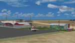
FSX Scenery - Airport of Lucas do Rio Verde (SILC), located in the state of Mato Grosso, Brazil. Made based on the Google Earth coordinates, includes AFCAD, 3D objects and landclass of city.
| Filename: | SILC__Lucas_do_Rio_Verde_Airport__Mato_Grosso_Braz.zip |
| License: | Freeware |
| Added: | 15th September 2016, 18:45:23 |
| Downloads: | 393 |
| Author: | Eduardo Mello |
| Size: | 5.17 MB |
| Category: Flight Simulator 2004 - Scenery | |
| Panama City, Florida - Panama City International Airport - KECP - Updated fixed |
|
File Description:
Panama City airport has a little changed a long while ago. I didn't realize I found it recently on Google Earth. General Aviation has been expanded parking spots and hangers. Jetways added.
| Filename: | Panama_City_Florida__Panama_City_International_Air.zip |
| License: | Freeware |
| Added: | 12th December 2020, 16:09:41 |
| Downloads: | 384 |
| Author: | Stuart John Gilbert II |
| Size: | 2.87 MB |


© 2001-2026 AVSIM Online
All Rights Reserved
Privacy Policy |