
Where Flight Simulation Enthusiasts Gather from Around the World!
AVSIM Library - Search Results

| Category: Flight Simulator 2004 - Aircraft Repaints, Textures and Modifications | |
| AS 350 "Miami Dade Police" |

|
Images related to this file:
File Description:
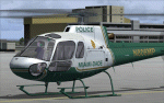
This is a repaint of the Nemeth Designs (ND) freeware AS 350 in the real world livery of the "Miami-Dade Police" AS350 for FS9 (FS2004) only. I believe this is the only repaint of the Miami Dade helicopter for public use as I was unable to locate any others, but that doesn't mean they may not exist somewhere. With that, I was unable to find too many decent photos of the chopper either so there has been a little guess work with this paint, primarily the under carriage. This is a complete aircraft, so no other files are required to fly her. All repainted textures have been saved in 32 bit format for enhanced detail. Installation, Distribution and Contact details can be located ion the TC Read Me file that is included with this download. Thanks to all of you who have supported my efforts, it is appreciated. In the event that someone from the Miami Dade Police Aviation Unit sees this - it would be appreciated if they could let me know of its accuracy - cheers :)
| Filename: | AS_350_Miami_Dade_Police.zip |
| License: | Freeware, limited distribution |
| Added: | 27th February 2012, 03:08:14 |
| Downloads: | 281 |
| Author: | Tony Cannon and Nemeth Designs |
| Size: | 18.21 MB |
| Category: Flight Simulator 2004 - Gauges | |
| TerraVue: Moving Map, Ground Proximity, Information pages |
|
File Description:
FS2004 Gauge: TerraVue. This gauge contains a moving map display with a terrain elevation legend color-keyed to the FS9 map. The legend allows the elevation of terrain lying ahead of the aircraft to be taken into account. TerraVue can display the FS map in seven ranges from 4 NM to 160 NM. The Map mode also employs animation to show the proximity between the aircraft and ground in a graphical and digital display with indicators showing whether the distance is increasing or decreasing. The gauge can be switched to the Information mode which will display up to four individual pages of data that is created by you. These scrollable pages may contain checklists, airport diagrams, approach plates, strip charts, etc. Fully functional, free software to help quickly construct these pages is included along with an illustrated tutorial that demonstrates the simple copy/paste process that tailors these pages to include whatever data you wish. For panel or separate window installation with TerraVue Icon gauge. By Glenn Copeland
| Filename: | TerraVue_Moving_Map_Ground_Proximity_Information_p.zip |
| License: | Freeware |
| Added: | 24th June 2006, 15:13:12 |
| Downloads: | 5,075 |
| Author: | Glenn Copeland |
| Size: | 1.92 MB |
| Category: Flight Simulator X - AI Aircraft | |
| Air Sial Airbus A320-200 |
|
Images related to this file:
File Description:

Repaint of Air Sial A320-200. There are 2 separate texture for FSX and FS9. To be used with The FAIB_A320_IAE model available separately. This is an AI only aircraft.
Air Sial is a proposed start-up formed by the local business community in Sialkot, which seeks to boost air traffic to the Pakistani region. The airline is under the Sialkot Chamber of Commerce and Industry, which has a capital expenditure of PKR2 billion (USD20 million). According to the Chamber of Commerce and Industry, Air Sial secured an RPT license from the Civil Aviation Authority in Oct-2017. Air Sial initially planned to launch domestic services in Jun-2020, with international services launching in 2021. The start-up plans to operate services to key destinations in Pakistan and the Middle East using three A320 aircraft.
In Nov-2020, Air Sial took delivery of its first aircraft, an A320 (AP-BOA) on lease from AerCap. The carrier plans to commence domestic operations in Dec-2020, serving Islamabad, Lahore, Karachi and Sialkot. By Kamil Fryzol
| Filename: | Air_Sial_Airbus_A320200.zip |
| License: | Freeware |
| Added: | 3rd December 2020, 20:18:33 |
| Downloads: | 32,180 |
| Author: | Kamil Fryzol |
| Size: | 4.61 MB |
| Category: Flight Simulator X - Scenery | |
| St. Helena, Ascension, and Tristan da Cunha Islands |
|
Images related to this file:
File Description:
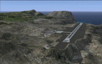
This project was begun to add the new airport (FHSH) to St. Helena Island and eventually was expanded to include a complete remake of Ascension Island (FHAW) and Tristan da Cunha (with an optional airport FHTC) and Gough Island with the actual weather station heliport (FHGH). Tested in both the default FSX/Acceleration and with FTX Global/Vector, accurate coastlines, lakes, road data, and SRTMGL1 (30m) mesh, as well as corrected landclass are provided based on the latest available satellite imagery. Flight plans are provided for the proposed commercial service to St. Helena, and some additional GA and military flights to the island are added as well.
The FSX St. Helena (FHSH) airport was created by aligning master plans for the airport with current satellite data and by studying many of the pictures that have been posted as the airport has taken shape. The official opening of the real airport on May 21, 2016, has been pushed back for more field tests due to challenging crosswinds. The Ascension Island (FHAW) airport was updated after I realized that Ascension could receive commercial service as a result of the new St. Helena airport. The entire airfield is redesigned to allow the volcanic terrain to display properly. The airbase, towns, BBC Atlantic relay station, and numerous satellite dishes, radomes, and wind turbines now appear in their real-world locations. Since I was already in the region, I added the Tristan da Cunha Islands (including Inaccessible, Nightingale and Gough Islands) and the Gough Island weather station maintained by the South African National Antarctic Programme. I also added an optional airport (and flight plans) to Tristan da Cunha (FHTC), which can be easily enabled/disabled. The FHTC airport is placed on the only part of the island that appears to be free of people or farmland, and the area is just long enough to accommodate a pared-down version of the St. Helena airport.
Updates were created or rebuilt in a manner which carefully aligns airport data with current satellite imagery. Scenery was created using Airport Design Editor X v1.67.5684, SBuilderX 3.13, and the FSX Object Placement Tool. Scenery objects were added and modified from stock FSX scenery to resemble as closely as possible the actual airports. The animated flag model is by Dietmar Loleit, the FSX apron lights included are from the set created by Jim Dhaenens, and the animated wind turbines and radomes are from the freeware package by Ray Porter.
| Filename: | St_Helena_Ascension_and_Tristan_da_Cunha_Islands.zip |
| License: | Freeware |
| Added: | 1st May 2016, 11:23:05 |
| Downloads: | 6,078 |
| Author: | Carlyle Sharpe |
| Size: | 10.52 MB |
| Category: Flight Simulator 2004 - Scenery | |
| Kotzebue PAOT on the northwestern coast of Alaska |
|
Images related to this file:
File Description:
There are four main northwestern Alaska towns which have good airports and are serviced by Alaska Airlines. From these airports local flights connect to nearby villages, "nearby" in Alaska meaning up to 150 miles away. The northernmost is Barrow. Southwest of Barrow is Kotzebue, then Nome, and the furthest south is Bethel. The town of Kotzbue is north of the Bering Strait on the northwestern coast, 320 miles southwest of Barrow. The population is just over 3,000 people. The location was for a long time a base for trading in furs, with three rivers emptying into the sea and providing routes into the interior land and villages; a meeting place between hunters and traders from Russia and elsewhere. The Kotzebue airport is called the Ralph Wien Memorial and has two runways. The modern one is aligned 08-26 and is 5,880 feet of 150 feet wide asphalt built across a shallow lagoon, with an ILS on 08 and PAPI on both ends. The second and older runway is originally military and gravel, aligned 17-35 and 3,786 feet long and used (wind allowing) by the GA planes that park alongside the runway. The prevalent wind is from the west; when the wind is from the east it is generally relatively feeble and with a much lower cloud base, possibly to the ground, hence the need for an ILS. All AI aircraft in FS9 much prefer to use a runway that has an ILS and so will continue to use 08-26 even if the wind is from the south until it reaches 30+ knots, even if they are a Cessna 150 flying VFR. So for AI realism in FS9 a northern or southern wind needs to be a strong one so that the runway is actually used. However, as Alaska Airlines, Northern Air Cargo, and Everts Air also fly to Kotzebue and can only use the east-west runway (as less than 4,000 feet of asphalt would be seriously inconvenient for a Boing 737 or DC6) it is necessary to have the northern or southern wind UNDER 30 knots at the times when they are landing or taking off. Your choice. I suppose a permanent strong wind from the west would be the most realistic on a daily basis, deterring all planes from ever using 17-35. The AI will develop along with further scenery additions in the neighbourhood.
| Filename: | Kotzebue_PAOT_on_the_northwestern_coast_of_Alaska.zip |
| License: | Freeware, limited distribution |
| Added: | 2nd August 2016, 16:47:52 |
| Downloads: | 462 |
| Author: | Roger Wensley |
| Size: | 19.32 MB |
| Category: Flight Simulator 2004 - Aircraft Repaints, Textures and Modifications | |
| DIAS Air MD-11 |
|
File Description:
These are DIAS AIR International Virtual Airlines (www.diasair.gr) fictional textures for the astonishing PMDG MD-11 addon for FS9!!!. Includes the registration SX-CMT named "MINOS".DIAS AIR is an international virtual company established in 2006, by an Airline Captain, Pilot Instructor and Examiner, only for very advanced members of the Flight Simmers Community. The organization utilises a sophisticated model for the simulation of the Economical & Technical environment of a real Aviation Company. Our pilot members are paid by an exclusive model using the "OCTANES" payment system, and not only! Our flight operations are global and cover all 5 continents. Our fleet includes 35 different types of aircraft for Microsoft Flight Simulator™. The dynamic site is updated on a daily basis. Our pilot ranks begin from Junior First Officer up to Senior Captain of the Company. We also use a private FORUM and a TeamSpeak Server for our member pilots. We operate only On-Line at our PRIVATE FS Server, at IVAO and VATSIM networks.Please note that in the screens you can see the upcoming Kerkyra MEGA Scenery by GAP (www.greekairportsproject.gr). Stay tuned...
| Filename: | DIAS_Air_MD11.zip |
| License: | Freeware, limited distribution |
| Added: | 8th January 2009, 13:32:13 |
| Downloads: | 246 |
| Author: | Nicholas Maggioros |
| Size: | 7.9 MB |
| Category: Flight Simulator 2004 - Miscellaneous Files | |
| ActiveSky Weather Adventures Vol. 2 - Fly the AT! (Manual install) |
|
File Description:
ActiveSky Weather Adventures Vol. 2 - Fly the AT! (Includes updated Vol. 1 - Winter's End) ***In addition to archives for AS2k4 users, saved flights with AS2k4 processed weather are included so people who don't own ActiveSky can fully enjoy these adventures and get a taste of what ActiveSky 2k4 has to offer! * Includes TWO Volumes of Weather Adventures * Volume 2 - Fly the AT! - Ten flights take you from Maine to Georgia along route of the Appalachian Trail - features three days of real-weather as a slow front approaches from the west - can YOU make it to Georgia before the thunder rolls in? * Volume 1 includes 10 flights highlighting weather phenomena such as a tornado outbreak in Texas and Oklahoma, a New England "nor'easter", and a massive upper-level low occupying the plains states! ***The ASWxAd-Kneeboard!*** A modification to FS9's kneeboard which allows viewing of original material describing these flights, radar and satellite loops, and annotated sectionals depicting flight plans and the AT! * Two versions available: This is the Manual Install. An automatic installer is also available - ASAD2INS.zip * Previous version had nearly 2000 downloads!
| Filename: | ActiveSky_Weather_Adventures_Vol_2__Fly_the_AT_Man.zip |
| License: | Freeware, limited distribution |
| Added: | 4th June 2004, 14:18:50 |
| Downloads: | 1,503 |
| Author: | Scott Gridley |
| Size: | 23.88 MB |
| Category: Flight Simulator 2004 - AFCAD Files | |
| EHAM for NL2000, Multiple Runways, First Attempt |
|
File Description:
AFCAD2 File for :
Amsterdam, Schiphol Intl Airport, the Netherlands ( EHAM )
for NL2000 Scenery .
with Runways 06 and 36R for landings and 36L and 36C for take-offs .
NL2000 scenery can be found on Avsim as nl2kv291.zip .
All credits to NL2000 team for the NL2000 scenery, many many thanks .
( Not to bo used with the default scenery )
This Afcad file was originally made by Victor Nauta as af2nl2k29v2_eham.zip .
But now with breakthrough NON parallel runway assignment by Project AI, Jim Vile and
Reggie Fields, non-parallel runways can be used simultaniously .
Thanks to Jim .
Although created to use all runways, something I can't do about it is to make FS9
use South or West bound traffic .
Now only North bound traffic is possible as Victor Nauta also complained about and didn't see a solution as well .
Even with maximum wind from South-West ( a common thing in the Netherlands ) AI is still assigned to North or East bound .
I have closed Runway 9 as it is rarely used, and also Runway 4 ( Gen. Aviation ) closed to avoid smaller turboporops landing there .
Have fun, Silvester
| Filename: | EHAM_for_NL2000_Multiple_Runways_First_Attempt.zip |
| License: | Freeware |
| Added: | 8th October 2004, 20:18:30 |
| Downloads: | 1,728 |
| Author: | Silvester van Wijk / Victor Nauta / Project AI |
| Size: | 17.39 KB |
| Category: Flight Simulator 2004 - Aircraft Repaints, Textures and Modifications | |
| NHL "Vancouver Canucks" Beechcraft Twin Bonanza" |
|
File Description:
Simmers,and Hockey fans,
This aircraft includes my Twin Bonanza Panel_ V3, and for you FSX users it also includes "Camera Definitions" so ***BE SURE YOU COPY aircraft.cfg file to your main Twinstar_ Twin_ Bonanza folder.NOTE!(Camera Definitions will have no effect in FS9)***These 1951 D Model Beechcraft Twin Bonanzas are pristine,no dirt,grease or oil leaks on these babies!Just fresh out of the paint booth, these are the 30th repaint of my now complete NHL collection.This file includes the texture.Canucks"(The Vancouver Canucks Edition)",texture.Vancouver,
"(The Vancouver Edition....NOLOGOS)",panel.Canucks and the panel.Vancouver folders and the aircraft.cfg file.It also includes two files to correct the kneeboard,they are the beech_baron_58_check.htm and the beech_baron_58_ref.htm,just copy these two files to your main Twinstar_ Twin_ Bonanza folder.
The following additional file is required.--------------twinstar__twin__bonanza.zip--------------
This file can be downloaded @ http://www.avsim.com/
Go to the file library and just use the Quick Search: type: Chris Tuinstra and you should see the twinstar__twin__bonanza.zip,along with my other NHL and NFL repaints.Again I thank each of you for your downloads.
This file includes a complete matching interior for both liveries".
| Filename: | NHL_Vancouver_Canucks_Beechcraft_Twin_Bonanza.zip |
| License: | Freeware |
| Added: | 24th June 2008, 23:00:26 |
| Downloads: | 218 |
| Author: | Chris Tuinstra |
| Size: | 7.66 MB |
| Category: Flight Simulator 2004 - Scenery | |
| Ferndale 53U in Montana US |
|
Images related to this file:
File Description:
I have made this because I downloaded and tried the Glacier Park photo land-class scenery by Blue Sky Scenery and then rediscovered that the airfield runways are not correctly positioned or aligned in FS9. So I corrected the Ferndale runway and while I was there also added 33 hangars and some parked planes. Of course, as all I know about the hangars is the colour of the roof this isn't up to total realism. It is, however, better than nothing and as I have a large stock of hangars from other sceneries not much effort was involved.
Ferndale is an "airpark" type of airfield where folks build their houses and hangers around the field, plus it also has a bunch of hangars; it is the "bunch" that I have replicated, as I have no idea at all what the houses look like. The field is 20 miles southeast of Glacier Park International at 3,060 feet ASL and around 55 miles south of the Canadian border. There are no large towns close by; the nearest would be Missoula, which is some 70 miles further south.
| Filename: | Ferndale_53U_in_Montana_US.zip |
| License: | Freeware, limited distribution |
| Added: | 29th May 2010, 17:54:14 |
| Downloads: | 291 |
| Author: | Roger Wensley |
| Size: | 2.26 MB |


© 2001-2026 AVSIM Online
All Rights Reserved
Privacy Policy |