
Where Flight Simulation Enthusiasts Gather from Around the World!
AVSIM Library - Search Results

| Category: Flight Simulator 2004 - Scenery | |
| Boulder (KBDU) / Longmont / Loveland, Colorado, Photo-Scenery (FS9 & FSX) |

|
Images related to this file:
File Description:
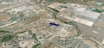
Boulder is situated where the Rocky Mountains meet the Great Plains. Just west of the city are imposing slabs of sedimentary stone tilted up on the foothills, known as Flatirons. Located at the base of the foothills is Boulder's main campus of the University of Colarado which is clearly visible from the sky. Longmont is home of the Denver ARTCC (Air Route Traffic Control Center) which controls all flights in the upper airspace of most of Colorado and parts of adjoining states. To explore the scenery depart from Boulder (KBDU) and head northeast. Extends my Rocky Mountain Park scenery to the east and my Denver scenery to the north. Provides another 3.500 sq km in 4.7m/pix quality. High resolution versions for FS9 and FSX (much sharper, but larger and multiple downloads) are available at www.blueskyscenery.com/GNB_East.html . The screenies are taken from the high-res versions, so expect this version to be slightly more blurry. YourDonation@Work: Dedicated to Senges and Eric.
| Filename: | Boulder_KBDU__Longmont__Loveland_Colorado_PhotoSce.zip |
| License: | Freeware, limited distribution |
| Added: | 28th December 2009, 20:14:09 |
| Downloads: | 2,389 |
| Author: | Gottfried Razek - blueskyscenery.com |
| Size: | 94.26 MB |
| Category: Flight Simulator 2004 - Scenery | |
| Leadville (KLXV), Mt. Elbert, Colorado, Photo-Scenery (FS9 & FSX) |
|
Images related to this file:
File Description:
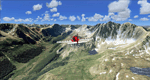
Extends my Aspen scenery to the east and contains more gorgeous Continental Divide area of the Rocky Mountains. Covers Leadville Lake County Airport (KLXV), which is the highest airport in North America (9.927 ft) and Mt. Elbert, which is the highest peak in the Rocky Mountains (14.443 ft). Aircraft performance deteriorates
with altitude, so many companies use the Leadville Airport as a base for high altitude performance testing. This scenery brings you another 3.500 sq km of beautiful Colorado in 4.7m/pix quality.
High resolution versions of this scenery for FS9 and FSX (much sharper, but larger and multiple downloads) are available at www.blueskyscenery.com/GNB_South2West.html . The screenies are taken from the high-res versions, so expect this version to be slightly more blurry. YourDonation@Work: Dedicated to Daniel, Art and Rotui.
| Filename: | Leadville_KLXV_Mt_Elbert_Colorado_PhotoScenery_FS9.zip |
| License: | Freeware |
| Added: | 1st February 2010, 19:06:58 |
| Downloads: | 1,713 |
| Author: | Gottfried Razek - blueskyscenery.com |
| Size: | 94.68 MB |
| Category: Flight Simulator X - Miscellaneous Files | |
| New Reduced Lights for TH2GO User (FSX and FS9) |
|
Images related to this file:
File Description:
with this new lights bitmap you can fly at night with your Triplehead2go high resolution and the lights appear in a normal size. for example the AI Traffic lights, Runway and taxi lights, the red Lights at Aerosoft Airports, the street lights from UTXEurope etc etc etc. you need no sunglasses anymore when you fly at night.
| Filename: | New_Reduced_Lights_for_TH2GO_User_FSX_and_FS9.zip |
| License: | Freeware |
| Added: | 5th April 2010, 23:44:23 |
| Downloads: | 1,278 |
| Author: | Frank Tiedge |
| Size: | 1.85 MB |
| Category: Flight Simulator 2004 - AFCAD Files | |
| Branson Airport KBBG for FS9--ILS Fix/Added Approaches |
|
File Description:
Modified AFCAD for Branson_airport_project_FS9.zip that includes all 3 of the published approaches, terminal waypoints, and missed approach code, and corrects the magnetic deviation of the ILS. Thank you to Bruce Nicholson for providing the updated code. Simply overwrite the old AFCAD with 6_KBBG_Branson_Airport_AFCAD_ADE9.BGL.
| Filename: | Branson_Airport_KBBG_for_FS9ILS_FixAdded_Approache.zip |
| License: | Freeware |
| Added: | 22nd August 2010, 16:22:38 |
| Downloads: | 879 |
| Author: | Carlyle Sharpe |
| Size: | 3.88 KB |
| Category: Flight Simulator X - Gauges | |
| TCAS and Radar for Flight Instrument Panels FS9 Compatible |
|
Images related to this file:
File Description:
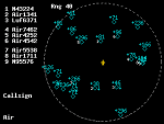
TCAS (traffic collision avoidance system) shows aircraft in the vicinity of
your own aircraft and warns when other aircraft are in close proximity or when
they their projected paths cross your path within 40 seconds.
TCAS features:
- It shows AI (artificial intelligence) aircraft
- It shows IVAO and VATSIM traffic when connected to IVAO or VATSIM networks
- It shows traffic on all altitudes
- It shows relative altitude and climbing/descending indication
- It shows intruders and gives proximity alerts (traffic advisories, TA)
- It shows traffic on the ground
- It does not give resolution advisories (RA)
- It shows the callsigns of the 9 aircraft closest to your aircraft
- Range is adjustable from 2 to 40 nm
- Display can be dimmed
- Take a screenshot anytime
(due to the size limit, the thumbnail picture looks a bit blurred. In the zip file, a screenshot of actual resolution (320x240) is included.
| Filename: | TCAS_and_Radar_for_Flight_Instrument_Panels_FS9_Co.zip |
| License: | Freeware |
| Added: | 5th July 2011, 04:09:05 |
| Downloads: | 2,398 |
| Author: | Emile van Gerwen |
| Size: | 69.8 KB |
| Category: Flight Simulator X - Aircraft Repaints, Textures and Modifications | |
| Lima Lima Flight Team Beech T34B Mentor FS9 Compatible |
|
File Description:
Repaints are for the Carenado T34B and can be used in either FS 9 or FS X .
Depicted are aircraft used by the Lima Lima Flight Team and at the time of painting were , LL10 , LL20 , LL40 , LL50 , LL52 , LL53 , LL67 , LL99 and LL15 ( with USAF markings ) .
Full instructions are included to install into either sim .
| Filename: | Lima_Lima_Flight_Team_Beech_T34B_Mentor_FS9_Compat.zip |
| License: | Freeware |
| Added: | 5th July 2011, 06:39:40 |
| Downloads: | 285 |
| Author: | John Glanville / Carenado |
| Size: | 18.39 MB |
| Category: Flight Simulator X - Aircraft Repaints, Textures and Modifications | |
| Propeller Texture Pack for FS9 Prop Planes converted FSX |
|
Images related to this file:
File Description:
Propeller texture 3-pack for FS2004 aircraft when used in FSX.
Your choice of 2-blade, 3-blade, or 4-blade propeller textures.
Subtle and as transparent as I could make them, these props will
make many FS2004 airplanes more FSX friendly.
Saved as 32 bit bitmaps, but easily converted via your DXTBMP program
to DXT3 or even DDS textures. I've tested all these prop textures as
32 bit bitmaps, DXT3 bitmaps, and DDS (32 bit) textures in FSX SP2 and all
work fine. Easy installation instructions. I offer these to the
flight sim community as PUBLIC DOMAIN. Use them in any way that you
please! No restrictions. An up-close screenshot is enclosed. By Tom Tiedman.
| Filename: | Propeller_Texture_Pack_for_FS9_Prop_Planes_convert.zip |
| License: | Freeware |
| Added: | 6th May 2012, 00:27:37 |
| Downloads: | 793 |
| Author: | Tom Tiedman |
| Size: | 110.27 KB |
| Category: Flight Simulator X - Utilities | |
| Taxi Navigation (+Destination Weather Reporter) for FSX/FS9 V1.0 |
|
Images related to this file:
File Description:
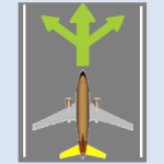
Do you prepare airport charts of every airport you visit, or just follow the progressive taxi to do taxiing?
This utility will make taxiing easy and realistic by providing simple taxi navigation information in text.
While taxiing, press "Ctrl + Shift + X", then taxi navigation information will be displayed.
It includes current taxiway name, intersecting taxiways' name and distance
(e.g. "On R7 : R2 (250m), R1 (643m), A (748m), A7 (748m)").
And one more thing, it also provides destination weather report.
It can be very helpful to set up exact T/D(Top of Descent), by assuming expected runway with wind information.
Enter destination airport before flight, and press "Ctrl + Shift + W" while flying,
then destination weather information will be displayed.
It looks like METAR and includes wind direction and speed, visibility, temperature, dew point and pressure
(e.g. "RKPK 29403KT 47SM 32/23 1010mb").
| Filename: | Taxi_Navigation_Destination_Weather_Reporter_for_F.zip |
| License: | Freeware |
| Added: | 3rd August 2012, 06:47:24 |
| Downloads: | 2,941 |
| Author: | Dongjin Shin |
| Size: | 4.88 MB |
| Category: Flight Simulator 2004 - AI Aircraft | |
| Our Airline opb Norfolk Air Boeing 737-300 FS9 |
|
Images related to this file:
File Description:

Textures only! You need the FAIB 737-300 FS9 model to use these textures!
| Filename: | Our_Airline_opb_Norfolk_Air_Boeing_737300_FS9.zip |
| License: | Freeware, limited distribution |
| Added: | 25th March 2013, 13:10:50 |
| Downloads: | 298 |
| Author: | Nils Bindauf |
| Size: | 1.89 MB |
| Category: Flight Simulator X - Scenery | |
| CYQQ (2010) Version 2 for FS9, FSX and Prepar3D |
|
Images related to this file:
File Description:
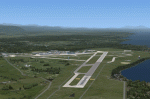
CYQQ (2010) portrays Canadian Forces Base Comox (Vancouver Island, British Columbia, Canada) (CYQQ), the Comox Valley Air Terminal and surrounding area. It is fully compatible with Ultimate Terrain Canada/Alaska for FS2004, Ultimate Terrain X - Canada for FSX and ORBX's FTX NA Blue. CYQQ (2010) includes over 100 "hand-crafted" buildings and other structures and 10 different vintage aircraft on static display, as well as aircraft and traffic files for a realistic AI scenario that causes a variety of military aircraft that come and go. (Use BC Regional AI - also available from this file library - for scheduled traffic.) Civilian AI is now routed so as not to transit military aprons.
Aside from the new approach lighting, generally, this new version is visually identical to its predecessor - even though quite different internally. As well, to the extent possible, it is compatible with Prepar3Dv2.
| Filename: | CYQQ_2010_Version_2_for_FS9_FSX_and_Prepar3D.zip |
| License: | Freeware, limited distribution |
| Added: | 20th June 2014, 11:39:47 |
| Downloads: | 11,046 |
| Author: | Don Grovestine |
| Size: | 33.19 MB |


© 2001-2026 AVSIM Online
All Rights Reserved
Privacy Policy |