
Where Flight Simulation Enthusiasts Gather from Around the World!
AVSIM Library - Search Results

| Category: Flight Simulator 2004 - Miscellaneous Files | |
| UK FS Flight Guide Vol 3 (L - R) |

|
File Description:
UK FS Flight Guide Vol 3 (L - R)
Part of a complete UK & Ireland airport
and helipads flight guide by Alan Trussell
(Consists of 5 parts)
UK FS Flight Guide Vol 1 (A - C)
UK FS Flight Guide Vol 2 (D - K)
UK FS Flight Guide Vol 3 (L - R)
UK FS Flight Guide Vol 4 (S - Z)
Plus - UK Flight Guide Needed Additional Files.
(For use with any photographic scenery for the uk).
(Compatible with FS9 & FSX)
Includes flight cards for 1521 airports & helipads,
Comprehensive airport information for pilots,designers
and enthusiasts.
Also some scenery and placemaker AFCADS
maps,airport lists,flight plan plus nav aids info,
imajes of each airport from the air and ground
plus screenshots by Dennis Williams.
**Please note Microsoft has a max length for file names,but for no good reason also includes the complete file extension path words in this maximum!
For this reason, please download each Zip file directly to your(My Computer/(C) Drive -(In my case),unzip and view from here as well - thus keeping the file extension length as short as possible. Anywhere else and it increases the file extension length such that some files cannot be opened or viewed.
More modern computers may have corrected this problem.**
| Filename: | UK_FS_Flight_Guide_Vol_3_L__R.zip |
| License: | Freeware |
| Added: | 8th January 2017, 07:35:56 |
| Downloads: | 257 |
| Author: | Alan Trussell |
| Size: | 359.03 MB |
| Category: Flight Simulator 2004 - Original Aircraft | |
| Mitsubishi G4M1 "Betty" |
|
File Description:
Mitsubishi G4M1 “Betty” twin engined attack aircraft.
Multi res model made with Abacus Flight Sim Design studio version2,
this model is specifically for FS9 (there is/will be a CFS2 version).
The “Betty” was a surprisingly agile aircraft with a long range. Used to
deliver a varied payload, ranging from single torpedo to multiple bombs
it’s mission were many and varied. In truth it was often sent where 4
engined bombers should have flown.
Animations
This model has the usual surface animations, detailed landing gear and
working cowl flaps and also includes the following:
Co pilot directions: In use, it was common practice for the co pilot to
stand on his seat and give the pilot taxiing instructions.
This is reproduced by using SHIFT + E
Action stations can be called by using the SHIFT+E+2 combination. Watch
the crew spring in to action!
Side door and ladder. This is actioned by using whatever combination you
use for concorde nose raise and lower.
Bomb bay: The Betty didn’t have traditional opening and closing bomb bay
doors but a series of different fitted panels depending on what payload was
being carried. This model is represented with a torpedo payload that can be
seen by using the spoiler key /
| Filename: | Mitsubishi_G4M1_Betty.zip |
| License: | Freeware |
| Added: | 22nd July 2006, 13:57:00 |
| Downloads: | 4,182 |
| Author: | Stuart Green |
| Size: | 3.45 MB |
| Category: Flight Simulator 2004 - Aircraft Repaints, Textures and Modifications | |
| Lockheed L-1049 Super Constellation Paintkit |
|
Images related to this file:
File Description:
Re-upload. FS2004 Lockheed L-1049 Super Constellation Paintkit. This paintkit is a supplement for the FS2004 Lockheed Super Constellation series project by Team 1049 - Roland Berger, Volker Boehme, Manfred Jahn, Luis Pallas, Bill Tyne, and Stefan Werner. In designated folders you will find templates in 32 bit format (incl. Alpha Channel) which form a basis for making repaints of textures of several versions of the turbo-compound powered Super Constellations. Represented are: R7V-1 (naval transport), C-121C (air force transport), VC-121E (air force VIP transport), L-1049G (overland passenger aircraft) and L-1049G (overwater passenger aircraft), L-1049H (passenger/freighter aircraft), and L-1049C-55-83 (special domestic version of L-1049C passenger aircraft for Eastern Air Lines). The templates of the L-1049G can also be used to make repaints for the L-1049C (overland and overwater) and L-1049E (overland and overwater). The templates of the L-1049H can also be used for the L-1049D. The templates of the R7V-1 can also be used for the C-121G and C-121J. The templates, based on the textures by Manfred Jahn, have been made by Maarten Brouwer. These templates have been tested in FS2004 (FS9) only.
| Filename: | Lockheed_L1049_Super_Constellation_Paintkit.zip |
| License: | Freeware, limited distribution |
| Added: | 12th June 2010, 01:19:39 |
| Downloads: | 429 |
| Author: | Maarten Brouwer |
| Size: | 11.95 MB |
| Category: Flight Simulator 2004 - Scenery | |
| TNCS - Juancho E. Yrausquin Airport - Saba, Netherlands Antilles |
|
Images related to this file:
File Description:
This island is the smallest municipality of the Netherlands. Saba is just under 30 miles south of St. Maarten, the island that was split between France and the Netherlands; to the southeast and 20 miles away is the small island of St. Eustatius, then St Kitts and then Nevis. The island comes out of the water like the top of Everest and keeps going, and there is no large space for a runway and no possibility of creating one with landfill with those steep sea cliffs. So what you have is a small runway (aligned 12/30) of 1,000 feet plus over-runs at each end that have small "closed" markings (see the white crosses) for a usable total of around 1,300 feet.
The airport restricts access as there is only space for four planes to park, plus a helicopter. And of course there is also the short runway to contend with. Landings are carried out under waivers issued by the Netherlands Civil Aviation Authority, and will always be on runway 12 as the southeast trade winds predominate. Twotters land there but only in real life; FS9 AI Twotters don't seem to find it adequate. There is no fuel or any other facility except for a small terminal building and a car park.
| Filename: | TNCS__Juancho_E_Yrausquin_Airport__Saba_Netherland.zip |
| License: | Freeware, limited distribution |
| Added: | 8th May 2013, 02:52:26 |
| Downloads: | 1,500 |
| Author: | Roger Wensley |
| Size: | 3.09 MB |
| Category: Flight Simulator 2004 - Scenery | |
| North Manitoba Airfields 20# in Canada |
|
Images related to this file:
File Description:
These are 20 airfields in north Manitoba, Canada. They were all previously posted individually But not on Avsim. There is a screenshot of Google Earth showing their names and locations amid other airfields. "Lodge" indicates the fact that there is a fishing lodge and airfield at that location but that I have no information to enable me to make the scenery. There are also some airfields that I downloaded years ago and are part of my FS9 set up, such as Flin Flon. There is AI with the supply flights that are vital for these isolated outposts. Gillam is a northern airfield that is connected to the rest of Canada by a railroad that continues north to Churchill Manitoba on the Hudson Bay coast and is used for grain exports during the ice-free summer months. A large number of the supply flights originate from Gillam. You may wonder about the numbers of fuel tanks at these airfields. These are not for the airfield use, they are for the settlement to be able to generate electricity and also to provide heating in the winter. If you find an error email me please, and note that my email address has been changed to rogwens at Gmail dot com.
| Filename: | North_Manitoba_Airfields_20_in_Canada.zip |
| License: | Freeware, limited distribution |
| Added: | 7th April 2021, 17:09:34 |
| Downloads: | 83 |
| Author: | Roger Wensley |
| Size: | 35.99 MB |
| Category: Flight Simulator X - Miscellaneous Files | |
| FeelThere Map screens megapack |
|
File Description:
This package looks to be my final release of its' kind. Here are over 250 different screens for use with FeelThere Map; an amalgamation of my prior work into one package. You must have the payware add-on, FeelThere Map installed. These screens will work in FS9 and FSX, but were not tested in other sims. They should work in any sim that works with FeelThere Map (i.e. compatible versions of P3D). Many more complete airline sets are found here, along with a few sensible national groupings, a new bizjet operator grouping, and the addition of luxury brand advertisements for our high-end GA cockpit interiors, or to perhaps complete a set for an airline that might only have 2 or 3 screens of its' own. Lots of retro carriers, and some of the complete sets draw from historic timetable art, and/or bring type specificity. There are other packages from different authors available on the internet that would enable the construction of several more complete airline sets, for the dedicated VA pilot. Speaking of VAs, there's a few VA-specific groupings herein, as well. There's literally something here for every Map-enabled aircraft and flight context in your hangar. Enjoy your flights.
| Filename: | FeelThere_Map_screens_megapack.zip |
| License: | Freeware |
| Added: | 25th April 2026, 17:13:15 |
| Downloads: | 27 |
| Author: | Henry Douglas |
| Size: | 18.38 MB |
| Category: Flight Simulator 2004 - Scenery | |
| KCMH - Port Columbus International - Columbus, Ohio, USA |
|
Images related to this file:
File Description:
Port Columbus International Airport in Columbus, Ohio, is a gem of an airport for aviation buffs. It first opened in 1929 at a site chosen by Chales Lindbergh, as part of an air-rail route from New York to Los Angeles. The original terminal building has been restored and is now used for office space. Two of the original three hangers are still in use (I included the third hanger in the scenery). The six hanger Lane Aviation FBO was added in 1935 and has been in operation these 78 years. In 1959 the modern terminal was first built, with additions and renovations to follow. Netjets opened their facilities in 2001. With the exception of the runways, this version of KCMH was built entirely from scratch. This is the first large airport I've done in which all buildings on the field (except for the control tower) are custom made and partly or fully photo textured. I've also made more use of ground photo textures. Many hours went into the creation of Port Columbus International Airport for FS9. I hope you enjoy it. My thanks to Wil Morgan of FRAME-RATE-FRIENDLY Studio (WWW.FRFSTUDIO.NET) for the AI aircraft parking assignments and general testing. The vintage TWA textures for the DC3's are by Dale De Luca.
| Filename: | KCMH__Port_Columbus_International__Columbus_Ohio_U.zip |
| License: | Freeware |
| Added: | 11th June 2013, 22:51:45 |
| Downloads: | 2,812 |
| Author: | Sidney Schwartz |
| Size: | 17.74 MB |
| Category: Flight Simulator 2004 - Scenery | |
| KCMI Update for KCMI Willard airport in Champaign, IL |
|
File Description:
I have made a few changes to parking lot lights and some movement of objects.
This update should have the previous version of kcmi_willard.zip installed already to work..
At request of different people. I have made three different levels of display for KCMI Willard Airport located in Champaign, IL.
To add the new scenery file to your KCMI just install and override the original Scenery folder in the KCMI Folder.
Then to select the level of display I have numerous settings that can be changed.
To change the level of vehicles seen chose one of the following.
KCMI_Vehicles_low.xxx
KCMI_Vehicles_med.xxx
KCMI_Vehicles_high.bgl
The default is the KCMI_Vehicles_high.bgl setting.
If you computer can not handle this high setting, just change KCMI_Vehicles_high.bgl to KCMI_Vehicles_high.xxx
Then change either KCMI_Vehicles_low.xxx or KCMI_Vehicles_med.xxx
By just changing the xxx to bgl
At the low setting, only a few vehicles will be seen.
___________________________________
Also you can change the following bgl files to see how they look also.
KCMI_Power Poles.bgl to KCMI_Power Poles.xxx will eliminate the power lines.
static-planes.bgl to static-planes.xxx will eliminate the two large planes at the corners of the runway.
KCMI_Maintenance.bgl to KCMI_Maintenance.xxx will eliminate related maintenance equipment of the two large planes.
____________________
Then restart your FS9 and it will apply the changes...
| Filename: | KCMI_Update_for_KCMI_Willard_airport_in_Champaign_.zip |
| License: | Freeware |
| Added: | 6th February 2006, 01:45:47 |
| Downloads: | 1,053 |
| Author: | Lawrence F Dorries |
| Size: | 69 KB |
| Category: Flight Simulator 2004 - Scenery | |
| Updates for Rockcliffe CYRO in Ottawa Canada |
|
Images related to this file:
File Description:
Flight Ontario posted their scenery for CYRO in 2008. I originally learned to fly at Rockcliffe Flying Club and came up with some additions and modifications in 2009, and now with the passage of time there are more changes. This version replaces the previous updates and is a self-contained version.
A mini tornado in 2009 destroyed the old willow tree and almost put paid to the clubhouse too (though all the buildings are still standing right now) so there is a new (temporary) clubhouse, a new hangar, the willow tree is gone, the car park is enlarged and is now asphalt, the fence line is revised and the entrance gate relocated. The previous modifications included the refueling point near the RFC buildings, revised apron shape, gravel car park, parked cars, extended perimeter fence, deck in front of the RFC clubhouse, more parked planes, the large and old willow tree, and the float dock in the river. Note in the winter picture the Ottawa River is frozen, as it is right now in reality, and you can download my "Frozen Lakes etc" post and turn your own Canadian winter into reality; I have been surprised by how few people are interested in winter flying in FS9.
| Filename: | Updates_for_Rockcliffe_CYRO_in_Ottawa_Canada.zip |
| License: | Freeware, limited distribution |
| Added: | 5th March 2010, 18:05:35 |
| Downloads: | 569 |
| Author: | Roger Wensley |
| Size: | 2.43 MB |
| Category: Flight Simulator X - Scenery | |
| Carnes Farm |
|
Images related to this file:
File Description:
These are the files that I talked about in the Prepar3d forums. I created these objects for Fs9, then upgraded them to the scenery SDK for FSX. They were created 10 years ago in GMAX, and I have used them successfully ever since in Prepared 1.4 as well.
For some reason the individual farmhouse and other objects that I created are not showing up in Prepar3d version 2.0.
That's where you guys come in! These files are free to use in anyway you want as long as proper attribution is given, but, I would like you guys who have both Prepar3d 1.4 and 2.0 to try them out in both and report back to me as to whether you have the same problems that I do. That's your only fee. And I'd like you guys to give it a shot in both, or all four( I am not sure that they will work in FS9 anymore, but try it out. Unfortunately I can't recompile my FSX SDK Files back to FS9 if it doesn't work).
What's included:
1. Photo real scenery of Barbourville, 10 miles to the north west of stinking Creek where we live, and;
2. Photo real scenery of the farm area and stinking Creek, upon which I have placed my GMAX objects;
A. The farm house.Carnes Farm From the Bridge at 500 AGL.jpg
B. The barn, shed and the RV in back of the farmhouse.
C. A two-story long structure the top of which is an apartment but the bottom of which is a re-creation of Mama Carne's store, along with all the real wood floors shelves and original contents.. It is also o n Google earth in 3-D as it is here with further description .
... A little note on Gmax.. Mama Carne's store was one the first structures that I built in Gmax. It was just a box. Later, I added the true architectural features that you see including the steps and rails which took about as long to create as it would have to Saw and fit and hammer the real rails, risers and steps.
D. K-6, my little 2300 foot strip for runways 03 and 21. It has VOR - (117.55), ILS(110.1), and NDB(222).
E. Gerald Bingham's house, 1/4 mile up Warriors Path North from us.( mostly dirt road with gravel topping).
F. Dewitt Baptist Church.
Off property Knox county
G.Escoe's Store and Post Office complete with great prices for gas at the included pumps.
Escoes.jpg
H. Rex allen's killer corner...sheds and farm equipment on the sharpest bend on Stinking Creek...my son went off it with a flat tire, unscathed, but more than several have lost their lives on that curve... there may be several iterations of the sheds...just delete or rename the wrong ones...I was experimenting with ModelConverterX, Arno Gerretsen's wonderful model and object scenery tool.
I. sitting on top of the Barbourville Photo real scenery Barbourville PhotoReal over the shopping center.jpg is the Barbourville P3D Shopping Center2.jpg shopping center all the stores and all the storefronts ... it's on 25 E. as you head into Barbourville.
Recreated, is the entire shopping center with the now outmoded Wal-Mart sign. Probably my magnum opus.
note on the Gmax scenes.
All of the scenery was either directly measured and if not practical for a such a long measuring device, walked off, as in the Stinking Creek Bridge and shopping center. All of the objects were then photographed, in 360° where possible and saved as texture for inclusion in the Gmax model.
Enjoy!
...oh... how do you get there? Wellllll.... situate yourself at Middlesboro (1a6), and tune your Nav radio to K-69's VOR, 117.55, take off and climb to 3500 feet...grinnnnn
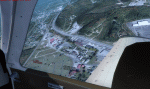
Welcome to Knox County Kentucky!
| Filename: | Carnes_Farm.zip |
| License: | Freeware |
| Added: | 2nd December 2013, 05:34:20 |
| Downloads: | 453 |
| Author: | Chas Honce |
| Size: | 91.13 MB |


© 2001-2026 AVSIM Online
All Rights Reserved
Privacy Policy |