
Where Flight Simulation Enthusiasts Gather from Around the World!
AVSIM Library - Search Results

| Category: Flight Simulator 2004 - Scenery | |
| Alaska North Slope 5 - Nuiqsut PAQT |

|
Images related to this file:
File Description:
The town of Barrow is in the far north of Alaska, and these are coastal villages or radar installations to the west, south, and now east of Barrow. There will be further additions. Nuiqsut is a mainly Inuit community on the west side of the Colville River, around 20 miles south of the coast, and with a slowly declining population of around 420 or so. The airfield is just south of the town and has a gravel runway 5,000 feet long and aligned 04-22 in FS9. The airfield is the only year-round contact route to the rest of the world, though there are plans for a permanent road. The AI includes daily passenger flights early and late in the day, cargo deliveries, and some GA. It seems that the only photos I had of the airport were either of the old building or were not of Nuiqsut at all. The only pic I have seen (recently, which is why I now have doubts) of the new building is insufficient to model it, so I am sticking with the old or maybe incorrect version.
| Filename: | Alaska_North_Slope_5__Nuiqsut_PAQT.zip |
| License: | Freeware, limited distribution |
| Added: | 21st June 2016, 21:45:32 |
| Downloads: | 246 |
| Author: | Roger Wensley |
| Size: | 4.37 MB |
| Category: Flight Simulator 2004 - Miscellaneous Files | |
| ActiveSky Weather Adventures Vol. 2 - Fly the AT! (Manual install) |
|
File Description:
ActiveSky Weather Adventures Vol. 2 - Fly the AT! (Includes updated Vol. 1 - Winter's End) ***In addition to archives for AS2k4 users, saved flights with AS2k4 processed weather are included so people who don't own ActiveSky can fully enjoy these adventures and get a taste of what ActiveSky 2k4 has to offer! * Includes TWO Volumes of Weather Adventures * Volume 2 - Fly the AT! - Ten flights take you from Maine to Georgia along route of the Appalachian Trail - features three days of real-weather as a slow front approaches from the west - can YOU make it to Georgia before the thunder rolls in? * Volume 1 includes 10 flights highlighting weather phenomena such as a tornado outbreak in Texas and Oklahoma, a New England "nor'easter", and a massive upper-level low occupying the plains states! ***The ASWxAd-Kneeboard!*** A modification to FS9's kneeboard which allows viewing of original material describing these flights, radar and satellite loops, and annotated sectionals depicting flight plans and the AT! * Two versions available: This is the Manual Install. An automatic installer is also available - ASAD2INS.zip * Previous version had nearly 2000 downloads!
| Filename: | ActiveSky_Weather_Adventures_Vol_2__Fly_the_AT_Man.zip |
| License: | Freeware, limited distribution |
| Added: | 4th June 2004, 14:18:50 |
| Downloads: | 1,504 |
| Author: | Scott Gridley |
| Size: | 23.88 MB |
| Category: Flight Simulator 2004 - Original Aircraft | |
| Mitsubishi F-2A (Beta Model, Version 2) |
|
Images related to this file:
File Description:

F-2A is a Japanese fighter aircraft and it has been developed with the United States based on the General Dynamics (post 1993, Lockheed Martin) F-16 Fighting Falcon. Its blue oceanic flight livery is referred to as "The most beautiful camouflage livery of the world". Its three divited canopy and big-wide wing is the most different part between the F-2 and F-16. This model is only for FS9, you can't use it with FSX. By Team FS KBT.
The Mitsubishi F-2 Fighter is manufactured by Mitsubishi Heavy Industries (MHI) and Lockheed Martin for the Japan Air Self-Defense Force, with a 60/40 split in manufacturing between Japan and the USA.
Some differences between the F-2 and the F-16A:
* a 25% larger wing area
* composite materials used to reduce overall weight and radar signature
* longer and wider nose to accommodate a phased-array radar
* larger tailplane
* larger air intake
* three-piece cockpit canopy
* capabilities for four ASM-1 or ASM-2 anti-ship missiles, four AAMs, and additional fuel tanks
| Filename: | Mitsubishi_F2A_Beta_Model_Version_2.zip |
| License: | Freeware |
| Added: | 3rd June 2010, 12:09:35 |
| Downloads: | 12,346 |
| Author: | Team FS KBT: Daisuke Yamamoto, Hiroaki Kubota, Shingo Katsumata with Friends |
| Size: | 72.93 MB |
| Category: Flight Simulator 2004 - Panels | |
| Ultimate Airbus A32x V2 |
|
Images related to this file:
File Description:

Ultimate Airbus A32x V2 is an Advancement of the previous Version "Ultimate Airbus V1" and generally follows the same Idea: To ease flying the WILCO Airbus Volume 1 (models A318, A319, A320 and A321). This Package therefore introduces 6 smaller Sub-Panels (p.e. Engine Starter, ECAM Control, Flaps Lever, Radio etc. including Clickspots to handle those Panels) instead of allways using the Pedestal or Overhead Panel covering the complete View. It also includes a "Co-Pilot" functionality to automate certain Parts of Flight Procedures (Lights, Gear, Spoliers, Flaps etc.), Buttons for Panel Lights and Doors as well as new Views.
A detailed Tutorial Flight considering the a. m. added functionality - based on Airbus Original Procedure- and Checklist but modified to fit with the functionality available in WILCO's Airbus Volume 1 - is also Part of this Package. It is especially written for Beginners because there is no such detailed Tutorial currently available.
This zip-file contains the FS9 version only which is slightly different from the FSX version. More detailed information on this package as well as on installation you will find in the "Readme_ExtVers_FS9.pdf" file.
| Filename: | Ultimate_Airbus_A32x_V2.zip |
| License: | Freeware |
| Added: | 10th March 2010, 23:43:20 |
| Downloads: | 8,411 |
| Author: | Steffen Froemter / Rolf Fritze |
| Size: | 3.18 MB |
| Category: Flight Simulator 2004 - Scenery | |
| Driftwood Bay AK23 near Dutch Harbor Alaska |
|
Images related to this file:
File Description:
This is Driftwood Bay, an Air Force field that is just 13 miles northwest of Dutch Harbor, and was once part of a DEW line station with a road heading up the hill.
In FS9 the stock runway is concrete and if you have a mesh with the hills correctly positioned then the runway sits in a deep hole on the hillside. In fact the runway is gravel, 3,500 feet long and aligned 32/14 next to the beach, which is where I moved it to. The beach, as configured by Ultimate Terrain (and contrary to my previous doubts, UT does cover the Aleutians) is incorrect, in that a marshy area just behind the beach is shown as sea with large indentations in what should be a fairly straight line of sand. However, this does not squeeze AK23 in any way so I left it; consider it to be a spring high tide. There is very little at AK23 beyond a gravel runway and a windsock and the AI is an Alaska State Troopers Piper Super Cub from Dutch Harbor, presumably monitoring the numerous Alaska Maritime National Wildlife Refuge areas.
| Filename: | Driftwood_Bay_AK23_near_Dutch_Harbor_Alaska.zip |
| License: | Freeware, limited distribution |
| Added: | 14th August 2012, 20:32:14 |
| Downloads: | 353 |
| Author: | Roger Wensley, Sidney Schwartz |
| Size: | 3.35 MB |
| Category: Flight Simulator 2004 - Panels | |
| Grumman Albatross version 2.1 Panel |
|
Images related to this file:
File Description:
FS2004 Grumman Albatross HU-16 version 2.1
Greg Pepper Michael Verlin
Panel Package
Along with the modifications I've made to Greg Pepper's wonderful Albatross, I felt that a upgrade for the panel was overdue.
The changes consist of a revised set of primary flight instruments in keeping with the chronological period.
The airspeed gauge is part of Greg's gauge set that he provided with the aircraft.
The attitude gauge and turn indicator come from Jens Christensen's DC-6 gauge package.
The altimeter, gyro and vertical speed were designed by Scott Thomas from his Aero Commander 500 gauge package.
The Bendix King radios were designed by Pierre Fasseaux.
The KLN90 gps was designed by Ike Slack.
I've also included Rob Barendregt's Ground Handling package and the RKG Fuelstat gauge.
A few notes on using this panel:
Please read Pierre's instructions for proper operation of the autopilot before you fly.
The GPS will load the flight plan you specify from FS9.
There is a hot spot in the upper left corner of the radio stack that will close it when it isn't needed.
Michael Verlin
[email protected]
May 27, 2012
| Filename: | Grumman_Albatross_version_21_Panel.zip |
| License: | Freeware |
| Added: | 27th May 2012, 23:13:55 |
| Downloads: | 699 |
| Author: | Greg Pepper Michael Verlin |
| Size: | 9.61 MB |
| Category: Flight Simulator 2004 - Scenery | |
| Colombian Airports |
|
File Description:
33 Colombian Airports for FS9 default scenery and the Colombia freeware mesh by Raimondo Taburet. I also recommend the San Andres Landclass and modified coastlines by Juan Sebastian Gonzalez (sandres_lc.zip at avsim.com). However, the scenery should also work with the default or any other mesh but I have not tested it.
The airports are based on GoogleEarth and airport layout data with generic objects added. Position of the airports has been corrected, ramps added, some generic buildings and objects added to most of the airports. All files start with the ICAO identifier of the airport; so you can take out what you don't like or use only what you like.
The package includes the following airports:
SKAM, SKAO (now SKMJ), SKAS, SKBN, SKBO, SKBQ, SKCB, SKCC, SKCL, SKFL, SKGO, SKGY, SKIB, SKLA, SKLT, SKMG, SKMP, SKMR, SKMU, SKOC, SKOT, SKPB, SKPV, SKQU, SKRG, SKSP, SKTJ, SKTL, SKTM, SKUC, SKUL, SKVP, Z09A.
NOTE:
There a two files, colapts1.zip with the airport sceneries and screenshots, and colapts2.zip with the object libraries; colapts2.zip is only needed if you don't have already the rwy12 and ez-objects libraries used.
| Filename: | Colombian_Airports.zip |
| License: | Freeware |
| Added: | 24th May 2014, 18:34:00 |
| Downloads: | 3,364 |
| Author: | Detlev J. Rohmer |
| Size: | 64.72 MB |
| Category: Flight Simulator 2004 - Scenery | |
| Green Lake CBG2 in British Columbia Canada |
|
Images related to this file:
File Description:
Green Lake is on the eastern side of the Coast Mountains of British Columbia, around 40 miles north of Cache Creek and 15 miles south of 100 Miles House (a previous posting). The airfield is beside the lake shore and serves the Flying U holiday ranch with a grass runway 2,575 feet long and aligned 18-36. There is no lighting. There is also mooring on the lake for boats and float planes. I have posted it as Green Lake CBG2, but I suggest that you just add it to your previously created "BC airfields", if you followed my previous suggestion. You then avoid the inevitable doubling up of common textures etc. Plus that way you will have just one FS9 library post to do and new airfields will not need yet another posting. Up to you. It just occurred to me that probably only a few of you have a copy of the Nav Canada Airfields handbook, so won't know the airfield altitudes, which is useful to have amid mountains. So, Pemberton is 670 feet Above Sea Level, Cache Creek 2,034 feet ASL, and Green Lake 3,550 feet ASL. The others to follow as posted. If you find a defect, email me.
| Filename: | Green_Lake_CBG2_in_British_Columbia_Canada.zip |
| License: | Freeware, limited distribution |
| Added: | 18th November 2020, 19:44:00 |
| Downloads: | 88 |
| Author: | Roger Wensley |
| Size: | 10.05 MB |
| Category: Flight Simulator 2004 - Scenery | |
| Trail CAD4 in British Columbia, Canada |
|
Images related to this file:
File Description:
Trail is in the valley carved out by the Columbia River, around 7 miles north of the Canada-US border and on both banks of the river. The town has a population of just under 8,000 and the main industry is mining. The airport is around 3 miles south-east of the town and on the east bank, with the runway parallel to the river and aligned 16-34, 75 feet wide and asphalt. There are currently no runway or taxiway lights, though there is an overall improvement programme in place to cope with increasing passenger demand. A new terminal building was recently completed, along with alterations to road access and parking; as I have no information regarding these road changes I have left the original "terminal" building in place and in use by Pacific Coastal, the only airline to fly to Trail. There is a Youtube video which gives a very good idea of the basic facilities, and of the surrounding hilly terrain which is similar to that at Bella Cooola at the far side of Pacific Coastal's coverage area. The original position of the airport in FS9 before I corrected it was best described as "in a hole". The hole remains nearby as there is no easy way to deal with it.
| Filename: | Trail_CAD4_in_British_Columbia_Canada.zip |
| License: | Freeware, limited distribution |
| Added: | 23rd December 2018, 17:27:38 |
| Downloads: | 140 |
| Author: | Roger Wensley |
| Size: | 12.3 MB |
| Category: Flight Simulator 2004 - Aircraft Repaints, Textures and Modifications | |
| United (Post-CO Merge) Boeing 747-400 |
|
Images related to this file:
File Description:
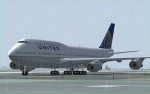
This is a repaint in one of the new "United" liverie's for the PAYWARE SMS Overland 747-400W model. This is a TEXTURES ONLY file so the SMS Overland aircraft will be required. The textures have been thoroughly tested in FS9 (FS2004) only. Will they work in FSX? "I don't know so trying them in FSX is done at your discretion. This version of the United livery is complete with customized alpha channels covering the fuselage (complete) and wings giving the plane a crisp, clean new look. All animations are as per the SMS model along with the various shadowing for the plane. This, I believe (and I could be wrong here and possible am :) ) is a very accurate rendition of one of the new United liveries for a very nice (affordable) payware model - if you don't have it, it is a worth looking at, especially if you are not interested in reading a 500 page manual before you can fly but want a MUCH better model than the default one. All Distribution, Installation and contact Details for me can be found in the SMS TC Read Me File enclosed. Enjoy her and happy, safe flying to all whether you down this file or not :)
| Filename: | United_PostCO_Merge_Boeing_747400.zip |
| License: | Freeware |
| Added: | 4th March 2012, 02:31:24 |
| Downloads: | 537 |
| Author: | Tony Cannon and SMS Overland |
| Size: | 5.08 MB |


© 2001-2026 AVSIM Online
All Rights Reserved
Privacy Policy |