
Where Flight Simulation Enthusiasts Gather from Around the World!
AVSIM Library - Search Results

| Category: Flight Simulator 2004 - Utilities | |
| AirTrack Plug-in v1.4 |

|
Images related to this file:
File Description:

This is an update of the Microsoft Flight Simulator 9/2004 plug-in for the AirTrack iPhone, iPad and iPod Touch app. In order to install it run the executable that will deploy a gauge in the proper folder and automatically activate it.
AirTrack is an App that allows tracking of FS9 flights on your iPhone or iPad in real time using a local wireless network with built-in parameter reporting, an EFIS MFD, an FMC and Airport information. You can also command the plane from the application.
The current update fixes some bugs, improves the communication between the plug-in and the applicaiton and allows the flight plan created at the Flight Simulators to be displaid in the AirTrack. It also adds support for speeds limits, flight director bars in the PDF and VAS selector.
To learn more about the app and its availability please visit the product' site: air.ipobjects.com. If you have any question regarding the FSX plug-in you can contact us at [email protected]
| Filename: | AirTrack_Plugin_v14.zip |
| License: | Freeware |
| Added: | 10th May 2011, 13:46:01 |
| Downloads: | 189 |
| Author: | Jofre Palau |
| Size: | 296.36 KB |
| Category: Flight Simulator 2004 - Miscellaneous Files | |
| ActiveSky Weather Adventures Vol. 2 - Fly the AT! |
|
File Description:
ActiveSky Weather Adventures Vol. 2 - Fly the AT! (Includes updated Vol. 1 - Winter's End) ***In addition to archives for AS2k4 users, saved flights with AS2k4 processed weather are included so people who don't own ActiveSky can fully enjoy these adventures and get a taste of what ActiveSky 2k4 has to offer! * Includes TWO Volumes of Weather Adventures * Volume 2 - Fly the AT! - Ten flights take you from Maine to Georgia along route of the Appalachian Trail - features three days of real-weather as a slow front approaches from the west - can YOU make it to Georgia before the thunder rolls in? * Volume 1 includes 10 flights highlighting weather phenomena such as a tornado outbreak in Texas and Oklahoma, a New England "nor'easter", and a massive upper-level low occupying the plains states! ***The ASWxAd-Kneeboard!*** A modification to FS9's kneeboard which allows viewing of original material describing these flights, radar and satellite loops, and annotated sectionals depicting flight plans and the AT! * This is the Automatic Installer version. A manual install is also available - ASAS2MAN.zip * Previous version had nearly 2000 downloads!
| Filename: | ActiveSky_Weather_Adventures_Vol_2__Fly_the_AT.zip |
| License: | Freeware, limited distribution |
| Added: | 4th June 2004, 14:14:58 |
| Downloads: | 2,798 |
| Author: | Scott Gridley |
| Size: | 22.04 MB |
| Category: Flight Simulator 2004 - Miscellaneous Files | |
| Active ILS - KIAH v2.0 |
|
File Description:
UPDATED KIAH see the readme file -- By design KIAH is now another Airport that features advanced ATC control. As most know initiating the ILS at certain airports for AI Traffic is not a function at this time when using AFCAD2. If you add a new ILS runway to an airport such as KIAH (8L/26R) only the user aircraft can use this runway when visibility falls below 3 miles. ATC will no longer use this runway for AI Traffic because FS9 sees it as a visual runway. This will cause ATC to vector your AI Traffic back to 8/26 (old numbers) 8R/26L (new numbers) which is also a Terminal Departure Runway. All 5 runways for KIAH are now simultaneously active for departure and arrival. There are many additional options added to version 2.0 so follow the instructions in the README and just sit back (or fly) and plane spot either VMC or IMC for a very active airport. *** SimFlyers Scenery AFCAD2 and special ILS bgl also included ***
| Filename: | Active_ILS__KIAH_v20.zip |
| License: | Freeware, limited distribution |
| Added: | 26th August 2004, 02:23:19 |
| Downloads: | 2,720 |
| Author: | Jim Vile |
| Size: | 81.21 KB |
| Category: Flight Simulator 2004 - Miscellaneous Files | |
| Active ILS - KMCO (Orlando International Airport) |
|
File Description:
This is the 3rd Airport in a series of new ILS runways. As most know initiating the ILS at certain airports for AI Traffic is not a function at this time when using AFCAD2. If you add a new ILS runway to an airport such as KMCO (Orlando International Airport 17L/35R) only the user aircraft can use this runway when visibility falls below 3 miles. ATC will no longer use this runway for AI Traffic because FS9 sees it as a visual runway. This will cause ATC to vector your AI Traffic back to 17/35 (old numbers) 17R/35L (new numbers) which is also a Terminal departure runway. This file adds all NAVAIDS for making 17L/35R a Precision Instrument Runway. I have added all the radar fixes for both the ILS approach portion and the proper missed approach procedures, altitudes and intersections as per current published plates. All AI Aircraft will now continue to use 17L/35R when Airport visual conditions are less than 3 miles.
| Filename: | Active_ILS__KMCO_Orlando_International_Airport.zip |
| License: | Freeware, limited distribution |
| Added: | 25th June 2004, 01:50:15 |
| Downloads: | 3,846 |
| Author: | Jim Vile |
| Size: | 45.38 KB |
| Category: Flight Simulator 2004 - Scenery | |
| Frazier Lake Airpark (1C9) California Scenery |
|
File Description:
This is a scenery upgrade for Frazier Lake, California (1C9). This is part Eight of a series of small airstrip and minor airfield scenery enhancements which are based on real world data from Google Earth. The scenery mainly reflects the appearance of the airpark from directly above. If you are familiar with the place when on the ground, due to the limited number of buildings available it probably looks quite different. There is now however, a water strip for float planes which was missing from the default. It is proper FS9 water so you may land on it. Also, a few images from the net show that the ground varies from green grass to bare earth so I have made four .bgl files for the base texture. Note, I am using Flight1 Ground Environment; the default fields will look different. You must have rwy12 and EZ scenery libraries installed for the buildings to show. Both libraries of objects are free. EZ Library is available at http://www.abacuspub.com/pub/AbacusEZLibraries.exe. Rwy12 and additional EZ Custom libraries from Avsim. Search under Scenery design.
| Filename: | Frazier_Lake_Airpark_1C9_California_Scenery.zip |
| License: | Freeware |
| Added: | 31st March 2006, 01:00:25 |
| Downloads: | 501 |
| Author: | Kim Gowney |
| Size: | 400.27 KB |
| Category: Flight Simulator 2004 - Aircraft Repaints, Textures and Modifications | |
| XL Airways Germany (Excel Airways Germany) Airbus A320 IAE UPDATE |
|
File Description:
This is a DXT3 photoreal repaint of the Wilco A320 IAE Airbus that comes with the payware Wilco Airbus collection, Vol 1, Deluxe Edition.This repaint is based on the real life A320 IAE XL Airways Germany, registration number D-AXLA. Just XL Airways Germany and France still operating. Wilco Feelthere Vol 1, Deluxe Edition 320 IAE is necessary to use this Repaint. Livery works with FS9. THIS FILE IS ONLY ONE UPDATE. NEED THE BASE REPAINT (xl_airways_germany_daxla.zip). Hope you enjoy it.
****NOTE:
XL-Airways-Germany and exactly the rePaint I made (D-AXLA), never existed in real-life.
This Aircraft crashed on 27.Nov.08 on a post-maintenance test flight into the Mediterranean Sea east of the French city of Perpignan, The aircraft was leased to XL Airways Germany by Air New Zealand, and had been repainted with Air New Zealand's livery in preparation for its return to Air New Zealand the following week.
I will be creating a new repaint for this aircraft in the future.****
| Filename: | XL_Airways_Germany_Excel_Airways_Germany__Airbus_A.zip |
| License: | Freeware |
| Added: | 12th November 2008, 15:27:36 |
| Downloads: | 631 |
| Author: | Max Flechsig |
| Size: | 157.25 KB |
| Category: Flight Simulator X - Aircraft Repaints, Textures and Modifications | |
| P-51D Swedish Air Force 26152 |
|
File Description:
This folder contains a repaint for the Shockwave World War II Fighters P-51D Mustang. Repaint by Jan Kees Blom, based on the repaint kit by John Terrell. It is for FSX only, as it contains 2048 x 2048 textures. For FS9, look for my earlier "Sierra Sue II" repaint, which contains a low res version of this repaint.
This aircract represents a J-26 of the Royal Swedish Air Force. A/C 26152 was previously 44-63675 E6-D "Sierra Sue II" of the 402nd FS, USAAF, flown by Lt. Bob Bohna. She was sold to Sweden after the war and flew with with 3rd squadron of the F4 wing, based on the island of Froson, with Cpl Sten Soderquist as her regular pilot. In 1954, she was sold to Nicaragua were she flew with registration GN91. She came to the US in 1970 and is currently owned by Roger Christgau, who flies her as "Sierra Sue II / Gul Kalle". Repaint by Jan Kees Blom, based on the repaint kit by John Terrell.
| Filename: | P51D_Swedish_Air_Force_26152.zip |
| License: | Freeware |
| Added: | 25th December 2008, 20:11:58 |
| Downloads: | 200 |
| Author: | Jan Kees Blom |
| Size: | 24.3 MB |
| Category: Flight Simulator X - Aircraft Repaints, Textures and Modifications | |
| P-51D 52nd FG QP-U "Hey Rube! IV" |
|
File Description:
This folder contains a repaint for the A2A/Shockwave World War II Fighters P-51D Mustang, representing 44-14227 "Hey Rube! IV", which flew with the 2nd FS/ 52nd FG from Madna, Italy in july 1944, with Captain Daniel Zoerb as its assigned pilot. Zoerb played in a carnival band before the war, and the expression "Hey Rube!" was used to indicate that trouble was about to break out. This aircraft ended up in Rumania. During an escort mission on 8 september 1944, to pick up some American POW's with a B17, Capt Zoerb lost power over Bucharest airfield and made a very hard landing, buckling the wings. He stayed overnight with the Rumanian pilots and was treated to a real feast: Sheep's head soup! The next day, he flew back in a B17. He finished his combat tour a major with seven kills and as CO of the squadron.
Repaint by Jan Kees Blom, based on the repaint kit by John Terrell. It should work in both FSX and FS9.
| Filename: | P51D_52nd_FG_QPU_Hey_Rube_IV.zip |
| License: | Freeware |
| Added: | 23rd January 2009, 10:44:12 |
| Downloads: | 320 |
| Author: | Jan Kees Blom |
| Size: | 7.7 MB |
| Category: Flight Simulator 2004 - Scenery | |
| FHSH - St. Helena Island & Airport - St. Helena, South Atlantic |
|
Images related to this file:
File Description:
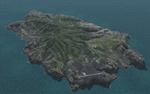
This project is a port of my FSX release of the the new airport (FHSH) on St. Helena Island. This scenery provides more accurate coastlines and roads, as well as corrected landclass based on the latest available satellite imagery. Flight plans are provided for the proposed commercial service to St. Helena, and some additional GA and military flights to the island are added as well.
The FS2004 St. Helena (FHSH) airport was created by aligning master plans for the airport with current satellite data and by studying many of the pictures that have been posted as the airport has taken shape. The official opening of the real airport on May 21, 2016, has been pushed back for more field tests due to challenging crosswinds. Updates were created or rebuilt in a manner which carefully aligns airport data with current satellite imagery. Scenery was created using Airport Design Editor 9 v1.67.5684 and SBuilder. Scenery objects were added and modified from stock FS9 scenery to resemble as closely as possible the actual airports.
| Filename: | FHSH__St_Helena_Island__Airport__St_Helena_South_A.zip |
| License: | Freeware |
| Added: | 5th May 2016, 07:44:38 |
| Downloads: | 2,235 |
| Author: | Carlyle Sharpe |
| Size: | 1.62 MB |
| Category: Flight Simulator 2004 - Sounds | |
| Rolls-Royce Merlin Sound Package |
|
File Description:
A few weeks ago at an airshow, I had the opportunity to get up close up to the Spitfire and get some recordings of that beautiful Rolls Royce Merlin engine. I have used some of these sounds for this sound pack and the result is absolutely amazing. Now I've got a spitfire which truly sounds like it should. This is a small file but don't be fooled, you'll love it, guaranteed! Obviously I don't know how a Spitfire sounds on the inside, so I've tried using FS9 default sounds along with some sounds downloaded from the internet and from a sound effects disk and wow, what a result. This file was created using the Alpha Spitfire as a test bed, so I'm not sure what it will be like in any other model. If you want to know what it sounds like, try putting these sounds into the Cessna 182S model as they run perfectly in that plane except it doesn't have retractable landing gear! I promise, you won't be disappointed!!
| Filename: | RollsRoyce_Merlin_Sound_Package.zip |
| License: | Freeware |
| Added: | 26th August 2006, 21:02:42 |
| Downloads: | 4,037 |
| Author: | Des Braban |
| Size: | 6.85 MB |


© 2001-2026 AVSIM Online
All Rights Reserved
Privacy Policy |