
Where Flight Simulation Enthusiasts Gather from Around the World!
AVSIM Library - Search Results

| Category: Flight Simulator 2004 - Scenery | |
| World Trade Center Twin Towers (Textures Only) |

|
Images related to this file:
File Description:
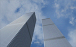
World Trade Center Twin Towers Textures - Only for Use With Tatu Kantomaa's New York City Objects.
These are Textures Only!
You must either have Tatu Kantomaa's New York City Objects scenery installed or you must download and install His scenery to use my textures (full details on file location in readme).
This is my way of rebuilding the Twin Towers and now they can Live again within the World of Flight Simulation.
Special Thanks To Tatu Kantomaa for granting me permission to upload these WTC texture modifications for use with His Great scenery "New York City Objects". His excellent scenery really improves NYC in FS9 with many other buildings created at a very high level of quality. Both North and South Tower Helipads are landable. You will find the Towers Glow with the color of the sunset so Dusk flights are very special when combined with My custom WTC night lighting. Please see Read Me file for more important information.
| Filename: | World_Trade_Center_Twin_Towers_Textures_Only.zip |
| License: | Freeware |
| Added: | 10th September 2011, 18:19:53 |
| Downloads: | 2,288 |
| Author: | Todd Manbeck,Tatu Kantomaa |
| Size: | 7.86 MB |
| Category: Flight Simulator 2004 - Scenery | |
| Bella Coola CYBD in British Columbia, Canada |
|
Images related to this file:
File Description:
Bella Coola is in one of the deep east-west fjords amid the Coastal Range on the coast of BC, approximately mid way between Vancouver and the Alaskan border and some 70 miles inland from the open ocean. The town of Bella Coola has a small population of around 150, while the population of the whole Bella Coola Valley is around 2,000. The valley is warmer in both summer and winter than the surrounding area, and tourism flourishes along with forestry, fishing, and local government administration. Although there is road access, the ferry service is the main connection to larger coastal towns or cities such as Vancouver. The airport, 7 miles east of the town, is connected by daily Pacific Coastal flights to Vancouver and Anahim Lake (to the east). The asphalt runway is 4,200 feet long and aligned 04-22 in FS9 (by 2010 this had changed to 05-23 in reality) and is without lighting of any sort, so it is restricted to daylight hours only. At the eastern end is the terminal building and in the middle the West Coast Helicopter hangar, which has a large fenced paddock-like enclosure in front of it. The helicopters hop over the three feet high fence as they "taxi" to the apron in front of the hanger (but not in FS9!). Between the two there are four other company hangars spread out along the roadway beside the fence. I have never seen the airfield in Summer, and I have not attempted to replicate the apron as it now shows in Google Earth. The screenshots show the main and overwhelming feature of Bella Coola, the large valley amid the steep mountains. This terrain has an inevitable effect on the ai, in that you will never see a plane land as it hits solid rock before it makes it to the runway. You will, however, see them take off. Pacific Coastal currently flies Beechcraft 1900's to Bella Coola; I have used the Saab 340 which I have seen there some years ago and which I prefer.
| Filename: | Bella_Coola_CYBD_in_British_Columbia_Canada.zip |
| License: | Freeware, limited distribution |
| Added: | 25th October 2018, 17:57:06 |
| Downloads: | 286 |
| Author: | Roger Wensley |
| Size: | 14.57 MB |
| Category: Flight Simulator 2004 - Scenery | |
| Cameri and Turbigo sceneries (rev. 3) - north Italy |
|
Images related to this file:
File Description:
The following files are required by this file:
http://library.avsim.net/esearch.php?DLID=163723&UploadID=&Name=&FileName=&Author=&CatID=root
http://library.avsim.net/esearch.php?DLID=186350&UploadID=&Name=&FileName=&Author=&CatID=root
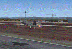
This scenery includes a global review of the previous Sceneries of Cameri Military airport (rev.2 Oct 2011), Cameri Museum (rev. 2 Oct 2011), Cameri Babini (rev. 2 oct 2011), Turbigo power station (rev. 2 Sep 2011 and update rev. 2.1 Oct 2014). All the above ARE NOW INCLUDED in this new unique scenery. Contents: Terrain in new version photo-realistic multi-seasons/night; adapted to Western Europe special elevation meshes; cover area of over 120 sqkm from Bellinzago-Oleggio (NW) to Magnago-Bienate (NE), from Novara (SW) to Cuggiono-Inveruno (SE); all the terrain has been restorated with 3D buildings, either through autogen that with specific dedicated objects (by GMax) and with significant addition of library objects ("dva51" and other existings). This scenery (located on the final approach to the Milan Malpensa international airport) includes the Cameri's Mil Airport with the Babini closed Army area and the planes of the Historical Museum of the airport; it is also included the thermoelectric power station of Turbigo. All the buildings are placed to recreate cities and villages covered in the photo-realistic terrain, including Bellinzago, Bienate, Buscate, Caltignaga, Cameri, Castano Primo, Castelletto Ticino, Cuggiono, Galliate, Inveruno, Magnago, Malvaglio, Nibbia, Novara, Oleggio, Pernate, Robecchetto, Romentino, Sant'Anna, San Pietro Mosezzo, Turbigo , Vanzaghello, and the covered Turin-Milan highway.
Details of the new buildings for the care and maintenance to F35 completely recreated, as obtainable from the current satellite view.
It REQUIRES the use of the following, to be downloaded separately :
- the libraries dva51 - the system of vegetations TreePlanter - the West Europe Meshes of Daniele Lanfranchi. See the Readme file. Enjoy!
Videos available here:
https://dl.dropboxusercontent.com/u/38829151/FS9/Cameri_Turbigo_v3%20shots.WMV
http://youtu.be/yVI2KeJKS5o
http://youtu.be/oKa0e_5kxIk
| Filename: | Cameri_and_Turbigo_sceneries_rev_3__north_Italy.zip |
| License: | Freeware |
| Added: | 21st January 2015, 21:32:36 |
| Downloads: | 995 |
| Author: | Aldo Della Vedova, Daniele Lanfranchi and Gian Mario Verga |
| Size: | 103.7 MB |
| Category: Flight Simulator 2004 - Scenery | |
| Gang Ranch CAY2 in British Columbia Canada |
|
Images related to this file:
File Description:
Gang Ranch is on the eastern side of the Coast Mountains of British Columbia, around 50 miles west of Green Lake and 5 miles west of the Fraser River that runs north-south at that latitude (51 degrees 30 minutes north, in round figures). The airfield is among some farm fields and difficult to spot (this will depend on your personal textures and settings) and the ranch buildings are scattered and a mile or two away, the nearest being the owner's house. The runway is gravel, only 1,800 feet long and aligned 08-26 at 2,150 feet above sea level. There is no lighting. I have posted it as Gang Ranch CAY2, but I suggest that you just add it to your previously created "BC airfields" (if you did that) and avoid the inevitable doubling up of common textures etc. Plus that way you will have just one FS9 library post to do and new airfields will not need yet another posting. Up to you. If you find a defect, email me.
| Filename: | Gang_Ranch_CAY2_in_British_Columbia_Canada.zip |
| License: | Freeware, limited distribution |
| Added: | 19th November 2020, 19:44:55 |
| Downloads: | 101 |
| Author: | Roger Wensley |
| Size: | 8.98 MB |
| Category: Flight Simulator 2004 - Scenery | |
| Anaktuvuk Pass PAKP in Alaska |
|
Images related to this file:
File Description:
Anaktuvuk Pass is a village located 85 miles north of Bettles and just north of the Brooks Range, in a valley that is a route between north and south. The inhabitants are mainly Numamiut, a section of the Inupiat that existed in history (and until today) away from the coastal food supply of fish etc. The current population is around 350. The airport has one gravel runway, aligned 1-19 with PAPI at both ends, and 5,500 feet long as there is no connection to the outside world other than the runway for all necessities that are not available on the tundra. There are two aprons, with light planes and passengers at the northern end of the runway and the Everts cargo flights unloading at the mid runway apron. A note here about my scenery making. There will not be many more to follow this as I am almost at the end of the photos I either took or found for scenery purposes, plus I expect to move on from FS9 at some point during next year.
| Filename: | Anaktuvuk_Pass_PAKP_in_Alaska.zip |
| License: | Freeware, limited distribution |
| Added: | 25th November 2019, 17:51:38 |
| Downloads: | 242 |
| Author: | Roger Wensley |
| Size: | 8.59 MB |
| Category: Prepar3D V5 - AI Aircraft | |
| Antonov An-8 for retro AI Traffic |
|
Images related to this file:
File Description:

Antonov An-8 for retro AI Traffic. The An-8 was a two-engine turboprop transport, used from the 1960s-early 2000s, and was the predecessor of the An-10/12 four-engine transports. This MCX conversion of the FS9 SBAI An-8 model is only compatible with P3Dv4.5-P3Dv5.2. The aircraft models have PBR texturing with dynamic light effects, lua-scripted night lighting, and hard-coded lights and smoke effects.
This package includes nine models and 52 repaints focusing on the aircraft during its service life, including many civilian operators. 22 of the paints are mine, and the other 30 are from other authorized sources, listed in the documentation. Models are described in the documentation. Permissions for conversion were kindly given by Sergey Bunevich on behalf of SBAI for the model, and Christian Gold of the Retro AI Traffic Group for most of the repaints. Instructions and extensive credits are in the documentation included in the package. Original aircraft by SBAI, MCX and RADiator utilities by Arno Gerretsen, MCX conversion and select repaints by Michael Pearson.
| Filename: | Antonov_An8_for_retro_AI_Traffic.zip |
| License: | Freeware |
| Added: | 25th July 2021, 04:07:35 |
| Downloads: | 183 |
| Author: | Michael Pearson |
| Size: | 10.58 MB |
| Category: Flight Simulator 2004 - Scenery | |
| Cape Dorset CYTE, Baffin Island, Nunavut, Canada |
|
Images related to this file:
File Description:
Cape Dorset is a village of 1,300 or so inhabitants at N 64 13 W 76 31 on Dorset Island, off the southwest corner of Baffin Island. It's Inuit name is Kinngait, which means "High Mountains"; watch out if you fly there in low clouds. The village (again) does not feature in FS9 but is included in this scenery with approximately the right shape, or shapes as there are separate parts. The airfield runway is just under 4,000 feet of gravel 100 feet wide at 158 feet above sea level. There is a double gradient to it, but unfortunately this cannot be replicated in FS.
Cape Dorset had a Hudson Bay Company store as long ago as 1913, and is now known as a centre for Inuit art. I added the roads, a new airfield background, a pond between apron and runway, plus of course there is the scenery file and the AFCAD and AI, which has two planes visiting, a First Air HS748 and a Canadian North Dash 8-100, as per real life.
| Filename: | Cape_Dorset_CYTE_Baffin_Island_Nunavut_Canada.zip |
| License: | Freeware, limited distribution |
| Added: | 9th December 2010, 18:45:06 |
| Downloads: | 1,015 |
| Author: | Roger Wensley |
| Size: | 2.75 MB |
| Category: Flight Simulator 2004 - Scenery | |
| Sanikiluaq CYSK in Hudson Bay, Nunavut, Canada |
|
Images related to this file:
File Description:
Sanikiluaq is a village 740 or so inhabitants at N56 30, W79, which means in the southern part of Hudson Bay, close to James Bay. The village is at the north end of Flaherty Island, which is the largest of the Belcher Islands. You might fly there from La Grande Riviere in Quebec (200 miles SSE) or maybe from Moosonee in Ontario at the bottom of James Bay (350 miles SSW). Sanikiluaq village does not feature in FS9, so the first thing to do was to add it; it is the right shape and with around the right number of houses on the right streets but as I wasn't going to model 100+ individual houses just think of it as a hand-made auto-generated village. I also had to move the airfield over beside the river, so there is a DELETE file and a GRASS file and a ROADS file, as well as an AFCAD for AI and a scenery file. And AI for a visiting Air Inuit plane.
| Filename: | Sanikiluaq_CYSK_in_Hudson_Bay_Nunavut_Canada.zip |
| License: | Freeware, limited distribution |
| Added: | 11th October 2010, 23:15:41 |
| Downloads: | 516 |
| Author: | Roger Wensley |
| Size: | 2.21 MB |
| Category: Flight Simulator 2004 - Aircraft Repaints, Textures and Modifications | |
| AS 350 "Miami Dade Police" |
|
Images related to this file:
File Description:
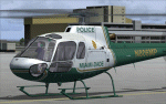
This is a repaint of the Nemeth Designs (ND) freeware AS 350 in the real world livery of the "Miami-Dade Police" AS350 for FS9 (FS2004) only. I believe this is the only repaint of the Miami Dade helicopter for public use as I was unable to locate any others, but that doesn't mean they may not exist somewhere. With that, I was unable to find too many decent photos of the chopper either so there has been a little guess work with this paint, primarily the under carriage. This is a complete aircraft, so no other files are required to fly her. All repainted textures have been saved in 32 bit format for enhanced detail. Installation, Distribution and Contact details can be located ion the TC Read Me file that is included with this download. Thanks to all of you who have supported my efforts, it is appreciated. In the event that someone from the Miami Dade Police Aviation Unit sees this - it would be appreciated if they could let me know of its accuracy - cheers :)
| Filename: | AS_350_Miami_Dade_Police.zip |
| License: | Freeware, limited distribution |
| Added: | 27th February 2012, 03:08:14 |
| Downloads: | 281 |
| Author: | Tony Cannon and Nemeth Designs |
| Size: | 18.21 MB |
| Category: Flight Simulator 2004 - AFCAD Files | |
| EGNM AFCAD v2.5 |
|
Images related to this file:
File Description: Can be used with the following on AVSIM:

Peter Slater's FS9 AFCAD for EGNM (2009 v2.5). This is the AFCAD (updated and tweaked) for:
Default Scenery Users (Default FS2004 Scenery)
EGNM Extreme Freeware Scenery Package v1.0 (Package by Peter Slater - found here on AVSIM)
UK2000 Part 7 (which includes EGNM) by Gary Summons
British Airports Vol.6 (which includes EGNM) by Justflight
BA and UK2000 AFCAD updated only but the v1 for the others are included. Please make sure you read the readme.txt before installing. You have the choice to configure which runway is used if not both (i.e. 14, 32 or both). By Peter Slater, uploaded by Gareth Abbott. Those who downloaded v2 please re-download this version. Visit his web site for his other projects at www.fsprojects.co.nr or search 'peter slater' here on AVSIM.
| Filename: | EGNM_AFCAD_v25.zip |
| License: | Freeware |
| Added: | 12th January 2012, 19:39:10 |
| Downloads: | 905 |
| Author: | Peter Slater, Gareth Abbott |
| Size: | 1.34 MB |


© 2001-2026 AVSIM Online
All Rights Reserved
Privacy Policy |