
Where Flight Simulation Enthusiasts Gather from Around the World!
AVSIM Library - Search Results

| Category: Flight Simulator 2004 - Scenery | |
| PABR - Barrow - Alaska, USA |

|
Images related to this file:
File Description:
The town of Barrow is in the far north of Alaska, and is best known in flying circles as the place where Wiley Post crashed his floatplane on takeoff and killed himself and Will Rogers. The crash was some 15 miles south of Barrow and was "assisted" by the mismatched fuselage, wings, and floats that had been assembled to create the floatplane. The Barrow population is largely Inupiat and totals some 4,400. The downtown area of Barrow is immediately north of the airport. The second and largest part of Barrow is further north past a string of lagoons and is locally called Browerville. To the northeast along the coast is the smallest part around what used to be the Naval Arctic Research Lab, and is now a college. To the east of this are the DEW buildings, plus two large navy hangars and the gravel runway that was used to serve the DEW station. The PABR runway is aligned 06-24 in FS9 and is 7,100 feet long and 150 feet wide, built on top of a gravel base and surround that copes with the underlying permafrost. There is PAPI at both ends and an ILS and approach lights on 06; 06 circuits are to the right. The airport notes include a warning that the apron is not a standard width and that large planes that are enroute to the far end of the runway will not be able to taxi past a plane parked at the gate and should use the runway as a taxiway, then turn and takeoff. FS9 AI cannot cope with that, so the apron here is wider. There are, in real life and the AI, daily flights by Air Alaska (three at least) and Era (several, and which is now called Ravn, hence the new hangar door motif) and air cargo flights by Northern Air Cargo and Everts, plus GA. The buildings have been made with photographic textures or textures made from reference photos. I decided that while 500+ scenery objects was probably ok for most people the required 900+ to "make" the town of Barrow would likely not be. The auto-generated FS9 town objects could not be left as Barrow with trees would not look at all like reality; I have "faded" the density of the town buildings into the distance from the airport.
| Filename: | PABR__Barrow__Alaska_USA.zip |
| License: | Freeware, limited distribution |
| Added: | 17th May 2016, 09:32:36 |
| Downloads: | 976 |
| Author: | Roger Wensley |
| Size: | 15.12 MB |
| Category: Flight Simulator 2004 - Scenery | |
| Nome PAOM on the northwestern coast of Alaska |
|
Images related to this file:
File Description:
There are four main northwestern Alaska towns which have good airports and are serviced by Alaska Airlines. From these airports local flights connect to nearby villages, "nearby" in Alaska meaning up to 200 miles away. The northernmost is Barrow. Southwest of Barrow is Kotzebue, then Nome, and the furthest south is Bethel. The town of Nome is south of the Bering Strait on the southern coast of the Seward Peninsula, around 185 miles south of Kotzebue, with a population of about 3,800. It is the town that led to the creation of the most famous dogsledge race in the world, the Iditarod, which is based on the delivery to Nome of diphtheria serum during the blizzard conditions of the winter of 1925. The Nome airport (it currently has no other name) was originally built as the last of the refuelling airfields for planes being ferried to Russia during WW2. It has two runways, aligned 09-27 and 02-20 in FS9 (the wandering magnetic north has recently renamed the magnetic headings) and both of them around 6,000 feet with an ILS on 27. There is a modern airport layout diagram included showing taxiway names etc. Alaska Airlines, ERA, and Bering Air (which is headquartered in Nome), along with the shared cargo terminal for Northern Air Cargo and Everts Air, are all on the southern apron. The northern apron is mainly for GA, along with maintenance facilities, a garage building that also houses a weather bureau, and at the far northern end of runway 02-20 an apron and hanger for the Alaska Air National Guard. All AI aircraft in FS9 much prefer to use a runway that has an ILS and so will continue to use 09-27 even if the wind is from the north or south, right up until it reaches 30+ knots, so for AI realism in FS9 a permanent wind from the west would be the most realistic on a daily basis. There is also a small gravel strip just north of the town and this is included (94Z), as are some old line-of-sight radio communication reflectors on the hills above the town. There is a note about making adjustments to Ultimate Terrain Alaska-Canada regarding both realistic road lighting and also auto-generation.
| Filename: | Nome_PAOM_on_the_northwestern_coast_of_Alaska.zip |
| License: | Freeware, limited distribution |
| Added: | 18th October 2016, 02:38:42 |
| Downloads: | 488 |
| Author: | Roger Wensley |
| Size: | 22.65 MB |
| Category: Flight Simulator 2004 - Scenery | |
| Dawson Creek CYDQ in British Columbia, Canada UPDATED |
|
Images related to this file:
File Description:
This is a revised version of Dawson Creek CYDQ and the floats base CBD3, made primarily to provide one of the parked planes with it's textures but also to improve the apron markings and the AI. The float AI now includes Beavers and I also removed two planes that were not properly showing their textures in my current FS9 installation. The Beavers were included in my post of Nimpo Lake CAF8 and will need to be installed to show up here. This version is complete in itself and can be installed as-is if you do not have the original scenery. Dawson Creek is at 2,148 feet asl just east of the Rocky Mountains, less than 10 miles west of the BC/Alberta border and where the Rockies are at their narrowest. The population grew when the Northern Alberta Railway was extended to Dawsons Creek in 1932, and grew even more more when the Alaska Highway was built in 1942, starting from Dawsons Creek. In the 1950's the town was linked through the Rockies by a railway and a road to the BC interior, and the town grew again. Now it is static at just under 12,000 and once again has become a farming centre, with Fort St John and Grand Prairie winning out for new industry and commerce. The airport is just to the east of the town. The runway is 5,000 feet of wide asphalt (150 feet) aligned 06/24, lit, and with PAPI and approach lights. There is also a water runway for float planes, separately designated as Dawson Creek CBD3. The two effectively operate as one; traffic for both use the mandatory frequency of 122.2 and talk to one controller in one control tower. However, in FS9 the ATC for two separately designated airfields (or float fields) operates as if they are nowhere near each other and takes no notice of near misses between the two lots of planes. As a result I have put them both in un-manned tower mode so you will announce your position and intentions and select your own parking spots, either next to one of the hangars or on the grass. The aprons vary from asphalt, to concrete, onwards to gravel, and then further onwards to some gravel amid the bare dirt; I have replicated this variation as far as FS9 permits.
| Filename: | Dawson_Creek_CYDQ_in_British_Columbia_Canada_UPDAT.zip |
| License: | Freeware, limited distribution |
| Added: | 17th December 2018, 17:50:08 |
| Downloads: | 208 |
| Author: | Roger Wensley |
| Size: | 26.71 MB |
| Category: Flight Simulator 2004 - Scenery | |
| Dixie A05 Forest Service airfield in Idaho USA |
|
Images related to this file:
File Description:
This airfield is in the mountains of Idaho, the first in a series. There are not many mountain airfields that can be succesfully modelled in FS9 because the FS9 terrain does not always match reality; no creek for instance, or the valley too small. There are others where the grass strip is all there is, so there is nothing to model apart from resizing the cleared area. Some are well known, well maintained, have clean shower facilities, and are well used for a weekend by small planes with two people and a tent on board, for instance Johnson Creek. Others are less well known but still in good condition, such as Dixie or Big Creek. And there are also some with cabin rental facilities, such as Sulphur Creek Ranch. Other names come to mind, such as Flying B and Pistol Creek, but unfortunately for one reason or another these could not be made. The other difficulty involving hills is succesful AI landings and take offs. At Johnson Creek, for instance, the wind should be from the south to make AI landings more likely to succeed. Dixie is south of the village of the same name, and not to be confused with the dirt strip that is just beside the village. The runway is at 5,148 feet ASL, just over 4,000 feet long and aligned 18-36, and the parking area is at the northern end, opposite the Forest Service buildings. There is a chart of the area included, and to the south of Dixie is the next in the series, Big Creek U60.
| Filename: | Dixie_A05_Forest_Service_airfield_in_Idaho_USA.zip |
| License: | Freeware, limited distribution |
| Added: | 25th May 2017, 17:53:48 |
| Downloads: | 154 |
| Author: | Roger Wensley |
| Size: | 8.69 MB |
| Category: Flight Simulator X - Scenery | |
| KAFW Fort Worth Alliance Airport - Texas, US |
|
Images related to this file:
File Description:
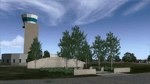
Ft. Worth Alliance Airport opened in 1989 and was billed as the world's first purely industrial airport. It is located around 14 miles North of the central business district of Ft. Worth and is also nearby the Dallas/Ft. Worth International Airport (KDFW). The airport serves general aviation, corporate jet, cargo, and military air traffic on a daily basis and it's proximity to the Texas Motor Speedway (only a few miles) brings extra dense traffic on race weekends. The airport is home to the American Airlines 777 and 767 maintenance base, FedEx Southwest Regional Sort Hub, Bell-Helicopter Training Center, DEA Air Operations Center and DynCorp International. Sadly the American Airlines maintenance base is set to close at the end of 2012 but is being kept alive in FSX!
This scenery features custom 3d buildings and objects bringing you a very accurate rendition of Ft. Worth Alliance Airport. Requires FSX Acceleration for the all scenery objects to display correctly.
Note: These files MUST be installed for the scenery to work correctly (otherwise there will be missing scenery objects at the airport):
-Filename: fsx_lts.zip - Ramp Lighting for FSX by Jim Dhaenens
-Filename: dlfcorelibraries2fsx.zip - Dan French Core Library Vol. 2
-Filename: lightstoo.zip - Jim Dhaenens Airfield Lighting
-Filename: objlib-jgse-fsx.zip - John Stinstrom JGSE Yellow Objects - this newer file replaces the older FS9 libraries with FSX versions
-Filename: objlib-ggse-fsx.zip - John Stinstrom GGSE Green Objects - this file also replaces FS9 libraries with FSX versions
| Filename: | KAFW_Fort_Worth_Alliance_Airport__Texas_US.zip |
| License: | Freeware, limited distribution |
| Added: | 12th December 2012, 16:56:36 |
| Downloads: | 2,937 |
| Author: | Brandon Thetford |
| Size: | 439.24 MB |
| Category: Flight Simulator X - Aircraft Repaints, Textures and Modifications | |
| Overland Airbus A320 Texture Pack |
|
Images related to this file:
File Description:
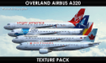
FS9/FSX Simmer`S Sky Overland Airbus A320 Texture Pack. Repaint by Sergey Gleba aka serg09. Link to my products on SimMarket: http://secure.simmarket.com/paintsim.mhtml
This archive contains the following 25 textures:
- Aegean Airlines SX-DGR
- Air Canada C-FXCD
- Avianca N538AV
- Avianca N451AV
- Delta N331NW
- Iberia EC-IZR
- Qatar Airways A7-AHQ
- South African Airways ZS-SZZ
- Virgin America N625VA
- Vueling Airlines EC-LQN
- Asiana Airlines HL7737
- Philippines Airlines RP-C8620
- SATA International CS-TKJ
- Cathay Dragon B-HSO
- China Southern Airlines B-6283
- Condor D-AICC
- Dragonair B-HSO
- Etihad Airways A6-EIN
- LATAM Airlines PR-MHX
- Saudi Arabian HZ-ASC
- Scandinavian Airlines OY-KAY
- Sichuan Airlines B-6771
- Thomas Cook OO-TCW
- Tunisair TS-IMP
- Yamal Airlines VP-BCU
| Filename: | Overland_Airbus_A320_Texture_Pack.zip |
| License: | Freeware |
| Added: | 19th January 2018, 01:35:54 |
| Downloads: | 763 |
| Author: | Sergey Gleba aka serg09 |
| Size: | 148.73 MB |
| Category: Flight Simulator 2004 - Scenery | |
| Warrenton, VA - KHWY - Patch fixed |
|
File Description:
The scenery for KHWY is perfectly fine but that included W66 file was screwed it up to my bad. I totally forgot about this uploaded was already too late. I wasn't thinking in my head. My goofed. Sorry for your inconvenience that someone told me figured it out without W66 runs fine no crashed desktop FS9. If you run KHWY with W66 old file was crashed. Sorry about that. I am enclosed patch new W66. It will be not crash again. I wasn't supposed to touch the ARP point out of the field. It is caused by crashed. I don't understand what is system S9 for. LOL! I leave it alone ARP point and complied with ADE. It works fine!
| Filename: | Warrenton_VA__KHWY__Patch_fixed.zip |
| License: | Freeware |
| Added: | 21st June 2020, 21:23:18 |
| Downloads: | 75 |
| Author: | Stuart John Gilbert II |
| Size: | 4.52 KB |
| Category: Flight Simulator X - Original Aircraft | |
| Fairchild Metro 23 for FSX |
|
Images related to this file:
File Description:
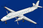
This presentation of the venerable Mike Stone aircraft is intended as a complimentary FSX update to the Blue Crown Airways package found online. Texture files have all been made uniform (DXT3), with some of them having been processed through the Blue Crown paint kit, for added detail. Some liveries also had flaws corrected. Many of these files were given more realistic engine textures, as well. Prop textures are .dds, so FS9 users looking to use these texture files will need to grab a .bmp texture from another texture file, in order for the prop to display correctly, when moving. A custom panel and soundset are also here. The only thing missing is a VC, due to limitations of the model.
| Filename: | Fairchild_Metro_23_for_FSX.zip |
| License: | Freeware |
| Added: | 14th December 2021, 20:00:28 |
| Downloads: | 249 |
| Author: | Mike Stone, Henry Douglas |
| Size: | 61.18 MB |
| Category: Flight Simulator 2004 - Scenery | |
| Norfolk Trees pt2 |
|
File Description:
This pack will place trees into the scenery for Norfolk UK for FS9. It is designed to be compliant with VFR Photographic Scenery, VFR Terrain part 1 and the UK2000 scenery. The scenery has been created using GianP's agen_x trees and Tree Planter by George Davison.
Part Two covers the area in an arc approximately 10 miles to the west and south of Norwich and is contiguous with part one.
If you have parts one and two installed you will now have tree cover for over 240 square miles of Norfolk comprising of more than 250,000 trees, the large majority of which have been �¢����hand planted�¢����
| Filename: | Norfolk_Trees_pt2.zip |
| License: | Freeware |
| Added: | 5th May 2010, 22:09:32 |
| Downloads: | 351 |
| Author: | Norman Dean |
| Size: | 1.15 MB |
| Category: Flight Simulator 2004 - Aircraft Repaints, Textures and Modifications | |
| Italian Air Force, Curtiss SB2C 'Helldiver' |
|
Images related to this file:
File Description:
The Curtiss SB2C replaced the Douglas SBD in Nov of 1943, Not well received by most Naval Dive Bomber pilots who didn't think it was a fitting replacement for the sturdy reliable and well liked SBD. Called the "Son of a Bitch 2nd Class ", "The Beast" and the "Big Assed Bird".
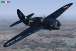
Textures only for two SB2C 'Helldivers' of the 86th Gruppo Antisom (Antisubmarine Warfare) of the Aeronautica Militare Italiana (Italian Air Force), Grottaglie Airport (TA), Italy, 1954/55 and one of the Italian Navy (M.M.I. Marina Militare Italiana) during the crews initial training at NAAS Cabaniss Field,Corpus Christi TX, 1951. These textures require the original freeware CFS2/FS2000/2K2/FS9 SB2C (1US_SB2C-4.zip) downloadable at http://www.avhistory.org/. Repaint by Manuele Villa.
| Filename: | Italian_Air_Force_Curtiss_SB2C_Helldiver.zip |
| License: | Freeware |
| Added: | 26th May 2010, 10:27:36 |
| Downloads: | 481 |
| Author: | Manuele Villa |
| Size: | 2.06 MB |


© 2001-2026 AVSIM Online
All Rights Reserved
Privacy Policy |