
Where Flight Simulation Enthusiasts Gather from Around the World!
AVSIM Library - Search Results

| Category: Flight Simulator X - Scenery | |
| NY3C - Taylor Field - Hammondsport, New York (Fictional ICAO) |

|
Images related to this file:
File Description:
The airport named Taylor Field (on 1970's sectional charts) is a small 1800' strip not shown in the stock FSX list of airports. There is no ICAO code or other designator I could find with extensive research. I used my own code of NY3C.
This is a part reality part historic scenery as it represents the modern day airport, the Glenn Curtiss Museum, and adjacent to the Airport a facsimile of the original horse racetrack that was used by Glenn Curtiss to fly his June Bug on July 4th 1908. It is a close As I can determine to the original spot using archival photos and conversations with the Director of the Curtiss Museum, Traff Doherty. Extensive use of new land class is also employed to give a better representation of the geographic area.
This will work with FSX stock scenery, but is designed with UTX (Flight One Software) in mind. It will work with ORBX Global and Global Vector as well. With these latter two there may be some missing roads but it won't affect the scenery.
| Filename: | NY3C__Taylor_Field__Hammondsport_New_York_Fictiona.zip |
| License: | Freeware |
| Added: | 24th July 2014, 07:46:29 |
| Downloads: | 343 |
| Author: | Jon Davidson |
| Size: | 9.79 MB |
| Category: Flight Simulator X - Aircraft Repaints, Textures and Modifications | |
| Lufthansa "Precious Cargo" Embraer EMB-505 Phenom 300 (D-ILHF) |
|
Images related to this file:
File Description:
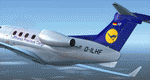
I don't think Lufthansa Cargo actually flies a Phenom 300 with the "Precious Cargo" repaint but, if they did, I bet it would be similar to this one. This is intended for those special flights that are more than urgent, and the cargo is more special than normal, hence the "Precious Cargo". D-ILHF would be used for those downtown or city center airports that the Gulfstreams or Falcons can't get into and out of. I made this repaint with the modern cargo haulers in mind, not necessarily the 'cargo dogs' with the mid-night and red eye runs and using aircraft with questionable maintenance and those that never seem to get washed and waxed. Not this one, it is kept in the hangar when not in use and is always in pristine condition. It come with a small red square of carpet for those times that the "Precious Cargo" can walk to the cabin door. Use only with the payware version of the Carenado EMB-505 Phenom 300 for FSX, P3D, and FSX:Steam. Hope you enjoy the repaint.
| Filename: | Lufthansa_Precious_Cargo_Embraer_EMB505_Phenom_300.zip |
| License: | Freeware |
| Added: | 12th November 2015, 16:18:50 |
| Downloads: | 688 |
| Author: | Ray Marshall |
| Size: | 26.56 MB |
| Category: Flight Simulator 2004 - Scenery | |
| FHSH - St. Helena Island & Airport - St. Helena, South Atlantic |
|
Images related to this file:
File Description:
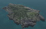
This project is a port of my FSX release of the the new airport (FHSH) on St. Helena Island. This scenery provides more accurate coastlines and roads, as well as corrected landclass based on the latest available satellite imagery. Flight plans are provided for the proposed commercial service to St. Helena, and some additional GA and military flights to the island are added as well.
The FS2004 St. Helena (FHSH) airport was created by aligning master plans for the airport with current satellite data and by studying many of the pictures that have been posted as the airport has taken shape. The official opening of the real airport on May 21, 2016, has been pushed back for more field tests due to challenging crosswinds. Updates were created or rebuilt in a manner which carefully aligns airport data with current satellite imagery. Scenery was created using Airport Design Editor 9 v1.67.5684 and SBuilder. Scenery objects were added and modified from stock FS9 scenery to resemble as closely as possible the actual airports.
| Filename: | FHSH__St_Helena_Island__Airport__St_Helena_South_A.zip |
| License: | Freeware |
| Added: | 5th May 2016, 07:44:38 |
| Downloads: | 2,237 |
| Author: | Carlyle Sharpe |
| Size: | 1.62 MB |
| Category: Prepar3D V1-4 - Scenery | |
| LRTR Traian Vuia P3D v4 |
|
Images related to this file:
File Description:
Timisoara RO LRTR V-4 (Released October 2017) for P3D v4- This scenery is an update of the stock Airport (ICAO code: LRTR).
What to expect? The entire airport has been updated with correct RWY, taxiways, aprons, COMM's (ATIS, GND, TWR), markings, parkings, roads, some buildings, lights and vegetation. All objects are from stock ADE! Entire work and object placing has been done using a photo overlay image from Google Earth, yet don't expect a photoreal scenery. The used background image has been removed due to Google's copyright policy. Due to using stock objects from library, don't expect perfect shape and colors of objects. I tried to customize the objects so that they look like the real ones. Basic shape and colors should match the real word buildings. NOTE: Some 3rd party addon's might change ground textures or building textures. I have also generated some own ground textures to match those of the airports. Unfortunately there is a problem with those textures not casting shadows. If you still want to see the shadows, you will have to turn on "Buildings" receieve shadows.
| Filename: | LRTR_Traian_Vuia_P3D_v4.zip |
| License: | Freeware |
| Added: | 8th October 2017, 01:15:58 |
| Downloads: | 905 |
| Author: | Gerald Krutsch |
| Size: | 1.07 MB |
| Category: Prepar3D V1-4 - Aircraft Repaints, Textures and Modifications | |
| VASP 1998 AI Package |
|
File Description:
VASP was the 2nd largest airline in Brazil, but was scaling down by 1998. VASP still had a great international network stretching to ATH/KIX/ICN/LAX/YYZ/JFK/BCN/ZRH ect. A fleet of 10 MD-11s did all the long haul flying, as well as plenty of domestic flights. 3 A300s and a large 737-200/300 fleet served the domestic routes. While VARIG was based in GIG, VASP was based in GRU and the planes tend to hang out there. There was only 1 special livery, which was a named MD-11, so not much variation unlike VARIG. VASP did serve SDU and CGH with mainline equipment, however, so these plans will help populate those airports. Included are repaints by Raphael Rodrigues for the FAIB 737-200, 737-300, FSPX MD-11, and TFS A300B4. Flightplans by Chasen Richardson. Part of the 1998 Flight Simulator Project. Follow us on Facebook at facebook.com/flightsim98 and on instagram as @bayviationsim. For more Retro AI, check out the forums at: http://retroai.proboards.com/
| Filename: | VASP_1998_AI_Package.zip |
| License: | Freeware, limited distribution |
| Added: | 29th October 2019, 07:18:35 |
| Downloads: | 308 |
| Author: | Raphael Rodrigues, Chasen Richardson/Bayviation |
| Size: | 4.51 MB |
| Category: Flight Simulator X - Aircraft Repaints, Textures and Modifications | |
| FSX/P3D Alisarda DC-9-32 1982 |
|
Images related to this file:
File Description:
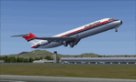
This is a repaint of the DC-9-32 in Alisarda colors. The freeware Eagle Rotorcraft Simulations' (George Arana) DC-9-30 native FSX conversion with VC, of Erick Cantu's DC-9-30, is needed for this repaint (Link provided). The textures are 32bit DDS. It was tested on FSX-SE, but should work on FSX & P3Dv3.
In 1977 Alisarda leased two DC-9 series 32s with 105 seats from Airfinco SA in Switzerland, which maintained their Swiss registration. The first aircraft delivered was HB-IKB on 13/4/1977, followed by HB-IKC on 13/10/1977. With the extra aircraft at their disposal, Alisarda started a scheduled service between Cagliari (in Sardinia) and Milan in 1978, and flights were operated from these two airports to Geneva, Zurich, Paris, and Düsseldorf. The two DC-9s, HB-IKB and HB-IKC, were eventually bought from Airfinco SA and re-registered as I-SARW and I-SARZ respectively. In turn, they were eventually replaced by two newly delivered MD-82s with 172 seats, in 1984.
| Filename: | FSXP3D_Alisarda_DC932_1982.zip |
| License: | Freeware |
| Added: | 21st January 2020, 17:48:36 |
| Downloads: | 57 |
| Author: | Ted Giana |
| Size: | 3.26 MB |
| Category: Flight Simulator 2004 - Scenery | |
| 13 Northern Ontario Airfields in Canada |
|
Images related to this file:
File Description:
These are 13 airfields in northwest Ontario, Canada. They were previously posted individually, but not on Avsim. There is a screenshot of Google Earth showing their names and locations. There are also updates to two previously posted airports, Red Lake CYRL and Sioux Lookout CYXL, and AI with the supply flights that are vital for these isolated outposts. Pickle Lake is a northern airfield that is connected to the rest of Canada by an all-weather road, and a large number of the supply flights originate from there. In fact these flights are the primary reason for the small towns existence. This will be followed by a posting of a similar number of northern Manitoba airfields. You may wonder about the numbers of fuel tanks at these airfields. These are not for the airfield use, they are for the settlement to be able to generate electricity and also to provide heating in the winter. If you find an error email me please, and note that my email address has been changed to rogwens at Gmail dot com.
| Filename: | 13_Northern_Ontario_Airfields_in_Canada.zip |
| License: | Freeware, limited distribution |
| Added: | 6th April 2021, 18:03:40 |
| Downloads: | 163 |
| Author: | Roger Wensley |
| Size: | 43.84 MB |
| Category: Prepar3D V1-4 - Scenery | |
| Piarco International Airport - TTPP V1.2 |
|
File Description:
TTPP v1.2 - In this version, problems with markings in tax lanes have been fixed. The textures of the taxi stands have also been redone. More vehicles and vegetation were included.
Piarco International Airport (IATA: POS, ICAO: TTPP) is an international airport serving the island of Trinidad and is one of two international airports in Trinidad and Tobago. The airport is located 30 km (19 mi) east of Downtown Port of Spain, located in the adjacent town of Piarco. It is the seventh busiest airport in the Caribbean in terms of passengers served[6] and third busiest in the English-speaking Caribbean, after Sangster International Airport and Lynden Pindling International Airport. The airport is also the primary hub and operating base for the country's national airline, as well as the Caribbean's largest airline, Caribbean Airlines.
Piarco International Airport has direct scheduled service to destinations in the United States, Canada, Central America, South America and Europe. It is also a significant transit hub for the Southern Caribbean and serves as the primary connection point for many passengers travelling from Guyana.
| Filename: | Piarco_International_Airport__TTPP_V12.zip |
| License: | Freeware |
| Added: | 4th February 2022, 03:49:10 |
| Downloads: | 562 |
| Author: | Eduardo Puelker |
| Size: | 53.65 MB |
| Category: Flight Simulator 2004 - Aircraft Repaints, Textures and Modifications | |
| Air China Boeing 737-66N |
|
File Description:
The 737-600 and -700 are the smaller members of Boeing's successful Next Generation 737-600/700/800/900 family. The new engines and wings allow the 737 to cruise at Mach 0.78 to Mach 0.80, while the larger wing allows greater fuel tankage and transcontinental USA range. The improved Next Generation Boeing 737 family (originally covered by the 737X designation) was launched in November 1993. The 737-700 was the first member of the new family to be developed, and is based on the 737-300, while the 737-600 is based on the 737-500. 737-600 was launched was launched on March 16 1996, first flew on January 22 1998 and entered service (with SAS) in September that year. This is an Air China Boeing 737-600 (Operator designator 6N = 737-66N). These textures are for use with Aircraft Repaints New Zealands' (ARNZ) AIS-AI model, which has groundbreaking new features for AI which include animated inbuilt scenery, which will bring your AI and airports to life!
| Filename: | Air_China_Boeing_73766N.zip |
| License: | Freeware |
| Added: | 30th March 2004, 19:16:19 |
| Downloads: | 1,067 |
| Author: | Andrew Jarvis |
| Size: | 657.65 KB |
| Category: Flight Simulator 2004 - Scenery | |
| The Greater Toronto Area Part 1 |
|
File Description:
Part 1 of Flight Ontario's scenery for the Greater Toronto Area and Southern Ontario.
Over a year in the making, this scenery for Fs 2002 and Fs 2004 is bounded by Detroit in the west, Kingston in the east, Huntsville in the north and Buffalo in the south and features:
* all-season scenery
* custom water textures
* completely modelled Toronto Airports...CYTZ (Toronto Island) and CYZD
(Downsview-home to Bombardier Aerospace and the Canadair Regional Jet
and Dash-8, and the Toronto Aerospace Museum)
* custom autogen for the GTA
* Custom landclass for southern Ontario
* custom shorelines (western Lake Ontario, Kingston area, Lake
Couchiching...Severn River...Sparrow Lake area, and the Muskoka Lake
area)
* prominent features around Hamilton include the Burlington Skyway and
Lift Bridge and steel mills
* the Welland Canal is featured with lift bridges, bascule bridge and
fixed link bridge from Pt Weller to Pt Colborne
* the Niagara area includes the Minolta Tower, and 3 hydro generating
plants with reservoirs
* compatibility with SimFlyers CYYZ
This scenery is downloadable in two parts and both parts are essential
| Filename: | The_Greater_Toronto_Area__Part_1.zip |
| License: | Freeware |
| Added: | 9th April 2004, 12:40:02 |
| Downloads: | 37,186 |
| Author: | Flight Ontario |
| Size: | 62.09 MB |


© 2001-2026 AVSIM Online
All Rights Reserved
Privacy Policy |