
Where Flight Simulation Enthusiasts Gather from Around the World!
AVSIM Library - Search Results

| Category: Flight Simulator 2004 - AFCAD Files | |
| EGAC EINN Project V3 Final Versions |

|
File Description:
This is the last and final installment for the Shannon / Belfast City Projects.
Basically these default AFCAD's have been amended to accommodate more traffic and larger traffic in some cases. More parking has been added to the airports and also runway lenghts increased.
EINN: Airport resurfaced from Asphalt to Tarmac. Two parallel runways now designated 2L and 2R and 20L and 20R. 2L is for landings only and 2R departures. 20L Departures and 20R Landings.
EGAC: More parking added and runway extended from 5800Ft to 8000ft so now the airport can handle 747 AI if required. Taxi problem with V2 of jets taxiing down runway 4 for 22 departure fixed. 3 helicopter pads also added.
You can also download the Harland and Wolf Shipyard from www.ifsd.ie as well as other Irish airport scenery, this is the best Irish scenery anywhere, so well worth a look.
Enjoy
| Filename: | EGAC_EINN_Project_V3_Final_Versions.zip |
| License: | Freeware |
| Added: | 8th March 2004, 16:08:32 |
| Downloads: | 1,261 |
| Author: | René Bruun |
| Size: | 9.71 KB |
| Category: Flight Simulator 2004 - Miscellaneous Files | |
| Active ILS - KIAH (G Bush Intercontinental/Houston Airport) |
|
File Description:
As most know initiating the ILS at certain airports for AI Traffic is not a function at this time when using AFCAD2. If you add a new ILS runway to an airport such as KIAH (G Bush Intercontinental/Houston Airport 8L/26R) only the user aircraft can use this runway when visibility falls below 3 miles. ATC will no longer use this runway for AI Traffic because FS9 sees it as a visual runway and will now vector your AI Traffic back to 8R/26L which is also a Terminal departure runway. This file adds all NAVAIDS for making 8L/26R a Precision Instrument Runway by adding all the radar fixes for both the ILS approach portion and the proper missed approach procedures, altitudes and intersections as per current published plates. All AI Aircraft will now continue to use 8L/26R when Airport conditions are less than 3 miles.
| Filename: | Active__ILS__KIAH_G_Bush_IntercontinentalHouston_Airport.zip |
| License: | Freeware, limited distribution |
| Added: | 19th June 2004, 07:15:30 |
| Downloads: | 2,031 |
| Author: | Jim Vile |
| Size: | 41.99 KB |
| Category: Civil Flight Simulators - Looking Glass Flight Unlimited 3 | |
| Duxford, Fowlmere |
|
File Description:
After a long time of sleep there was a wakeup for this package since UKS is not crashing any more.
For users without UKS there will be a Duxford version for the Sanfran region near area 52.
There are 2 airports in this package: Duxford gsu and Fowlmere gma
This package was designed for 2 independent regions UKS and SanFran
There are a lot of planes in this package, most of it is a converted AI plane to static model using
The new version of models.res refined by Ansgar Avermeyer and the Catalina model is from Capt.Bazza's AI
from 1999. He demonstrate as first the feasibility of AI model modifications :-).
Duxford UKS is at the geographic correct position very near to Fowlmere also included in this package.
A Tigermoth as moving object (not AI) is flying from Fowlmere to Duxford 06L.
Enjoy Duxford exhibition
| Filename: | Duxford_Fowlmere.zip |
| License: | Freeware, limited distribution |
| Added: | 9th November 2004, 19:11:47 |
| Downloads: | 252 |
| Author: | André Meystre |
| Size: | 1.87 MB |
| Category: Flight Simulator 2004 - AI Flight Plans | |
| Belavia Belarusian Airlines - Summer 05 |
|
File Description:
FS2002/2004 "Belavia" scheduled flightplans for the summer 2005 period, which have been compiled according to their company website informations. Belavia is a Belarusian company operating a fleet of Antonov 24RV, Tupolev Tu-134 and Tu-154 as well as Boeing 737-500 aircraft from both Minsk airports (Minsk-1 and Minsk-2). This file contains the published scheduled flights as well as their extra summer flights. From Minsk, Belavia is currently flying to Astana, Beirut, Berlin-Schönefeld, Frankfurt-Main, Hanover, Istanbul, Kaliningrad, Karaganda, Kyiv-Borispol, Larnaca, London-Gatwick, Manchester, Moscow-Domodedovo, Moscow-Sheremetyevo, Paris-CDG, Pavlodar, Roma-Fiumicino, Shannon, Simferopol, Sochi, Stockholm-Arlanda, Tbilisi, Tel Aviv-Ben Gurion, Warszawa, and Yerevan. Note that the codeshared flights to Warszawa operated by LOT are not included here, nor the flights to Vienna (operated by Austrian Arrows), Riga (Air Baltic) and Praha (Czech Airlines). Fully compatible with Traffic Tools by Lee Swordy. Enjoy.
| Filename: | Belavia_Belarusian_Airlines__Summer_05.zip |
| License: | Freeware |
| Added: | 25th April 2005, 02:56:06 |
| Downloads: | 1,776 |
| Author: | Jean-Philippe DELWICHE |
| Size: | 2.78 KB |
| Category: Flight Simulator 2002 - Utilities | |
| Weather Center 2.1 Novice Edition |
|
File Description:
Weather Center 2.1 is an advanced weather generation add-on module for Microsoft Flight Simulator 2000/2002. Weather Center 2.1 features a completely re-engineered weather generation core that produces some of the most realistic, generated weather environments ever seen in Flight Simulator! The new, unique "I-Field" algorithm translates automatically downloaded Internet data into a dynamic weather environment based not only on the data from the nearest reporting airport (like Weather Center 1), but on all nearby airports, which all provide some piece of the overall weather scene generated around the aircraft! The Novice edition includes a 15-minute demo period each time it is started, during which all the Expert features are enabled. After the demo period expires, there is no requirement to upgrade to the Expert edition; however, the Novice edition continues to function indefinitely with a simpler weather generation algorithm with most new core features disabled.
| Filename: | Weather_Center_21_Novice_Edition.zip |
| License: | Freeware |
| Added: | 6th June 2003, 19:36:17 |
| Downloads: | 1,779 |
| Author: | Keith Kile |
| Size: | 5.83 MB |
| Category: Flight Simulator 2004 - Scenery | |
| Kerkira Airport Enhancement |
|
File Description:
This is old scenery which has been updated for FS2004 and enhances the visual environment of Ionian sea island airport of Kerkira, also known as Corfu. Its part of my “Greek Airfields” package that currently is not fully compatible with FS2004 since MS decided to move the airports in Greece and elsewhere to adjacent positions and ASD, which I use for placing these objects, is not compatible with FS2004. Here you will find airport & terrain enhancements for Hellenic airport of Kerkira LGKR that make it look closer to the real one; hotels, runway turning bay, perimeter fences, windsocks, radio antennae, new approach radar antenna to the southwest and most importantly, an exclusion of autogen scenery that is wrongfully generated on each side of the runway. A big difference is attributed to Babis Peribolas’s Kerkira mesh terrain that is included in this scenery. Scenery includes the necessary ASD 2.1 textures.
| Filename: | Kerkira_Airport_Enhancement.zip |
| License: | Freeware, limited distribution |
| Added: | 4th September 2003, 02:23:06 |
| Downloads: | 12,184 |
| Author: | Kyprianos Biris |
| Size: | 1.94 MB |
| Category: Flight Simulator X - AFCAD Files | |
| Murtala Muhammed International Airport, Lagos (DNMM) Version 2 |
|
File Description:
Hi again fellow simmers....
This is an major update to my previous AFCAD on this famous West African airport.
Here are all its features:
- ILS offset fixed as well as some smaller details, like the fact that rwys 1L/1R are
permanently closed to take-off and landings.
- Corrected runway lightings/markings.
- DME on Rwy 19R now working.
- Right Hand Pattern Approach/Take-off only.
- Added correct amount of gates at the International Terminal with parking codes for airlines
that actually fly to DNMM (British Airways, Air France, KLM, Alitalia, Virgin Atlantic,
Virgin Nigeria, Sabena, Swiss, Afriqiya, Emirates, Qatar Airways, South African Airways and
more).
- Domestic Terminal fully laid out and functional with domestic airline parkinting codes
(Albarka, Chanchangi, ADC, Belleview, Kabo Air, etc).
- Cargo parking fully functional.
- Military parking (C130, MiG-21, MiG-29, Alpha Jet, Jaguar, Tornado).
To Install:
1. DELETE THE PREVIOUS 'AF2_DNMM.BGL' file from the 'Flight Simulator X/Addon
Scenery/scenery' folder.
2. Extract all files from the downloaded '.zip' file.
3. Now COPY the NEW 'AF2_DNMM.BGL' file and place it into 'Flight Simulator X/Addon
Scenery/scenery' folder.
4. Start up the Flight sim and the changes will be present.
READ THIS !!!
I've tried to the best of my ability to produce and much detail as possible but i'm sure
something has been left out (there always is).
I've used the latest Jeppesen charts and other materials at my disposal and even my own
eyesight at great risk to myself (yep, even pilots are restricted from certain places at
airports)
Also, lots of airports have changed drasticly on the past couple years like Abuja airport
(DNAA) and I would love to do justice to it as its fast becoming a major hub in the region. I
would be willing to join forces to with anyone that is good with AFCAD on this project.
Enjoy!
[email protected]
13:44 30/07/2007
| Filename: | Murtala_Muhammed_International_Airport_Lagos_DNMM_.zip |
| License: | Freeware |
| Added: | 30th July 2007, 19:44:57 |
| Downloads: | 3,286 |
| Author: | usman saleh |
| Size: | 7.38 MB |
| Category: Flight Simulator 2004 - Miscellaneous Files | |
| Active Approach - PHNL (Honolulu Intl Honolulu, Hawaii) |
|
File Description:
As most know the Approach and Final (VMC) for AI Traffic in FS9 is a straight in type landing and does not always consider high terrain at airports. This is do to the way that the coding is written in FS9 and it puts limits on IFR arriving aircraft. If you open runways at certain airports the AI Traffic will fly directly through a mountain once it is established on Final for a runway. What you will see with my file is a different type approach used for the way I control AI Traffic in FS9. No longer do the AI Planes use a straight in approach when landing to the west at PHNL. My new AI Aircraft Approach coding for FS9 now uses a base leg approach so AI Traffic does not fly through the mountains. The Honolulu Control Tower will clear all AI Traffic (IFR FP) landing either on 26L and 26R as a straight in landing even though the offset to final is 30 degrees from the runway center line. The Control Tower will instruct the AI Planes landing on either 22L or 22R to fly a left base leg which is greater then a 45 degree offset and then the AI Planes will turn on a short 1.5 mile final. The left base approach to 22L and 22R runways is a 65 degree offset from the runway center line. My testing shows excellent behavior of the FS9 default models, PAI models and the Aardvark planes of all sizes to execute this new type of visual approach that I am now writting code for which supersedes the FS9 default straight in ATC hard code approach. Read the text file for all the default scenery enhancements (plus Jetways) added to PHNL along with a full understanding of how the new Approaches work *** 3rd Party Scenery Designers Special APProach bgl and a FS2004 Default Scenery AFCAD included ***
| Filename: | Active_Approach__PHNL_Honolulu_Intl__Honolulu_Hawa.zip |
| License: | Freeware, limited distribution |
| Added: | 16th March 2005, 04:10:43 |
| Downloads: | 5,605 |
| Author: | Jim Vile |
| Size: | 134.3 KB |
| Category: Flight Simulator X - Scenery | |
| Victoria, Canada including US Southern Gulf Islands and San Juan Islands - Part 2 of 2 |
|
Images related to this file:
File Description:
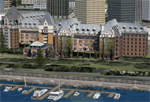
FSX-only version of Victoria, Canada area scenery including the Southern Gulf Islands and the San Juan Islands of the US. Includes automated installer and configurator by Scot Fraser.
Features:
-accurate shorelines, lakes and streams;
-landclass;
-FSX multi-LOD mesh with 10m maximum resolution;
-complete road network with moving traffic;
-railroads;
-utility corridors;
-marinas and ferry terminals;
-many static boats, including a custom model of the Canada Coast Guard ship Sir Wilfred Laurier;
-detailed models of major buildings and the Ogden Point Terminal;
-many bridges;
-nearly 300 marine lights; and corrected antennae locations.
Facilities include Don Grovestine's famous CYYJ (Victoria International Airport); 12 other Canadian land-based airports: Butler Field, Duncan (CAM3), Gaines, Hastings, Hudson Island, James Island, Thomas, Village Bay, Raven Field (CML2), Saltspring, Sidney Island, Whiskey Point; 20 US airports Blakely (38WA), Burden (61WA), Center Island (79WA), Clam Harbor (WA35), Crane Island, Decatur Shores (WN07), Decatur-Jones (WA18), Waldronaire (90WA), Orcas Island (KORS), Friday Harbour (KFHR), Lopez Island (S31), Pile Point, Roche Harbor (WA09), Shaw Island, Stuart Island Airpark (7WA5), Stuart Island West (2WA3), Wilding (6WA5), Windsock (4WA4); 12 floatplane facilities: Bedwell (CAB3), Fisherman's Bay (WA81), Friday Harbor (W33), Ganges (CAX6), Maple Bay, Mayne (CAW7), Port Washington (CAP8), Roche Harbor (W39), Rosario (W49), Shawnigan Lake (CAV8), Victoria Harbour (CYWH), Victoria International (CAP5) and Westsound, Orcas (WA83) - many with AI traffic; 9 heliports: Ganges (CAL7), Mayne (CBF5), Camel Point (CBF7), Jubilee (CBK8), Victoria General (CBW7) Madrona Bay (CBW9), Shoal Point (CBZ7), Mount Belcher (CMBH).
AI models include the DHC-2 floatplane in local liveries, a cruise ship model (by Mitsuya Hamaguchi) and two repaints, pilot boat, and small boats (by Larry Silsbee).
Ultimate Terrain X compatible (not required). Users of Vancouver+ for FSX will also get additional cruise ship traffic and additional floatplane and helicopter traffic. Full documentation. By Don Grovestine, Jon Patch and Holger Sandmann. Many other contributors: see documentation. Part 2 of 2 - you also need file vicenh7a.zip
| Filename: | Victoria_Canada_including_US_Southern_Gulf_Islands.zip |
| License: | Check within download |
| Added: | 29th January 2010, 21:21:49 |
| Downloads: | 23,175 |
| Author: | Don Grovestine, Jon Patch and Holger Sandmann |
| Size: | 59.08 MB |
| Category: Flight Simulator X - Scenery | |
| Victoria, Canada including US Southern Gulf Islands and San Juan Islands - Part 1 of 2 |
|
Images related to this file:
File Description:
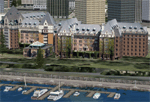
FSX-only version of Victoria, Canada area scenery including the Southern Gulf Islands and the San Juan Islands of the US. Includes automated installer and configurator by Scot Fraser.
Features:
-accurate shorelines, lakes and streams;
-landclass;
-FSX multi-LOD mesh with 10m maximum resolution;
-complete road network with moving traffic;
-railroads;
-utility corridors;
-marinas and ferry terminals;
-many static boats, including a custom model of the Canada Coast Guard ship Sir Wilfred Laurier;
-detailed models of major buildings and the Ogden Point Terminal;
-many bridges;
-nearly 300 marine lights; and corrected antennae locations.
Facilities include Don Grovestine's famous CYYJ (Victoria International Airport); 12 other Canadian land-based airports: Butler Field, Duncan (CAM3), Gaines, Hastings, Hudson Island, James Island, Thomas, Village Bay, Raven Field (CML2), Saltspring, Sidney Island, Whiskey Point; 20 US airports Blakely (38WA), Burden (61WA), Center Island (79WA), Clam Harbor (WA35), Crane Island, Decatur Shores (WN07), Decatur-Jones (WA18), Waldronaire (90WA), Orcas Island (KORS), Friday Harbour (KFHR), Lopez Island (S31), Pile Point, Roche Harbor (WA09), Shaw Island, Stuart Island Airpark (7WA5), Stuart Island West (2WA3), Wilding (6WA5), Windsock (4WA4); 12 floatplane facilities: Bedwell (CAB3), Fisherman's Bay (WA81), Friday Harbor (W33), Ganges (CAX6), Maple Bay, Mayne (CAW7), Port Washington (CAP8), Roche Harbor (W39), Rosario (W49), Shawnigan Lake (CAV8), Victoria Harbour (CYWH), Victoria International (CAP5) and Westsound, Orcas (WA83) - many with AI traffic; 9 heliports: Ganges (CAL7), Mayne (CBF5), Camel Point (CBF7), Jubilee (CBK8), Victoria General (CBW7) Madrona Bay (CBW9), Shoal Point (CBZ7), Mount Belcher (CMBH).
AI models include the DHC-2 floatplane in local liveries, a cruise ship model (by Mitsuya Hamaguchi) and two repaints, pilot boat, and small boats (by Larry Silsbee).
Ultimate Terrain X compatible (not required). Users of Vancouver+ for FSX will also get additional cruise ship traffic and additional floatplane and helicopter traffic. Full documentation. By Don Grovestine, Jon Patch and Holger Sandmann. Many other contributors: see documentation. Part 1 of 2 - you also need file vicenh7b.zip
| Filename: | Victoria_Canada_including_US_Southern_Gulf_Islands.zip |
| License: | Check within download |
| Added: | 29th January 2010, 21:23:17 |
| Downloads: | 23,167 |
| Author: | Don Grovestine, Jon Patch and Holger Sandmann |
| Size: | 56.8 MB |


© 2001-2026 AVSIM Online
All Rights Reserved
Privacy Policy |