
Where Flight Simulation Enthusiasts Gather from Around the World!
AVSIM Library - Search Results

| Category: Flight Simulator X - AFCAD Files | |
| Palm Beach Intl (KPBI) Florida |

|
Images related to this file:
File Description:
This airport was designed with the latest version of ADE (Airport Design Editor) and made only for the FSX default airport: one version with the Crosswind runway activated and in full operation where all 3 runways will be used for takeoff/landing, and one version as the default runway operation: runways now corrected to 14/32, 10L/28R and 10R/28L and all approach data corrected for them, taxiways and taxi signs updated to the latest charts, assigned parking with extra parking, the gap in the main terminal at concourse A and B now has a building there, new control tower, extra fuel trucks, support vehicle roads rebuilt and many other improvements, airport views are from inside the new control tower (when in tower view) please view the readme before installation
| Filename: | Palm_Beach_Intl_KPBI_Florida.zip |
| License: | Freeware |
| Added: | 2nd June 2012, 08:11:25 |
| Downloads: | 3,448 |
| Author: | Ray Smith |
| Size: | 655.02 KB |
| Category: Flight Simulator 2004 - Original Aircraft | |
| RAF United Kingdom 3.Sqn Eurofighter Typhoon |
|
Images related to this file:
File Description: The design of Eurofighter Typhoon is optimized for air dominance performance with high instantaneous and sustained turn rates, and specific excess power. Special emphasis has been placed on low wing loading, high thrust to weight ratio, excellent all round vision and carefree handling.
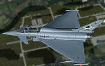
The Eurofighter is a single-seat, twin-engine, agile combat aircraft which will be used in the air-to-air, air-to-ground and tactical reconnaissance roles. Developed by Europe's leading aerospace companies, Eurofighter Typhoon is now in service with the Air Forces of Germany, Spain, Italy and the United Kingdom and will fulfil Air Force requirements well into the 21st Century. Aircraft production is ongoing and with 638 aircraft under contract to the four Partner Nations and Austria, as the first export customer.
| Filename: | RAF_United_Kingdom_3Sqn_Eurofighter_Typhoon.zip |
| License: | Commercial demo |
| Added: | 15th January 2012, 08:10:07 |
| Downloads: | 644 |
| Author: | Andreas Meyer |
| Size: | 9.35 MB |
| Category: Flight Simulator 2004 - AI Aircraft | |
| Mikoyan-Gurevich MiG-23 Flogger (Part 3) |
|
Images related to this file:
File Description:

Mikoyan-Gurevich MiG-23 Flogger (Part 3). I present a comprehensive AI traffic model and texture package for this classic (and still-serving) Russian multi-role fighter. The MiG-23, with just over 5,000 built, was Russia's first production of a true multi-role aircraft with a beyond-visual-range air superiority role as its primary function. The aircraft was arguably the direct counterpart of the F-4 Phantom, although it carried about half of the ordnance load. Nevertheless, in capable hands and late versions, the Flogger has been and is a very potent adversary; having served in multiple conflicts in Europe, Asia, Africa, and the Middle East. The MiG-23 entered service in 1970, was eventually operated by 43 countries, and is still in service in 14 of them. An original 8-LOD model brings this aircraft to the flightsim world. This package contains the MiG-23ML and MiG-23P; with 10 models and 91 repaints. Included in that count is a small service pack for parts 1 and 2 of this project which fixes one texture glitch and adds three more operator countries, instructions are included in the documentation. Original aircraft model, afterburner effects, flight dynamics, and textures by Michael Pearson. Please read included documentation for credits and disclaimers.
| Filename: | MikoyanGurevich_MiG23_Flogger_Part_3.zip |
| License: | Freeware |
| Added: | 31st March 2014, 15:44:18 |
| Downloads: | 528 |
| Author: | Michael Pearson |
| Size: | 27.27 MB |
| Category: Flight Simulator X - Original Aircraft | |
| ARX-5X Coyote, Version 2.1 |
|
Images related to this file:
File Description:

The ARX-5X (Concept 5) is a single-seat unlimited category aerobatic aircraft built around the 495c.i. 600hp Trace-Orenda OE600 V-8 aircraft engine and designed specifically for freestyle airshow type aerobatics.
Version 2 has a totally new airfile and flight dynamics - the plane can easily handle compulsory competition maneuvers as well as more advanced gyroscopic maneuvers such as lomcovaks and tumbles.
The ARX-5X cruises around 200kts, with a never-exceed speed of 240kts. This FSX native model contains animations, reflections, environment mapping, spec mapping and a full dynamic virutal cockpit. Although it is not a real aircraft it does have several real-world components such as the Chelton Fligh Systems EAU (engine airdata unit) display, and a Hartzell "scimitar" swept blade propeller.
This release is not a quick & dirty update simply "ported" into FSX, it is a full FSX rebuild by the original authors, compiled with XtoMDL and conforming the FSX SDK using dds textures and new modeling techniques for the best overall end-user performance. Includes 2 configs, 7 models, and 20 schemes with a custom smoke system and night time pyrotechnic effects. Aircraft, effects, and panel by Jason L. Terry and Mike VIvaldi. Aditional Skins by Brady Duros and Joshua B. Nyhus.
| Filename: | ARX5X_Coyote_Version_21.zip |
| License: | Freeware |
| Added: | 21st September 2012, 12:42:46 |
| Downloads: | 1,206 |
| Author: | Jason L. Terry, Mike Vivaldi, Josh Nyhus, Brady Duros |
| Size: | 41.04 MB |
| Category: Flight Simulator 2004 - Scenery | |
| Alaska South Slope 5; Ambler PAFM |
|
Images related to this file:
File Description:
There are four main northwestern Alaska towns which are serviced by Alaska Airlines, and from which local flights spread out. The northernmost is Barrow. Southwest of Barrow is Kotzebue, then Nome, and the furthest south is Bethel (not yet made). This is a continuation of the series for the flights from Kotzebue, 130 miles to the east to Ambler on the bank of the Kobuk River. The next additions will be a few miles further east, Shungnak and Kobuk, and a small strip just to the north of Kobuk. Ambler is a small village (population now around 260) beside the Kobuk River, the river being the reason for the existance of the village as it served (and still does) as both a source of food and a transport route. The airfield is just north of the village, with two runways, each around 3,500 feet of lit gravel and aligned 36-18 and 09-27, with PAPI on 36. There are scheduled flights by Era (now renamed Ravn) and by Bering Air, both of them originating in Kotzebue and routing east to Ambler, Shungnak, Kobuk, and then back again. The AI includes these flights along with Everts Air and GA. There are revisions to Kotzbue to provide more parking.
| Filename: | Alaska_South_Slope_5_Ambler_PAFM.zip |
| License: | Freeware, limited distribution |
| Added: | 11th October 2016, 23:26:52 |
| Downloads: | 207 |
| Author: | Roger Wensley |
| Size: | 4.21 MB |
| Category: Flight Simulator X - Panels | |
| F-111 Aardvark HUD - Navigation/Situation awareness cockpit with RADAR |
|
Images related to this file:
File Description:
FSX Alphasim F-111 Aardvark HUD. Navigation/Situation awareness cockpit.
REVISION 4. UPGRADE. COMPLETE PACKAGE. Adds upgraded dual role air-to-air ground mapping RADAR with target lock up and script on radar and HUD to enable precise intercepts in all weather day or night and new Sound. Massive amount of digital data.
Must have ALPHASIM F-111 Aardvark to build up this complete and separate F-111. Exceptional capability cockpit Comprising:
-Pilot, WSO and virtual panels;
-3 MFD with 19 selectable pages of data;
-NEW RADAR and 3 GPS type moving maps;
-16 Nearest airports page with full Citynames and ICAO entry capable displays in HUD;
-Clipboard, autopilot;
-Autothrottle and TFR;
-Enhanced HUD is selectable in all views including 10 camera views;
-All data clearly readable size;
-Aircraft carrier capable;
-Effects: bombs, missiles, flares, dump and burn, exhaust trail;
-Detailed REVISED 48 pge Flight Manual plus docs folder.
Configuration ensures crisp and extremely precise controlled flight even down to
10 ft AGL. This panel will set a new benchmark of the amount and type of
data provided and its presentation. Possibly the best pilots' aircraft ever.
Simple Panel replacement if previous version already installed.
By Karol Chlebowski.
| Filename: | F111_Aardvark_HUD__NavigationSituation_awareness_c.zip |
| License: | Check within download |
| Added: | 31st December 2009, 03:09:04 |
| Downloads: | 1,072 |
| Author: | Karol Chlebowski |
| Size: | 35.61 MB |
| Category: Flight Simulator 2004 - Aircraft Repaints, Textures and Modifications | |
| Brooks Fuel Douglas DC-7C (N90251) |
|
Images related to this file:
File Description:

Textures for Tom Gibson's Douglas DC-7C - repainted by Manfred Meyer.
You need to download and install the latest Douglas DC-7C base pack with model, sound and panel from the website calclassic.com.
These textures depict N90251 (c/n 45367) originally delivered 1958 to Transports Aeriens Intercontinenteaux TAI as F-BIAQ, later to Madair Madagascar and from 1964 on with UTA for the French Air Force as 85-CB (F-ZBCB) and served for the french nuclear program in the Pacific. Later the DC-7 was equipped with large radomes on top and beneath the fuselage for tracking satellites and missiles. In December 1978 GCA bought the plane, registered it as N90251 and leased to Petroleum AT. From 1979 to 1982 the aircraft was stored and then in September 1986 bought by T & G. Aviation. For conversion to a spray plane, a 25 000 liter tank was brought into the cabin through the entry door in pieces and welded together inside. N90251 served as sprayer in Morocco and after returning to USA in 1995 Roger Brooks from Fairbanks bought the Seven and used it for transporting bulk fuel to remote settlements and mines in Alaska, using the former spray tank.
| Filename: | Brooks_Fuel_Douglas_DC7C_N90251.zip |
| License: | Freeware |
| Added: | 10th March 2015, 00:01:12 |
| Downloads: | 165 |
| Author: | Manfred Meyer |
| Size: | 6.48 MB |
| Category: Flight Simulator 2004 - Scenery | |
| El Dorado International Airport (SKBO) 2011 |
|
File Description:
El Dorado International Airport (IATA: BOG, ICAO: SKBO) is an international airport located in Bogota, Colombia. It is the largest Latin America airport in terms of cargo movements with 593,946 tons (2010) and the third in terms of
passenger traffic, only behind Sao Paulo-Guarulhos International Airport and Mexico City's Benito Juarez International Airport, transporting 18,934,203 passengers in 2010; as well as the largest airport in Colombia and the main
international and domestic air gateway in the country, serving as an important hub for Avianca, Copa Airlines Colombia, Aires, Satena, EasyFly and other cargo companies.
This file has the right coordinates, with the apron and characteristics of the airport. The runways were reoriented to the correct direction, runway were re-sized the gates placed on correct location and number, CATAM was placed
(Colombian Air force and Colombian National Army) and Colombia National Police and Colombian National Armada were assigned a correct apron. All the jet ways including the ones of the executive terminal are working. There is a copy
of all the airport charts required to navigate in and out of this airport which are courtesy of: Areonatica Civil de Colombia and the originals can be found at www.aerocivil.gov.co/ under Informacion Aeronautica click AIP; on AIP
click Aerodromos then click at SKBO.
| Filename: | El_Dorado_International_Airport_SKBO_2011.zip |
| License: | Freeware |
| Added: | 31st August 2011, 06:46:21 |
| Downloads: | 4,537 |
| Author: | Anwar Gonzalez |
| Size: | 14.34 MB |
| Category: Flight Simulator 2004 - Scenery | |
| Port Hardy CYZT in British Columbia, Canada |
|
Images related to this file:
File Description:
Port Hardy airport is on the coast of Vancouver Island in BC, at the far northern end and 5 miles east of the town. The town and the airport are both gateways to local touristic attractions such as Cape Scott Provincial Park, the North Coast and BC Marine Trails, and kayaking, caving, surfing, fishing, camping, and scuba diving (and I discovered just how big orca are). Fishing, logging, and mining have been important and to an extent still are for the town population of just over 4,000. The airport, along with the ferries, connects Port Hardy to the rest of the west coast with Pacific Coastal Saab 340 or Beechcraft 1900C flights to and from Vancouver at least twice a day. There are also Grumman Goose amphibious flights to local float bases such as Port McNeill, Alert Bay, Whaletown, Surge Narrows, Echo Bay, and Minstrel Island. These are all included in the AI and previously posted. There are three runways: 11-29 of 5,000 feet with ILS on 11 and righthand circuits on 29, 07-25 of 4,000 feet with righthand circuits on 25, and 16-34 with a much shortened 3,500 feet on 34 due to a displaced threshold. There is a control tower but it is not manned 24 hours a day; a "mandatory frequency" (MF for short and a Canadian invention) is used by the tower when it is manned, and when there is no tower response the aircraft continues to announce intentions and position. Something I have been meaning to explain to those who query it, is that in real life as well as in FS9 helicopters at a mixed use airport or airfield will act as if they are planes and join downwind, turn on base and then finals, "land" along the runway and then use the taxiway to the parking. This means all aircraft are doing the same thing and an orderly queue avoids collisions. This is one of a series connected in some way with Pacific Coastal airline destinations, the first being Bella Coola. There is AI available for Pacific Coastal online.
| Filename: | Port_Hardy_CYZT_in_British_Columbia_Canada.zip |
| License: | Freeware, limited distribution |
| Added: | 11th November 2018, 16:48:50 |
| Downloads: | 235 |
| Author: | Roger Wensley |
| Size: | 19.26 MB |
| Category: Flight Simulator X - Scenery Design | |
| (Version 2.0) KEFD -Ellington 2025 Refresh FSX (Circa 2006-2010)- Johnson Space Center Houston |
|
Images related to this file:
File Description:
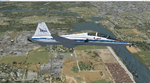
Version 2.0 covers landclass across the entire greater Houston area, with a large increase in LOD. This version significantly tightens up and improves the landclass from version 1.0, and adds a vast amount of scenery objects that brings the Bay Area-KEFD area into the modern era. This improves and adds a highly accurate runway 17 approach with accurate placement of buildings and scenery around the year 2011-modern day. In addition, includes several new files including a new airport/helipad via Houston Clear lake regional airport, T41 La Porte Municipal and surrounding shipping ports, Kemah Boardwalk, and a giant improvement to Johnson Space Center Houston. Rundway 35 and Runway 22 landclass is significantly increased, and more accurate as well. You can fly an accurate VFR approach or set up an ILS for any one of KEFD's runways with ease with this improvement.List of Version 2.0 additions and changes: - I added a ton of scenery objects and tightened up the landclass at Johnson Space Center Houston- NASA Control Center--- Added Talon Park with T38s (via static objects)--- Added Gemeni V rocket and 747 for the shuttle transporter--- And a whole bunch of vegetation, new buildings, and tour buses.- Added Kemah boardwalk and several boat docks- Removed a TON of highrise textures and replaced with medium and large city suburb landclass.- Added Clear Lake regional Hospital with helipad and surrounding scenery by Walter Reed Park- Added El Jardin or "Bayport Container port" with several scenery objects and significantly tightened up landclass.-- Looks great when setting up ILS approach for RWY 22- Tightened up Bay Area BLVD landclass, "adding" University of Houston Clear Lake"-- UHCL was semi already present, just made it more pronounced.- Made Red Bluff road landclass super recognizable!-- Red Bluff road is used to set up VFR approach and or field break for RWY 22 and RWY 17 R.----- Its common to see private jets and the USAF doing a break along Red Bluff road.- Added First Baptist Church, and water tower to Pasadena Convention center- Made Fairmont Parkway pronounced with landclass- Added Houston Port Authority at Morgan's Point--- Another Landmark for the RWY 22 ILS approach, NASA religiously uses this to line up the 10 mile ILS.- Tightened up landclass at Village Grove East and along Fairmont Parkway- Added a TON of scenery objects and landclass corrections for approach of RWY 17 L and 17 R.---- Added Home Depot, Lowes, Walmart Super center, Guitar center etc.---- added South Main Baptist Church--- Bondy Jr High, Turner Elementary, and Pasadena Memorial High School--- Added Saint Luke's Hospital--- Added Hampton Inn Suites and HCA rehab hospital--- Added a ton to the container facility behind best buy and storage facility--- Added smaller churches on RWY 17 approach--- Added a ton of scenery at the base of RWY 17 R, i.e., concrete plant, containers, trucks-- Added gas stations on the corner of beltway 8 and genoa red bluff-- Significantly changed and tightened up landclass at the base of RWY 22 and RWY 17 L and 17 R-- Made several roads and Beltway pronounced------ This decision looks AWESOME at night, really adds demarcation to the roads.**All of this makes the RWY 17 approach super recognizable** RWY 22 approach landclass is much more accurate.- Significantly changed and tightened up landclass near southbelt ellington and interstate 45.- Added Grace Church-- I wanted to do San Jacinto College south, but seemed over kill at that point.- SIGNIFICANTLY tightened up landclass for RWY 35 approach and near baybrook mall.-- Along I45- Added TDECU stadium at the University of Houston Main Campus---- So you can practice flybys for Cougar games!- Added the Battleship at San Jacinto Monument- I also "borrowed" T41 La Porte Municipal's tower camera to make a SWEET view of KEFD.- I included landclass for Sealy Texas this time, as well as my significant enhancements of Austin, Texas greater area as well (optional, but recommended!)---------------------------------------------------------------------------Version 1.0 originally added:- Added the Johnson Space Center Houston, which is now greatly enhanced and blended.- San Jacinto Community College-Central- Pasadena Convention Center- Pasadena Water Treatment Facility- NASA Bouncy Lab- Pasadena Shopping center, now greatly enhanced and blended.- Baybrook Mall and other shopping spots.- Significant Landclass improvements across the entire greater Houston Area File also includes landclass and scenery improvements for the greater Austin, Texas Area (optional), KIAH, KDWH, and Sealy, Texas. Each of these projects combined covers roughly 15,000 square miles of landclass improvement. Allowing you to fly entirely from Houston to Austin, or Houston to San Antonio in accurate landclass. -Enjoy!DJN
| Filename: | Version_20_KEFD_Ellington_2025_Refresh_FSX_Circa_2.zip |
| License: | Freeware |
| Added: | 12th October 2025, 16:15:47 |
| Downloads: | 70 |
| Author: | Dan Nelson |
| Size: | 277.28 MB |


© 2001-2026 AVSIM Online
All Rights Reserved
Privacy Policy |