
Where Flight Simulation Enthusiasts Gather from Around the World!
AVSIM Library - Search Results

| Category: Flight Simulator X - Scenery | |
| Faroe Island |

|
Images related to this file:
File Description:
Version four of Faroe Island scenery with many updates, mesh corrections, new gmax buildings and ungoing work for the extended runway on Vagar airport
| Filename: | Faroe_Island.zip |
| License: | Freeware |
| Added: | 26th February 2011, 00:41:57 |
| Downloads: | 2,394 |
| Author: | Ryan Andersen and Peter H. Poulsen |
| Size: | 70.95 MB |
| Category: Flight Simulator X - Scenery | |
| Mesh South America / MeSA Islands |
|
File Description:
FSX Mesh South America Project:
This terrain mesh file is a part of a whole project covering all the Continent of South America and some islands, divided in tiles identified in a map by its column (letters) and rows (numbers).
Those files were multi-LOD compiled from 90m SRTM2 source data, reprocessed with 3DEM to remove voids and spikes, providing a 76.4m (LOD9) horizontal resolution topography intended for use only in FSX updated with SP1.
Although not well documented, to improve performance, the updated FSX loads DEM files in threads and only the closer terrain (about 5 NM from the point of view) is rendered in high detail, while at far distances FSX shows up its default low resolution mesh, when there is not a third part terrain mesh compiled in all others intermediate level of details (multi-LOD).
THIS FILE: FSX_MeSA_Islands (Ascencion, Georgia, Gough and Trindade)
| Filename: | Mesh_South_America__MeSA_Islands.zip |
| License: | Freeware |
| Added: | 10th June 2007, 23:59:44 |
| Downloads: | 1,139 |
| Author: | Hely Heck Junior and José Lôbo |
| Size: | 2.75 MB |
| Category: Flight Simulator 2004 - Aircraft Repaints, Textures and Modifications | |
| Aeca Douglas C-47 Skytrain (YV211T) |
|
Images related to this file:
File Description:
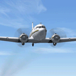
Douglas C-47 Skytrain, registration YV211T, a charter airline flying to Los Roques Islands, Venezuela. Textures only for the Manfred Jahn´s
Douglas DC-3/C-47 Skytrain. By Rafael Ledezma and Juan Ernesto Oropeza.
| Filename: | Aeca_Douglas_C47_Skytrain_YV211T.zip |
| License: | Freeware |
| Added: | 30th December 2016, 07:54:41 |
| Downloads: | 179 |
| Author: | Rafael Ledezma and Juan Ernesto Oropeza |
| Size: | 4.21 MB |
| Category: Flight Simulator X - Scenery | |
| Cape_Verde_Mesh |
|
File Description:
To improve performance, FSX updated with SP1 loads DEM files in threads and only
the closer terrain (about 10 NM from the point of view) is rendered in high
detail, while at far distances FSX shows up its default low resolution mesh,
if it is not available a multi-resolution one. This terrain mesh file was multilod compiled from 90m SRTM2 source data, reprocessed with 3DEM to remove voids and spikes, providing a 76.4m (LOD9) horizontal resolution topography intended
for use only in FSX updated with SP1.
It covers the Cape Verde, a group of islands in the North Atlantic Ocean, that consist of two small archipelagos, about 400 miles off the western coast of Senegal (Africa), including: Boa Vista, Brava, Maio, Mosteiros, Paul, Praia, Porto Novo, Ribeira Grande, Sal, Santa Catarina, Santa Cruz, Sao Domingos, Sao Filipe, Sao Miguel, Sao Nicolau, Sao Vicente and Tarrafal (Geographic coordinates: 16ºN/24ºW).
Authors:
Hely Heck Junior - Magrao ( [email protected] ) and Jose Lobo (
[email protected] ) TerraBrasilis: www.terra-brasilis.org
| Filename: | Cape_Verde_Mesh.zip |
| License: | Freeware |
| Added: | 21st June 2007, 16:26:23 |
| Downloads: | 4,333 |
| Author: | Hely Heck Jr. and José Lôbo |
| Size: | 1.55 MB |
| Category: Flight Simulator 2004 - Scenery | |
| CYYG Charlottetown Airport, PEI |
|
File Description:
Charlottetown Airport (CYYG) is part of the Maritime Airport series by CanUk Scenery. Created primarily with GMAX, the scenery features photoreal building textures, custom taxiway and apron textures, static vehicles, off-airport buildings, custom landclass and realistic night lighting. Please visit CanUk's website at www.cysjhangar.ca/canuk to view other available Maritime, Manitoba and Ontario sceneries.
| Filename: | CYYG_Charlottetown_Airport_PEI.zip |
| License: | Freeware, limited distribution |
| Added: | 26th November 2005, 02:19:09 |
| Downloads: | 8,620 |
| Author: | Adam Bentley and David Madge - CanUk |
| Size: | 15.35 MB |
| Category: Flight Simulator 2004 - Panels | |
| Supermarine Spitfire |
|
File Description:
This panel is based on the default CFS panel. I have added custom radios and Nav instruments as well as special taxi/landing views where you look on the side with your head out of the plane. You also can use the panning buttons which elevate the seat for a better view from your seat when taking off. Special gauges by Jean-Pierre Langer and Arne Bartels, including an airspeed gauge in knots.
| Filename: | Supermarine_Spitfire.zip |
| License: | Freeware |
| Added: | 5th January 2004, 23:15:20 |
| Downloads: | 4,522 |
| Author: | Jean-Pierre Langer and Arne Bartels |
| Size: | 1.7 MB |
| Category: Flight Simulator 2004 - Scenery | |
| Himalayan Peaks LOD10 Mesh, Volume 1 - Mt. Everest and Kula Kangri |
|
File Description:
Highly detailed terrain mesh of the Mt. Everest and Kula Kangri areas, N26°-29° E85°-92°. The files in this package are based on Shuttle Radar (SRTM) Version 2 data but with many of the void areas, especially the most significant sections, filled with elevation data generated from topographic maps by Jonathan de Ferranti. While Jonathan's work is unrelated to flight simulation he kindly gave me permission to compile his data for use in FS. The result is a wonderful improvement in detail and accuracy over any existing mesh file, freeware or commercial, based on SRTM or DTED data alone. Due to the large area of the Himalayas I've compiled the source data as two separate series: the "Himalayan Peaks" series covers prominent mountains and ranges in higher detail and locally overrides any existing LOD9 terrain mesh. In addition, a LOD9 "base mesh" series covering the entire Himalayas will be available for those who do not yet have an add-on terrain mesh of these beautiful mountains.
| Filename: | Himalayan_Peaks_LOD10_Mesh_Volume_1__Mt_Everest_an.zip |
| License: | Freeware, limited distribution |
| Added: | 9th February 2006, 22:13:00 |
| Downloads: | 37,042 |
| Author: | Holger Sandmann and Jonathan de Ferranti |
| Size: | 52.01 MB |
| Category: Flight Simulator 2004 - Scenery | |
| Cape Town International Airport, South Africa |
|
File Description:
Cape Town Intl Airport, South Africa. A highly detailed airport for FS2004, containing photo realistic ground textures, hangars and buildings.
| Filename: | Cape_Town_International_Airport_South_Africa.zip |
| License: | Freeware, limited distribution |
| Added: | 16th July 2004, 01:42:18 |
| Downloads: | 38,722 |
| Author: | Lourens Basson and André Steyn, Aeroworx |
| Size: | 6.12 MB |
| Category: Flight Simulator 2004 - AI Aircraft | |
| United Express de Havilland Canada DHC-8-200 Dash 8 |
|
File Description:
For AI Aircraft use but does fly well. DXT 3 format files with alpha. Aircraft has been setup to be called by ATC as "Air Shuttle", the callsign for Mesa Airlines, a UAL Affiliate. Maximum detail has been used for good eye candy. Texture files only - you must get the model and air files from Project AI or FSPainter.
| Filename: | United_Express_de_Havilland_Canada_DHC8200_Dash_8.zip |
| License: | Freeware |
| Added: | 19th May 2006, 03:10:35 |
| Downloads: | 1,608 |
| Author: | Jim Martin, FSPainter, and Project AI |
| Size: | 152.36 KB |
| Category: Flight Simulator 2002 - Panels | |
| Partenavia P-68 |
|
File Description:
Photorealistic FS2002 2D panel for the Vulcanair/Partenavia P68C with cockpit views by Jean-Pierre Langer according pictures of real 3A-MOI plane with custom P-68 gauges and Garmin GPS.
| Filename: | Partenavia_P68.zip |
| License: | Freeware |
| Added: | 28th October 2003, 16:15:50 |
| Downloads: | 1,897 |
| Author: | Jean-Pierre Langer and Arne Bartels |
| Size: | 15.4 MB |
© 2001-2026 AVSIM Online
All Rights Reserved
Privacy Policy |