
Where Flight Simulation Enthusiasts Gather from Around the World!
AVSIM Library - Search Results

| Category: Flight Simulator 2004 - AI Aircraft | |
| AMI 46th Brigata Aerea Complete Package |

|
Images related to this file:
File Description:

This freeware AI package, produced by Military AI Works contains everything needed to activate AMI's 46th Brigata Aerea in FS2004.
The 46th Brigata Aerea 'Silvio Angelucci' is the only squadron committed to air transport within the Italian Air Force, and one of
the most prestigious. the 46th Brigata Aerea is equipped with C-27 Spartans and the most recent versions of the C-130, and hosts a
crew training facility as well as maintenance facilities at Pisa-San Giusto (LIRP). The squadron is divided into three operational
groups. All of these units are included in this package, which contains repaints, AFCADs, flight plans and custom call signs for
each depicted unit. As a bonus, two further C-27s based in Italy are included. Credits: AFCADs: Miljan Korac, Giacomo Gramazio,
Stewart Pearson and Giorgio Perotti, Scenery objects: Mike Guenther and John Stinstrom, Models: Miljan Korac and Henry Tomkiewicz,
FDE and Effects Design: Michael McIntyre, Henry Tomkiewicz and John Stinstrom, Repaints: Michael Pearson and Graham King,
Voicepacks: Stewart Pearson, Flightplans and waypoints: Giacomo Gramazio
| Filename: | AMI_46th_Brigata_Aerea_Complete_Package.zip |
| License: | Freeware |
| Added: | 29th January 2014, 08:33:36 |
| Downloads: | 751 |
| Author: | MAIW - Giacomo Gramazio |
| Size: | 15.55 MB |
| Category: Flight Simulator X - Scenery | |
| YBLT - Ballarat Aerodrome - Victoria, Australia |
|
Images related to this file:
File Description:
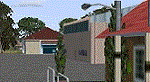
YBLT (Ballarat Aerodrome) is a regional 'airport' in the central west of the State of Victoria, Australia and utilises infrastructure from the days of RAAF operations which lasted till the early 1960's. Thus the buildings are now a bit outdated but this file does not reflect that as I have not done any custom texturing so everything in this package tends to look a bit new and crispy.
Note the name of this 'airport'. The locals are adamant it is an aerodrome, not an airport. I have not found any freeware or commercial offerings for an alternative to the default and so I have put one together.
This is a reasonable approximation of the airport /aerodrome but is not entirely accurate as the hangars/buildings I have modelled myself are generic ones I have done and do not look exactly like the ones at that facility. The connecting road is not in true alignment as I have created it so as it blends into the surrounding default scenery.
| Filename: | YBLT__Ballarat_Aerodrome__Victoria_Australia.zip |
| License: | Freeware |
| Added: | 21st October 2014, 01:51:16 |
| Downloads: | 838 |
| Author: | Robert Budd |
| Size: | 4.43 MB |
| Category: Flight Simulator 2002 - Scenery | |
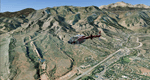
| Alaska Bush Scenery: Stony River Bend & Old Stony |
|
File Description:
Here's your big chance to take-off and land using a curved airstrip. Stony River Bend is located just west of Merrill Pass, very close to Tom Fica's cabin at Two Lakes (part of his 'Merrill Pass' scenery add-on). The bumpy dirt runway - becoming slightly overgrown and prone to waterlogging - is marked out with wooden posts (lit at night) and presents a unique challenge: one that I haven't really sorted out just yet! There's a small settlement just up a log-lined trail from the airfield with a gravel service track connecting with a basic NDB/DME facility to help out with night or low visibility approaches. Although Stony River Bend is fictional, it has been based loosely on a real life runway at Elk City in Idaho. Three miles downstream is another simple backwoods strip called Old Stony - the narrow gravel runway here is conventional, but it's probably in an even worse state of repair. Designed for use with Eddie Denney's FS2002 mesh of Alaska, but the scenery is usable without it.
| Filename: | Alaska_Bush_Scenery_Stony_River_Bend__Old_Stony.zip |
| License: | Freeware, limited distribution |
| Added: | 31st March 2003, 13:09:28 |
| Downloads: | 1,873 |
| Author: | James Belk |
| Size: | 2.04 MB |
| Category: Flight Simulator X - AFCAD Files | |
| Warren Grove Range Airport (NJ24), New Jersey |
|
File Description:
Located 03 miles SW of Burlington County, New Jersey, Warren Grove Range is a private concrete airfield 1800' in length. It is owned by the Department of Defense and exists in a restricted flight area. The bare sand of this area has washed out the satellite images tremendously from over-exposure thanks to reflected sunlight - you can't even make out the runway (which FSX places incorrectly over a mile away). Due to lack of ground definition and primary use as a military facility, this airport has not been developed by MSEAirports and the concrete runway has been removed.
Scenery constructed with use of satellite images/streetview/aerial photos - the author has not been there in person.
This scenery is meant to be used in conjunction with MegaScenery Earth New Jersey/Delaware 003. It is not required, but apron use is minimized to allow satellite scenery to show through as much as possible, and objects are placed based on the MSE textures - lack of it may make scenery look out of place.
| Filename: | Warren_Grove_Range_Airport_NJ24_New_Jersey.zip |
| License: | Freeware |
| Added: | 20th August 2011, 19:58:05 |
| Downloads: | 174 |
| Author: | Drew Sikora |
| Size: | 153.47 KB |
| Category: Flight Simulator 2004 - Scenery | |
| Colorado Springs South (KCOS), Colorado, Photo-Scenery |
|
Images related to this file:
File Description:
Colorado Springs South (KCOS), Colorado, Photo-Scenery (FS9 & FSX)
This region covers the area of Colorado Springs. Just west of the city you can fly around Pikes Peak. At 14.115ft it is the easternmost of Colorado's 54 fourteeners. Northwest of the city lies the Garden Of Gods with its many vertical rock formations. They are made of sedimentary beds red and white sandstones, conclomerates and limestone that were deposited horizontally but have been tilted vertically and faulted by the immense mountain building forces caused by the uplift of the Pikes Peak massiv. Deep within Chayenne Mountain is the North American Aerospace Defense Command's (NORAD) main technical facility which collects and evaluates data from a worldwide system of satellites, radars and other sensors.
High resolution versions of this scenery for FS9 and FSX (much sharper, but larger and multiple downloads) are available at www.blueskyscenery.com/GNB_South3East.html . The screenies are taken from the high-res versions, so expect this version to be slightly more blurry. YourDonation@Work: Dedicated to Veit and Hector.
| Filename: | Colorado_Springs_South_KCOS_Colorado_PhotoScenery.zip |
| License: | Freeware, limited distribution |
| Added: | 5th February 2010, 16:30:42 |
| Downloads: | 1,979 |
| Author: | Gottfried Razek, blueskyscenery.com |
| Size: | 95.63 MB |
| Category: Flight Simulator 2004 - Scenery | |
| 5B2 - Saratoga County Airport |
|
Images related to this file:
File Description:
5B2 - Saratoga County Airport v1.0

Located in the foothills of the Adirondack Mountains in upstate NY USA. This facility is owned by Saratoga County, formerly housed Rich Air and currently houses North American Aviation. 5B2 is a non-controlled airfield catering to small engine a/c up to a few private jet daily traffic serving 'The Northcountry' and Saratoga Springs, New York.
All Objects fully designed and completely redone in GMAX using high resolution 32bit photo-real textures. Optional DXT3 textures included. Also includes new AFCAD file, more accurate airport grounds perimeter, satellite photo-real grounds, custom taxiways, taxi-signs and taxi lights, area roads, animated hangar doors, and near area landclass. Some GA AI traffic tracks included with this release, afcad also designed to support general AI. Rwy12 objects (Lars Extra Object Library) required for a few static parking lot cars. All textures mipmapped for performance. By EdGeneer Cox.
| Filename: | 5B2__Saratoga_County_Airport.zip |
| License: | Freeware, limited distribution |
| Added: | 24th February 2012, 19:24:19 |
| Downloads: | 1,536 |
| Author: | EdGeneer Cox |
| Size: | 103.26 MB |
| Category: Flight Simulator 2002 - AFCAD Files | |
| China Lake NAWS, CA. AFCAD JANET |
|
File Description:
This is the AFCAD to a top secret facility known as China Lake Naval Air weapons station in California. The stories are wide and far ranging about this secret place in the desert.
There is a supposed underground tram system running 180 MPH under the Death Valley mountains to Area 51. (some reports of the tram running up to 275 MPH) Lockheed has a targeting and ranging station on base used to develop aircraft that are invisible. (the craft blend with the sky) Orbs can be seen here, UFO's reported daily, and on and on.
Folklore,? maybe. I dont know anything. Speculation only. Gates are approximated. My work is free to the simming community. Please do not sell any of ol' Bucks work.
Please do not include my work any any pay packages. Free is good. God bless the USA. If this is subversive to the USA, please feel free to pull my AFCADS.
P.S.: SDK is included with Lee Swordys installer. I had trouble getting this AFCAD to install so good luck. That is why I have included the SDK.
| Filename: | China_Lake_NAWS_CA_AFCAD_JANET.zip |
| License: | Freeware, limited distribution |
| Added: | 6th September 2003, 17:06:33 |
| Downloads: | 471 |
| Author: | Buck Martin |
| Size: | 49.75 KB |
| Category: Flight Simulator 2004 - Scenery | |
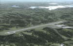
| PASY - Shemya (Eareckson Air Station) - Alaska, USA |
|
Images related to this file:
File Description:
Shemya is pretty well AT the western end of the Aleutian chain of islands in Alaska, around 240 miles west of Amchitka. There is no town on Shemya and the whole island is occupied (and owned) by the Air Force. There are three runways, two of which are from the 1940's and are now unused; in fact one of them has been partly ploughed up and also used for outdoor storage. The single in-use runway is aligned 10-28 and is 10,000 feet of 150 feet wide asphalt with an ils on 28, the runway that is used 99% of the time. The base is now not active but is maintained as a refuelling facility, so for landing and takeoff purposes it is open. The older and now unused areas are those where the hangers are slowly rusting away and the asphalt is turning green with encroaching and well-watered wildlife plants. The tower is now closed, so there is no atc and you just announce your intentions. Read the history of Shemya, a lot happened there.
| Filename: | PASY__Shemya_Eareckson_Air_Station__Alaska_USA.zip |
| License: | Freeware, limited distribution |
| Added: | 18th February 2015, 19:52:36 |
| Downloads: | 451 |
| Author: | Roger Wensley |
| Size: | 8.81 MB |
| Category: Flight Simulator X - Scenery | |
| Branson Airport KBBG--New Airport, Scenery, and Flight Plans |
|
Images related to this file:
File Description:
This project adds a new, detailed Branson Airport KBBG (Missouri) to FSX, which opened in May 2009, and is a privately developed commercial airport. The construction of the airport, which involved the flattening of several Ozark Mountains, is claimed to be the largest earthmoving project in Missouri history. As a result, the airport actually sits on a manmade plateau, surrounded by rolling hills. The airport uses the ICAO identifier BBG, however, the airlines use the IATA code BKG. The airport is served by AirTran, Frontier, and ExpressJet (Branson AirExpress), and is located in hilly terrain. Aircraft equipped with a terrain avoidance warning system may experience system activation on final approach. Birds are in the vicinity of the airport. AFCAD with sloping terrain created using Airport Design Editor X v1.47.07, and the hilltops were cleared and flattened and roads were added using SBuilderX 3.13. The terminal, hangar, FBO, and cars were added and modified from stock FSX scenery, using the FSX Object Tool, to resemble as closely as possible the actual airport.
| Filename: | Branson_Airport_KBBGNew_Airport_Scenery_and_Flight.zip |
| License: | Freeware |
| Added: | 5th August 2010, 01:08:33 |
| Downloads: | 2,003 |
| Author: | Carlyle Sharpe |
| Size: | 6.02 MB |
| Category: Flight Simulator X - AFCAD Files | |
| LGRX - Araxos Airforce Base, Greece |
|
File Description:
LGRX - Araxos AB is a large Hellenic Airforce base located near Araxos Cape, Achaea Prefecture and serves the city of Patras as well as the western part of the Peloponese region. It is the home of the 116 Combat Wing. It is used by a few civilian airlines, mainly for the tourist industry.
The stock airport shows three runways in use, however in reality only one runway is currently used the centre runway is now the main taxiway.
I have added the civilian apron and terminal buildings and various buildings and hangers throughout the base, all are Generic Buildings. Parking for Military and Civilian use, a cargo ramp and lots of trees. As usual I used the fantastic ADE (Airport Design Editor) to design this airport but you should download the great lights package by Jim Dhaenens as I have used some of his Apron Lights. I have provided ILS in one version for simmers who like to fly with it, although there is no ILS at Araxos.
| Filename: | LGRX__Araxos_Airforce_Base_Greece.zip |
| License: | Freeware |
| Added: | 1st July 2013, 18:04:18 |
| Downloads: | 620 |
| Author: | Mike Major |
| Size: | 31.04 KB |
© 2001-2026 AVSIM Online
All Rights Reserved
Privacy Policy |