
Where Flight Simulation Enthusiasts Gather from Around the World!
AVSIM Library - Search Results

| Category: Flight Simulator 2004 - AFCAD Files | |
| Seattle-Tacoma International Airport UPGRADE (KSEA) |

|
File Description:
(SEE ZIPDIVE FOR SCREENSHOTS)
This is an upgrade of the default scenery using Airport Design Editor (ADE). I tried making this as close as possible to the real thing with the help of Google Earth and FlightAware, determining which gates are occupied by which airlines, and what aircraft types typically occupied the gate (i.e., having enough space for those jumbos).
You'll find the following additions in this afcad scenery:
-Expanded concourse A to hold up to 14 gates
-Jetways/gates added to concourse D
-The new third runway to the West (with an exclusion to keep trees out of the runway)
-Extra overnight parking
-Many of the default jetways too tall for most of the aircraft arriving at SEA replaced with shorter jetways for small narrowbodies
and 757s (rwy12 jetways I believe, hope there's no problem with using them)
-Updated location of airlines at each gate (to the best of my ability and resources...)
-That lounge building that sits on top of concourse A (using generic buildings).
| Filename: | SeattleTacoma_International_Airport_UPGRADE_KSEA.zip |
| License: | Freeware |
| Added: | 4th August 2017, 13:05:25 |
| Downloads: | 1,579 |
| Author: | Carlos Si |
| Size: | 12.6 MB |
| Category: Flight Simulator X - Scenery | |
| MMTJ - Gen Abelardo L Rodriguez Intl - Tijuana, Mexico ----- KSDM - Brown Mun - San Diego, California - USA |
|
Images related to this file:
File Description:
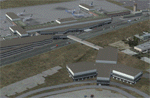
This scenery adds the new Cross Border Xpress (CBX) terminal to MMTJ, which opened on December 9, 2015, making it the first airport in the world to have connecting terminals in two different countries. All of MMTJ is also updated to reflect the most current airport layout. The neighboring KSDM is also completely updated and included in this scenery package. This scenery is optimized to fit seamlessly with FTX Global/Vector and also includes an optional CVX file which adds roads for default FSX users. All elements of both airports were traced directly from current satellite imagery and updated to reflect current satellite positioning. Scenery was created using Airport Design Editor X v1.61.5298, SBuilderX 3.13, and the FSX Object Placement Tool. Scenery objects were added and modified from stock FSX scenery to resemble as closely as possible the actual airports. The FSX apron lights included are from the set created by Jim Dhaenens.
| Filename: | MMTJ__Gen_Abelardo_L_Rodriguez_Intl__Tijuana_Mexic.zip |
| License: | Freeware |
| Added: | 3rd January 2016, 12:58:36 |
| Downloads: | 2,679 |
| Author: | Carlyle Sharpe |
| Size: | 3.58 MB |
| Category: Flight Simulator X - Scenery | |
| SCIP - Isla de Pascua & Mataveri Intl - Easter Island |
|
Images related to this file:
File Description:
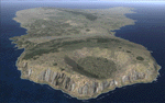
This project rebuilds Easter Island / Isla de Pascua. Mataveri Intl (SCIP) is completely overhauled, and all airport objects are aligned from satellite imagery. Landclass polygons and coastlines were meticulously hand-drawn directly from satellite imagery to provide the most detailed and accurate scenery available for this region. AI road and boat traffic is activated for the region. Accurate coastlines and road data, as well as corrected land and waterclass are provided based on the latest available satellite imagery. GA flights use default aircraft and include an option to add Chilean Air Force planes around the island. Numerous Moai (Easter Island heads) have been placed around the island according to satellite imagery. Scenery was created using Airport Design Editor X v1.61.5298, SBuilderX 3.13, and the FSX Object Placement Tool. Scenery objects were added and modified from stock FSX scenery to resemble as closely as possible the actual airports. The FSX apron lights included are from the terrific set created by Jim Dhaenens.
| Filename: | SCIP__Isla_de_Pascua__Mataveri_Intl___Easter_Islan.zip |
| License: | Freeware |
| Added: | 12th July 2014, 08:17:55 |
| Downloads: | 5,731 |
| Author: | Carlyle Sharpe |
| Size: | 5.33 MB |
| Category: Flight Simulator X - Scenery | |
| Cedar Rapids Iowa USA Eastern Iowa Airport-KCID |
|
Images related to this file:
File Description:
Cedar Rapids Iowa USA Eastern Iowa Regional Airport for FSX. Several improvements have been made to the default airport. The default terminal buildings have been replaced with buildings created in FSDS; aircraft gates have been correctly coded using Airport Design Editor 1.70.6042; a new airport vehicle network has been built to prevent airport vehicles from entering the taxiways; extra fuel trucks have been added throughout the airport; the tower view has been changed to display from the roof of the control tower; static FedEx and UPS scenery objects have been placed throughout the airport; all taxiway signs are correctly placed and all taxiway designators are correctly named; there is the option to open both runways to AI traffic; optionally, a set of GA flight plans is included using all default FSX aircraft to liven up the GA area; and Jim Dhaenen's excellent ramp lights are also included. Please read the README FIRST.txt and installation.txt files to insure proper installation of all files.
| Filename: | Cedar_Rapids_Iowa_USA_Eastern_Iowa_AirportKCID.zip |
| License: | Check within download |
| Added: | 29th September 2017, 16:54:49 |
| Downloads: | 868 |
| Author: | Patrick Finch |
| Size: | 6.34 MB |
| Category: Prepar3D V1-4 - Scenery | |
| KDSM - Des Moines Iowa USA International Airport For Prepar3D |
|
Images related to this file:
File Description:
Des Moines Iowa International Airport for P3D. Originally created for FSX, this airport has been converted to work in P3D. Several improvements have been made to the default airport. The default terminal buildings have been replaced with buildings created in FSDS; aircraft gates have been correctly coded using Airport Design Editor 1.76.6715; a new airport vehicle network has been built; extra fuel trucks have been added throughout the airport; the tower view has been changed to display from the roof of the control tower; all taxiway designators are correct and all taxiway signs are correctly placed and named; there is the option to open both runways to AI traffic; A large cargo area for FedEx and UPS is included, as well as an area for the 132nd Fighter Wing of the Iowa Air National Guard; and Jim Dhaenen's excellent ramp lights are also included. Please refer to the README FIRST.txt file to insure proper installation of all files.
| Filename: | KDSM__Des_Moines_Iowa_USA_International_Airport_Fo.zip |
| License: | Freeware, limited distribution |
| Added: | 24th June 2018, 01:00:08 |
| Downloads: | 936 |
| Author: | Patrick Finch |
| Size: | 4.66 MB |
| Category: Flight Simulator X - Scenery | |
| Lafayette Louisiana USA Regional Airport |
|
Images related to this file:
File Description:
Lafayette Louisiana USA Regional Airport for FSX. Several improvements have been made to the default airport. The default terminal building has been replaced with a custom building created in FSDS; aircraft gates have been correctly coded using Airport Design Editor 1.70.6042; a new airport vehicle network has been built to prevent airport vehicles from entering the taxiways; extra fuel trucks have been added throughout the airport; the tower view has been changed to display from the roof of the control tower; static FedEx and UPS scenery objects have been placed throughout the airport; all taxiway signs are correctly placed and all taxiway designators are correctly named; there is the option to open both runways to AI traffic; the ILS for Runway 4R has been added; optionally, a set of GA flight plans is included using all default FSX aircraft to liven up the GA area; and Jim Dhaenen's excellent ramp lights are also included. Please read the README.txt file to insure proper installation of all files.
| Filename: | Lafayette_Louisiana_USA_Regional_Airport.zip |
| License: | Freeware, limited distribution |
| Added: | 2nd November 2017, 17:58:44 |
| Downloads: | 691 |
| Author: | Patrick Finch |
| Size: | 3.09 MB |
| Category: Flight Simulator 2004 - Scenery | |
| Scotports Volume 1 |
|
Images related to this file:
File Description:
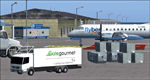
It is well noted that Scottish Airports are very neglected by scenery developers in FS9, mainly the smaller Airports. Therefore I decided to do a little something about it! - Using the wonderful Airport Design Editor (ADE), I have constructed these sceneries from scratch, after deleting all of the disappointing default buildings and objects. The airports included are 99% realistic regarding runways, aprons and taxiways and general airport layout, however there may be a one or two minor discrepancies due to FS limitations. I have also added fictional ILS to runways which don't have ILS in the real world. All scenery objects and textures are by Sidney Schwartz (especially for ADE), of whom, without his long hours of work, none of this would have been possible. Airports in this package are: Campbeltown (EGEC), Eday (EGED), Kirkwall (EGPA), Sumburgh (EGPB), Wick (EGPC), Inverness v2 (EGPE), Islay (EGPI), and Dundee (EGPN). All these airports are served by Loganair.
| Filename: | Scotports_Volume_1.zip |
| License: | Freeware |
| Added: | 3rd November 2011, 19:35:10 |
| Downloads: | 4,360 |
| Author: | Chris Horsfield |
| Size: | 70.7 MB |
| Category: Flight Simulator X - Scenery | |
| Los Roques Archipelago and Airports |
|
Images related to this file:
File Description:
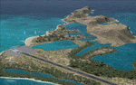
This project rebuilds Venezuela's Los Roques archipelago, adds the Gran Roque (SVRS) and Dos Mosquises (SVDM) airports, and includes AI flight plans, boat traffic, and a custom terrain mesh for Gran Roque. Accurate coastlines and lakes, as well as corrected landclass and waterclass are provided based on the latest available satellite imagery. Although current satellite imagery for this region only exists in relatively low resolution, an abundance of aerial photography was used to add custom features to Gran Roque and Dos Mosquises. Updates were created or rebuilt in a manner which carefully aligned airport data with current satellite imagery, when available. Scenery was created using Airport Design Editor X v1.50.4402, SBuilderX 3.13, and the FSX Object Placement Tool. Scenery objects were added and modified from stock FSX scenery to resemble as closely as possible the actual airports. Thank you to John Hinson and Tiago Besciak for granting permission to adapt their AI flight plans to realistically populate (SVRS) Gran Roque.
| Filename: | Los_Roques_Archipelago_and_Airports.zip |
| License: | Freeware |
| Added: | 27th July 2013, 02:34:10 |
| Downloads: | 1,401 |
| Author: | Carlyle Sharpe |
| Size: | 7.66 MB |
| Category: X-Plane - Scenery | |
| BR RJ SBBZ - Buzios Airport v1.0.0 |
|
Images related to this file:
File Description:
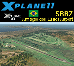
This is an X-Plane 11 and X-Plane 10 scenery package for Umberto Modiano Airport (IATA: BZC, ICAO: SBBZ), which is the airport serving Armacao dos Buzios, Brazil. It is named after Umberto Modiano, a local businessman who financially supported the emancipation movement of Armação dos Búzios as an independent municipality, which was completed in 1995.
It includes corrected aprons, ramps, gates, taxiways, lighting system, city buildings, ortho-photoscenery for the airfield area, and (XP11 only) airport ground services (like push back).
The airport was inaugurated in 2003 and it is dedicated to general aviation. On July 11, 2012 the facility was temporarily closed to conduct renovation works demanded by the National Civil Aviation Agency of Brazil. However, on May 28, 2016, after completing the renovations and legal procedures, the airport was again opened for general aviation.
This scenery was tested and is operational (as of January 16, 2018) in "X-Plane 11.11 64 bit", Windows 10 Home. It was also tested and is also operational (as of January 16, 2018) in "X-Plane 10.51 64 bit", Windows 10 Home.
| Filename: | BR_RJ_SBBZ__Buzios_Airport_v100.zip |
| License: | Freeware |
| Added: | 2nd February 2018, 00:12:38 |
| Downloads: | 61 |
| Author: | Rui Mesquita |
| Size: | 8.35 MB |
| Category: Flight Simulator X - AFCAD Files | |
| Warren Grove Range Airport (NJ24), New Jersey |
|
File Description:
Located 03 miles SW of Burlington County, New Jersey, Warren Grove Range is a private concrete airfield 1800' in length. It is owned by the Department of Defense and exists in a restricted flight area. The bare sand of this area has washed out the satellite images tremendously from over-exposure thanks to reflected sunlight - you can't even make out the runway (which FSX places incorrectly over a mile away). Due to lack of ground definition and primary use as a military facility, this airport has not been developed by MSEAirports and the concrete runway has been removed.
Scenery constructed with use of satellite images/streetview/aerial photos - the author has not been there in person.
This scenery is meant to be used in conjunction with MegaScenery Earth New Jersey/Delaware 003. It is not required, but apron use is minimized to allow satellite scenery to show through as much as possible, and objects are placed based on the MSE textures - lack of it may make scenery look out of place.
| Filename: | Warren_Grove_Range_Airport_NJ24_New_Jersey.zip |
| License: | Freeware |
| Added: | 20th August 2011, 19:58:05 |
| Downloads: | 174 |
| Author: | Drew Sikora |
| Size: | 153.47 KB |


© 2001-2026 AVSIM Online
All Rights Reserved
Privacy Policy |