
Where Flight Simulation Enthusiasts Gather from Around the World!
AVSIM Library - Search Results

| Category: Flight Simulator 2004 - Scenery | |
| Houn, Libyan (HLON/HUQ) |

|
File Description:
Googly scenery for HLON Hon, Libya, a small domestic airport serving the oasis town (which is correctly spelt Houn) about 250 miles south-east of Tripoli. It is the capital of the Al Jufrah region. Although the airport holds ICAO and IATA status, as far as I can establish there are
currently no scheduled services to this airport, so present-day traffic is limited to the occasional charter, cargo or private flight. Flight Simulator 2004 has made no provision for traffic with only a runway provided and this scenery seeks to redress the situation so that you and your "AI" traffic can use the airport. The scenery does not purport to be ultra-accurate. Based on high quality satellite imagery from Google Earth, the layout is proportionally correct but the
added airport features, such as buildings, are built from default Microsoft objects
and add-on libraries so will not look exactly like the real thing. You are not obliged to download and install any additional scenery libraries, but to enjoy this scenery in its entirety, you may wish to. It will work fine, with or without.
| Filename: | Houn_Libyan_HLONHUQ.zip |
| License: | Freeware |
| Added: | 18th April 2008, 09:51:02 |
| Downloads: | 842 |
| Author: | John Hinson |
| Size: | 65.71 KB |
| Category: Flight Simulator 2004 - Scenery | |
| DTTG Gabes, Tunisia |
|
File Description:
Googly scenery for Gabes (ICAO: DTTG), a somewhat nondescript airport
shoe-horned into one of Tunisia's largest industrial cities. Famed for
its beaches, the city hosts cement, chemical and brick factories and an
oil refinery, resulting in poor levels of air pollution. The airport is
a joint military and civilian operation although military traffic appears
to be mostly helicopter activity and the civilian traffic consists of an
ATR of Sevenair calling in once in a blue moon.
Microsoft have only provided a runway at this airport in Flight Simulator
2004 and this scenery seeks to redress the situation so that you and your
"AI" traffic can use the airport realistically.
The scenery does not purport to be ultra-accurate. Based on high quality
satellite imagery from Google Earth, the layout is proportionally correct but the
added airport features, such as buildings, are built from default Microsoft objects
and add-on libraries so will not look exactly like the real thing.
You are not obliged to download and install any additional scenery libraries,
but to enjoy this scenery in its entirety, you may wish to. It will work fine,
with or without.
| Filename: | DTTG_Gabes_Tunisia.zip |
| License: | Freeware |
| Added: | 14th October 2008, 13:18:33 |
| Downloads: | 757 |
| Author: | John Hinson |
| Size: | 83.15 KB |
| Category: Flight Simulator 2004 - Scenery | |
| HEMM Mersa Matruh, Egypt |
|
File Description:
Googly scenery for HEMM Mersa Matruh - a large Air Base near the north coast of
Egypt. Marsa Matruh, as the town should be spelt, is a seaport 150 miles west of
Alexandria but its main function today is that of a holiday resort for the
residents of Cairo. It does not have an airport of its own, but uses a small
corner of the Air Base for civilian flights. Microsoft Flight Simulator has
made no provision for any traffic at this airport and this scenery seeks to
redress the situation.
Scheduled flights are operated by Egyptair Express using Embraer 170 jets,
but other airlines call here from time to time, such as Air Sinai and Midwest
Airlines.
The scenery does not purport to be ultra-accurate. Based on high quality
satellite imagery from Google Earth, the layout is proportionally correct but the
added airport features, such as buildings, are built from default Microsoft objects
and add-on libraries so will not look exactly like the real thing.
You are not obliged to download and install any additional scenery libraries,
but to enjoy this scenery in its entirety, you may wish to. It will work fine,
with or without.
| Filename: | HEMM_Mersa_Matruh_Egypt.zip |
| License: | Freeware |
| Added: | 18th February 2008, 17:32:10 |
| Downloads: | 1,988 |
| Author: | John Hinson |
| Size: | 114.6 KB |
| Category: Flight Simulator 2004 - Scenery Design | |
| EZ-Object Library Part 2 - Fast Food resturants |
|
File Description:
FS2004 FlightLevel390 EZ-Object Library part2
Contains a mixture of 4 low polygon Fast Food Resturants with seperate signage.Dominos Pizza,Sonic,Waffle House & Pizza Hut.
DXT3 day textures with night lighting.Optimized for good FPS.
These objects can be used in your own freeware scenery enhancements and will also be needed for FL390's upcoming KBTRv2 Scenery release.
A seperate 3rd part containing Inland River barges,and a few other goodies will follow this upload soon.Part 3 will also be needed for our KBTRv2 Scenery and Galveston Bay/Houston Ship Channel Water Scenery as part 3 will contain the barges and other objects that will be needed.
Not tested in FS X.
| Filename: | EZObject_Library_Part_2__Fast_Food_resturants.zip |
| License: | Freeware |
| Added: | 24th May 2007, 03:20:43 |
| Downloads: | 1,825 |
| Author: | FlightLevel390/Joe DeGregorio |
| Size: | 3.58 MB |
| Category: Flight Simulator X - Scenery | |
| EGNG Samlesbury Airfield |
|
File Description:
Samlesbury Airfield nr Preston. Home to the Canberra, the EE Lighning and the ill fated TSR2 Project. Blended to fit Horizon GenX Scenery and Mesh the tabletop/cliff edge effect has been removed. Requires Runway12 libraries to display as included pictures. The included AI flight file has been supplied by Gerry Winskill and requires the Canberra file baccanb.zip by Bill 'Tornado' Holker
| Filename: | EGNG_Samlesbury_Airfield.zip |
| License: | Freeware, limited distribution |
| Added: | 19th October 2007, 09:35:02 |
| Downloads: | 1,124 |
| Author: | Tony Meredith |
| Size: | 753.76 KB |
| Category: Flight Simulator X - Scenery | |
| Timaru Regional Airport (NZTU), South Canterbury, NZ |
|
Images related to this file:
File Description:
Richard Pearse Airport, Timaru, is a regional airport servicing the South Canterbury area. This scenery includes an accurate model of the airport. It is part of the Vector Land Class series of airfields, although you can use it with the default FSX, or any other landclass base such as FTX NZSI. It requires the VectorLandClass Libraries, not included, see the manual for details.
| Filename: | Timaru_Regional_Airport_NZTU_South_Canterbury_NZ.zip |
| License: | Freeware, limited distribution |
| Added: | 6th March 2013, 23:39:40 |
| Downloads: | 3,160 |
| Author: | Robin Corn, Godzone Virtual Flight |
| Size: | 19.08 MB |
| Category: X-Plane - Scenery | |
| BR RS SBSM - Santa Maria Airport v1.0.0 |
|
Images related to this file:
File Description:
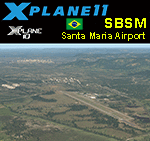
This is an X-Plane 11 and X-Plane 10 scenery package for Santa Maria Airport (IATA: RIA, ICAO: SBSM), which is the airport serving Santa Maria, Brazil. It is operated by the Brazilian Air Force. Some of its facilities are shared with the Santa Maria Air Force Base of the Brazilian Air Force. It includes corrected aprons, ramps, gates, taxiways, lighting system, city buildings, ortho-photoscenery for the airfield area, and (XP11 only) airport ground services (like push back). This scenery was tested and is operational (as of May 23, 2017) in "X-Plane 11.01 64 bit", Windows 10 Home. It was also tested and is also operational (as of May 23, 2017) in "X-Plane 10.51 64 bit", Windows 10 Home. Only the default X-Plane 11 libraries, by Laminar Research, are needed. No third party libraries are used.
| Filename: | BR_RS_SBSM__Santa_Maria_Airport_v100.zip |
| License: | Freeware |
| Added: | 24th May 2017, 04:29:04 |
| Downloads: | 84 |
| Author: | Rui Mesquita |
| Size: | 14.65 MB |
| Category: X-Plane - Scenery | |
| BR CE - SNQX Quixada Airport v1.0.0 |
|
Images related to this file:
File Description:
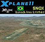
This is an X-Plane 11 and X-Plane 10 scenery package for Quixada Airport (ICAO: SNQX), which is the airport serving Quixada and "Area Q" region of Ceara, in Brazil. The "Area Q" regeon is a reference to the nearby towns of Quixadá, Quixeramobim, Quixelô, Quixeré e Quiterianópolis. It includes corrected aprons, ramps, gates, taxiways, lighting system, city buildings, ortho-photoscenery for the airfield area, and (XP11 only) airport ground services (like push back). This scenery was tested and is operational (as of May 30, 2017) in "X-Plane 11.02b1 64 bit", Windows 10 Home. It was also tested and is also operational (as of May 30, 2017) in "X-Plane 10.51 64 bit", Windows 10 Home. Only the default X-Plane 11 libraries, by Laminar Research, are needed. No third party libraries are used.
| Filename: | BR_CE__SNQX_Quixada_Airport_v100.zip |
| License: | Freeware |
| Added: | 30th May 2017, 15:25:46 |
| Downloads: | 65 |
| Author: | Rui Mesquita |
| Size: | 26.03 MB |
| Category: X-Plane - Scenery | |
| BR RR SJKQ - Caramambatai Monte Roraima v1.0.0 |
|
Images related to this file:
File Description:
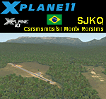
This is an X-Plane 11 and X-Plane 10 scenery package for Caramambatai Monte Rorraima Airport (ICAO: SJKQ, no IATA code) which is an airport serving Uiramuta, Roraima, Brazil, located in the vicinity of "Monte Rorraima" (or Mount Roraima), the highest of the Pakaraima chain of tepui plateaus in South America. It includes corrected aprons, ramps, gates, taxiways, lighting system, village buildings, ortho-photoscenery for the airfield area, and (XP11 only) airport ground services (like push back). This scenery was tested and is operational (as of April 15, 2017) in "X-Plane 11.00 RC #1 64 bit", Windows 10 Home. It was also tested and is also operational (as of April 15, 2017) in "X-Plane 10.51 64 bit", Windows 10 Home. Only the default X-Plane 11 libraries, by Laminar Research, are needed. No third party libraries are used.
| Filename: | BR_RR_SJKQ__Caramambatai_Monte_Roraima_v100.zip |
| License: | Freeware |
| Added: | 15th April 2017, 19:10:33 |
| Downloads: | 93 |
| Author: | Rui Mesquita |
| Size: | 14.71 MB |
| Category: X-Plane - Scenery | |
| BR SP SBSJ - Sao Jose dos Campos Embraer Airport v1.0.0 |
|
Images related to this file:
File Description:

This is an X-Plane 11 and X-Plane 10 scenery package for São José dos Campos-Professor Urbano Ernesto Stumpf Airport (IATA: SJK, ICAO: SBSJ), is the airport serving São José dos Campos, Brazil. It includes corrected aprons, ramps, gates, taxiways, lighting system, city buildings, ortho-photoscenery for the airfield area, and (XP11 only) airport ground services (like push back). Embraer main plant and headquarters is the main operator. This scenery was tested and is operational (as of March 18, 2017) in "X-Plane 11 Public Beta #15 64 bit", Windows 10 Home. It was also tested and is also operational (as of March 18, 2017) in "X-Plane 10.51 64 bit", Windows 10 Home. Only the default X-Plane 11 libraries, by Laminar Research, are needed. No third party libraries are used.
| Filename: | BR_SP_SBSJ__Sao_Jose_dos_Campos_Embraer_Airport_v1.zip |
| License: | Freeware |
| Added: | 19th March 2017, 08:13:08 |
| Downloads: | 111 |
| Author: | Rui Mesquita |
| Size: | 15.45 MB |
© 2001-2026 AVSIM Online
All Rights Reserved
Privacy Policy |