
Where Flight Simulation Enthusiasts Gather from Around the World!
AVSIM Library - Search Results

| Category: Flight Simulator 2004 - Scenery | |
| Alaska South Slope 5; Ambler PAFM |

|
Images related to this file:
File Description:
There are four main northwestern Alaska towns which are serviced by Alaska Airlines, and from which local flights spread out. The northernmost is Barrow. Southwest of Barrow is Kotzebue, then Nome, and the furthest south is Bethel (not yet made). This is a continuation of the series for the flights from Kotzebue, 130 miles to the east to Ambler on the bank of the Kobuk River. The next additions will be a few miles further east, Shungnak and Kobuk, and a small strip just to the north of Kobuk. Ambler is a small village (population now around 260) beside the Kobuk River, the river being the reason for the existance of the village as it served (and still does) as both a source of food and a transport route. The airfield is just north of the village, with two runways, each around 3,500 feet of lit gravel and aligned 36-18 and 09-27, with PAPI on 36. There are scheduled flights by Era (now renamed Ravn) and by Bering Air, both of them originating in Kotzebue and routing east to Ambler, Shungnak, Kobuk, and then back again. The AI includes these flights along with Everts Air and GA. There are revisions to Kotzbue to provide more parking.
| Filename: | Alaska_South_Slope_5_Ambler_PAFM.zip |
| License: | Freeware, limited distribution |
| Added: | 11th October 2016, 23:26:52 |
| Downloads: | 208 |
| Author: | Roger Wensley |
| Size: | 4.21 MB |
| Category: Flight Simulator X - Scenery | |
| RNAS Twatt (HMS Tern) |
|
File Description:
Opened on the 1 April 1941 RNAS (HMS Tern) was used throughout the second world war by various Sqns of the Royal Navy undergoing training.
The station had 4 concrete runways with various hangers and the usual building associated with a military base. It was also the first unit in the UK to experience a helicopter crash when a Sikorsky helicopter getting ready for take off; hit a parked Blenheim.
The UK and Iceland where involved in what was called the cod wars in the early 1970s, and NATO was concerned that it would have to remove its bases from Iceland should the dispute escalate between the 2 countries and there was talk of Twatt becoming a NATO base. However, this did not happen and the idea was dropped.
There was also talk of the unit becoming a base for helicopters supporting the oil industry, however, as a result of the drop in oil prices during the 80s that idea was also dropped.
Most of the airfield has been returned to farming now with only the unique Control Tower and a handful of other building remaining.
NB: For more detailed history of this unit go to:-
https://canmore.org.uk/site/81752/twatt-airfield
| Filename: | RNAS_Twatt_HMS_Tern.zip |
| License: | Freeware |
| Added: | 30th January 2017, 02:56:37 |
| Downloads: | 144 |
| Author: | Terry Boissel |
| Size: | 18.84 MB |
| Category: Flight Simulator 2004 - AFCAD Files | |
| Los Angeles International KLAX for Simflyer 2004 |
|
File Description:
This should be the best AFCAD you can find for this scenery. I have spent many hours trying to make this perfect. I have used a number of materials to make it correct, I even used aerial photos. The AFCAD uses the correct runways unlike the default airport that Microsft provides. I have done my best to test every part of this AFCAD. I even added a gate to the international terminal that the Simflyer developers left out. Keep in mind that there may still be flaws. There is runway 25L for landing and 25R for take-off. Then runway 24L for take-off and 24R for landings. I think it will be difficult for someone to fill all the spots at this airport. There are a ton of cargo spots that are the hardest to fill due to the fact that not many people make cargo flightplans. I am sorry if you download my other file for 2004, it was incorrect. Please ignore it, this is the real thing. If any of you have try my RAFCAD for 2002 in the past then you'll love this one even more. I will keep perfecting this file so it will be as real as possible.
| Filename: | Los_Angeles_International_KLAX_for_Simflyer_2004.zip |
| License: | Freeware |
| Added: | 24th November 2003, 04:43:31 |
| Downloads: | 2,346 |
| Author: | Aaron Ricchio |
| Size: | 25.78 KB |
| Category: Flight Simulator 2004 - Scenery | |
| CYQU - Grande Prairie, Alberta, Canada |
|
Images related to this file:
File Description:
Grande Prairie is at 2,195 feet asl, 65 miles southeast of Dawsons Creek, 90 miles southwest of Peace River and around 60 miles east of the Rockies. The town has a population of 55,000 and growing. The airport is just to the west of the town and was originally a military base, built during WW2. The two runways are 07-25 and 11-29 and when one is the active runway then the other is used as a taxiway. AI in FS9 doesn't like this, and just stops at the first hold short without ever reaching the active runway. I have found a way to overcome this and AI will now use taxiway A and whichever runway is inactive to feed to and from both ends of the active runway. The vertical red tanks are for de-icing fluid; de-icing is carried out before take-off in the winter. The industrial area to the southeast is now larger than I have made it, but I kept it to this minimum size to keep frame rates down. All the buildings are modeled specifically for CYQU. The AI includes Westjet, Air Canada Jazz, and others as listed. The GA AI uses only FS9 standard aircraft.
| Filename: | CYQU__Grande_Prairie_Alberta_Canada.zip |
| License: | Freeware, limited distribution |
| Added: | 9th May 2014, 10:05:40 |
| Downloads: | 673 |
| Author: | Roger Wensley |
| Size: | 18.33 MB |
| Category: Flight Simulator 2004 - Scenery | |
| El Dorado International Airport (SKBO) 2011 |
|
File Description:
El Dorado International Airport (IATA: BOG, ICAO: SKBO) is an international airport located in Bogota, Colombia. It is the largest Latin America airport in terms of cargo movements with 593,946 tons (2010) and the third in terms of
passenger traffic, only behind Sao Paulo-Guarulhos International Airport and Mexico City's Benito Juarez International Airport, transporting 18,934,203 passengers in 2010; as well as the largest airport in Colombia and the main
international and domestic air gateway in the country, serving as an important hub for Avianca, Copa Airlines Colombia, Aires, Satena, EasyFly and other cargo companies.
This file has the right coordinates, with the apron and characteristics of the airport. The runways were reoriented to the correct direction, runway were re-sized the gates placed on correct location and number, CATAM was placed
(Colombian Air force and Colombian National Army) and Colombia National Police and Colombian National Armada were assigned a correct apron. All the jet ways including the ones of the executive terminal are working. There is a copy
of all the airport charts required to navigate in and out of this airport which are courtesy of: Areonatica Civil de Colombia and the originals can be found at www.aerocivil.gov.co/ under Informacion Aeronautica click AIP; on AIP
click Aerodromos then click at SKBO.
| Filename: | El_Dorado_International_Airport_SKBO_2011.zip |
| License: | Freeware |
| Added: | 31st August 2011, 06:46:21 |
| Downloads: | 4,540 |
| Author: | Anwar Gonzalez |
| Size: | 14.34 MB |
| Category: Flight Simulator 2004 - Scenery | |
| Watson Lake CYQH and CEJ9 in the Yukon Territories, Canada |
|
Images related to this file:
File Description:
Watson Lake is at 2,200 feet asl on the east side of the Rockies, in the Yukon Territories. The town is less than five miles north of the border with BC and is built around Wye Lake, just a few miles southeast of the much larger Watson Lake. Whitehorse is some 200 miles to the west, and Fort Nelson 220 miles to the east. The airport was built during WW2 and there remains one surviving original hangar, along with later additions. Unusually, the town of Watson Lake came into being because of the airport's existence, though with the closure of one mine that the airport used to serve and the serial closure of another (closed four times?) both the airport and the town (population 500) are in a downward spiral. The airport is 5 miles to the west of the town. There were two runways, but one is now closed and the remaining one is 08-26, 5,500 feet and 150 feet wide. There are two aprons, the northern one being half-used by CL 415 fire-fighting planes (included in the AI, along with Central Mountain Air). All the buildings for CYQH are modeled specifically, but the CJE9 shed is a guess.
| Filename: | Watson_Lake_CYQH_and_CEJ9_in_the_Yukon_Territories.zip |
| License: | Freeware, limited distribution |
| Added: | 14th July 2014, 21:38:57 |
| Downloads: | 446 |
| Author: | Roger Wensley |
| Size: | 17.6 MB |
| Category: Flight Simulator 2004 - Scenery | |
| KCMH - Port Columbus International - Columbus, Ohio, USA |
|
Images related to this file:
File Description:
Port Columbus International Airport in Columbus, Ohio, is a gem of an airport for aviation buffs. It first opened in 1929 at a site chosen by Chales Lindbergh, as part of an air-rail route from New York to Los Angeles. The original terminal building has been restored and is now used for office space. Two of the original three hangers are still in use (I included the third hanger in the scenery). The six hanger Lane Aviation FBO was added in 1935 and has been in operation these 78 years. In 1959 the modern terminal was first built, with additions and renovations to follow. Netjets opened their facilities in 2001. With the exception of the runways, this version of KCMH was built entirely from scratch. This is the first large airport I've done in which all buildings on the field (except for the control tower) are custom made and partly or fully photo textured. I've also made more use of ground photo textures. Many hours went into the creation of Port Columbus International Airport for FS9. I hope you enjoy it. My thanks to Wil Morgan of FRAME-RATE-FRIENDLY Studio (WWW.FRFSTUDIO.NET) for the AI aircraft parking assignments and general testing. The vintage TWA textures for the DC3's are by Dale De Luca.
| Filename: | KCMH__Port_Columbus_International__Columbus_Ohio_U.zip |
| License: | Freeware |
| Added: | 11th June 2013, 22:51:45 |
| Downloads: | 2,814 |
| Author: | Sidney Schwartz |
| Size: | 17.74 MB |
| Category: Flight Simulator 2004 - Scenery | |
| HCMI Berbera, Somalia |
|
Images related to this file:
File Description:
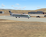
Googly scenery for HCMI Berbera, Somalia - an airport largely overlooked in
Flight Simulator 2004 with just a runway and tower provided at what is actually
the country's largest airport. At one time it had two active runways and a
strong military presence but today activity is limited to occasional
civilian flights. These scenery files add taxiways, aprons, buildings and
other airport features (and remove the non-existent tower that Microsoft
put there) so that you and your "AI" traffic can land, taxi, park and take
off in a realistic manner. This desert-surrounded airport is served three times per week by Douglas DC-9 jets of Kenyan airline African Express Airways.
The scenery does not purport to be ultra-accurate. Based on high-detail satellite
imagery from Google Earth, the layout is proportionally correct but the added
airport features, such as buildings, are built from default Microsoft objects
and add-on libraries so will not look like the real thing.
You are not obliged to download and install any additional scenery libraries,
but to enjoy this scenery in its entirety, you may wish to. It will work fine,
with or without. [File re-uploaded at request of AVSIM]
| Filename: | HCMI_Berbera_Somalia.zip |
| License: | Freeware |
| Added: | 29th May 2010, 09:26:33 |
| Downloads: | 1,319 |
| Author: | John Hinson |
| Size: | 62.07 KB |
| Category: Flight Simulator X - Scenery | |
| KDEN - Denver, Colorado International Airport |
|
Images related to this file:
File Description:
Denver Colorado International Airport For FSX. Several improvements have been made to the default airport, those being:
1. A United Airlines commuter terminal has been added to Concourse B along with custom made jetways complete with the United Airlines logo (these jetways are NOT animated).
2. All jetways and scenery objects will display as long as scenery complexity in FSX is set at normal or higher.
3. The vehicle paths have been redesigned so as not to allow airport vehicles to enter taxiways
4. Optionally, all runways may be opened for AI traffic.
5. The land class has been changed in places so as to prevent autogen objects from displaying on the airport grounds.
6. The tower view has been changed to display from the roof of the control tower.
7. Extra fuel trucks have been added throughout the airport.
8. All gates are accurately portrayed.
9. All taxiways are included and are accurately named, and taxiway signs are accurately placed.
Also, there is an option to place several static United Airlines and Southwest Airlines aircraft in designated spots.
This is an improved version of the airport which I first did in 2007.
Please refer to the README FIRST.txt file for important information
| Filename: | KDEN__Denver_Colorado_International_Airport.zip |
| License: | Freeware, limited distribution |
| Added: | 5th January 2014, 23:51:59 |
| Downloads: | 3,490 |
| Author: | Patrick Finch |
| Size: | 2.57 MB |
| Category: Flight Simulator X - Scenery | |
| Ireland VFR Small Airports Part 2 |
|
Images related to this file:
File Description:
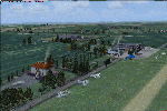
Ireland VFR Small Airports Part 2.
This scenery consists of EIME Casement Aerodrome, EIWT Weston Executive Airport and EIKH Kilrush Airfield. Casement and Weston are within 8nm of Dublin International whilst Kilrush lies approximately 30miles to the south west.
EIME's main runway 11/29 is 1,829m (6,001feet) in length and has handled the largest of heavies. Weston caters for small executive jets, GA and helicopters. Kilrush is a small private airstrip with grass and paved runways.
The scenery has been created almost entirely from real photographs and features many open hangers with internal textures. Each airport features a full panoramic view from inside the tower, sound, lighting, and smoke effects, together with animations, high definition people and military personnel. Full night lighting with wash lighting of the aprons is included. The scenery can be used as a standalone, however it also uses many objects from my Ireland VFR Small Airports Part 1. It has been tested with FSXA only and is designed to complement vfr photographic scenery. It will also work with the default terrain and I have included a set of photoreal textures with night masks. Full installation instructions are included in the Readme file. I hope you enjoy using the airports as much as I enjoyed making them.
| Filename: | Ireland_VFR_Small_Airports_Part_2.zip |
| License: | Freeware, limited distribution |
| Added: | 15th February 2012, 04:35:57 |
| Downloads: | 4,354 |
| Author: | George Keogh |
| Size: | 86.1 MB |


© 2001-2026 AVSIM Online
All Rights Reserved
Privacy Policy |