
Where Flight Simulation Enthusiasts Gather from Around the World!
AVSIM Library - Search Results

| Category: Flight Simulator X - AFCAD Files | |
| LGRX - Araxos Airforce Base, Greece |

|
File Description:
LGRX - Araxos AB is a large Hellenic Airforce base located near Araxos Cape, Achaea Prefecture and serves the city of Patras as well as the western part of the Peloponese region. It is the home of the 116 Combat Wing. It is used by a few civilian airlines, mainly for the tourist industry.
The stock airport shows three runways in use, however in reality only one runway is currently used the centre runway is now the main taxiway.
I have added the civilian apron and terminal buildings and various buildings and hangers throughout the base, all are Generic Buildings. Parking for Military and Civilian use, a cargo ramp and lots of trees. As usual I used the fantastic ADE (Airport Design Editor) to design this airport but you should download the great lights package by Jim Dhaenens as I have used some of his Apron Lights. I have provided ILS in one version for simmers who like to fly with it, although there is no ILS at Araxos.
| Filename: | LGRX__Araxos_Airforce_Base_Greece.zip |
| License: | Freeware |
| Added: | 1st July 2013, 18:04:18 |
| Downloads: | 624 |
| Author: | Mike Major |
| Size: | 31.04 KB |
| Category: Flight Simulator 2004 - Scenery | |
| Little Port Walter for Holger Sandmann's Tongass Fjords scenery |
|
Images related to this file:
File Description:
This is a second fish farm at the southern end of Baranof Island and Chatham Strait in southern Alaska. Big Port Walter is named on the chart of the area, and there is a section of the chart included here. Little Port Walter is a much smaller offshoot bay, sheltered from the weather and ideal for a fish farm. This scenery is designed specifically for use in the Tongass Fjord scenery. I may have incorrectly identified Tongass Fjords as being required for Hawk Logging when Glacier Bay is needed. Ah well, it is one or the other of them. The fish farm (or hatchery, the description varies) has an identifying code so it will show up on a gps as PWL. There is no interaction with atc as there are no designated water runways, so PWL on the gps just acts as a waypoint. There will be further posts for use with Tongass Fjords, Misty Fjords, and Glacier Bay, and I still find these scenery areas by Holger and his crew the most satisfying in FS9.
| Filename: | Little_Port_Walter_for_Holger_Sandmanns_Tongass_Fj.zip |
| License: | Freeware, limited distribution |
| Added: | 23rd November 2014, 01:33:12 |
| Downloads: | 235 |
| Author: | Roger Wensley |
| Size: | 3.38 MB |
| Category: Flight Simulator 2004 - Scenery | |
| PASY - Shemya (Eareckson Air Station) - Alaska, USA |
|
Images related to this file:
File Description:
Shemya is pretty well AT the western end of the Aleutian chain of islands in Alaska, around 240 miles west of Amchitka. There is no town on Shemya and the whole island is occupied (and owned) by the Air Force. There are three runways, two of which are from the 1940's and are now unused; in fact one of them has been partly ploughed up and also used for outdoor storage. The single in-use runway is aligned 10-28 and is 10,000 feet of 150 feet wide asphalt with an ils on 28, the runway that is used 99% of the time. The base is now not active but is maintained as a refuelling facility, so for landing and takeoff purposes it is open. The older and now unused areas are those where the hangers are slowly rusting away and the asphalt is turning green with encroaching and well-watered wildlife plants. The tower is now closed, so there is no atc and you just announce your intentions. Read the history of Shemya, a lot happened there.
| Filename: | PASY__Shemya_Eareckson_Air_Station__Alaska_USA.zip |
| License: | Freeware, limited distribution |
| Added: | 18th February 2015, 19:52:36 |
| Downloads: | 453 |
| Author: | Roger Wensley |
| Size: | 8.81 MB |
| Category: Navigation and ATC - Navigation | |
| LSZS - Samedan visual approach chart v3 |
|
Images related to this file:
File Description:
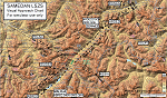
Custom made visual approach chart and pilot's briefing for Engadin (St. Moritz) Samedan LSZS airport in Switzerland, Europe's highest elevation airport (5,600 ft.) situated in the Swiss Alps. This airport is a day VFR operations only and has no instrument approach due to extreme terrain around it. A demanding visual descent into a canyon, in between steep rising terrain, is required to make the visual approaches for both runways with a steep 4.4* degrees final approach portion guided by the PAPI's. Still, executive jets up to Boeing 737(BBJ) size approach the airport often in the winter peak season VFR with these procedures. It is designed as per real operators' pilot briefing for Samedan. Real airport's full pilot briefing document also included. The real airport's excellent briefing (included) intentionally does not contain the maneuvers needed for the approach of jets through the mountains but only reporting points for all and maneuvers for light aircraft only. This gap is what this chart covers. Version 2 chart included better graphics and refined visual procedure for jets and version 3 now includes real pilot's briefing guide.
| Filename: | LSZS__Samedan_visual_approach_chart_v3.zip |
| License: | Freeware, limited distribution |
| Added: | 20th March 2015, 23:35:11 |
| Downloads: | 2,026 |
| Author: | Kyprianos Biris |
| Size: | 7.1 MB |
| Category: Flight Simulator X - Scenery | |
| Steeple Morden |
|
File Description:
This FSX scenery package is for Former RAF Steeple Morden, USAAF Station No. 122. It includes the main airfield and 14 of the outlying sites
that housed all of the inhabitants. Built in 1940 , originally a grass satellite field of Bassingbourn, Steeple Morden first accommodated the RAF No. 11 and No. 17 OTU (Operational Training Unit), flying Vickers Wellingtons and Bristol Blenheims respectively. The RAF used the airfield from 1940 to July 9th of 1943.
In July of 1943, the RAF turned the base over to the 355th Fighter Group of the 8th USAAF and concrete runways and hard stands were added.
The 355th were famous for destroying more enemy aircraft on the ground than any other unit in the USAAF.
They were dubbed, "The Steeple Morden Strafers" and were comprised of the 354th (WR), 357th (OS) and 358th (YF) Fighter Squadrons.
Study of the site plans and other information revealed that RAF Steeple Morden was very much interwoven with the village of Litlington, Cambridgeshire .
The base may have well be called RAF Litlington instead of Steeple Morden.
| Filename: | Steeple_Morden.zip |
| License: | Freeware |
| Added: | 25th June 2016, 23:51:18 |
| Downloads: | 336 |
| Author: | Terry Flemming |
| Size: | 83.9 MB |
| Category: Flight Simulator 2004 - Scenery | |
| Alaska South Slope 4; Selawik PASK |
|
Images related to this file:
File Description:
There are four main northwestern Alaska towns which are serviced by Alaska Airlines, and from which local flights spread out. The northernmost is Barrow. Southwest of Barrow is Kotzebue, then Nome, and the furthest south is Bethel. This series is for the flights from and around Kotzebue, mostly on the South Slope of the Brooks Range of mountains. There will be further additions. Selawik is a village (population now around 760) around 75 miles east of Kotzebue on three of the delta islands of the Selawik River where it flows into Selawik Lake. The delta forms part of the Selawik National Wildlife Refuge for migratory birds. The airfield is just next to the village, with two runways, 3,450 feet of lit gravel aligned 03-21 and 3,100 feet of gravel aligned 09-27. There are scheduled flights by Era (now renamed Ravn) and by Bering Air, both of them originating in Kotzebue and routing east to Noorvik, Kiana, Selawik, etc, and then back again. The AI includes these flights along with Everts Air and GA.
| Filename: | Alaska_South_Slope_4_Selawik_PASK.zip |
| License: | Freeware, limited distribution |
| Added: | 9th October 2016, 04:17:52 |
| Downloads: | 214 |
| Author: | Roger Wensley |
| Size: | 4.34 MB |
| Category: Flight Simulator 2004 - Scenery | |
| Howick Airfield (FAHC), South Africa |
|
Images related to this file:
File Description:
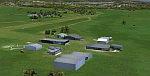
This package will add a custom (Gmax) made Howick Airfield (FAHC), KwaZulu Natal, South Africa with photoreal textures and seasonal ground textures.
Howick is a small town in the KwaZulu Natal Midlands just off the N3 freeway which connects Johannesburg and Durban and home to the famous Howick waterfall. The Umgeni river falls 95m (311 ft) over the cliffs on the way to the Indian Ocean. The town is also home to the Midmar dam. This dam is very well known as being the location of the annual Midmar Mile swimming event which, in 2009, was recognized by the Guinness Book of World Records as the world's largest open water swimming event with 13 755 competitors taking part.
The sloped grass runway is aligned 16/34 and 825m long and sits at an elevation of 3 615ft. Both runways have obstacles on the approach, with powerlines 730m from the threshold of runway 16, while runway 34's approach have hills around 900m before the threshold. The sloped runway has been created in FS2004 within the limits of the simulator itself.
| Filename: | Howick_Airfield_FAHC_South_Africa.zip |
| License: | Freeware, limited distribution |
| Added: | 15th January 2021, 20:25:51 |
| Downloads: | 205 |
| Author: | Kobus van Wyk |
| Size: | 7.67 MB |
| Category: Flight Simulator 2004 - Miscellaneous Files | |
| Active ILS - KMCO (Orlando International Airport) |
|
File Description:
This is the 3rd Airport in a series of new ILS runways. As most know initiating the ILS at certain airports for AI Traffic is not a function at this time when using AFCAD2. If you add a new ILS runway to an airport such as KMCO (Orlando International Airport 17L/35R) only the user aircraft can use this runway when visibility falls below 3 miles. ATC will no longer use this runway for AI Traffic because FS9 sees it as a visual runway. This will cause ATC to vector your AI Traffic back to 17/35 (old numbers) 17R/35L (new numbers) which is also a Terminal departure runway. This file adds all NAVAIDS for making 17L/35R a Precision Instrument Runway. I have added all the radar fixes for both the ILS approach portion and the proper missed approach procedures, altitudes and intersections as per current published plates. All AI Aircraft will now continue to use 17L/35R when Airport visual conditions are less than 3 miles.
| Filename: | Active_ILS__KMCO_Orlando_International_Airport.zip |
| License: | Freeware, limited distribution |
| Added: | 25th June 2004, 01:50:15 |
| Downloads: | 3,846 |
| Author: | Jim Vile |
| Size: | 45.38 KB |
| Category: Flight Simulator 2004 - Miscellaneous Files | |
| Active ILS - KIAH v2.0 |
|
File Description:
UPDATED KIAH see the readme file -- By design KIAH is now another Airport that features advanced ATC control. As most know initiating the ILS at certain airports for AI Traffic is not a function at this time when using AFCAD2. If you add a new ILS runway to an airport such as KIAH (8L/26R) only the user aircraft can use this runway when visibility falls below 3 miles. ATC will no longer use this runway for AI Traffic because FS9 sees it as a visual runway. This will cause ATC to vector your AI Traffic back to 8/26 (old numbers) 8R/26L (new numbers) which is also a Terminal Departure Runway. All 5 runways for KIAH are now simultaneously active for departure and arrival. There are many additional options added to version 2.0 so follow the instructions in the README and just sit back (or fly) and plane spot either VMC or IMC for a very active airport. *** SimFlyers Scenery AFCAD2 and special ILS bgl also included ***
| Filename: | Active_ILS__KIAH_v20.zip |
| License: | Freeware, limited distribution |
| Added: | 26th August 2004, 02:23:19 |
| Downloads: | 2,720 |
| Author: | Jim Vile |
| Size: | 81.21 KB |
| Category: Flight Simulator X - Scenery Design | |
| "Gerald R. Ford Intl "KGRR" FSX" |
|
Images related to this file:
File Description:
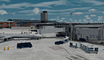
Microsoft Flight Simulator X Welcome to A "Fully Modeled" Gerald R. Ford International Airport (KGRR) for FSX.
All 3D Buildings including Runways, Taxiways and Photoreal, Even to the the smallest detail is custom hand made, through blender modeling tool.AI Traffic including Airport vehicles Work Perfectly. All Scenery is original work, This was a 3 year Long project, and was finally finished on 2021 of June. Main Features to this scenery is Custom 3D Building, Custom Seasonal Photoreal, Custom Fully modeled Airport, Custom Parked Static Vehicles throughout the airport, Custom Fences, Custom Runway and Taxiways, Working Ai Traffic, Custom small Detail and so much more...
Note to have it fully functional, GSX level 2 is Required to Power the Jetways, there's also a option to have static jetways, if you don't have GSX.
Please Don't Modify, Change, or Re-upload, Reuse 3d objects or Textures. The airport is intended to be Freeware. This is a Cheer-Up Gift to all Simulation Aviation community Pilots. Please enjoy! Fly lots "Keep-Climbing "Please Share the news of this Airport being released Thankyou.
| Filename: | Gerald_R_Ford_Intl_KGRR_FSX.zip |
| License: | Freeware, limited distribution |
| Added: | 7th July 2021, 15:35:39 |
| Downloads: | 984 |
| Author: | Dillon Rocque |
| Size: | 393.6 MB |


© 2001-2026 AVSIM Online
All Rights Reserved
Privacy Policy |