
Where Flight Simulation Enthusiasts Gather from Around the World!
AVSIM Library - Search Results

| Category: Flight Simulator X - Scenery | |
| Singapore Changi - WSSS Package |

|
File Description:
This Airport package is being released in conjunction with the release of the ADE Design Utility (Airport Design Editor) to illustrate the power and design capabilities of the newest Version 1.40.
The main airport in my Scenery is the Singapore Changi WSSS Airport. I also included the additional Changi RSAF (Military) Airport. Changi RSAF (WSAC) is the 3rd runway at Singapore and is used by the Singapore Military. Even though it is runway 02R/20L for Singapore it is not attached to WSSS.
New Approach/Transitions have been added using the ADE Approach Editor Tool and both airports are up to date including all Terminal_Waypoints for SID Departures and Terminal Arrival Transitions to the ILS runways. Many Scenery features have also been added at each of the Airports. Optional files that add static aircraft to the EXPO area of WSAC and Freeway Vehicle Traffic for all the Freeway/MotorWays. Read the included Readme txt file for the added enhancements.
| Filename: | Singapore_Changi__WSSS_Package.zip |
| License: | Freeware, limited distribution |
| Added: | 3rd April 2009, 19:14:37 |
| Downloads: | 25,016 |
| Author: | Jim Vile |
| Size: | 580.61 KB |
| Category: Flight Simulator 2004 - Scenery | |
| CYYN Swift Current Municipal Airport |
|
File Description:
Swift Current Municipal airport is situated approximately 8 km east of the City of Swift Current. It is one of those tiny airports where the default flightsim scenery has no resemblance to the real world airport. CYYN was constructed using GMAX and represents the airport as it was in the Summer of 2007. It includes nearly all the buildings at the airport, runway signs, the addition of fencing, and a rotating beacon. CYYN also includes a landclass file to better represent the terrain around the airport, at least as far as the limits of the default landscape will allow. The airport has a long history, being built in 1937, as one of the hundred-mile airports on the Trans Canada airway. It was greatly expanded as an RCAF / RAF station during world war II. Many of the wartime structures still exist but many are in poor shape. Two of the original three runways remain in service. The airfield is often used by 15 Wing aircraft of CFB Moose Jaw to practice approaches.
| Filename: | CYYN_Swift_Current_Municipal_Airport.zip |
| License: | Freeware |
| Added: | 30th August 2008, 03:25:36 |
| Downloads: | 1,346 |
| Author: | Gregory Putz |
| Size: | 5.28 MB |
| Category: Flight Simulator 2004 - Scenery | |
| Sioux Lookout CYXL in northwest Ontario Canada |
|
File Description:
Sioux Lookout is a small town of some 5,000 folks in northwest Ontario, towards the Manitoba border, and a regional centre for surrounding villages. The airfield is some two miles east of the town. It originally had two runways but the smaller was abandoned recently as part of a planned long term improvement of the field, leaving just 34/16 with its 5,300 feeet of asphalt. Both Wasaya and Bearskin fly to Sioux Lookout; on the field there are two maintenance companies, Eagle and Allen, and hangers for the Ministry of Health, Bearskin Airlines, Wasaya, and the Nishnawbe Aski Police Service (NAPS). I think there is now another company too, but I have no information on them so I pretended this was two years ago. As well as the airfield scenery there is also a landclass file an "AFCAD" file for your AI aircraft. You should also download and install Northwest Ontario Airports by Eric O'Link, and preferably also have Ultimate Terrain; I have not tested this without UT and there is a small lake nearby.
| Filename: | Sioux_Lookout_CYXL_in_northwest_Ontario_Canada.zip |
| License: | Freeware |
| Added: | 26th November 2008, 13:08:04 |
| Downloads: | 853 |
| Author: | Roger Wensley |
| Size: | 2.66 MB |
| Category: Flight Simulator 2004 - Scenery | |
| DTTR El Borma, Tunisia |
|
File Description:
Googly scenery for El Borma (ICAO: DTTR, IATA: EBM), a small airport with a
long runway deep in the Tunisian desert near the Algerian border. El Borma,
also known as Al Borma or Al Burmah is one of Tunisia's top onshore oil and
natural gas sources and it is this that probably justifies the twice-weekly
flights operated by ATR turboprops of Sevenair.
Microsoft have only provided runways at this airport in Flight Simulator
2004 and this scenery seeks to redress the situation so that you and your
"AI" traffic can use the airport realistically.
The scenery does not purport to be ultra-accurate. Based on high quality
satellite imagery from Google Earth, the layout is proportionally correct but the
added airport features, such as buildings, are built from default Microsoft objects
and add-on libraries so will not look exactly like the real thing.
You are not obliged to download and install any additional scenery libraries,
but to enjoy this scenery in its entirety, you may wish to. It will work fine,
with or without.
| Filename: | DTTR_El_Borma_Tunisia.zip |
| License: | Freeware |
| Added: | 17th December 2008, 16:49:15 |
| Downloads: | 1,028 |
| Author: | John Hinson |
| Size: | 58.32 KB |
| Category: Flight Simulator X - AFCAD Files | |
| CYxs Prince Geroge - British Columbia, Canada |
|
File Description:
I have completely reconstructed CYXS using ADE (v1.40), Google Earth satellite images and current airport chart. Runways have been repositioned and runway 15/33 extended from 7400 ft to 11450 ft. ILS has been added to runway 33. Roads, parking areas and new buildings added. Aprons readjusted. Automated jetways added. Parking for AI aircraft and refueling truck added. Additional scenery objects have been added and to view these will require you to install additional files as described below. Airport views are from the roof of the control tower.
Latest News: YXS - The New Transpacific Logisitics Alternative
The Runway Expansion Project has transformed runway 15/33 from 7,400 ft. to 11,450 ft., complete with centre line (LED) lighting, dual ILS navigational systems and a dedicated de-icing refueling pad for wide body aircraft. Once completed, the Runway Expansion Project will allow the PGAA to market the airport as a new transpacific logistics alternative, providing carriers the opportunity to make Prince George a destination of choice for refueling and transshipment of cargo
| Filename: | CYxs_Prince_Geroge__British_Columbia_Canada.zip |
| License: | Freeware |
| Added: | 5th November 2009, 02:16:13 |
| Downloads: | 748 |
| Author: | Robert Catherall |
| Size: | 878.39 KB |
| Category: Flight Simulator 2004 - Scenery | |
| Terrace CYXT in British Columbia, Canada - REVISED |
|
Images related to this file:
File Description:
This version includes the correct Piper Cub texture, unreported by all but one downloader (why?).
Terrace is fifteen miles east and inland from Prince Rupert, which is 500 miles north of Vancouver up the BC coast. It is at the point in the mountains where two fjords meet, one coming from Prince Rupert and the other from Kitimat. The airport is a couple of miles south of the town and on the south side of the Skeene River. There are two runways, and the main one is a recently-extended 7,500 feet long and lighted 33/15. The second is 5,373 feet of unlit 03/21. The apron has been enlarged to be able to accommodate a Boeing 737 so I have parked an Air Canada jet there, but the pics show the planes that do fly to Terrace, and these are Air Canada and Hawk Air Dash 8-300's. The original aircraft and the textures are down-loadable and and can be used for AI.
| Filename: | Terrace_CYXT_in_British_Columbia_Canada__REVISED.zip |
| License: | Freeware, limited distribution |
| Added: | 21st February 2010, 16:25:38 |
| Downloads: | 1,113 |
| Author: | Roger Wensley |
| Size: | 3.39 MB |
| Category: Flight Simulator 2004 - AFCAD Files | |
| Newark Liberty Int'l Airport (KEWR) with active Crosswind Runway |
|
Images related to this file:
File Description:
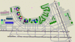
A high spec AFCAD2 for the FS2004 Newark Liberty Int'l Airport (KEWR) scenery by Steve Whalin. This afcad has been built using FAA Charts and information from the Airport Website. All taxiways are named and all aprons are reworked to be as real as possible according to photos. All gates are named as per real life and have airlines assigned to them. The Fedex and UPS aprons are represented and can accomodate many cargo aircraft. The final addition is random GA parking and the CO maintenance area to the north of the airport. Overflow parking is also available for rush hour periods (Ball Park). This airport features a tower view and also night and approach lighting. Finally, by using the crosswind runway technique, runways 04L/22R, 04R/22L and 11/29 can all be used simultaniously for take-off and landing. Runway 11/29 will be mainly used by CO Express flights. Enjoy!!
This afcad works with the Steve Whalin scenery only (Requires: kewr.zip).
| Filename: | Newark_Liberty_Intl_Airport_KEWR_with_active_Cross.zip |
| License: | Freeware |
| Added: | 2nd March 2010, 19:26:13 |
| Downloads: | 1,356 |
| Author: | Lee Brompton |
| Size: | 259.8 KB |
| Category: Flight Simulator 2004 - Scenery | |
| OPDB Dalbandin, Pakistan |
|
Images related to this file:
File Description:
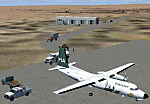
Googly scenery for OPDB Dalbandin, Pakistan - a quiet domestic airport for
which no operational facilities are provided in Flight Simulator 2004. These
scenery files add/correct the runways, apron, taxiways, buildings and other
airport features so that you and your "AI" traffic can land, taxi, park
and take off in a realistic manner.
The airport appears to be served all of once per week by ATRs of Pakistan
International Airways so will hardly buzz with activity, but you will be
assured of a friendly welcome when you arrive.
The scenery does not purport to be ultra-accurate. Based on high-detail satellite
imagery from Google Earth, the layout is proportionally correct but the added
airport features, such as buildings, are built from default Microsoft objects
and add-on libraries so will not look like the real thing.
You are not obliged to download and install any additional scenery libraries,
but to enjoy this scenery in its entirety, you may wish to. It will work fine,
with or without.
[File re-uploaded at the request of AVSIM]
| Filename: | OPDB_Dalbandin_Pakistan.zip |
| License: | Freeware |
| Added: | 5th May 2010, 22:32:37 |
| Downloads: | 1,017 |
| Author: | John Hinson |
| Size: | 65.99 KB |
| Category: Flight Simulator 2004 - Scenery | |
| Terrace CYXT in BC Canada Updated |
|
Images related to this file:
File Description:
This version of Terrace has night textures that work, good news for the 319 downloaders who did not tell the author that the ones already posted did not work. Why? Terrace is fifteen miles east and inland from Prince Rupert, which is 500 miles north of Vancouver up the BC coast. It is at the point in the mountains where two fjords meet, one coming from Prince Rupert and the other from Kitimat. There are two runways, the main one is a recently-extended 7,500 feet long and lighted 33/15 and the second is 5,373 feet of unlit 03/21. The apron has been enlarged to be able to accomodate a Boeing 737; though I don't think there is an airline using a 737 for flights to Terrace I have parked an Air Canada jet and the pics show the planes that do fly to Terrace, Air Canada and Hawk Air Dash 8-300's. The aircraft and the textures are down-loadable and and can be used for AI.
| Filename: | Terrace_CYXT_in_BC_Canada_Updated.zip |
| License: | Freeware, limited distribution |
| Added: | 3rd July 2010, 03:28:31 |
| Downloads: | 1,068 |
| Author: | Roger Wensley |
| Size: | 3.72 MB |
| Category: Flight Simulator X - AFCAD Files | |
| EHAM - Amsterdam Airport Schiphol - Amsterdam, The Netherlands |
|
Images related to this file:
File Description:
Amsterdam Airport Schiphol is the Netherlands' main international airport, located 20 minutes (9.1 km; 5.6 mi) southwest of Amsterdam, in the municipality of Haarlemmermeer.
The airport is the primary hub for KLM as well as for Arkefly, Corendon Dutch Airlines, Martinair and Transavia. The airport also serves as a European hub for Delta Air Lines and as a base for Vueling. Schiphol is considered to be an Airport City.
Using ADEx 1.50, aeronautical maps and Google Earth the default AFCAD has been completely reworked to reflect today's situation including gate assignments.
Schiphol has a complex runway lay-out and usage and FSX may assign a runway that in real life is not used as such. I have implemented Jim Vile's crosswind runway technique to open all runways. Now the pilot can decide which runway to use but AI aircraft may show unrealistic behaviour. Only tailored AFCADs taking into account different wind directions will solve this but that is beyond the scope of this project.
Jetways appear based on your 'scenery complexity' settings.
| Filename: | EHAM__Amsterdam_Airport_Schiphol__Amsterdam_The_Ne.zip |
| License: | Freeware |
| Added: | 2nd November 2012, 19:54:24 |
| Downloads: | 2,202 |
| Author: | Menno C. Robert |
| Size: | 3.86 MB |


© 2001-2026 AVSIM Online
All Rights Reserved
Privacy Policy |