
Where Flight Simulation Enthusiasts Gather from Around the World!
AVSIM Library - Search Results

| Category: Flight Simulator X - Scenery | |
| Mesh South America / MeSA B08 |

|
File Description:
FSX Mesh South America Project:
This terrain mesh file is a part of a whole project covering all the Continent of South America and some islands, divided in tiles identified in a map by its column (letters) and rows (numbers).
Those files were multi-LOD compiled from 90m SRTM2 source data, reprocessed with 3DEM to remove voids and spikes, providing a 76.4m (LOD9) horizontal resolution topography intended for use only in FSX updated with SP1.
Although not well documented, to improve performance, the updated FSX loads DEM files in threads and only the closer terrain (about 5-10 NM from the point of view) is rendered in high detail, while at far distances FSX shows up its default low resolution mesh, when there is not a third part terrain mesh compiled in all
others intermediate level of details (multi-LOD).
THIS FILE:
FSX_MeSA_B08 (Column B x Row 08)
This file covers the area inside the boundaries:
N = 22º 30' S; S = 28º 7,5' S;
W = 82º 30' W; E = 75º 0' W;
AUTHORS:
Hely Heck Junior - Magrao ( [email protected] )
and Jose Lobo ( [email protected] )
TerraBrasilis: www.terra-brasilis.org
| Filename: | Mesh_South_America__MeSA_B08.zip |
| License: | Freeware |
| Added: | 11th June 2007, 22:10:37 |
| Downloads: | 1,208 |
| Author: | Hely Heck Jr. and José Lôbo |
| Size: | 1.51 MB |
| Category: Flight Simulator X - Scenery | |
| Mesh South America / MeSA B09 |
|
File Description:
FSX Mesh South America Project:
This terrain mesh file is a part of a whole project covering all the Continent of South America and some islands, divided in tiles identified in a map by its column (letters) and rows (numbers).
Those files were multi-LOD compiled from 90m SRTM2 source data, reprocessed with 3DEM to remove voids and spikes, providing a 76.4m (LOD9) horizontal resolution topography intended for use only in FSX updated with SP1.
Although not well documented, to improve performance, the updated FSX loads DEM files in threads and only the closer terrain (about 5-10 NM from the point of view) is rendered in high detail, while at far distances FSX shows up its default low resolution mesh, when there is not a third part terrain mesh compiled in all others intermediate level of details (multi-LOD).
THIS FILE:
FSX_MeSA_B09 (Column B x Row 09
covers the area inside the boundaries:
N = 33º 45' S; S = 39º 22,5' S;
W = 82º 30' W; E = 75º 0' W;
AUTHORS:
Hely Heck Junior - Magrao ( [email protected] )
and Jose Lobo ( [email protected] )
TerraBrasilis: www.terra-brasilis.org
| Filename: | Mesh_South_America__MeSA_B09.zip |
| License: | Freeware |
| Added: | 11th June 2007, 22:11:00 |
| Downloads: | 1,196 |
| Author: | Hely Heck Jr. and José Lôbo |
| Size: | 1.53 MB |
| Category: Flight Simulator X - Scenery | |
| Mesh South America / MeSA B11 |
|
File Description:
FSX Mesh South America Project:
This terrain mesh file is a part of a whole project covering all the Continent
of South America and some islands, divided in tiles identified in a map by its
column (letters) and rows (numbers).
Those files were multi-LOD compiled from 90m SRTM2 source data, reprocessed
with 3DEM to remove voids and spikes, providing a 76.4m (LOD9) horizontal
resolution topography intended for use only in FSX updated with SP1.
Although not well documented, to improve performance, the updated FSX loads DEM
files in threads and only the closer terrain (about 5-10 NM from the point of view)
is rendered in high detail, while at far distances FSX shows up its default low
resolution mesh, when there is not a third part terrain mesh compiled in all
others intermediate level of details (multi-LOD).
THIS FILE:
FSX_MeSA_B11 (Column B x Row 11)
covers the area inside the boundaries:
N = 39º 22,5' S; S = 45º 0' S;
W = 82º 30' W; E = 75º 0' W;
AUTHORS:
Hely Heck Junior - Magrao ( [email protected] )
and Jose Lobo ( [email protected] )
TerraBrasilis: www.terra-brasilis.org
| Filename: | Mesh_South_America__MeSA_B11.zip |
| License: | Freeware |
| Added: | 11th June 2007, 22:11:28 |
| Downloads: | 1,154 |
| Author: | Hely Heck Jr. and José Lôbo |
| Size: | 1.55 MB |
| Category: Flight Simulator X - Scenery | |
| Mesh South America / MeSA B13 |
|
File Description:
FSX Mesh South America Project:
This terrain mesh file is a part of a whole project covering all the Continent
of South America and some islands, divided in tiles identified in a map by its
column (letters) and rows (numbers).
Those files were multi-LOD compiled from 90m SRTM2 source data, reprocessed
with 3DEM to remove voids and spikes, providing a 76.4m (LOD9) horizontal
resolution topography intended for use only in FSX updated with SP1.
Although not well documented, to improve performance, the updated FSX loads DEM
files in threads and only the closer terrain (about 5-10 NM from the point of view)
is rendered in high detail, while at far distances FSX shows up its default low
resolution mesh, when there is not a third part terrain mesh compiled in all
others intermediate level of details (multi-LOD).
THIS FILE:
FSX_MeSA_B13 (Column B x Row 13)
covers the area inside the boundaries:
N = 50º 37,5' S; S = 56º 15' S;
W = 82º 30' W; E = 75º 0' W;
AUTHORS:
Hely Heck Junior - Magrao ( [email protected] )
and Jose Lobo ( [email protected] )
TerraBrasilis: www.terra-brasilis.org
| Filename: | Mesh_South_America__MeSA_B13.zip |
| License: | Freeware |
| Added: | 11th June 2007, 22:12:07 |
| Downloads: | 1,160 |
| Author: | Hely Heck Jr. and José Lôbo |
| Size: | 1.82 MB |
| Category: Flight Simulator 2004 - AI Flight Plans | |
| World GA Traffic |
|
File Description:
These AI flight plan files have been created as a replacement to (NOT an addition to) the default Microsoft FS2004 GA flight plans. If you already use proper AI flight plans for commercial traffic, this is ideal for you.
The default flight plans, as many know, are far from realistic as traffic just flies back and forth between two airports at regular intervals throughout each 24-hour day.These replacement plans are far more realistic in that:
a) Aircraft keep flying to different airports throughout the day, returning home in the evening.
b) Each aircraft flies to different destinations on different days of the week,
c) Evening flights are substantially reduced,
d) Night flights are minimal, and
e) Appropriate country-based tail numbers are used.
The flights comprise a total of 25389 aircraft, flying to 5520 different airfields. There are no circuits or touch and go flights to hamper your landing.
They use only the MS default aircraft and fly to and from the default GA airports in FS2004. The only vintage aircraft included in these plans are DC-3s and Piper Cubs.
(File re-uploaded at the request of AVSIM)
| Filename: | World_GA_Traffic.zip |
| License: | Freeware |
| Added: | 16th February 2010, 11:32:58 |
| Downloads: | 7,539 |
| Author: | John Hinson |
| Size: | 48.04 MB |
| Category: Flight Simulator X - AFCAD Files | |
| LQSA - Sarajevo Intl. Airport, Bosnia Herzegovina |
|
File Description:
Sarajevo International Airport (IATA: SJJ, ICAO: LQSA), also known as Butmir Airport, is the main international airport in Bosnia and Herzegovina, located 3.3 NM (6.1 km; 3.8 mi) southwest of the railway station in the capital city of Sarajevo in the suburb of Butmir. Since the Dayton Accord in 1996, the airport has welcomed a thriving commercial flight business which includes B&H Airlines, Austrian Airlines, Lufthansa, Jat Airways, Croatia Airlines, Turkish Airlines, Germanwings and others. In 2006, 466,186 passengers traveled through Sarajevo airport, compared to only 25,000 in 1996. In 2011 Sarajevo International Airport had 599,996 passengers which is more than all of the airports in Bosnia-Herzegovina had together and 6,5% more than in 2010. In 2012 the company has a slight decline in traffic. In 2005 the European branch of the Airports Council International awarded Sarajevo the award of Best Airport Under 1 Million Passengers. I just land in this airport, thank you to Sarajevo approach for a nice job. This file has the right coordinates, with runway 46 meters wide, apron and characteristics of the airport, airport vehicles and buildings.
| Filename: | LQSA__Sarajevo_Intl_Airport_Bosnia_Herzegovina.zip |
| License: | Freeware |
| Added: | 10th November 2012, 22:52:51 |
| Downloads: | 2,141 |
| Author: | Anwar Gonzalez |
| Size: | 4.44 MB |
| Category: Flight Simulator X - Aircraft Repaints, Textures and Modifications | |
| VRS F-18E Superbug "TOP GUN MAVERICK" Repaint Textures |
|
Images related to this file:
File Description:
VRS F-18E Superbug "TOP GUN MAVERICK" Repaint Textures!
I "converted/painted over" one of the jets included in the Payware VRS SuperBug Package (VFA-14 LINE) and made it Maverick's New Super Hornet Ride...Sierra Hotel! Have fun turnin' and burnin' over China Lake, Fallon and thru the Mach Loop!
*** INSTALLATION ****
Copy and paste the "texture.TOP_GUN_MAVERICK" file into your
"FSX/SimObjects/Airplanes/VRS_FA-18E/" file
Add the following lines to your "aircraft.cfg" file...
[fltsim.xx]
title=TOP GUN MAVERICK
sim=FA-18E-6.8_SE
panel=
model=
texture=TOP_GUN_MAVERICK
kb_checklists=HTML/FA-18E-check
kb_reference=HTML/FA-18E-keys
ui_manufacturer=Boeing
ui_type=F/A-18E
ui_variation=TOP GUN MAVERICK
ui_typerole=Twin Engine Jet
ui_createdby=Vertical Reality Simulations
atc_heavy=0
atc_id=00
atc_airline=HORNET
atc_flight_number=00
atc_parking_types=MIL_COMBAT
description=
atc_parking_codes=M001
*************************************************************************
Special Thanks to VRS for making such an awesome aricraft to fly in FSX! The scenery I used in the promo pics (NAS FALLON B-17 weapons range) is courtesy of "Blue Sky Scenery".
On a personal note, painting airplanes for FSX has become a hobby of sorts for me during these difficult Covid-19 times, and it is my hope that my latest "Labor of Love" brings some happiness to your day!
Kick the Tires and Light the Fires!
Daniel Gregory
[email protected]
01-02-2021
| Filename: | VRS_F18E_Superbug_TOP_GUN_MAVERICK_Repaint_Texture.zip |
| License: | Freeware |
| Added: | 4th January 2021, 18:35:45 |
| Downloads: | 380 |
| Author: | Daniel W Gregory |
| Size: | 5.14 MB |
| Category: Prepar3D V1-4 - Aircraft Repaints, Textures and Modifications | |
| Avro Lancaster (NA-S) No.44 Sqn R5508 |
|
Images related to this file:
File Description:
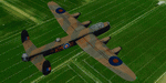
This folder contains a repaint for the AVRO Lancaster by Aeroplane Heaven, in the colors of Lancaster B.1 R5508 of No.44 Squadron based on Waddington, UK, as flown by Squadron Leader John Nettleton from South Africa during the low-level daylight raid on the MAN factory in Augsburg, Germany on 17 April, 1942. It involved six aircraft of 44 squadron and six of 97 squadron, that had to fly some 1000 miles over hostile terrain in daylight at low level. Only two of 44 sqn and five of 97 sqn reached the target, and two more aircraft were shot down near Augsburg by flak. Four 97 sqn aircraft returned to base under cover of darkness, but of 44 sqn, only Squadron Leader Nettletons aircraft, although heavily damaged, made it back to the UK. Nettleton received the VC for this raid, F/L Penman of 97 Sqn the DSO. 8 DFC's and 10 DFM's were awarded to other crew members. Nettleton died on 13 July 1943, returning from a raid on Turin. It is believed he was shot down near Brest by a FW190 of JG.2. His body and those of his crew were never recovered. Repaint by Jan Kees Blom, based on the paintkit by Aeroplane Heaven.
| Filename: | Avro_Lancaster_NAS_No44_Sqn_R5508.zip |
| License: | Freeware |
| Added: | 7th March 2020, 17:25:46 |
| Downloads: | 59 |
| Author: | Jan Kees Blom |
| Size: | 27.9 MB |
| Category: Microsoft Flight Simulator (2020) - AI Aircraft | |
| AIA_B737-800-Flybondi |
|
Images related to this file:
File Description:
Flybondi (iata code FO) is an Argentine airline that operates domestic flights and regional flights and is based in the airport of the city of Buenos Aires, ARG (Aeroparque iata code AEP).
As of June 2022, it has six B737-800 WL aircraft, two with Scimitars.
Textures and model of AIA B737-800 for Argentine company FLYBONDI Airline for use in artificial traffic plane in its two versions with wingletst(WL) and Scimitars winglets(SWL). These are the textures as of June /22.
The model and paintkit is authored by AI-Aardvark by David Rawlins and can be obtained from the author's page www.ai-aardvark.com. OR file model aia_738w.zip (AVSIM) and file paintkit aia738pk.zip (AVSIM)
The package is composed of:
a) aircraft with Scimitar winglets (SWL)
AIA B737-800 SWL registration LV-KAH
AIA B737-800 SWL registration LV-KAY
b) aircraft with winglets (WL)
AIA B737-800 WL registration LV-HKN
AIA B737-800 WL registration LV-KCD
AIA B737-800 WL registration LV-KCE
AIA B737-800 WL registration LV-KDR
AI AARDVARK 737-800
MODEL & PAINTKIT: DAVID RAWLINS
Modelo Aardvark "aia_738w.zip" (AVSIM) and painkit "aia738pk.zip" (AVSIM) by David Rawlins :: www.ai-aardvark.com
PAINT by :: @2022 JORGE E. GRANA
| Filename: | AIA_B737800Flybondi.zip |
| License: | Freeware |
| Added: | 12th July 2022, 18:21:32 |
| Downloads: | 220 |
| Author: | JORGE EDUARDO GRANA |
| Size: | 2.53 MB |
| Category: Flight Simulator X - AFCAD Files | |
| LFRV Meucon-Vannes |
|
File Description:
Vannes-Meucon Airport is a regional airport in France (IATA: VNE, ICAO: LFRV). It supports general aviation with no commercial airline service scheduled.
Summary of Changes:
Realigned runway 9/27 to runway 8/26 (as it is in real life). Note that in FSX although this runway is not closed, ATC will never assign this runway, as it is a grass strip, and ATC prefers the asphalt 4/22 instead. IRL 4/22 is actually 3/21 but I couldn't realign this runway, as it has a localiser approach which can't be removed or moved in ADE
Added taxiways B+D to allow traffic to taxi to/from the end of runway 22 via runway 8/26 without causing pileups. Whilst not completely accurate, its very close.
Added fuel trucks to top end of apron, (on the charts this area is designated as a hangar, I chose not to include this, as the FSX hangars look rubbish) Note that only 1 fuel truck moves at a time.
Added a few extra parking spaces. I dislike the method of using every free space for parking, so I have only included parking where LFRV really has designated parking. The airport now has 11 GA parking spaces small-medium.
| Filename: | LFRV_MeuconVannes.zip |
| License: | Freeware, limited distribution |
| Added: | 20th November 2011, 00:26:06 |
| Downloads: | 326 |
| Author: | Martin Joy |
| Size: | 5.89 KB |


© 2001-2026 AVSIM Online
All Rights Reserved
Privacy Policy |