
Where Flight Simulation Enthusiasts Gather from Around the World!
AVSIM Library - Search Results

| Category: Flight Simulator X - Aircraft Repaints, Textures and Modifications | |
| C208B Grand Caravan |

|
Images related to this file:
File Description:
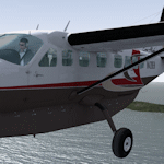
Repaint of the Carenado C208 Grand Caravan HD in a fictional scheme. The paint carry's the ERA logo and fictional registration number N420EH from the virtual ERA Alaska Group at fseconomy. You must have the Carenado C208 HD Caravan for these files to work, they are texture files only. Basic installation instructions are included.
| Filename: | C208B_Grand_Caravan.zip |
| License: | Freeware |
| Added: | 13th July 2012, 05:49:19 |
| Downloads: | 848 |
| Author: | Rick Bubier, Carenado |
| Size: | 6.7 MB |
| Category: Flight Simulator X - Original Aircraft | |
| Ultima Thule DH3T Turbo Otter |
|
File Description:
Ultima Thule Lodge Turbo Otter on Skis. Ultima Thule Lodge is located in the Wrangell/St. Elias national park in Alaska. It is operated by Paul Claus. http://www.ultimathule.com.
Ultima Thule scenery is also available here at Avsim. Real sounds, guage updates, and repaint by Garrett Smith for Premier Aircraft Design DH3T "Garrett" Super Otter.
| Filename: | Ultima_Thule_DH3T_Turbo_Otter.zip |
| License: | Freeware, limited distribution |
| Added: | 12th February 2009, 22:36:02 |
| Downloads: | 4,973 |
| Author: | Premier Aircraft Design, Garrett Smith |
| Size: | 34.72 MB |
| Category: Flight Simulator 2004 - Scenery | |
| Kotzebue PAOT on the northwestern coast of Alaska |
|
Images related to this file:
File Description:
There are four main northwestern Alaska towns which have good airports and are serviced by Alaska Airlines. From these airports local flights connect to nearby villages, "nearby" in Alaska meaning up to 150 miles away. The northernmost is Barrow. Southwest of Barrow is Kotzebue, then Nome, and the furthest south is Bethel. The town of Kotzbue is north of the Bering Strait on the northwestern coast, 320 miles southwest of Barrow. The population is just over 3,000 people. The location was for a long time a base for trading in furs, with three rivers emptying into the sea and providing routes into the interior land and villages; a meeting place between hunters and traders from Russia and elsewhere. The Kotzebue airport is called the Ralph Wien Memorial and has two runways. The modern one is aligned 08-26 and is 5,880 feet of 150 feet wide asphalt built across a shallow lagoon, with an ILS on 08 and PAPI on both ends. The second and older runway is originally military and gravel, aligned 17-35 and 3,786 feet long and used (wind allowing) by the GA planes that park alongside the runway. The prevalent wind is from the west; when the wind is from the east it is generally relatively feeble and with a much lower cloud base, possibly to the ground, hence the need for an ILS. All AI aircraft in FS9 much prefer to use a runway that has an ILS and so will continue to use 08-26 even if the wind is from the south until it reaches 30+ knots, even if they are a Cessna 150 flying VFR. So for AI realism in FS9 a northern or southern wind needs to be a strong one so that the runway is actually used. However, as Alaska Airlines, Northern Air Cargo, and Everts Air also fly to Kotzebue and can only use the east-west runway (as less than 4,000 feet of asphalt would be seriously inconvenient for a Boing 737 or DC6) it is necessary to have the northern or southern wind UNDER 30 knots at the times when they are landing or taking off. Your choice. I suppose a permanent strong wind from the west would be the most realistic on a daily basis, deterring all planes from ever using 17-35. The AI will develop along with further scenery additions in the neighbourhood.
| Filename: | Kotzebue_PAOT_on_the_northwestern_coast_of_Alaska.zip |
| License: | Freeware, limited distribution |
| Added: | 2nd August 2016, 16:47:52 |
| Downloads: | 457 |
| Author: | Roger Wensley |
| Size: | 19.32 MB |
| Category: Flight Simulator 2004 - Scenery | |
| Elim ELI and Moses Point MOS in Alaska |
|
Images related to this file:
File Description:
Elim is a coastal village 90 miles east of Nome, living from fishing and with a population of around 330. The airfield has a gravel runway 3,000 feet long. The majority of flights to and from the airfield originate in Nome, but there are also others to and from nearby fields such as Golovin, Unalakleet, Shaktoolik, and Koyuk. A further 7 miles or so east of Elim is another field called Moses Point MOS, which is included here and was an Army Airforce field before being transferred to the private ownership of the Elim Native Corporation. Until Elim ELI was established (date unknown, but after 1988) this served the village of Elim and although the runway is now unlit and not in very good condition (translate that as "full of potholes") it is stated that the longer runway can still be used if Elim is not adequate. However, the note is undated and there are no details of how often it is used or even if it is actually still currently in use. There is one hangar still in existence; all the rest has been demolished and (mostly) removed. A note here about my scenery making. This is post number 502 and there will not be many more to follow this as I am almost at the end of the photos I either took or found for scenery purposes. There is a limit to what can be located online and I have already been making use of the little there is; eg Unalakleet. So, if you are near an airport (preferably Canadian or Alaskan) and have a camera..... Let me know.
| Filename: | Elim_ELI_and_Moses_Point_MOS_in_Alaska.zip |
| License: | Freeware, limited distribution |
| Added: | 2nd August 2019, 16:11:35 |
| Downloads: | 100 |
| Author: | Roger Wensley |
| Size: | 4.69 MB |
| Category: Flight Simulator 2004 - Scenery | |
| Homer PaHO in Alaska US missing parked planes |
|
Images related to this file:
File Description:
These are the parked planes and their textures that I forgot to include in the Homer PAHO scenery post. Apologies.
| Filename: | Homer_PaHO_in_Alaska_US_missing_parked_planes.zip |
| License: | Freeware, limited distribution |
| Added: | 28th July 2021, 17:02:11 |
| Downloads: | 54 |
| Author: | Roger Wensley |
| Size: | 3.45 MB |
| Category: Flight Simulator 2004 - Scenery | |
| Homer PaHO in Alaska US missing parked planes |
|
Images related to this file:
File Description:
These are the parked planes and their textures that I forgot to include in the Homer PAHO scenery post. Apologies.
| Filename: | Homer_PaHO_in_Alaska_US_missing_parked_planes.zip |
| License: | Freeware, limited distribution |
| Added: | 28th July 2021, 17:02:25 |
| Downloads: | 97 |
| Author: | Roger Wensley |
| Size: | 3.45 MB |
| Category: Flight Simulator X - Aircraft Repaints, Textures and Modifications | |
| Alaska Airlines "New livery Boeing 747-400 *FIX* |
|
File Description:
Accidently, the US flag on the left side of the fuselage got left off in the original upload. This is the replacement texture with the flag. Just place this file in your PMDG Boeing 747-400 Alaskan Airlines folder.
| Filename: | Alaska_Airlines_New_livery_Boeing_747400_FIX.zip |
| License: | Freeware |
| Added: | 15th March 2017, 04:49:31 |
| Downloads: | 563 |
| Author: | Ray Reyes |
| Size: | 546.27 KB |
| Category: Flight Simulator 2004 - Scenery | |
| Naknek (5NK) and Naknek South (WSN) - Alaska, USA |
|
Images related to this file:
File Description:
Naknek and Naknek South are two towns close to the mouth of the Naknek River and on opposite banks. King Salmon is approximately 15 miles to the east. The canneries on both banks of the river are the reason for the existence of both towns and airfields, with fishing for salmon being the primary industry of the area. This takes place from the beach by individuals, by small boats in the river and the immediate sea area, and offshore by larger craft. There is a picture of one boat unloading in Naknek which will be known to anyone who has watched the most famous television fishing programme of all, Deadliest Catch. Cornelia Marie is better known for the crab fishing based in Dutch Harbor, but this area too is just as productive though without the drama. Naknek 5NK has two gravel runways and a float runway in the adjoining lake; all three are just under 2,000 feet long. Naknek South WSN has two gravel runways, 12-30 being 3,300 feet long and 04-22 2,260 feet. As the road connecting to King Salmon is on the north bank it is probable that more seasonal workers are brought into the southern canneries by air, hence the longer runway (and with PAPI on 12). Grant Aviation run scheduled flights into both and there are numerous seasonal charter flights. The AI is a further modification of that posted with King Salmon PAKN and includes these flights, and presumes that you have already downloaded PAKN.
| Filename: | Naknek_5NK_and_Naknek_South_WSN__Alaska_USA.zip |
| License: | Freeware, limited distribution |
| Added: | 29th April 2015, 20:44:31 |
| Downloads: | 214 |
| Author: | Roger Wensley |
| Size: | 6.09 MB |
| Category: Flight Simulator 2004 - Scenery | |
| Allakaket 6A8 Runway and Taxiway Lighting in Alaska |
|
Images related to this file:
File Description:
Allakaket is on the Koyukuk River in Alaska, 40 miles southwest of Bettles. This posting adds proper runway and taxiway lighting to the scenery, as shown in the screenshots. There will be lights on top of traffic cones visible during the day, just as there are at Allakaket in real life so that pilots can still see them after a snowfall. At night there will be lit lights that properly illuminate the runway for landing, and at a lower level of brightness the taxiway. Put the bgl's into the existing scenery folder of your Allakaket 6A8 installation and say yes to replace the existing bgl's that have the same names. Add the texture bmp's to the texture folder. That's all, and in fact you could try it without the textures in the Allakaket 6A8 texture folder, but read on. Instal the Library objects once and for all by placing the CONTENTS of the Lighting Library scenery folder in your static objects scenery folder and the CONTENTS of the texture folder in the static objects texture folder (which is how I install scenery objects libraries). Alternatively, put them in the scenery and texture folders of your Add on scenery folder, or even in the main scenery and texture folders. They just have to be in related scenery and texture folders that are always active when FS9 is running. There will be further retro upgrades to other recent scenery that was posted with temporary lighting. Say thank you to Greg Putz for making the lighting.
| Filename: | Allakaket_6A8_Runway_and_Taxiway_Lighting_in_Alask.zip |
| License: | Freeware, limited distribution |
| Added: | 23rd November 2019, 20:30:02 |
| Downloads: | 116 |
| Author: | Roger Wensley |
| Size: | 711.35 KB |
| Category: Flight Simulator 2004 - AFCAD Files | |
| Ted Stevens Anchorage International Airport, Anchorage, Alaska (PANC) |
|
File Description:
A fix to my other Anchorage file where I left 1 of the FedEx cargo spots unconnected. Sorry. This file has exactly 202 parking areas to add traffic. Most gates are for Alaska, but all airlines are represented at their proper place at the airport. For more AFCADS, please see my website at http://www.freewebs.com/afcads/. More uploaded everyday.
| Filename: | Ted_Stevens_Anchorage_International_Airport_Anchor.zip |
| License: | Freeware |
| Added: | 13th June 2006, 15:10:06 |
| Downloads: | 1,681 |
| Author: | Jason Landuyt |
| Size: | 92.81 KB |
© 2001-2026 AVSIM Online
All Rights Reserved
Privacy Policy |