
Where Flight Simulation Enthusiasts Gather from Around the World!
AVSIM Library - Search Results

| Category: Flight Simulator X - Scenery | |
| Mesh South America / MeSA D09 |

|
File Description:
FSX Mesh South America Project:
This terrain mesh file is a part of a whole project covering all the Continent
of South America and some islands, divided in tiles identified in a map by its
column (letters) and rows (numbers).
Those files were multi-LOD compiled from 90m SRTM2 source data, reprocessed
with 3DEM to remove voids and spikes, providing a 76.4m (LOD9) horizontal
resolution topography intended for use only in FSX updated with SP1.
Although not well documented, to improve performance, the updated FSX loads DEM
files in threads and only the closer terrain (about 5-10 NM from the point of view)
is rendered in high detail, while at far distances FSX shows up its default low
resolution mesh, when there is not a third part terrain mesh compiled in all
others intermediate level of details (multi-LOD).
THIS FILE:
FSX_MeSA_D09 (Column D x Row 09)
covers the area inside the boundaries:
N = 33º 45' S; S = 39º 22.5' S;
W = 67º 30' W; E = 60º 0' W;
AUTHORS:
Hely Heck Junior - Magrao ( [email protected] )
and Jose Lobo ( [email protected] )
TerraBrasilis: www.terra-brasilis.org
| Filename: | Mesh_South_America__MeSA_D09.zip |
| License: | Freeware |
| Added: | 13th June 2007, 12:36:59 |
| Downloads: | 1,259 |
| Author: | Hely Heck Jr. and José Lôbo |
| Size: | 52.3 MB |
| Category: Flight Simulator X - Scenery | |
| Mesh South America / MeSA D12 |
|
File Description:
FSX Mesh South America Project:
This terrain mesh file is a part of a whole project covering all the Continent
of South America and some islands, divided in tiles identified in a map by its
column (letters) and rows (numbers).
Those files were multi-LOD compiled from 90m SRTM2 source data, reprocessed
with 3DEM to remove voids and spikes, providing a 76.4m (LOD9) horizontal
resolution topography intended for use only in FSX updated with SP1.
Although not well documented, to improve performance, the updated FSX loads DEM
files in threads and only the closer terrain (about 5-10 NM from the point of view)
is rendered in high detail, while at far distances FSX shows up its default low
resolution mesh, when there is not a third part terrain mesh compiled in all
others intermediate level of details (multi-LOD).
THIS FILE:
FSX_MeSA_D12 (Column D x Row 12)
covers the area inside the boundaries:
N = 45º 0' S; S = 50º 37.5' S;
W = 67º 30' W; E = 60º 0' W;
AUTHORS:
Hely Heck Junior - Magrao ( [email protected] )
and Jose Lobo ( [email protected] )
TerraBrasilis: www.terra-brasilis.org
| Filename: | Mesh_South_America__MeSA_D12.zip |
| License: | Freeware |
| Added: | 13th June 2007, 15:28:04 |
| Downloads: | 1,146 |
| Author: | Hely Heck Jr. and José Lôbo |
| Size: | 5.54 MB |
| Category: Flight Simulator X - Scenery | |
| Mesh South America / MeSA D13 |
|
File Description:
FSX Mesh South America Project:
This terrain mesh file is a part of a whole project covering all the Continent
of South America and some islands, divided in tiles identified in a map by its
column (letters) and rows (numbers).
Those files were multi-LOD compiled from 90m SRTM2 source data, reprocessed
with 3DEM to remove voids and spikes, providing a 76.4m (LOD9) horizontal
resolution topography intended for use only in FSX updated with SP1.
Although not well documented, to improve performance, the updated FSX loads DEM
files in threads and only the closer terrain (about 5-10 NM from the point of view)
is rendered in high detail, while at far distances FSX shows up its default low
resolution mesh, when there is not a third part terrain mesh compiled in all
others intermediate level of details (multi-LOD).
THIS FILE:
FSX_MeSA_D13 (Column D x Row 13)
covers the area inside the boundaries:
N = 50º 37.5' S; S = 56º 15' S;
W = 67º 30' W; E = 60º 0' W;
AUTHORS:
Hely Heck Junior - Magrao ( [email protected] )
and Jose Lobo ( [email protected] )
TerraBrasilis: www.terra-brasilis.org
| Filename: | Mesh_South_America__MeSA_D13.zip |
| License: | Freeware |
| Added: | 13th June 2007, 16:38:14 |
| Downloads: | 1,124 |
| Author: | Hely Heck Jr. and José Lôbo |
| Size: | 4.79 MB |
| Category: Flight Simulator X - Scenery | |
| Mesh- South America MeSA_E06 |
|
File Description:
FSX Mesh South America Project:
This terrain mesh file is a part of a whole project covering all the Continent
of South America and some islands, divided in tiles identified in a map by its
column (letters) and rows (numbers).
Those files were multi-LOD compiled from 90m SRTM2 source data, reprocessed
with 3DEM to remove voids and spikes, providing a 76.4m (LOD9) horizontal
resolution topography intended for use only in FSX updated with SP1.
Although not well documented, to improve performance, the updated FSX loads DEM
files in threads and only the closer terrain (about 5-10) NM from the point of view)
is rendered in high detail, while at far distances FSX shows up its default low
resolution mesh, when there is not a third part terrain mesh compiled in all
others intermediate level of details (multi-LOD).
THIS FILE:
FSX_MeSA_E06 (Column E x Row 06)
covers the area inside the boundaries:
N = 11º 15' S; S = 16º 52.5' S;
W = 60º 0' W; E = 52º 30' W;
AUTHORS:
Hely Heck Junior - Magrao ( [email protected] )
and Jose Lobo ( [email protected] )
TerraBrasilis: www.terra-brasilis.org
| Filename: | Mesh_South_America_MeSA_E06.zip |
| License: | Freeware |
| Added: | 14th June 2007, 01:40:40 |
| Downloads: | 877 |
| Author: | Hely Heck Jr. and José Lôbo |
| Size: | 70.05 MB |
| Category: Flight Simulator X - Scenery | |
| Mesh-South America MeSA_E10 |
|
File Description:
FSX Mesh South America Project:
This terrain mesh file is a part of a whole project covering all the Continent
of South America and some islands, divided in tiles identified in a map by its
column (letters) and rows (numbers).
Those files were multi-LOD compiled from 90m SRTM2 source data, reprocessed
with 3DEM to remove voids and spikes, providing a 76.4m (LOD9) horizontal
resolution topography intended for use only in FSX updated with SP1.
Although not well documented, to improve performance, the updated FSX loads DEM
files in threads and only the closer terrain (about 5-10 NM from the point of view)
is rendered in high detail, while at far distances FSX shows up its default low
resolution mesh, when there is not a third part terrain mesh compiled in all
others intermediate level of details (multi-LOD).
THIS FILE:
FSX_MeSA_E10 (Column E x Row 10)
covers the area inside the boundaries:
N = 33º 45' S; S = 39º 22,5' S;
W = 60º 0' W; E = 52º 30' W;
AUTHORS:
Hely Heck Junior - Magrao ( [email protected] )
and Jose Lobo ( [email protected] )
TerraBrasilis: www.terra-brasilis.org
| Filename: | MeshSouth_America_MeSA_E10.zip |
| License: | Freeware |
| Added: | 14th June 2007, 13:59:05 |
| Downloads: | 943 |
| Author: | Hely Heck Jr. and José Lôbo |
| Size: | 21.54 MB |
| Category: Flight Simulator X - Scenery | |
| Mesh-South America MeSA_F04 |
|
File Description:
FSX Mesh South America Project:
This terrain mesh file is a part of a whole project covering all the Continent
of South America and some islands, divided in tiles identified in a map by its
column (letters) and rows (numbers).
Those files were multi-LOD compiled from 90m SRTM2 source data, reprocessed
with 3DEM to remove voids and spikes, providing a 76.4m (LOD9) horizontal
resolution topography intended for use only in FSX updated with SP1.
Although not well documented, to improve performance, the updated FSX loads DEM
files in threads and only the closer terrain (about 5-10 NM from the point of view)
is rendered in high detail, while at far distances FSX shows up its default low
resolution mesh, when there is not a third part terrain mesh compiled in all
others intermediate level of details (multi-LOD).
THIS FILE:
FSX_MeSA_F04 (Column F x Row 04)
This file covers the area inside the boundaries:
N = 0º 0' S; S = 5º 37.5' S;
W = 52º 30' W; E = 45º 0' W;
AUTHORS:
Hely Heck Junior - Magrao ( [email protected] )
and Jose Lobo ( [email protected] )
TerraBrasilis: www.terra-brasilis.org
| Filename: | MeshSouth_America_MeSA_F04.zip |
| License: | Freeware |
| Added: | 14th June 2007, 14:01:32 |
| Downloads: | 973 |
| Author: | Hely Heck Jr. and José Lôbo |
| Size: | 68.63 MB |
| Category: Flight Simulator X - Scenery | |
| Mesh-South America MeSA_G04 |
|
File Description:
FSX Mesh South America Project:
This terrain mesh file is a part of a whole project covering all the Continent
of South America and some islands, divided in tiles identified in a map by its
column (letters) and rows (numbers).
Those files were multi-LOD compiled from 90m SRTM2 source data, reprocessed
with 3DEM to remove voids and spikes, providing a 76.4m (LOD9) horizontal
resolution topography intended for use only in FSX updated with SP1.
Although not well documented, to improve performance, the updated FSX loads DEM
files in threads and only the closer terrain (about 5-10 NM from the point of view)
is rendered in high detail, while at far distances FSX shows up its default low
resolution mesh, when there is not a third part terrain mesh compiled in all
others intermediate level of details (multi-LOD).
THIS FILE:
FSX_MeSA_G04 (Column G x Row 04)
covers the area inside the boundaries:
N = 0º 0' S; S = 5º 37.5' S;
W = 45º 0' W; E = 37º 30' W;
AUTHORS:
Hely Heck Junior - Magrao ( [email protected] )
and Jose Lobo ( [email protected] )
TerraBrasilis: www.terra-brasilis.org
| Filename: | MeshSouth_America_MeSA_G04.zip |
| License: | Freeware |
| Added: | 15th June 2007, 00:10:58 |
| Downloads: | 867 |
| Author: | Hely Heck Jr. and José Lôbo |
| Size: | 35.9 MB |
| Category: Flight Simulator 2004 - Aircraft Repaints, Textures and Modifications | |
| America West Airlines Boeing 757-200 'Arizona' |
|
File Description:
The historical Project Opensky or POSKY Boeing 757-200 has another paint to add to it's long list. This time it is that of the America West Arizona Special livery. This repaint is around 97% handpainted with a few photoreal elements added to ensure close to 100% accuracy and detail that is not commonly seen in the world of Flight Simulation. Nearly every pixel of these textures has either been modified or looked over in some way or form to assist in the detailing. The paint includes custom night textures, highly accurate textures that were compared to a long line of real photos of the aircraft, custom wing textures with fuselage reflection, dirt, shading and several other things that you would find on the other thousands of high quality paints available online. Paint and model have been tested with success in Flight Simulator X, however, it was mainly tested in Flight Simulator 2004 and I cannot guarantee the same results of throwing it into FSX. This is a complete package with model, virtual cockpit model, effects and virtual cockpit gauges so no other files should be required.
| Filename: | America_West_Airlines_Boeing_757200_Arizona.zip |
| License: | Freeware, limited distribution |
| Added: | 24th March 2007, 10:05:54 |
| Downloads: | 1,960 |
| Author: | Kyle Schurb |
| Size: | 12.65 MB |
| Category: Flight Simulator X - Scenery | |
| Oahu Scenery Version 1 |
|
File Description:
This scenery sits on top of "MegaSceneryX - Hawaii - Honolulu and Oahu Island", SO IT REQUIRES THE MEGASCENERY X - Hawaii - Honolulu & Oahu Island" photo scenery from http://www.megascenery.com/
This is primarily an Autogen scenery with some custom developed objects for the coast of Oahu.
I used autogens from default FSX for the most part as well as the FSX Acceleration. IF you did not install acceleration, it should not be an issue. you would just not see some of the autogens from the acceleration package. I have also included some custom built GMAX Objects with this package. There is also an AFCAD file for a new fictitious Heliport that is included ("PMMH)".
This scenery package also includes a Mission called "Oahu Sacred Falls Landing". It is a short mission without any surprises or twists, yet I am confident many of you would find it interesting and very very challenging. But do not be discouraged at the difficulty of completing the mission. You may want to turn off crash detection to make it easier if you'd like. The fun is in the journey..right?
Lastly, I have included a fix for my MM_PHNGv1 scenery as part of this package.
| Filename: | Oahu_Scenery_Version_1.zip |
| License: | Freeware, limited distribution |
| Added: | 29th February 2008, 02:31:04 |
| Downloads: | 4,126 |
| Author: | Manny Mahadevan |
| Size: | 9.9 MB |
| Category: Flight Simulator X - Scenery | |
| Bhutan Airports and Paro Valley |
|
Images related to this file:
File Description:
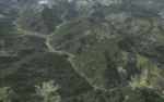
This project adds and updates all of the airports of Bhutan. Bathpalathang (VQBT) and Gelephu (VQGP) are added, Yongphulla (VQ10) is updated and recoded as VQTY, and Paro (VQPR) is fully updated to reflect current satellite imagery. These are all fully functioning AI airports as well. Special attention was given to the entire Paro Valley, and numerous road/river vectors were updated around Gelephu. Accurate coastlines, lakes, road and river data, as well as corrected landclass are provided based on the latest available satellite imagery. They are optimized to fit seamlessly with FTX Vector's roads/water, but they should be fully functional in all FSX configurations.
GA-encoded flight plans for the Buddha Air/Kathmandu charter are provided to enhance service to Paro. NASA SRTM Global 3 arc second terrain mesh is also included for all of Bhutan. Updates were created or rebuilt in a manner which carefully aligned airport data with current satellite imagery, when available. Scenery was created using Airport Design Editor X v1.61.5298, SBuilderX 3.13, and the FSX Object Placement Tool. Scenery objects were added and modified from stock FSX scenery to resemble as closely as possible the actual airports.
| Filename: | Bhutan_Airports_and_Paro_Valley.zip |
| License: | Freeware |
| Added: | 19th January 2015, 06:09:17 |
| Downloads: | 11,429 |
| Author: | Carlyle Sharpe |
| Size: | 21.4 MB |


© 2001-2026 AVSIM Online
All Rights Reserved
Privacy Policy |