
Where Flight Simulation Enthusiasts Gather from Around the World!
AVSIM Library - Search Results

| Category: Flight Simulator X - AFCAD Files | |
| CZBB Boundary Bay Airport, BC, Canada |

|
File Description:
This is a complete redo of the default FSX CZBB Boundary Bay Airport, BC using ADE v1.37, Google Earth satellite image and the latest airport chart effective as of 31 July 2008. The airport center and boundary repositioned. Control tower moved and replaced. Runway 07/25 extended to 5606 ft from 3540 ft and new taxiway E added. VASI Added to Runway 07/25. Taxiway signs added and/or corrected. Airport aprons resized and added where necessary. Taxiways and roads added. Static airport library objects and vegetation added for an improved look. XWind runways activated. Airport views are from the roof of the control tower when in tower view. A fuel truck has been added - Shift-F will bring this truck to your aircraft for refueling and will automatically refuel AI aircraft after landing and before take off. Airport chart and history included.
| Filename: | CZBB_Boundary_Bay_Airport_BC_Canada.zip |
| License: | Freeware |
| Added: | 5th November 2009, 02:16:37 |
| Downloads: | 448 |
| Author: | Robert Catherall |
| Size: | 381.61 KB |
| Category: Flight Simulator X - AFCAD Files | |
| CZBB Boundary Bay Airport, BC |
|
File Description:
This is a complete redo of the default FSX CZBB Boundary Airport, BC using ADE v1.37, Google Earth satellite image and the latest airport chart effective as of 31 July 2008. The airport center and boundary repositioned. Control tower moved and replaced. Runway 07/25 extended to 5606 ft from 3540 ft and new taxiway E added. VASI Added to Runway 07/25. Taxiway signs added and/or corrected. Airport aprons resized and added where necessary. Taxiways and roads added. Static airport library objects and vegetation added for an improved look. XWind runways activated. Airport views are from the roof of the control tower when in tower view. A fuel truck has been added - Shift-F will bring this truck to your aircraft for refueling and will automatically refuel AI aircraft after landing and before take off. Airport chart and history included.
| Filename: | CZBB_Boundary_Bay_Airport_BC.zip |
| License: | Freeware |
| Added: | 26th March 2009, 08:31:55 |
| Downloads: | 491 |
| Author: | Robert Catherall |
| Size: | 137.2 KB |
| Category: Flight Simulator 2004 - Scenery | |
| SCPQ - Mocopulli Airport - Dalcahue, Chile |
|
File Description:
SCPQ / MHC: FS2004 is missing this airport. This is a new airport built in Dalcahue, Chile with LAN airline flight schedule from/to Puerto Montt, Chile. The scenery has some good and detailed objects. The scenery is made using Google imagers and some detailed Chart maps that I had found.
| Filename: | SCPQ__Mocopulli_Airport__Dalcahue_Chile.zip |
| License: | Freeware |
| Added: | 17th October 2014, 01:25:28 |
| Downloads: | 479 |
| Author: | Stuart John Gilbert II |
| Size: | 1.39 MB |
| Category: Flight Simulator X - Scenery Design | |
| Raw, Inf, SBX Files |
|
Images related to this file:
File Description:
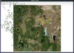
FS2004 & FSX Raw, Inf, and Sbx Files.
Some files for making Landclass with LWM Viewer, EZ-Landclass and SBuilderX. PhotoMaps not included. You will find my uploaded LC Scenery Files on AVSim ( USA Landclass Vegetation Part I ).
| Filename: | Raw_Inf_SBX_Files.zip |
| License: | Freeware |
| Added: | 13th February 2015, 14:52:53 |
| Downloads: | 239 |
| Author: | Markus Balz |
| Size: | 1.45 MB |
| Category: Flight Simulator X - Miscellaneous Files | |
| San Fransico sectional chart 2010 for FSMap |
|
File Description:
Hi resolution San Fransico sectional chart 2010 for FSMap
| Filename: | San_Fransico_sectional_chart_2010_for_FSMap.zip |
| License: | Freeware |
| Added: | 2nd April 2011, 05:09:22 |
| Downloads: | 401 |
| Author: | Ross Reed |
| Size: | 52.79 MB |
| Category: Flight Simulator X - Miscellaneous Files | |
| Los Angeles TAC 2010 for FSMap |
|
File Description:
High resolution 2010 Los Angeles TAC chart for FSMap.
| Filename: | Los_Angeles_TAC_2010_for_FSMap.zip |
| License: | Freeware |
| Added: | 2nd April 2011, 05:09:59 |
| Downloads: | 344 |
| Author: | Ross Reed |
| Size: | 18.52 MB |
| Category: Flight Simulator X - AFCAD Files | |
| LYPA - Pancevo Airport - Pancevo, Serbia |
|
File Description:
Pancevo Airport (Aerodrom Pancevo) (ICAO: LYPA) is an airport near the city of Pancevo, Serbia near Belgrade. The airport is mostly used for general aviation operations. It has a single grass runway 778 meters long and 62 meters wide.
The airport is also used by Utva Aviation Industry, a manufacturer of light sporting and training aircraft also located in Pancevo, for testing its aircraft. VFR chart included.
| Filename: | LYPA__Pancevo_Airport__Pancevo_Serbia.zip |
| License: | Freeware |
| Added: | 29th June 2016, 08:30:08 |
| Downloads: | 205 |
| Author: | Danilo Jankovic |
| Size: | 394.98 KB |
| Category: Flight Simulator X - Scenery | |
| Maiduguri International Airport FSXP3D |
|
Images related to this file:
File Description:
Maiduguri International Airport (IATA: MIU, ICAO: DNMA) is an airport serving Maiduguri, the capital of Borno State in Nigeria.
The Maiduguri VOR-DME (Ident: MIU) is located 2.9 nautical miles (5.4 km) northeast of the airport. The Maiduguri non-directional beacon (Ident: MA) is located on the field.
---------------------------------
Photoreal Background, Corrected Parkings, Added more buildings and trees, Ramp Lights(not dynamic lights), Airport chart....
| Filename: | Maiduguri_International_Airport_FSXP3D.zip |
| License: | Freeware |
| Added: | 21st April 2019, 20:12:09 |
| Downloads: | 594 |
| Author: | Raheem Adeleke |
| Size: | 21.96 MB |
| Category: Flight Simulator 2002 - Scenery | |
| Bex (LSGB) for Suisse 2002 |
|
File Description:
Bex (LSGB)is a small airfield with a grass runway South West of Switzerland. New photorealistic textures, smoke effects, roads and river correction. The file includes also a VAC (Visual Approach Chart) that shows the real airport circuit within FS2002.
| Filename: | Bex_LSGB_for_Suisse_2002.zip |
| License: | Freeware |
| Added: | 21st January 2003, 13:33:13 |
| Downloads: | 2,326 |
| Author: | Daniel Gauthier |
| Size: | 2.89 MB |
| Category: Flight Simulator X - AFCAD Files | |
| EGTR - Elstree Airfield - Hertfordshire, England |
|
File Description:
This aerodrome update is for EGTR and made only for the FSX default airport: Taxiways added along with aircraft parking, buildings and fuelling point.. This update is based on the Aerodrome Chart issued by the CAA on 8 March 2012.
| Filename: | EGTR__Elstree_Airfield__Hertfordshire_England.zip |
| License: | Freeware |
| Added: | 11th July 2013, 16:15:58 |
| Downloads: | 190 |
| Author: | David McGregor |
| Size: | 4.53 KB |
© 2001-2026 AVSIM Online
All Rights Reserved
Privacy Policy |