
Where Flight Simulation Enthusiasts Gather from Around the World!
AVSIM Library - Search Results

| Category: Flight Simulator 2004 - Scenery | |
| ZBER - Erenhot Airport (Non-Stock) |

|
Images related to this file:
File Description:

A basic google-earthed scenery for Erenhot airport which is missing in FS9 stock version.
All features accurately placed/shaped according to sat imagery. Navaids up-to-date as AIRAC cycle 1110.
Features basic default terminal & tower, and taxisigns.
Scheduled operators at ZBER: Beijing Capital Airlines, Tianjin Airlines.
| Filename: | ZBER__Erenhot_Airport_NonStock.zip |
| License: | Freeware, limited distribution |
| Added: | 29th December 2011, 23:13:36 |
| Downloads: | 555 |
| Author: | Yohann Baptiste |
| Size: | 298 KB |
| Category: Flight Simulator 2004 - Scenery | |
| ZGBS - Bose Airport |
|
Images related to this file:
File Description:
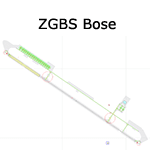
A google-earthed scenery for Bose airport (alternate spelling: Baise) which is missing in FS9 stock version, with basic default terminal & tower, and taxisigns.
All features accurately placed/shaped according to sat imagery. Navaids valid as AIRAC 1110.
No approach coded.
Current scheduled operators at ZGBS: China Express Airlines.
| Filename: | ZGBS__Bose_Airport.zip |
| License: | Freeware, limited distribution |
| Added: | 13th January 2012, 00:34:03 |
| Downloads: | 600 |
| Author: | Yohann Baptiste |
| Size: | 419.21 KB |
| Category: Prepar3D V1-4 - Scenery | |
| DGAA - Kotoka Intl - Accra, Ghana |
|
File Description:
this is an updated version of the default p3d airport
*updated runway dimensions and corrected positions, verified markings and lighting
*reconstructed all ramps and taxiways in the correct positions
*built approximate new terminal with gates (will be updated if new aerial photos become available)
*current as of airac 2004
| Filename: | DGAA__Kotoka_Intl__Accra_Ghana.zip |
| License: | Freeware |
| Added: | 9th April 2020, 18:23:28 |
| Downloads: | 1,217 |
| Author: | Mike Teague |
| Size: | 61.61 KB |
| Category: Prepar3D V1-4 - Scenery | |
| LLBG - Ben Gurion - Tel Aviv, Israel - P3DV4 - airac 2006 |
|
File Description:
this is an updated version of the default p3d airport:
*airac 2006*
-orphaned the ILS at the closed airport LLJR so to not interfere with the ILS 30 at LLBG
-added apron edge lights
*airac 2005*
-corrected the general airport location (it was pretty far off)
-updated runway dimensions, verified markings and lighting
-added loc/dme/gs to rwy 8 (BC 110.9), 21 (BN 109.7) and 30 (BD 111.9)
-all new ramps and taxiways
-new terminal, gates, other parking
my intent is to have a functional and current airport, not eye candy. the idea is to pretty much
match the real charts for online use (vatsim, etc). not tested with any type of AI traffic or atc.
| Filename: | LLBG__Ben_Gurion__Tel_Aviv_Israel__P3DV4__airac_20.zip |
| License: | Freeware |
| Added: | 21st May 2020, 22:55:05 |
| Downloads: | 1,401 |
| Author: | Mike Teague |
| Size: | 434.72 KB |
| Category: Prepar3D V1-4 - Utilities | |
| GENav pro Navigation |
|
Images related to this file:
File Description:

Previous payware product at SimMarket, now 100% free.
With GENav pro you will view all AIRAC navigation data and terminal procedures inside Google Earth. GENav pro run under Windows and require only Google Earth for displaying. You can also edit your own routes or just copy routes into GENav to view in Google Earth. You can search for example an airport or a fix by short or long name, Google Earth will take you there.
You can connect to Microsoft Flight Simulator to view your aircraft. Moving map and heading is available.
GENav pro is highly optimized for best performance and clear views without clutter. There are smart filters to select relevant data to display, all AIRAC items are available. You will find all data such as nav-aid frequencies, airport runways with ILS frequencies by click the displayed icons in Google Earth.
You can edit routes visual direct inside Google Earth by click. The database can always be updated with Navigraph's latest AIRAC data.
With GENav you can easy build valid routes. Unlike other common autorouting program, GENav is the tool for you to build routes with correct airway direction and correct connected to SID/STAR's. You will easy draw your routes most stright and correct to destination. It is also excellent for visual and instrument navigation flights.
FEATURES:
*** Display airports, nav aids, waypoints
*** Display High/Low airways and airways direction
*** Display SID/STAR, Approaches and Transitions
*** Display ARTCC/FIR border
*** AIRAC data available by click
*** Search airport and fixes
*** AIRAC data compatible Navigraph data
*** Visual editable routes
*** VOR to VOR route navigation data
*** Display your aircraft
BASIC SYSTEM REQUIREMENTS:
*** Windows with Google Earth installed
( Notice, no flightsim program required )
OPTIONALLY REQUIREMENTS:
*** SID/STAR require the Navigraph purchase or an alternative free source
*** Airways direction & high/low info require the Navigraph purchase
*** To display aircraft, Microsoft Flight Simulator or Prepare3D v1/v2, with free FSUIPC is required.
*** To display aircraft at a separate computer, also the payware WideFS is required.
| Filename: | GENav_pro_Navigation.zip |
| License: | Freeware |
| Added: | 25th May 2016, 11:24:52 |
| Downloads: | 654 |
| Author: | Lennart Vedin |
| Size: | 4.5 MB |
| Category: Flight Simulator 2004 - Utilities | |
| GENav pro Navigation |
|
Images related to this file:
File Description:

Previous payware product at SimMarket, now 100% free.
With GENav pro you will view all AIRAC navigation data and terminal procedures inside Google Earth. GENav pro run under Windows and require only Google Earth for displaying. You can also edit your own routes or just copy routes into GENav to view in Google Earth. You can search for example an airport or a fix by short or long name, Google Earth will take you there.
You can connect to Microsoft Flight Simulator to view your aircraft. Moving map and heading is available.
GENav pro is highly optimized for best performance and clear views without clutter. There are smart filters to select relevant data to display, all AIRAC items are available. You will find all data such as nav-aid frequencies, airport runways with ILS frequencies by click the displayed icons in Google Earth.
You can edit routes visual direct inside Google Earth by click. The database can always be updated with Navigraph's latest AIRAC data.
With GENav you can easy build valid routes. Unlike other common autorouting program, GENav is the tool for you to build routes with correct airway direction and correct connected to SID/STAR's. You will easy draw your routes most stright and correct to destination. It is also excellent for visual and instrument navigation flights.
FEATURES:
*** Display airports, nav aids, waypoints
*** Display High/Low airways and airways direction
*** Display SID/STAR, Approaches and Transitions
*** Display ARTCC/FIR border
*** AIRAC data available by click
*** Search airport and fixes
*** AIRAC data compatible Navigraph data
*** Visual editable routes
*** VOR to VOR route navigation data
*** Display your aircraft
BASIC SYSTEM REQUIREMENTS:
*** Windows with Google Earth installed
( Notice, no flightsim program required )
OPTIONALLY REQUIREMENTS:
*** SID/STAR require the Navigraph purchase or an alternative free source
*** Airways direction & high/low info require the Navigraph purchase
*** To display aircraft, Microsoft Flight Simulator or Prepare3D v1/v2, with free FSUIPC is required.
*** To display aircraft at a separate computer, also the payware WideFS is required.
| Filename: | GENav_pro_Navigation.zip |
| License: | Freeware |
| Added: | 25th May 2016, 11:24:32 |
| Downloads: | 529 |
| Author: | Lennart Vedin |
| Size: | 4.5 MB |
| Category: Prepar3D V1-4 - Scenery | |
| SCEL - Arturo Merino Benitez Intl - Santiago, Chile |
|
File Description:
this is an updated version of the default p3d airport:
*added runway 17R/35L and IMER loc/dme/gs (111.1)
*added all west side taxiways (z, p, etc)
*corrected positions of ramps and taxiways
*added new terminal buildings (including the under construction)
*updated all taxiway signage
*current as of airac 2004
| Filename: | SCEL__Arturo_Merino_Benitez_Intl__Santiago_Chile.zip |
| License: | Freeware |
| Added: | 4th April 2020, 00:37:22 |
| Downloads: | 338 |
| Author: | Mike Teague |
| Size: | 122.49 KB |
| Category: Fly! - Navigation | |
| AIRAC Cycle 0209 Database Update for Fly! - Drop in EPD/DBD format |
|
File Description:
Includes a very large update to the Fly! navigational databases based on the ICAO AIRAC cycle of every 28 days. Current cycle: 0209 - Effective 9.5.2002 through 10.2.2002. (6 new countries, 837 new navaids, 29545 new waypoints (yes, gps approaches)) Most records are updated, and have highly accurate LatLon values. Enjoy!
| Filename: | AIRAC_Cycle_0209_Database_Update_for_Fly__Drop_in_.zip |
| License: | Freeware, limited distribution |
| Added: | 7th September 2002, 04:25:44 |
| Downloads: | 387 |
| Author: | B. Bauer |
| Size: | 4 MB |
| Category: Flight Simulator 2004 - Flight Plans | |
| Flightplans for Copenhagen EKCH for 737/747 FMC |
|
File Description:
180+ standard routings for Copenhagen EKCH for PMDG's 737/747 FMC. These will provide complete routings for most of the European nonstop services in and out of EKCH that can be loaded into the aircraft's FMC without having to type in the route description. Validated against AIRAC 0902.
| Filename: | Flightplans_for_Copenhagen_EKCH_for_737747_FMC.zip |
| License: | Freeware |
| Added: | 26th February 2009, 12:05:49 |
| Downloads: | 755 |
| Author: | Christoph Schmidt |
| Size: | 98.74 KB |
| Category: Fly! - Navigation | |
| AIRAC Cycle 0209 Database Update for Fly! - Dex format |
|
File Description:
Includes a very large update to the Fly! navigational databases based on the ICAO AIRAC cycle of every 28 days. Current cycle: 0209 - Effective 9.5.2002 through 10.2.2002. (6 New Countries, 837 New Navaids, 29545 New Waypoints (yes, gps approaches)) Most records are updated, and have highly accurate LatLon values. Enjoy!
| Filename: | AIRAC_Cycle_0209_Database_Update_for_Fly__Dex_form.zip |
| License: | Freeware, limited distribution |
| Added: | 7th September 2002, 04:24:31 |
| Downloads: | 447 |
| Author: | B. Bauer |
| Size: | 2.49 MB |
© 2001-2026 AVSIM Online
All Rights Reserved
Privacy Policy |