
Where Flight Simulation Enthusiasts Gather from Around the World!
AVSIM Library - Search Results

| Category: Flight Simulator 2004 - Flight Plans | |
| A CYZT-KPDX-01 |

|
File Description:
An FS2K4 GPS flight and plan by the Ancient Brit and the Team for the FS2K4 default aircraft (B737-400) and scenery. Depart Port Hardy (CYZT) runway 11, British Columbia, Canada and arrive 1 hour 33 minutes later at Portland International (KPDX) runway 10R, Oregon, USA. The plan is fully flight briefed with Word and text briefings and also with a kneeboard in-flight briefing. The Briefings contain climb, cruise, and top of descent and fuel loading details, waypoint timings and destination details. A start-up flight that loads the plan, weather and kneeboard flight briefing is included. A low level departure through valleys and mountains with a spectacular climb to cruise; followed by the close passing of Mount Hood and St. Helens concluding with a sweeping turn into the sunset for alignment for finals are features of this flight.
| Filename: | A_CYZTKPDX01.zip |
| License: | Freeware |
| Added: | 5th September 2003, 23:25:23 |
| Downloads: | 2,807 |
| Author: | Denis Egan |
| Size: | 50.6 KB |
| Category: Flight Simulator 2004 - Scenery | |
| Terrain Mesh of Glacier National Park |
|
File Description:
New and updated scenery enhancements for the mountain ranges of southeastern British Columbia and parts of the Alberta Rocky Mountains. They require an existing installation of my files bcmesh9d.zip and/or bcmesh9e.zip. Scenery coverage follows the Trans-Canada Highway from Banff National Park to west of Revelstoke (~350km), with accurate transportation network, rivers and lakes, hydro dams, ski hills, glaciers, and landclass/waterclass updates based on satellite imagery. Also, similar enhancements to the parks and towns of the southern Kootenay, Selkirk, and Monashee mountains. The mesh source data are 0.75-arcsec (~23-m) CDED files, compiled at LOD10 (38-m) resolution. Due to significant changes in FS2004 to vector layering and autogen features, the special scenery enhancements cannot be used with FS2002. However, terrain mesh, new lakes and land/waterclass replacements will work well in FS2002.
| Filename: | Terrain_Mesh_of_Glacier_National_Park.zip |
| License: | Freeware, limited distribution |
| Added: | 18th December 2003, 23:17:35 |
| Downloads: | 8,857 |
| Author: | Holger Sandmann |
| Size: | 12.79 MB |
| Category: Flight Simulator 2004 - Scenery | |
| New Terrain Mesh of the Province of Quebec in LOD09 (1/4) |
|
File Description:
The files in this package contain terrain mesh files of the province of Quebec (N45 to N53) to be used with my Quebec enhanced sceneries for FS2004 (Scenes_du_Quebec_2k4.zip). The public data sources are the Shuttle Radar Topography Mission (SRTM-3, 90m) and the Canadian Digital Elevation Data (CDED - 0.75s/arc - 23m). (QC09_2k4a.zip to QC09_2k4d.zip - 4 parts)
***********************
Les fichiers de ces archives contiennent les donnees d'elevation de terrain (mesh files - lod09), pour FS2004, du territoire de la province de Quebec sous le 53ieme degre de latitude nord. Ils ont ete crees pour etre utilises avec mes nouvelles scenes du Quebec contenues dans Scenes_du_Quebec_2k4.zip. Les donnees sources sont du domaine public et proviennent de la Shuttle Radar Topography Mission (SRTM-3, 90m) et des donnees numerique d'elevation du Canada (DNEC - 0.75s/arc -23 m). (QC09_2k4a.zip to QC09_2k4d.zip - 4 parties)
| Filename: | New_Terrain_Mesh_of_the_Province_of_Quebec_in_LOD09_14.zip |
| License: | Freeware, limited distribution |
| Added: | 27th January 2010, 18:10:18 |
| Downloads: | 8,915 |
| Author: | Gilles Gauthier |
| Size: | 23.76 MB |
| Category: Flight Simulator 2004 - Scenery | |
| New Terrain Mesh of the Province of Quebec in LOD09 (2/4) |
|
File Description:
The files in this package contain terrain mesh files of the province of Quebec (N45 to N53) to be used with my Quebec enhanced sceneries for FS2004 (Scenes_du_Quebec_2k4.zip). The public data sources are the Shuttle Radar Topography Mission (SRTM-3, 90m) and the Canadian Digital Elevation Data (CDED - 0.75s/arc - 23m). (QC09_2k4a.zip to QC09_2k4d.zip - 4 parts)
***********************
Les fichiers de ces archives contiennent les donnees d'elevation de terrain (mesh files - lod09), pour FS2004, du territoire de la province de Quebec sous le 53ieme degre de latitude nord. Ils ont ete crees pour etre utilises avec mes nouvelles scenes du Quebec contenues dans Scenes_du_Quebec_2k4.zip. Les donnees sources sont du domaine public et proviennent de la Shuttle Radar Topography Mission (SRTM-3, 90m) et des donnees numerique d'elevation du Canada (DNEC - 0.75s/arc -23 m). (QC09_2k4a.zip to QC09_2k4d.zip - 4 parties)
| Filename: | New_Terrain_Mesh_of_the_Province_of_Quebec_in_LOD0.zip |
| License: | Freeware, limited distribution |
| Added: | 1st November 2009, 06:47:09 |
| Downloads: | 4,627 |
| Author: | Gilles Gauthier |
| Size: | 27.78 MB |
| Category: Flight Simulator 2004 - Scenery | |
| New Terrain Mesh of the Province of Quebec in LOD09 (3/4) |
|
File Description:
The files in this package contain terrain mesh files of the province of Quebec (N45 to N53) to be used with my Quebec enhanced sceneries for FS2004 (Scenes_du_Quebec_2k4.zip). The public data sources are the Shuttle Radar Topography Mission (SRTM-3, 90m) and the Canadian Digital Elevation Data (CDED - 0.75s/arc - 23m). (QC09_2k4a.zip to QC09_2k4d.zip - 4 parts)
***********************
Les fichiers de ces archives contiennent les donnees d'elevation de terrain (mesh files - lod09), pour FS2004, du territoire de la province de Quebec sous le 53ieme degre de latitude nord. Ils ont ete crees pour etre utilises avec mes nouvelles scenes du Quebec contenues dans Scenes_du_Quebec_2k4.zip. Les donnees sources sont du domaine public et proviennent de la Shuttle Radar Topography Mission (SRTM-3, 90m) et des donnees numerique d'elevation du Canada (DNEC - 0.75s/arc -23 m). (QC09_2k4a.zip to QC09_2k4d.zip - 4 parties)
| Filename: | New_Terrain_Mesh_of_the_Province_of_Quebec_in_LOD0.zip |
| License: | Freeware, limited distribution |
| Added: | 27th January 2010, 18:15:12 |
| Downloads: | 7,495 |
| Author: | Gilles Gauthier |
| Size: | 29.35 MB |
| Category: Flight Simulator 2004 - Scenery | |
| New Terrain Mesh of the Province of Quebec in LOD09 (4/4) |
|
File Description:
The files in this package contain terrain mesh files of the province of Quebec (N45 to N53) to be used with my Quebec enhanced sceneries for FS2004 (Scenes_du_Quebec_2k4.zip). The public data sources are the Shuttle Radar Topography Mission (SRTM-3, 90m) and the Canadian Digital Elevation Data (CDED - 0.75s/arc - 23m). (QC09_2k4a.zip to QC09_2k4d.zip - 4 parts)
***********************
Les fichiers de ces archives contiennent les donnees d'elevation de terrain (mesh files - lod09), pour FS2004, du territoire de la province de Quebec sous le 53ieme degre de latitude nord. Ils ont ete crees pour etre utilises avec mes nouvelles scenes du Quebec contenues dans Scenes_du_Quebec_2k4.zip. Les donnees sources sont du domaine public et proviennent de la Shuttle Radar Topography Mission (SRTM-3, 90m) et des donnees numerique d'elevation du Canada (DNEC - 0.75s/arc -23 m). (QC09_2k4a.zip to QC09_2k4d.zip - 4 parties)
| Filename: | New_Terrain_Mesh_of_the_Province_of_Quebec_in_LOD0.zip |
| License: | Freeware, limited distribution |
| Added: | 27th January 2010, 18:17:08 |
| Downloads: | 7,854 |
| Author: | Gilles Gauthier |
| Size: | 20.94 MB |
| Category: Flight Simulator 2004 - Scenery | |
| Fairbanks International PFAF Float Base in Alaska |
|
Images related to this file:
File Description:
This is the floatplane base which is part of Fairbanks International Airport, PFAF. It has a separate PAFX identifier here due to the limitations of AI in FS9. Though it doesn't come close to the activity level of Lake Hood in Anchorage Alaska it is still a fairly busy place. In Fairbanks there is this floatbase, Chena Marina to the southwest, Chena River to the northwest, and Metro Field to the east between Fairbanks and the river. You will need Ultimate Terrain Alaska Canada, and you must first install the version of Fairbanks International PFAF by William Morgan, as this scenery was the starting point for the floatplane base scenery, and without it the result would be disappointing. There are scenery and land class files, files that modify PFAF, AFCAD for AI, and a traffic file.
| Filename: | Fairbanks_International_PFAF_Float_Base_in_Alaska.zip |
| License: | Freeware, limited distribution |
| Added: | 19th August 2010, 22:55:46 |
| Downloads: | 795 |
| Author: | Roger Wensley |
| Size: | 1.03 MB |
| Category: Flight Simulator 2004 - Scenery | |
| Chena Marina AK28 in Fairbanks Alaska |
|
Images related to this file:
File Description:
Chena Marina AK28 is a float plane "pond" close to and southwest of Fairbanks International Airport, with a gravel strip alongside the water; the "strip" is actually a gravel road that functions as a runway when required. Or maybe it's a runway that functions as a road? Though it doesn't come close to the activity level of Lake Hood in Anchorage Alaska it is still a fairly busy place, and in fact Fairbanks is a hub of summer floatplane activity with a water runway at the International Airport and another "pond" known as Metro Field that is between Fairbanks and the river, plus a base on the Chena River. In this download there is a scenery folder, land-class folders, an AFCAD folder, and a "Traffic" folder, and you will definitely need Ultimate Terrain Alaska Canada.
| Filename: | Chena_Marina_AK28_in_Fairbanks_Alaska.zip |
| License: | Freeware, limited distribution |
| Added: | 14th August 2010, 17:11:31 |
| Downloads: | 816 |
| Author: | Roger Wensley |
| Size: | 5.57 MB |
| Category: Flight Simulator X - Aircraft Repaints, Textures and Modifications | |
| "Black and White" Embraer EMB-505 Phenom 300 (C-BERT) |
|
Images related to this file:
File Description:
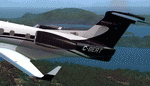
The classic black and white livery with reversed C in white and the balance of the tail in black. Black engine covers with some artsy fartsy work underneath to match up with the swooping lines along the white fuselage. White wings and some black accents on the winglets. A little red maple leaf near the cabin entry and on the opposite fuselage side for those that may not know that this belongs in Canada. Specifically, Vancouver Island.
A tribute to Bert P., our friend and maker of the mods. (C-BERT) for FSX, P3D, and FSX:Steam. You must have the payware Carenado EMB505 HD Phenom 300 installed to use this repaint. Next time you come in contact with Bert, be sure to tell him how valuable his mods are to the community.
| Filename: | Black_and_White_Embraer_EMB505_Phenom_300_CBERT.zip |
| License: | Freeware |
| Added: | 2nd October 2015, 19:27:30 |
| Downloads: | 672 |
| Author: | Ray Marshall |
| Size: | 40.07 MB |
| Category: Flight Simulator 2004 - Aircraft Repaints, Textures and Modifications | |
| Iran Air/Nouvelair Airbus A320 |
|
File Description:
This is a repainting of the FS Painter Airbus A320 CFM(Model is not included) in the hybrid colour scheme of Iran Air/Nouvelair. This aircraft(A320) is the first one of the type in Iran Air fleet and dare say this hybrid livery does look good on Iran Air!
This is actually an AI aircraft but you can easily fly it in both MS Flight Simulator 2002 and 2004(you just need to add some panel and sound files to make it look and sound more real, otherwise enjoy it flying!
Base textures by FS Painter, Iran Air/Nouvelair hybrid texture by Pantee Farhangi.
| Filename: | Iran_AirNouvelair_Airbus_A320.zip |
| License: | Freeware |
| Added: | 1st December 2003, 15:48:50 |
| Downloads: | 1,105 |
| Author: | Pantee Farhangi / FS Painter |
| Size: | 319.22 KB |


© 2001-2026 AVSIM Online
All Rights Reserved
Privacy Policy |