
Where Flight Simulation Enthusiasts Gather from Around the World!
AVSIM Library - Search Results

| Category: Flight Simulator X - AFCAD Files | |
| CYQG - Windsor International Airport - Windsor, Ontario, Canada v1.1 |

|
Images related to this file:
File Description:

This airport update was made with the latest version of ADE (Airport Design Editor) and made for FSX as a replacement for the stock (default) airport. I've made several changes to the airport which are listed below. All these enchancements are as close to the real airport as I can get with stock library objects. I've used satellite images, terminal photos and maps throughout the whole process so building locations are as accurate as possible. Happy landings in the beautiful Canada!
Features:
Expanded parking apron, Main terminal building with parking for commercial aircraft,
Seperate parking aprons for GA traffic, Hangars and other airport buildings added,
Airport vehicles and objects throughout the airport, Airport fire station with fire truck,
De-icing vehicle/runway plow, Static fuel station with fuel vehicles
Newly expanded taxiway for runway 7/25 (v.1.1), New hangar and taxiway near runway 30 threshold (v1.1)
| Filename: | CYQG__Windsor_International_Airport__Windsor_Ontar.zip |
| License: | Freeware |
| Added: | 31st July 2012, 11:21:35 |
| Downloads: | 717 |
| Author: | Jaison Diaz / Endeavour AI |
| Size: | 105.69 KB |
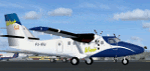
| Category: Flight Simulator 2004 - Scenery | |
| Whale Cove CYXN in Hudson Bay, Nunavut, Canada |
|
Images related to this file:
File Description:
Whale Cove is a small village with 300 or so inhabitants at N62 W92 on the west shore of Hudson Bay, 40 miles south of the large airport at Rankin Inlet. The village does not feature in FS9, so the first thing to do was to add it; not all the smaller streets are in place but it is the right shape.
I also had to add the roads, delete the stock airfield background, and add a new background. Plus, although the village isn't near the airfield I thought that if the place is called Whale Cove then the least I could do was create the cove, so there is also "whaleWATER" and "whalecoastDELETE", plus of course the scenery file and the AFCAD and AI.
NOTE: If you have had a problem with textures not showing up in the villages in these northern sceneries there is a note on how to fix it.
| Filename: | Whale_Cove_CYXN_in_Hudson_Bay_Nunavut_Canada.zip |
| License: | Freeware, limited distribution |
| Added: | 15th October 2010, 20:48:12 |
| Downloads: | 418 |
| Author: | roger Wensley |
| Size: | 1.19 MB |
| Category: Flight Simulator 2004 - AI Aircraft | |
| Winair de Havilland Canada DHC-6 (PJ-WIO) |
|
Images related to this file:
File Description:
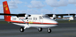
Textures only for the Winair DHC6 - PJ-WIO '50th Anniversary' PAI/HTAI (Henry Tomkiewicz) base model required. DHC6.bmp & Prop-hs.bmp 32bit textures. Modified prop texture and thumbnail included. Supports FS9, FSX also P3D V2.5
Note the correct aircraft should be a cc138 (DHC6 short nose), but I can`t find a proper AI model. Any help with that will be greatly appreciated.
| Filename: | Winair_de_Havilland_Canada_DHC6_PJWIO.zip |
| License: | Freeware |
| Added: | 20th March 2015, 01:53:01 |
| Downloads: | 818 |
| Author: | Finbar Lesmond |
| Size: | 1.03 MB |
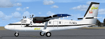
| Category: Flight Simulator 2004 - AI Aircraft | |
| Winair de Havilland Canada DHC-6 (PJ-WIJ) |
|
Images related to this file:
File Description:
Textures only for the Winair DHC6 - PJ-WIJ '50th Anniversary' PAI/HTAI (Henry Tomkiewicz) base model required. DHC6.bmp & Prop-hs.bmp 32bit textures. Modified prop texture and thumbnail included. Supports FS9, FSX also P3D V2.5
| Filename: | Winair_de_Havilland_Canada_DHC6_PJWIJ.zip |
| License: | Freeware |
| Added: | 20th March 2015, 01:52:13 |
| Downloads: | 782 |
| Author: | Finbar Lesmond |
| Size: | 786.42 KB |
| Category: Flight Simulator 2004 - AI Aircraft | |
| Winair de Havilland Canada DHC-6 (PJ-WCA) |
|
Images related to this file:
File Description:
Textures only for the Winair DHC6 - PJ-WCA '50th Anniversary' PAI/HTAI (Henry Tomkiewicz) base model required. DHC6.bmp & Prop-hs.bmp 32bit textures. Modified prop texture and thumbnail included. Supports FS9, FSX also P3D V2.5
| Filename: | Winair_de_Havilland_Canada_DHC6_PJWCA.zip |
| License: | Freeware |
| Added: | 20th March 2015, 01:51:46 |
| Downloads: | 304 |
| Author: | Finbar Lesmond |
| Size: | 693.78 KB |
| Category: Flight Simulator 2004 - Scenery | |
| Georgian Bay Airfields CYEM & CNR4 in Ontario, Canada |
|
Images related to this file:
File Description:
These are two airfields in Ontario around Georgian Bay, which is off the east side of Lake Huron in the Great Lakes. Manitoulin East Muni CYEM is at the northern end of the Bay in an area of coves and lakes, on what is actually an island that is almost but not quite connected to the mainland in several places. There is no immediately adjacent town and the field serves the county area. The runway is 3,500 feet of asphalt aligned 02-20 with PAPI at both ends. The second airfield is Tobermory CNR4, which is just south of the small town and ferry terminal of the same name on the northern end of the peninsula that forms Georgian Bay. The runway is 3,180 feet long and aligned 12-30; there is no longer a 450 feet displacement to the 30 threshold.
| Filename: | Georgian_Bay_Airfields_CYEM__CNR4_in_Ontario_Canad.zip |
| License: | Freeware, limited distribution |
| Added: | 12th August 2018, 19:31:18 |
| Downloads: | 138 |
| Author: | Roger Wensley |
| Size: | 17.45 MB |
| Category: Flight Simulator 2004 - AI Aircraft | |
| Rwandair Express de Havilland Canada Dash 8-200 |
|
File Description:
As the flag carrier for Rwanda, Rwandair operates regional flights to eastern Africa and Johannesburg and a domestic route to Kamambe. Their hub is located at Kigali Int'l Airport (HRYR). Flightplans can be found at www.dusteagle.tk, by Daan 'dustEagle' Callaerts
| Filename: | Rwandair_Express_de_Havilland_Canada_Dash_8200.zip |
| License: | Freeware, limited distribution |
| Added: | 15th July 2006, 05:41:06 |
| Downloads: | 1,619 |
| Author: | Daan Callaerts & FSP/PAI |
| Size: | 107.53 KB |
| Category: Flight Simulator 2002 - Scenery | |
| DEW Line Stations for Alaska, Canada And Greenland |
|
File Description:
This scenery is meant to capture the essence of the Distant Early Warning (DEW) Line of radar and communications stations stretching from the Aleutian Islands in Alaska across the Northern shores of Alaska and Canada into Greenland. The package includes 78 of the DEWLine stations. The DEW Line served as the early warning system for North America during the years of the cold war. Many of the stations were built in the 50’s with others added in the 60’s, 70’s and into the 80’s. Most of these installations have now been closed. Many of the objects have been modeled from photographs. Where possible, site photographs were used to insure that the layouts were as representative of the sites as possible. They are, however, representations only.
| Filename: | DEW_Line_Stations_for_Alaska_Canada_And_Greenland.zip |
| License: | Freeware, limited distribution |
| Added: | 1st February 2003, 00:19:18 |
| Downloads: | 5,230 |
| Author: | Al Gay and Bear Baker |
| Size: | 11.65 MB |
| Category: Flight Simulator 2004 - AI Aircraft | |
| Frontier Airlines DeHavilland Canada DHC-6 Twin Otter |
|
File Description:
These are textures only for the DHC-6 Twin Otter for use with the 1975 Frontier flight plans from Retro AI Traffic Group. Requires the base DHC-6 from Henry Tomkiewicz, available at Avsim.
| Filename: | Frontier_Airlines_DeHavilland_Canada_DHC6_Twin_Ott.zip |
| License: | Freeware, limited distribution |
| Added: | 8th July 2007, 21:08:35 |
| Downloads: | 314 |
| Author: | Kristopher Crook, Retro AI Traffic Group |
| Size: | 136.36 KB |
| Category: Flight Simulator 2004 - Scenery | |
| CYKF - Kitchener, Regional Muni of Waterloo - Ontario Canada |
|
Images related to this file:
File Description:
The town of Kitchener is in southern Ontario, 40 miles southwest of Toronto. The population is just over half a million, including the adjoining Cambridge and Waterloo which are known locally as the Tri Cities. The Kitchener name was adopted in 1916, replacing the former "City of Berlin".
The airport is on the northeastern side of the town, with the main runway aligned 08-26 and just over 7,000 feet of asphalt 150 feet wide, lit, with PAPI at both ends and approach lighting and ILS on 26. The second runway is aligned 14-32 and is 4,100 feet long, lit and with PAPI at both ends; right hand circuits for 32. The airport is being steadily enlarged and improved, with new hangars for rental, operators, and maintenance companies. The largest and most visible presence is the training operation located just off the southwest end of taxiway A, where there are 14 Cessna 172, 2 Cessna 152, 2 Piper Seminole, and others. These are represented in the AI. There are morning and evening scheduled flights by Westjet to Calgary and American Eagle to Chicago, also in the AI. To the southwest, past taxiway C, there is GA parking; request taxi to what is named here "southwest parking" where there are spaces on both grass and asphalt. To the southeast, along a taxiway off the southeast corner of the main apron, are mainly operators and maintenance facilities. This version of CYKF includes the new(ish) terminal, the first of the new central rental hangars alongside the new taxiway and access road, and the very new large hangar off taxiway C, but not the new airport services building (fire and snow clearance) that is off to the southeast of taxiway A, and not the new car park to the south of the airport access road. So an uncertain and possibly historically innacurate date, but with the correct taxiway lighting and signage, and building textures from photographs.
| Filename: | CYKF__Kitchener_Regional_Muni_of_Waterloo__Ontario.zip |
| License: | Freeware, limited distribution |
| Added: | 7th May 2016, 21:13:28 |
| Downloads: | 547 |
| Author: | Roger Wensley |
| Size: | 28.69 MB |
© 2001-2026 AVSIM Online
All Rights Reserved
Privacy Policy |