
Where Flight Simulation Enthusiasts Gather from Around the World!
AVSIM Library - Search Results

| Category: Flight Simulator X - AFCAD Files | |
| CYxs Prince Geroge - British Columbia, Canada |

|
File Description:
I have completely reconstructed CYXS using ADE (v1.40), Google Earth satellite images and current airport chart. Runways have been repositioned and runway 15/33 extended from 7400 ft to 11450 ft. ILS has been added to runway 33. Roads, parking areas and new buildings added. Aprons readjusted. Automated jetways added. Parking for AI aircraft and refueling truck added. Additional scenery objects have been added and to view these will require you to install additional files as described below. Airport views are from the roof of the control tower.
Latest News: YXS - The New Transpacific Logisitics Alternative
The Runway Expansion Project has transformed runway 15/33 from 7,400 ft. to 11,450 ft., complete with centre line (LED) lighting, dual ILS navigational systems and a dedicated de-icing refueling pad for wide body aircraft. Once completed, the Runway Expansion Project will allow the PGAA to market the airport as a new transpacific logistics alternative, providing carriers the opportunity to make Prince George a destination of choice for refueling and transshipment of cargo
| Filename: | CYxs_Prince_Geroge__British_Columbia_Canada.zip |
| License: | Freeware |
| Added: | 5th November 2009, 02:16:13 |
| Downloads: | 747 |
| Author: | Robert Catherall |
| Size: | 878.39 KB |
| Category: Flight Simulator X - AFCAD Files | |
| CZBB Boundary Bay Airport, BC, Canada |
|
File Description:
This is a complete redo of the default FSX CZBB Boundary Bay Airport, BC using ADE v1.37, Google Earth satellite image and the latest airport chart effective as of 31 July 2008. The airport center and boundary repositioned. Control tower moved and replaced. Runway 07/25 extended to 5606 ft from 3540 ft and new taxiway E added. VASI Added to Runway 07/25. Taxiway signs added and/or corrected. Airport aprons resized and added where necessary. Taxiways and roads added. Static airport library objects and vegetation added for an improved look. XWind runways activated. Airport views are from the roof of the control tower when in tower view. A fuel truck has been added - Shift-F will bring this truck to your aircraft for refueling and will automatically refuel AI aircraft after landing and before take off. Airport chart and history included.
| Filename: | CZBB_Boundary_Bay_Airport_BC_Canada.zip |
| License: | Freeware |
| Added: | 5th November 2009, 02:16:37 |
| Downloads: | 448 |
| Author: | Robert Catherall |
| Size: | 381.61 KB |
| Category: Flight Simulator X - Scenery | |
| Okanagan Lake, British Columbia, Canada Upgrades |
|
Images related to this file:
File Description:
A scenery upgrade to Okanagan Lake, BC, Canada. This scenery continues the upgrades to the Kelowna area near CYLW. South of the airport the lake received marinas and docks and a marina entrance station located near the bridge. As per Google Earth both sides of the lake at the bridge have several marinas, docks and small piers, lot's of boats and some added fictitious objects including a landable water helipad. This scenery is stand-alone. Nothing else is required. Read the text file for instructions and please enjoy. By Savageale.
| Filename: | Okanagan_Lake_British_Columbia_Canada_Upgrades.zip |
| License: | Freeware |
| Added: | 4th December 2011, 08:08:34 |
| Downloads: | 992 |
| Author: | Tim Durham |
| Size: | 1.58 MB |
| Category: Flight Simulator X - Scenery | |
| CTH3 Canada, Quebec, Les Grandes-Bergeronnes |
|
Images related to this file:
File Description:
This is the scenery Les Grandes Bergeronnes ( CTH3 ) which represents the reality. Les Grandes Bergeronnes is a small village located on Northern bank of the St-Laurent river of Quebec at Canada. This scenery is design with FSDS and it accepts Mesh of Gilles Gauthier.This scenery has the function for FS-X.
| Filename: | CTH3_Canada_Quebec_Les_GrandesBergeronnes.zip |
| License: | Freeware |
| Added: | 31st December 2009, 04:53:04 |
| Downloads: | 567 |
| Author: | Regis Dassylva |
| Size: | 725.14 KB |
| Category: Flight Simulator X - Scenery | |
| CYSM Fort Smith, Northwest Territories, Canada |
|
File Description:
Fort Smith Airport, (IATA: YSM, ICAO: CYSM), is located approximately 4 Km west of town of Fort Smith.
| Filename: | CYSM_Fort_Smith_Northwest_Territories_Canada.zip |
| License: | Freeware |
| Added: | 17th April 2010, 16:32:13 |
| Downloads: | 1,533 |
| Author: | Robert Catherall |
| Size: | 4.51 MB |
| Category: Flight Simulator 2004 - Scenery | |
| Pemberton CYPS in British Columbia Canada |
|
Images related to this file:
File Description:
Pemberton is a small village in the Coast Mountains of British Columbia, with a permanent population of under 3,000 and reliant on logging and increasing tourism. It is around 40 miles north of Squamish and 15 miles north of Whistler and the flight north is best described as scenic. The Nairn Falls, a scenic attraction for tourists, are close by. The runway is 3,920 feet of asphalt aligned 06-24, between and close to the join of the Lillooet River and the Green River. The airfield buildings are to the north of the runway, and at the eastern end is a Fire Base for the expected summer forest fires. To the south and west is the Pemberton Golf Course. All the buildings are replicated, and once again this is not an airport, it is an airfield without any lighting and typical of my future posts which are updated versions of airfield scenery made some time ago and not posted. This one is probably more intricate than most that will follow. The lack of lighting is actually very sensible as landing in the mountains in the dark..... Gun Lake is included here, but not for regular use as it is a deserted dirt strip 40 miles to the north that was once used for fire fighting and there is nothing to see. Just a part of the scenery in this area of BC. If you want to follow this trip on Google Earth the next stop is Cache Creek. If you find a defect, email me. Do not email me about the strange doors to the front of the Blackcomb hangar. I was surprised when I saw it and then discovered that the "doors" are actually flexible curtains that are rolled up and down and if rolled down too far...
I have the ok to use the Bell 212 CCG helicopter as a scenery object, but not to post the entire object library of the Red Deer CYQF scenery; if you have the scenery it should show up here.
| Filename: | Pemberton_CYPS_in_British_Columbia_Canada.zip |
| License: | Freeware, limited distribution |
| Added: | 17th November 2020, 17:29:13 |
| Downloads: | 107 |
| Author: | Roger Wensley |
| Size: | 16.18 MB |
| Category: Flight Simulator 2002 - AI Flight Plans | |
| Jazz flights for Eastern Canada(Maritimes) |
|
File Description:
These flights are athentic flights for the new year. All flights are correct to the best of my ability.I left no island untouched.Works well with my Flycan.E.zip which covers all flights between the mainland and NFLD.
| Filename: | Jazz_flights_for_Eastern_CanadaMaritimes.zip |
| License: | Freeware |
| Added: | 7th January 2003, 01:24:09 |
| Downloads: | 401 |
| Author: | Al J Sibley |
| Size: | 14.08 KB |
| Category: Flight Simulator 2004 - Scenery | |
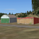
| Matheson Point CWMP in Nunavut, Canada |
|
Images related to this file:
File Description:
This was a DEW line I Station on the southeast shore of King William Island; the island is around 70 miles square and Gjoa Haven is also on the southeast corner, 20 miles to the south. The station was closed in 1963 and has now been totally dismantled and removed except for a fallen 300 feet communications tower. The runway is still there (mostly) and is around 3,360 feet of gravel 120' wide, aligned 146T/326T. There are no lights, signage, or windsock, or any building remaining. All of these DEW line stations are not particularly impressive or even interesting. However, you can bet that any pilot flying regularly in the north along the coast knows where all these runways are, in case one of them suddenly becomes his favourite in the whole world just after the sudden silence.
| Filename: | Matheson_Point_CWMP_in_Nunavut_Canada.zip |
| License: | Freeware, limited distribution |
| Added: | 22nd November 2012, 16:28:19 |
| Downloads: | 178 |
| Author: | Roger Wensley |
| Size: | 785.57 KB |
| Category: Flight Simulator 2004 - AFCAD Files | |
| Alert, Northwest Territories, Canada (CYLT/YLT) |
|
File Description:
CYLT is the world's northernmost permanent airport, located at Alert, Nunavut, Canada, approximately 830 km south of the true North Pole about 10 km west of Cape Sheridan, the northeastern tip of Ellesmere Island, on the shore of ice-covered Lincoln Sea. It is operated by the Canadian Department of National Defense and is part of Canadian Forces Station Alert. This Afcad adds five (5) new parking spots to Alert. THIS AFCAD IS PURELY FICTIONAL!
| Filename: | Alert_Northwest_Territories_Canada_CYLTYLT.zip |
| License: | Freeware |
| Added: | 5th July 2007, 20:19:25 |
| Downloads: | 577 |
| Author: | Shane Sidsworth |
| Size: | 2.55 KB |
| Category: Flight Simulator 2002 - Scenery | |
| Pacific Northwest Illustrated Scenery Catalog - CANADA |
|
File Description:
Constant additions of scenery for FS2002 have resulted in the neccessity of two separate catalogs (Microsoft Word format), one covering the US northwestern states and one for Canada; rather than my old editions that covered both. This one for the Canadian western provinces has over 60 files of scenery for British Columbia, Northwest Territories and the Yukon Territories. Updated links. Plenty of screenshots. Unless the sim community is overwhelmed with new scenery developments for this area over the next few weeks, this should do it for awhile. Although I have been meticulous in searching these files out, there is bound to be a few I missed. If you are or become aware of them, I would appreciate your bringing them to my attention.
| Filename: | Pacific_Northwest_Illustrated_Scenery_Catalog__CAN.zip |
| License: | Freeware, limited distribution |
| Added: | 25th November 2002, 20:14:38 |
| Downloads: | 1,207 |
| Author: | Heather Sherman |
| Size: | 2.89 MB |
© 2001-2026 AVSIM Online
All Rights Reserved
Privacy Policy |