
Where Flight Simulation Enthusiasts Gather from Around the World!
AVSIM Library - Search Results

| Category: Flight Simulator 2004 - Scenery | |
| Grande Cache CEQ5 in Alberta, Canada |

|
Images related to this file:
File Description:
Grande Cache is at 4,117 feet above sea level, just under 90 miles south of Grande Prairie and 220 miles west of Edmonton. It is among the eastern foothills of the Rockies. The town was established to accommodate employees of a coal mine and their families in the early 1970's. There was a financial roller coaster ride for the coalmine during the next few years and despite the opening of a wood chip plant and a federal prison the town was eventually downgraded to a hamlet by a vote in 2018, as it was essentially bankrupt and had a population of less than 4,500. The airport, some 10 miles east of the town, had two aprons, one for GA and scheduled flights and another, the eastern one, for fire fighting planes. I say "had" as it was closed in January 2017. However, the fire fighting area appears to have been maintained (tanks repainted, for instance) and is presumably able to support operations if required. The date for this scenery is 2009.
| Filename: | Grande_Cache_CEQ5_in_Alberta_Canada.zip |
| License: | Freeware, limited distribution |
| Added: | 29th September 2021, 03:59:20 |
| Downloads: | 87 |
| Author: | Roger Wensley |
| Size: | 7.49 MB |
| Category: Flight Simulator 2004 - Scenery | |
| CYOC - Old Crow - Yukon Territory, Canada |
|
Images related to this file:
File Description:
Old Crow is in the far north of the Yukon Territory, Canada, 115 miles south of the nearest coastline and 30 miles east of the border with Alaska. The town has a population of less than 300 and the population are reliant on the caribou migration for an annual food supply replenishment. The fact that it is the only Yukon town that cannot be reached by car makes the airport important, and there are regular flights by Air North, the Yukon airline. They are included in the AI along with GA aircraft. I had several tries at matching up the Hawker Siddeley 748 with the right set of textures and I have included both here so that you do not have to go through the same torture. Thanks go to Hernan for sorting all that out, and for his textures. The airport is beside the town that is built along a bank of the Porcupine River. I have replicated the current shore line of the river that has cut a new channel at one end of the town, and I flattened the river as it was somewhat mountainous. The runway is gravel and just over 5,000 feet long, aligned 03-21. The terminal building is specific to Old Crow as I had photos, but the hangars are approximations and the village houses are only representational.
| Filename: | CYOC__Old_Crow__Yukon_Territory_Canada.zip |
| License: | Freeware, limited distribution |
| Added: | 5th December 2014, 13:31:46 |
| Downloads: | 370 |
| Author: | Roger Wensley |
| Size: | 7.58 MB |
| Category: Flight Simulator 2004 - AI Flight Plans | |
| Shell Canada Embraer 170 Corporate Flightplans |
|
File Description:
Shell Canada Embraer 170 Corporate operating between base in Calgary and Albian Aerodrome. The data is based on internet research. Albian Village and Albian Aerodrome were built to support expansion of the Athabasca Oil Sands Project (AOSP). AOSP Expansion 1 is a 100,000-barrel-a-day expansion of both bitumen mining and upgrading facilities. At peak, AOSP Expansion 1 will employ more than 6,000 skilled trades people at construction sites near Fort McMurray and near Fort Saskatchewan, Alberta. Repaint by Darren Belanger on Avsim - shellcanada_e170_dtb.zip
| Filename: | Shell_Canada_Embraer_170_Corporate_Flightplans.zip |
| License: | Freeware |
| Added: | 6th February 2009, 23:32:53 |
| Downloads: | 760 |
| Author: | Jerel Gregory Hayes |
| Size: | 7.97 KB |
| Category: Flight Simulator X - AFCAD Files | |
| Greater Moncton International Airport / Canada (CYQM) |
|
Images related to this file:
File Description:
CYQM - Greater Moncton International Airport / Moncton, New Brunswick, Canada
This airport update was made with the latest version of ADE (Airport Design Editor) and made for FSX as a replacement for the stock (default) airport. I found that most stock airports in FSX lack a decent amount of character and realism and this area in particular was dreadful! The stock airport was rather inaccurate. I've made several additions to the airport which are listed below. All these enchancements are as close to the real airport as I can get with stock library objects. I've used satellite images, terminal photos and maps throughout the whole process so building locations are as accurate as possible. Happy landings in the beautiful Canada!
Features:
*Expanded parking apron
*Main terminal building with it's 2 jetways and additional parking for regional jets/turboprops
*Seperate parking aprons for GA traffic near the old terminal
*Hangar and other airport buildings added
*Airport vehicles and objects throughout the airport
*Main road in front of airport added with static vehicles
*Parking lots with static vehicles
*Airport fire station with fire trucks
*Static de-icing vehicles
| Filename: | Greater_Moncton_International_Airport__Canada_CYQM.zip |
| License: | Freeware |
| Added: | 21st July 2012, 02:41:58 |
| Downloads: | 815 |
| Author: | Jaison Diaz |
| Size: | 10.6 KB |
| Category: Flight Simulator 2004 - Aircraft Repaints, Textures and Modifications | |
| FSD Cessna 337H "O' Canada" Schemes |
|
File Description:
These 2 complete textures are for the FSD Cessna 337, a licenced copy of the 337 is required to use these textures, thanks for your interest!
| Filename: | FSD_Cessna_337H_O_Canada_Schemes.zip |
| License: | Freeware, limited distribution |
| Added: | 6th September 2005, 13:16:25 |
| Downloads: | 511 |
| Author: | Glenn Baker/ FSD International |
| Size: | 1.75 MB |
| Category: Flight Simulator 2004 - Scenery | |
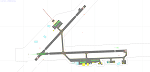
| CYPE - Peace River - Northwest Alberta, Canada |
|
Images related to this file:
File Description:
The Peace River flows east from the Rockies, joining up with the Slave River to empty into Great Slave Lake. The town is on both banks close to a bend, 245 miles northwest of Edmonton. The population is 7,000 and the surrounding area is either farmland or forest and used for winter sports; Peace River hosted the 2004 Alberta Winter Games. The airport is just over 3 miles west of the town. The runway is 5,000 feet of wide asphalt (150 feet) aligned 04/22, lit, and with PAPI. There is a second runway to the south of the main runway, 1,900 feet of grass and aligned 08/26. The apron is to the north of the runway at the eastern end and is large; there is a purpose-built terminal building, plus other hangar buildings along taxiway C that extends westward from the apron. The airport gives the impression that it is under-used; there are no long lines of parked planes waiting for the weekend and few scheduled flights. These are mainly (totally?) by Sunwest Home Aviation, but unfortunately nobody has made the textures for Sunwest and my talents do not run in that direction so I have made believable substitutions. There is also a small but obstinate AI difficulty, described in the notes.
| Filename: | CYPE__Peace_River__Northwest_Alberta_Canada.zip |
| License: | Freeware, limited distribution |
| Added: | 10th November 2013, 23:56:22 |
| Downloads: | 332 |
| Author: | Roger Wensley |
| Size: | 10.83 MB |
| Category: Flight Simulator 2004 - Scenery | |
| High Prairie CZHP in Alberta, Canada |
|
Images related to this file:
File Description:
High Prairie is at 1,974 feet asl, 15 miles west of Lesser Slave Lake, 70 miles southeast of Peace River CYPE, and 90 miles east of Grande Prairie CYQU (both already posted). The town has a population of around 2,600 and is based on agriculture, forestry, and oil and gas. The initial impetus behind its growth was the routing of the railroad in 1914. The airport is around 2 miles south of the town, and is fairly basic. There is a single runway just under 4,000 feet of asphalt aligned 07-25. There is a daily flight and around 2010 this was by Central Mountain Air. I believe that there is now a newer terminal building, but a lack of information leaves the older one in place here. There are runway and taxiway lights, unlike some of my recent posts. I made this to fill in the gap between Edmonton and the airports to the northwest such as Grande Prairie.
| Filename: | High_Prairie_CZHP_in_Alberta_Canada.zip |
| License: | Freeware, limited distribution |
| Added: | 9th December 2018, 17:21:09 |
| Downloads: | 119 |
| Author: | Roger Wensley |
| Size: | 3.16 MB |
| Category: Flight Simulator 2004 - Scenery | |
| Kasba Lake CJL8 Northwest Territories Canada |
|
Images related to this file:
File Description:
This is a sixth airfield with links to Lake Athabasca, which is in Alberta and Saskatchewan. Kasba Lake is some 135 miles northeast of Stony Rapids and is in the Northwest Territories. The airfield is owned and run by and for Kasba Lake Lodge and it is one of several fishing vacation spots that are serviced by flights from Stony Rapids. It is these flights to the north that explain the number of regular scheduled flights into Stony Rapids from the south. The Kasba Lake Lodge has docks for boats and also for clients that want to arrive in their own floatplanes. The ai is for both Kasba Lake and Obre Lake and replaces the porpoising plane that I had used for Obre Lake. Norilor flies the weekend package-deal-long-distance delivery flights for Kasba Lake direct from Winnipeg, and now also for Obre Lake.
| Filename: | Kasba_Lake_CJL8_Northwest_Territories_Canada.zip |
| License: | Freeware, limited distribution |
| Added: | 9th August 2018, 14:21:17 |
| Downloads: | 148 |
| Author: | Roger Wensley |
| Size: | 2.48 MB |
| Category: Flight Simulator 2004 - Scenery | |
| Mackenzie CYZY in British Columbia, Canada |
|
Images related to this file:
File Description:
Mackenzie is around 120 miles west of Peace River and the BC/Alberta border, at the southern end of Williston Lake. The lake is 135 miles long and the population of the town is about 3,500; those figures illustrate typical Canada, a huge area enjoyed by the few. The main occupations relate to timber and mining in some form, plus tourism (in particular winter sports tourism). The airport is 2 miles southwest of the town, with no regular scheduled flights but it is not unusual to find Central Mountain Air there delivering either charter passengers or freight. The single runway is aligned 16-34 and 100 feet wide lit asphalt that is just over 5,000 feet long, with (in 2010 or so) an additional 1,500 feet of gravel. There is PAPI at both ends of the asphalt. The largest operation based at the airfield is a helicopter company, at the northern end of the apron. There is a "mandatory frequency" of 123.5 which is a Canadian invention; you MUST have a radio. There is no control tower at the actual airfield, and if or when there is no response from further afield then you announce your intentions etc. In FS9 there is no way to "switch off or on" the monitoring of a MF radio frequency so you will find that this one is always silent.
| Filename: | Mackenzie_CYZY_in_British_Columbia_Canada.zip |
| License: | Freeware, limited distribution |
| Added: | 27th December 2018, 20:19:05 |
| Downloads: | 131 |
| Author: | Roger Wensley |
| Size: | 19.81 MB |
| Category: Flight Simulator 2004 - Scenery | |
| Mountain View CPZ3 in Ontario, Canada |
|
Images related to this file:
File Description:
This is Mountain View, a small RCAF airfield at the eastern end of Lake Ontario on Prince Edward Island, some 40 miles west of Kingston. Mountain View is used for training during the summer months, and part of this training is for C-130 crews, who practice landing on rough or unprepared landing strips. The crews are based at Trenton, which is a large base 10 miles to the northwest on the mainland. There are (or were, I haven't seen it recently) numerous parked and ancient fighter planes such T-33's and Canadair Tutors; these could also have possibly been used for summer training or perhaps were just stored. Last summer there were only two hangars left standing; in 2002 there were five. In real life you would be on the lookout not only for C-130's but also (at certain times during the summer) for parachutists and also gliders. This airfield is one that you will fly over and not land on; I confess that I have cheated with the length of the 06L-24R gravel "practice" runway, so that it became possible for the FS version of a touch-n-go with a C-130 to be completed without using the grass. The aerial photograph shows the new "practice" gravel runway under construction.
| Filename: | Mountain_View_CPZ3_in_Ontario_Canada.zip |
| License: | Freeware, limited distribution |
| Added: | 9th March 2012, 15:05:57 |
| Downloads: | 350 |
| Author: | Roger Wensley |
| Size: | 7.26 MB |
© 2001-2026 AVSIM Online
All Rights Reserved
Privacy Policy |