
Where Flight Simulation Enthusiasts Gather from Around the World!
AVSIM Library - Search Results

| Category: Flight Simulator X - Aircraft Repaints, Textures and Modifications | |
| Seaborne Airlines deHavilland Canada DHC6-300 - Wheeled |

|
Images related to this file:
File Description:
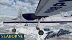
Repaint of Aerosoft DHC6-300 wheeled in Seaborne livery. Textures only.
| Filename: | Seaborne_Airlines_deHavilland_Canada_DHC6300__Whee.zip |
| License: | Freeware |
| Added: | 4th February 2014, 08:45:35 |
| Downloads: | 242 |
| Author: | Rob Potter |
| Size: | 4.02 MB |
| Category: Flight Simulator 2004 - Scenery | |
| Dawson Creek CYDQ in British Columbia, Canada |
|
Images related to this file:
File Description:
Dawson Creek is at 2,148 feet asl just east of the Rocky Mountains, less than 10 miles west of the BC/Alberta border. The Peace River, 25 miles north of Dawson Creek, links the two sides of the Rockies, winding through peaks that reach up almost to 8,000 feet. The population grew when the Northern Alberta Railway was extended to Dawsons Creek in 1932, and grew even more more when the Alaska Highway was built in 1942 and Dawsons Creek was where it started from. The airport is just to the east of the town. The runway is 5,000 feet of wide asphalt (150 feet) aligned 06/24, lit, and with PAPI and approach lights. There is a water runway to the north of the main runway with the same alignment, separately designated as Dawson Creek CBD3. The two operate as one; traffic for both use the mandatory frequency of 122.2 and talk to one controller in one control tower. However, in FS9 the ATC for two separately designated airfields operates as if they are nowhere near each other and near misses are the result. I have put them both in un-manned tower mode so you will announce your position and intentions and select your own parking spots etc. There is in reality a lack of apron markings but I have marked the positions of both gates. The apron is not large so there is only one other apron parking spot (see the traffic cone) and most parking is either next to one of the hangars or on the grass. The aprons vary from asphalt, to concrete, onwards to gravel, and then further onwards to some gravel amid the bare dirt; I have replicated this variation as far as FS9 permits. The buildings are bespoke from photos. The AI includes Central Mountain Air with two daily scheduled flights and Northern Cariboo as one of the airlines that occasionally runs charter flights in CYDQ. There are also private GA flights, and float plane flights into and out of CBD3.
| Filename: | Dawson_Creek_CYDQ_in_British_Columbia_Canada.zip |
| License: | Freeware, limited distribution |
| Added: | 22nd November 2013, 23:31:40 |
| Downloads: | 653 |
| Author: | Roger Wensley |
| Size: | 16.65 MB |
| Category: Flight Simulator X - Scenery | |
| CYHZ - Halifax International Airport - NS, Canada - UPDATE |
|
File Description:
UPDATE: CYHZ - Halifax Internationl Airport, Nova Scotia, Canada.
Note: This version can be installed in both FSX and Lockheed Martin P3D v1.4
This is an update to my previous scenery upload, 10-31-2009, to reflect changes to runway 05/23. This runway as been extended from 8800 feet to 10500 feet to accommodate the 'heavies' now using this airport. Taxiway designators update and/or added. Minor adjustment made runway approach headings. Main body of the airport remains unchanged.
| Filename: | CYHZ__Halifax_International_Airport___NS_Canada__U.zip |
| License: | Freeware |
| Added: | 26th November 2013, 02:24:35 |
| Downloads: | 26,542 |
| Author: | Robert Catherall |
| Size: | 2.74 MB |
| Category: Flight Simulator 2004 - Scenery | |
| Fort Good Hope CZGH - Northwest Territories, Canada |
|
Images related to this file:
File Description:
This is the second in a series of airfields that follow that early access route to the Canadian northern shore, the Mackenzie River. At the far northern end of the river there are Tuktoyaktuk, Inuvik, and Fort McPherson, all posted. Fort Good Hope is at 268 feet ASL and on the east bank of the Mackenzie, 180 miles southeast of Fort McPherson and 100 miles west of Great Bear Lake. The town has a population of around 560, and the main sources of income are from the traditional trapping and hunting. The airport is a mile south of the town, and has almost 4,000 feet of gravel runway. There are scheduled flights to the town by North Wright; I also have two AI GA flights and a Buffalo Airways delivery trip that hops north and south from field to field.
| Filename: | Fort_Good_Hope_CZGH__Northwest_Territories_Canada.zip |
| License: | Freeware, limited distribution |
| Added: | 4th July 2014, 21:03:03 |
| Downloads: | 277 |
| Author: | Roger Wensley |
| Size: | 3.08 MB |
| Category: Flight Simulator 2004 - Scenery | |
| Fort Simpson Island CET4 - Northwest Territories, Canada |
|
Images related to this file:
File Description:
Fort Simpson Island is the fifth in a series of airfields that follow (approximately) in a southward direction the Mackenzie River. At the far northern end of the river there is Tuktoyaktuk, then Inuvik, Fort McPherson, Fort Good Hope, Deline, and then Wrigley, all posted. Fort Simpson Island is at 405 feet asl and on the west bank of the the Mackenzie, around 110 miles south of Wrigley at the junction of the Mackenzie and the Liard rivers. The town of Fort Simpson is on an island, and has a population of 1,250 or so folks. The Hudson Bay trading post was established here in 1822. The airport is right next to the town, and has 3,000 feet of gravel runway, though with a displaced threshold of 1,000 feet at each end (unmarked, on gravel) this is effectively 2,000 feet for landing. The Canada Flight Supplement lists the runway as being 100 feet wide; the gravel is definitely far less and the 100 refers to the width in the winter when you are landing on snow and don't care if there is gravel or grass underneath. There are no scheduled flights as these go to the nearby Fort Simpson CYFS. There is a mandatory radio frequency which is for both CYFS and CET4 and in this case I have set the "tower" to "manned" so you will report position and obey instructions. Runway 13 has right hand circuits. I have modified the Ultimate Terrain route for the Mackenzie Highway so that it remains on the west side of the river and does not wander randomly from one side to the other north of Fort Simpson.
| Filename: | Fort_Simpson_Island_CET4__Northwest_Territories_Ca.zip |
| License: | Freeware, limited distribution |
| Added: | 6th July 2014, 02:56:05 |
| Downloads: | 208 |
| Author: | Roger Wensley |
| Size: | 2.46 MB |
| Category: Flight Simulator X - Scenery | |
| CYSG - St. Georges Aerodrome - Quebec, Canada - v1.2 |
|
Images related to this file:
File Description:
Saint-Georges Aerodrome, (ICAO: CYSG), is a general aviation aerodrome located 1.5 nautical miles (2.8 km; 1.7 mi) west-southwest of Saint-Georges, Quebec, Canada near the border with Maine. The airport has a long, paved runway, suitable for use by jets. This scenery FSX and P3D Airport St-Georges was inspired by the great FS2004 scenery of the late pilot Virtual Hugues Caron img12. It was made very humbly in his memory. This scenery been validated and tested with FSX SP1, SP2, Acceleration and P3D v2. This is a complete reproduction, more accurate and realistic in Saint-Georges Beauce airport with all the buildings around it. For technical information or assistance contact one of the following email addresses support: [email protected] or [email protected]. Web site : http://imaginairvirtuel.qc.ca
In addition to compatibility P3D added, version 1.2 will replace and improve version 1.1. It is suggested to uninstall version 1.1 and replace it.
| Filename: | CYSG__St_Georges_Aerodrome__Quebec_Canada__v12.zip |
| License: | Freeware, limited distribution |
| Added: | 8th March 2015, 22:27:34 |
| Downloads: | 1,417 |
| Author: | Georges Bourgouin |
| Size: | 7.67 MB |
| Category: Flight Simulator 2004 - Scenery | |
| CYSA - Stratford Municipal Airport - Ontario, Canada **Fix** |
|
File Description:
In the actual Stratford Municipal Version, the airport building and the hangars are 25 percent sunk into the ground. This update solve this problem.
| Filename: | CYSA__Stratford_Municipal_Airport__Ontario_Canada_.zip |
| License: | Freeware |
| Added: | 6th April 2015, 00:10:37 |
| Downloads: | 218 |
| Author: | David Kolas |
| Size: | 1.93 KB |
| Category: Prepar3D V1-4 - Scenery | |
| CYEG - Edmonton International Airport - Alberta, Canada (Updated) |
|
File Description:
Prepar3D Scenery--CYEG, Edmonton International Airport, Alberta, Canada. This airport update is for CYEG with two optional files made only for the Prepar3Dv2 default airport: one version with the Crosswind runway activated and in full operation where both runways will be used for takeoff/landing and one version as the default runway operation: assigned parking updated as per their website with extra parking including a gate for the A380, the new terminal expansion added, taxiways and taxi signs updated to the latest charts, extra fuel trucks, support vehicle roads rebuilt and many other improvements, airport views are from inside the control tower (when in tower view) please view the readme before installation. By Robert Catherall.
| Filename: | CYEG__Edmonton_International_Airport__Alberta_Cana.zip |
| License: | Freeware |
| Added: | 7th October 2015, 22:40:09 |
| Downloads: | 1,471 |
| Author: | Robert Catherall |
| Size: | 572.01 KB |
| Category: Flight Simulator X - Scenery | |
| CYZF - Yellowknife Airport Base - Northwest Territories, Canada |
|
File Description:
Sim Scenery Markers present CYZF (FSX/P3D) Base file this contains all models and the Airport and Surroundings
Yellowknife Airport as it is in 2015. Modeled with Dual installers for FSX and P3D 3.0.
Look as a separate upload the photo scenery that goes with it.
| Filename: | CYZF__Yellowknife_Airport_Base__Northwest_Territor.zip |
| License: | Freeware, limited distribution |
| Added: | 12th November 2015, 15:59:11 |
| Downloads: | 3,745 |
| Author: | Mark Beale, Shane Strong, Berwyn Goudey |
| Size: | 77.15 MB |
| Category: Flight Simulator X - AFCAD Files | |
| CYEG - Edmonton International Airport - Edmonton, Alberta - Canada |
|
Images related to this file:
File Description:
This file was made only as an update for the FSX default airport. The airport has now more accurate placed parking spots and terminals. For all improvements view the readme.
| Filename: | CYEG__Edmonton_International_Airport__Edmonton_Alb.zip |
| License: | Freeware, limited distribution |
| Added: | 15th February 2016, 20:25:32 |
| Downloads: | 535 |
| Author: | Kai P. Kamjunke |
| Size: | 877.64 KB |


© 2001-2026 AVSIM Online
All Rights Reserved
Privacy Policy |