
Where Flight Simulation Enthusiasts Gather from Around the World!
AVSIM Library - Search Results

| Category: Flight Simulator 2004 - Scenery | |
| Inuvik CYEV update in Northwest Territories, Canada |

|
Images related to this file:
File Description:
This is a revised version of Inuvik CYEV, with slightly improved building textures, some more add-ons around the buildings, new lighting for runway and apron, new signage, night textures for the terminal and tower, apron floodlights (by Sidney Schwartz) and landclass textures for the town. There is also new AI which gets rid of the porpoising First Air B737 and replaces it with a turboprop, and also links together Inuvik, Tuktoyaktuk, and Sachs Harbour; there is an Aklak Air DC3 flight (Kenn Borek under a diferent name) that leaves Inuvik at 1500GMT and does the round trip to Tuk, Sachs, Tuk, and then back to Inuvik. Aklavik, Sachs Harbour, and Tuktoyaktuk will be posted and should also be installed; there are linked scenery and AI improvements for all in the four posts.
| Filename: | Inuvik_CYEV_update_in_Northwest_Territories_Canada.zip |
| License: | Freeware, limited distribution |
| Added: | 14th May 2012, 17:18:26 |
| Downloads: | 616 |
| Author: | Roger Wensley |
| Size: | 6.62 MB |
| Category: Flight Simulator 2004 - Scenery | |
| Embrun CPR2 in Ontario Canada 2012 Revision |
|
Images related to this file:
File Description:
Embrun is in Ontario a few miles southeast of Ottawa, and southwest of my posted strips Russel Farm, Russellet Strip, and Indian Creek. It is a real airfield, used by Embrun Flying Club, and there is now fuel since the owner built a house on the field and moved in, and more hangars than there used to be. All in all a nice airfield with a grass runway 2,260 feet long, and in this REVISED version with a new windsock. There are electric cables strung along the road at the eastern end of the runway, marked by visibility balls; watch out for those. At the western end there are some old grain silos; these shouldn't be a problem, and if you are flying a taildragger give you something to aim at until the tail comes up. I did my first grass field landing and take off there when I was learning to fly, and it is just the right distance from Rockcliffe for a nice afternoon training flight. Look out for geese taking off from the fields to the west when you use 26; that departure from Embrun along with 50 geese was more entertaining than most.
| Filename: | Embrun_CPR2_in_Ontario_Canada_2012_Revision.zip |
| License: | Freeware, limited distribution |
| Added: | 9th February 2012, 01:31:31 |
| Downloads: | 303 |
| Author: | Roger Wensley |
| Size: | 3.8 MB |
| Category: Flight Simulator X - AFCAD Files | |
| CYYG - Charlottetown General Airport / Charlottetown, PE Canada |
|
Images related to this file:
File Description:
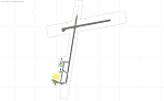
CYYG - Charlottetown General Airport / Charlottetown, PE Canada
This airport update was made with the latest version of ADE (Airport Design Editor) and made for FSX as a replacement for the stock (default) airport. I found that most stock airports in FSX lack a decent amount of character and realism and I've tried to fix that a little bit. I've added proper parking for commercial and general aircraft traffic as well as adding new buildings for the terminal as well as some hangars. A few small touches like cars in the parking lot and some static aircraft and birds were added as well.
I hope to do a few more of these as time permits, hope you enjoy!
| Filename: | CYYG__Charlottetown_General_Airport___Charlottetow.zip |
| License: | Freeware |
| Added: | 11th July 2012, 04:04:01 |
| Downloads: | 541 |
| Author: | Jaison Diaz |
| Size: | 7.14 KB |
| Category: Flight Simulator X - AFCAD Files | |
| CYQR - Regina International Airport / Regina, Saskatchewan, Canada |
|
Images related to this file:
File Description:
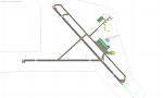
CYQR - Regina International Airport / Regina, Saskatchewan, Canada
This airport update was made with the latest version of ADE (Airport Design Editor) and made for FSX as a replacement for the stock (default) airport. I found that most stock airports in FSX lack a decent amount of character and realism and this area in particular was dreadful! The stock airport was rather inaccurate. I've made several additions to the airport which are listed below. All these enchancements are as close to the real airport as I can get with stock library objects. I've used satellite images, terminal photos and maps throughout the whole process so building locations are as accurate as possible. Happy landings in the beautiful Canada!
Features:
*Expanded parking apron
*Main terminal building with it's 5 jetways and additional parking for regional jets/turboprops
*Seperate parking aprons for GA traffic
*Hangar and other airport buildings added
*Airport vehicles and objects throughout the airport
*Main road in front of airport added with static vehicles
*Parking lots with static vehicles
*Airport fire station with fire trucks
*Static de-icing vehicles
| Filename: | CYQR__Regina_International_Airport__Regina_Saskatc.zip |
| License: | Freeware |
| Added: | 19th July 2012, 05:51:15 |
| Downloads: | 1,147 |
| Author: | Jaison Diaz |
| Size: | 9.51 KB |
| Category: Flight Simulator X - AFCAD Files | |
| CYXU - London International Airport / London, Ontario, Canada |
|
Images related to this file:
File Description:
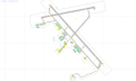
CYXU - London International Airport / London, Ontario, Canada
This airport update was made with the latest version of ADE (Airport Design Editor) and made for FSX as a replacement for the stock (default) airport. I've made several changes to the airport which are listed below. All these enchancements are as close to the real airport as I can get with stock library objects. I've used satellite images, terminal photos and maps throughout the whole process so building locations are as accurate as possible. Happy landings in the beautiful Canada!
Features:
*Expanded parking apron
*Main terminal building with its jetways and regional jet parking area
*Seperate parking aprons for GA traffic
*Hangars and other airport buildings added
*Airport vehicles and objects throughout the airport
*Parking lots with static vehicles
*Airport fire station with fire trucks
*De-icing vehicles/runway plows
*Cargo ramp
*Helipad
*Diamond Aircraft Industries building/apron
| Filename: | CYXU__London_International_Airport__London_Ontario.zip |
| License: | Freeware |
| Added: | 28th July 2012, 08:41:55 |
| Downloads: | 956 |
| Author: | Jaison Diaz / Endeavour ai |
| Size: | 128.88 KB |
| Category: Flight Simulator 2004 - Scenery | |
| CYPR - Prince Rupert - British Columbia, Canada 2012 |
|
Images related to this file:
File Description:
Another nice little B.C. airport. Remember, all our sceneries are raised cage free and are gluten free.
| Filename: | CYPR__Prince_Rupert__British_Columbia_Canada__2012.zip |
| License: | Freeware |
| Added: | 2nd March 2013, 10:53:51 |
| Downloads: | 1,063 |
| Author: | Sidney Schwartz |
| Size: | 1.69 MB |
| Category: Flight Simulator 2004 - Scenery | |
| CYHD - Dryden Regional - Ontario, Canada * Updated v2 * |
|
Images related to this file:
File Description:
This greatly modifies my previous (2009) post of Dryden; this version has bespoke buildings and is stand-alone and does not require you to have the previous post. There will also be follow-up posts of Sioux Lookout and Geraldton. Dryden is in northern Ontario, 110 miles east of the Manitoba border, 40 miles west of Sioux Lookout, and with the US border 90 miles to the south. The town is on the northern shore of Wabigoon Lake and has a population of around 7,800. The main business is pulp and paper, along with agriculture, tourism, and mining. The airport is 5 miles northeast of the town.
Dryden Regional has 6,000' of asphalt which in FS9 is aligned 11-29. The second runway is compacted sand 2,000' long and aligned 05-23. There are two aprons, the western being for the terminal building and some ga parking, and the eastern larger and used in the summer for parking fire fighting planes, along with maintenance hangarage and accomodation etc. The Ontario Fire Service planes were included with my original Geraldton post and are included here again; they fly back and forth and keep Dryden busy along with several Bearskin Airlines and Perimeter Aviation flights.
| Filename: | CYHD__Dryden_Regional__Ontario_Canada___Updated_v2.zip |
| License: | Freeware, limited distribution |
| Added: | 16th March 2013, 09:59:52 |
| Downloads: | 595 |
| Author: | Roger Wensley |
| Size: | 26.99 MB |
| Category: Flight Simulator X - Scenery | |
| (CZBM) Roland-Desourdy Airport - Bromont, Quebec, Canada |
|
Images related to this file:
File Description:
This scenery is a rendition of Bromont (CZBM) airport using GMAX.
Previously known as the Aeroport des Cantons de l Est, as of May 2012, this regional airport is now officially renamed Roland-Desourdy Airport.
A 5000' X 100' runway;
Paved parking for aircrafts;
A 190' X 100' hangar;
Runway lighting system;
Visual approach landing system;
Instrument approach system;
100LL and Jet fuel;
Rotating beacon;
Air to ground communications (UNICOM).
| Filename: | CZBM_RolandDesourdy_Airport__Bromont_Quebec_Canada.zip |
| License: | Freeware, limited distribution |
| Added: | 23rd December 2012, 15:57:03 |
| Downloads: | 2,528 |
| Author: | Pierre Gallant |
| Size: | 7.09 MB |
| Category: Flight Simulator 2004 - Scenery | |
| Peawanuck CYPO / Winisk CYWN - Northern Ontario, Canada |
|
Images related to this file:
File Description:
Peawanuck is on the bank of the Winisk River, 23 miles upstream from where the river empties into the Hudson Bay just west of James Bay. It has a population of around 240, and was established in 1986 when the original settlement (Winisk) at the mouth of the river was destroyed by a flood. The airport is on a bluff in a corner of the river at 171 feet ASL, with a gravel runway just over 3,500 feet long and aligned 11-29. There is only basic runway lighting, with no ILS, VASI, or PAPI; there is also no apron lighting, or fuel. Service is provided by Air Creebec with connector flights to Moosonee and Timmins, and on to Montreal. A search of their timetable did not provide any information regarding timings but I made the AI flight from Timmins a daily one; it is probably only once or twice a week. There is also a daily private Cessna from Moosonee. Winisk, at the mouth of the river, has another gravel runway which is over 6,000 feet long. There is also a large hangar and to the north the remaining buildings and fuel tanks etc of a Radar Control site which was closed in 1965 after only 7 years of use.
| Filename: | Peawanuck_CYPO__Winisk_CYWN__Northern_Ontario_Cana.zip |
| License: | Freeware, limited distribution |
| Added: | 29th December 2012, 09:14:03 |
| Downloads: | 281 |
| Author: | Roger Wensley |
| Size: | 2.61 MB |
| Category: Flight Simulator 2004 - Scenery | |
| Lady Franklin Point CWLF in Nunavut, Canada |
|
Images related to this file:
File Description:
Lady Franklin Point was a DEW line station on the southwest corner of Victoria Island, and then a North Warning System station until January 2000 when there was a fire. As a result there are now no NWS buildings, and no central long DEW line station building, only the outlying and already unused buildings from the DEW line site. However, the runway is still there and over 5,000 feet of gravel in length, aligned and signed 90T/270T, though on the atc it will be called 55/235 as FS9 knows nothing about the Canadian Northern Domestic Airspace. There is no runway lighting. Kugluktuk is around 80 miles to the southwest, on the mainland.
I should have mentioned a long time ago that to see the apron lights working (on my fields that HAVE apron lights) requires you to have the "lights_ss_v2" by Sidney Schwartz installed.
| Filename: | Lady_Franklin_Point_CWLF_in_Nunavut_Canada.zip |
| License: | Freeware, limited distribution |
| Added: | 10th November 2012, 04:04:06 |
| Downloads: | 260 |
| Author: | Roger Wensley |
| Size: | 1.81 MB |


© 2001-2026 AVSIM Online
All Rights Reserved
Privacy Policy |