
Where Flight Simulation Enthusiasts Gather from Around the World!
AVSIM Library - Search Results

| Category: Flight Simulator 2004 - Scenery | |
| PABA - Barter Island (Kaktovik) - Alaska North Slope 8 |

|
Images related to this file:
File Description:
The town of Barrow is in the far north of Alaska, and these are coastal villages or radar installations to the west, south, and now east of Barrow. There will be further additions. Barter Island is a DEW station Air Force base 310 miles east of Barrow and 75 miles east of Bullen Point. The runway is just under 5,000 feet of gravel and aligned 06-24 on a spit of land at the northeast corner of the island. The big hangar is still there on the apron. Most of the DEW buildings have now been removed but this scenery is dated around 2005 when there were more of them still there. Between the DEW station and the airstrip is the village of Kaktovik, with a population of some 300 mainly traditional Inupiat. The village was first pioneered when the DEW station was built in the 1950's and grew as the years passed. The FS9 error discovered when making this scenery was that FS9 had mistakenly "placed" Kaktovik at Bullen Point (not physically, it was just wrongly stated as the local town); this is now only partly corrected as FS9 refused to accept my Bullen Point revision but allowed me to associate Kaktovik with Barter Island. Kaktovik is definitely on Barter Island. I could also mention that the runway was in the sea, but there isn't much point in that as Bill would say it was all the fault of Ultimate Terrain, so I won't bother. The next DEW station to the east is in Canada and called Komakuk; this has already been made and posted. The next in this series will be far to the west. The AI has daily flights by ERA, plus Northern Air Cargo, and some GA.
| Filename: | PABA__Barter_Island_Kaktovik__Alaska_North_Slope_8.zip |
| License: | Freeware, limited distribution |
| Added: | 19th July 2016, 17:49:16 |
| Downloads: | 208 |
| Author: | Roger Wensley |
| Size: | 3.42 MB |
| Category: Flight Simulator 2004 - Scenery | |
| Nanisivik CYSR and Arctic Bay CJX7 in Nunavut, Canada |
|
Images related to this file:
File Description:
Nanisivik is an airfield in the north of Baffin Island, 470 miles north of the Arctic circle. It was built to service a zinc and lead mine that was opened in 1976 as Canada's first Arctic mine, now closed and dismantled. The deep water Strathcona Sound has been ear-marked by the Canadian government for development as a naval base, so I have left the large ore storage shed and the jetty in place. The airfield is at 2,106 feet on the top of the Borden Peninsula hills with a lighted 6,400 feet of 150 feet wide gravel runway runway aligned 11/29. There is a terminal and other maintenance buildings, and First Air have a building there from when the mine generated a lot of traffic and jets were used. Arctic Bay is a village 11 miles west of Nanisivik airfield with a population of around 690 which also uses the Nanisivik airfield. There is another gravel strip much closer to the village that is called Arctic Bay CJX7, but this is smaller with only 1,500' of 50' wide gravel and has no facilities of any sort. The village is partly dependent on visiting sports hunters and other limited tourist visits. At almost 73 degrees north the average year will have only four or even three months where the average high is above freezing. The buildings on the field have been modelled specifically for this scenery, and as in real life there is only JetA available. The AI visiting aircraft are a Kenn Borek Twin Otter and a First Air 42-300. As Nanisivik is in the "Northern Domestic Airspace" the runway is signed in "true" bearings and not magnetic as magnetic compasses become unreliable close to the magnetic pole.
| Filename: | Nanisivik_CYSR_and_Arctic_Bay_CJX7_in_Nunavut_Cana.zip |
| License: | Freeware, limited distribution |
| Added: | 28th May 2011, 19:59:18 |
| Downloads: | 495 |
| Author: | Roger Wensley |
| Size: | 2.64 MB |
| Category: Flight Simulator X - Scenery | |
| Kiwi360 (KiwiFruit Country)- Custom buildings, helipad, Hi Res photoreal, Aerius R22 Repaint. Te Puke, New Zealand |
|
File Description:
Kiwi360 (formally know as Kiwifruit Country) is a theme park based around the Kiwifruit (AK.A Chinese Gooseberry or Zespri- The trade name) which is a major export of New Zealand grown predominately in the Bay of Plenty Region. The park is situated about midway between Tauranga and Whakatane, about 5km east of the township of Te Puke.
The Bay of Plentys sunny climate ensures good growing conditions for the delicious fruit and has also spawned a mini tourist industry of tours of the orchards and sorting/packing/coolstores. These include tourist flights by Aerius (http://www.aerius.co.nz ) using a Robinson R44 helicopter.
This scenery was made after a visit when carrying out a GPS survey: I took a few photos and whacked it up. It isn't perfect but will be useful for flights in small helos (I.e. Robinson R22, R44 or Hughes 300/269).
It includes the famous giant Kiwifruit slice, the helipad next to it; the main Kiwi 360 building; a large coolstore/packhouse and the backpackers next to the park. It also includes a lot of library objects (especially trees- If these are adversely affecting performance, you can disable this bgl)
This is placed on a high resolution aerial photo provided by Environment Bay of Plenty.
The scenery also has reflection maps and night maps for those who like getting up at the crack of dawn or simulating frost protection work (although I don't believe the pad is certified for night operations in real life).
The download also includes a repaint of the default Robinson R22 in the colours of ZK-HJZ (in actual fact an R44) kindly provided by James Eden from the ARNZ Forums (see the readme for the .cfg entry to add this repaint)
This helipad isn't in controlled airspace but Tauranga Tower is nearby and will need to be called before entering their airspace (above 2500ft LL for the CTA or within about 10nm of Tauranga for the CTZ) Radio procedures are carried out on Christchurch Information 125.5 for flight following/planning.
| Filename: | Kiwi360_KiwiFruit_Country_Custom_buildings_helipad.zip |
| License: | Freeware, limited distribution |
| Added: | 29th June 2008, 06:05:29 |
| Downloads: | 2,455 |
| Author: | Tim Barnes, James Eden |
| Size: | 11.63 MB |
| Category: Flight Simulator 2004 - Scenery | |
| EPGO Goraszka 2010 - The Airshow Challenge |
|
Images related to this file:
File Description:
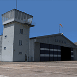
EPGO Goraszka 2010 - The Airshow Challenge is a freeware, extremely detailed scenery of a general aviation airport located 12nm (20km) south-east of Warsaw downtown and Warsaw Frederic Chopin International Airport, Poland. EPGO Goraszka airfield was built in 1994 and currently belongs to a General Aviation company, which offers aero-taxi flights, air transport and special flights (air photo, patrol) and airport services. The airport has a 800m-long runway and a lightened helipad, which can be used by helicopters of up to 5700kg weight. General Aviation's fleet includes Antonov AN-2, PZL-104 Wilga 80, Bell 407 and 427. Since 1996 the International Air Picnic Goraszka is organized every year by the "Polish Eagles" foundation created on initiative of Zbigniew Niemczycki.
The scenery is equipped with an automatic installer. Currently we support a safe, manual way of adding new sceneries to the Scenery Library in Flight Simulator. This is just one thing users need to do for themselves. Detailed instructions will be given during the installation process.
Scenery features:
-Compatible with FS2004 only
-Highest level of accuracy in geographic positioning, modeling and texturing
-Incredibly high quality photoreal textures of all airport buildings. Textures are based on over 300 real world -photographs made for this project.
-Hundreds of 3D objects like tents, exhibitions, airport buildings and surrounding buildings
-Life in the airport: people and cars will enhance your feelings
-AI traffic, animations and effects, designed specifically for FS2004
-Some buildings include interior (control tower)
-High quality aerial photos of the airport surroundings (5 seasons + night) with autogen and water mask
-Ultra high quality aerial photos of the airport (with seasons)
-Plain airport scenery with no airshow objects available too (details in the manual)
-Product includes manual and airport charts in PDF format
EPGO Goraszka 2010 - The Airshow Challenge scenery is compatible with almost every payware add-on, including Ultimate Terrain Eastern Europe and Warsaw Photo Scenery by Simdesign.
Scenery by Drzewiecki Design - www.drzewiecki-design.net
| Filename: | EPGO_Goraszka_2010__The_Airshow_Challenge.zip |
| License: | Freeware |
| Added: | 14th July 2010, 09:49:07 |
| Downloads: | 3,752 |
| Author: | Drzewiecki Design - Stanislaw Drzewiecki, Jakub Paczek |
| Size: | 132.03 MB |
| Category: Flight Simulator X - Scenery | |
| Victoria, Canada including US Southern Gulf Islands and San Juan Islands - Part 1 of 2 |
|
Images related to this file:
File Description:
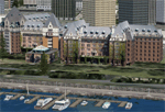
FSX-only version of Victoria, Canada area scenery including the Southern Gulf Islands and the San Juan Islands of the US. Includes automated installer and configurator by Scot Fraser.
Features:
-accurate shorelines, lakes and streams;
-landclass;
-FSX multi-LOD mesh with 10m maximum resolution;
-complete road network with moving traffic;
-railroads;
-utility corridors;
-marinas and ferry terminals;
-many static boats, including a custom model of the Canada Coast Guard ship Sir Wilfred Laurier;
-detailed models of major buildings and the Ogden Point Terminal;
-many bridges;
-nearly 300 marine lights; and corrected antennae locations.
Facilities include Don Grovestine's famous CYYJ (Victoria International Airport); 12 other Canadian land-based airports: Butler Field, Duncan (CAM3), Gaines, Hastings, Hudson Island, James Island, Thomas, Village Bay, Raven Field (CML2), Saltspring, Sidney Island, Whiskey Point; 20 US airports Blakely (38WA), Burden (61WA), Center Island (79WA), Clam Harbor (WA35), Crane Island, Decatur Shores (WN07), Decatur-Jones (WA18), Waldronaire (90WA), Orcas Island (KORS), Friday Harbour (KFHR), Lopez Island (S31), Pile Point, Roche Harbor (WA09), Shaw Island, Stuart Island Airpark (7WA5), Stuart Island West (2WA3), Wilding (6WA5), Windsock (4WA4); 12 floatplane facilities: Bedwell (CAB3), Fisherman's Bay (WA81), Friday Harbor (W33), Ganges (CAX6), Maple Bay, Mayne (CAW7), Port Washington (CAP8), Roche Harbor (W39), Rosario (W49), Shawnigan Lake (CAV8), Victoria Harbour (CYWH), Victoria International (CAP5) and Westsound, Orcas (WA83) - many with AI traffic; 9 heliports: Ganges (CAL7), Mayne (CBF5), Camel Point (CBF7), Jubilee (CBK8), Victoria General (CBW7) Madrona Bay (CBW9), Shoal Point (CBZ7), Mount Belcher (CMBH).
AI models include the DHC-2 floatplane in local liveries, a cruise ship model (by Mitsuya Hamaguchi) and two repaints, pilot boat, and small boats (by Larry Silsbee).
Ultimate Terrain X compatible (not required). Users of Vancouver+ for FSX will also get additional cruise ship traffic and additional floatplane and helicopter traffic. Full documentation. By Don Grovestine, Jon Patch and Holger Sandmann. Many other contributors: see documentation. Part 1 of 2 - you also need file vicenh7b.zip
| Filename: | Victoria_Canada_including_US_Southern_Gulf_Islands.zip |
| License: | Check within download |
| Added: | 29th January 2010, 21:23:17 |
| Downloads: | 23,161 |
| Author: | Don Grovestine, Jon Patch and Holger Sandmann |
| Size: | 56.8 MB |
| Category: Flight Simulator X - Scenery | |
| Victoria, Canada including US Southern Gulf Islands and San Juan Islands - Part 2 of 2 |
|
Images related to this file:
File Description:
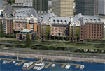
FSX-only version of Victoria, Canada area scenery including the Southern Gulf Islands and the San Juan Islands of the US. Includes automated installer and configurator by Scot Fraser.
Features:
-accurate shorelines, lakes and streams;
-landclass;
-FSX multi-LOD mesh with 10m maximum resolution;
-complete road network with moving traffic;
-railroads;
-utility corridors;
-marinas and ferry terminals;
-many static boats, including a custom model of the Canada Coast Guard ship Sir Wilfred Laurier;
-detailed models of major buildings and the Ogden Point Terminal;
-many bridges;
-nearly 300 marine lights; and corrected antennae locations.
Facilities include Don Grovestine's famous CYYJ (Victoria International Airport); 12 other Canadian land-based airports: Butler Field, Duncan (CAM3), Gaines, Hastings, Hudson Island, James Island, Thomas, Village Bay, Raven Field (CML2), Saltspring, Sidney Island, Whiskey Point; 20 US airports Blakely (38WA), Burden (61WA), Center Island (79WA), Clam Harbor (WA35), Crane Island, Decatur Shores (WN07), Decatur-Jones (WA18), Waldronaire (90WA), Orcas Island (KORS), Friday Harbour (KFHR), Lopez Island (S31), Pile Point, Roche Harbor (WA09), Shaw Island, Stuart Island Airpark (7WA5), Stuart Island West (2WA3), Wilding (6WA5), Windsock (4WA4); 12 floatplane facilities: Bedwell (CAB3), Fisherman's Bay (WA81), Friday Harbor (W33), Ganges (CAX6), Maple Bay, Mayne (CAW7), Port Washington (CAP8), Roche Harbor (W39), Rosario (W49), Shawnigan Lake (CAV8), Victoria Harbour (CYWH), Victoria International (CAP5) and Westsound, Orcas (WA83) - many with AI traffic; 9 heliports: Ganges (CAL7), Mayne (CBF5), Camel Point (CBF7), Jubilee (CBK8), Victoria General (CBW7) Madrona Bay (CBW9), Shoal Point (CBZ7), Mount Belcher (CMBH).
AI models include the DHC-2 floatplane in local liveries, a cruise ship model (by Mitsuya Hamaguchi) and two repaints, pilot boat, and small boats (by Larry Silsbee).
Ultimate Terrain X compatible (not required). Users of Vancouver+ for FSX will also get additional cruise ship traffic and additional floatplane and helicopter traffic. Full documentation. By Don Grovestine, Jon Patch and Holger Sandmann. Many other contributors: see documentation. Part 2 of 2 - you also need file vicenh7a.zip
| Filename: | Victoria_Canada_including_US_Southern_Gulf_Islands.zip |
| License: | Check within download |
| Added: | 29th January 2010, 21:21:49 |
| Downloads: | 23,165 |
| Author: | Don Grovestine, Jon Patch and Holger Sandmann |
| Size: | 59.08 MB |
| Category: Flight Simulator X - Aircraft Repaints, Textures and Modifications | |
| Airbus A318 FD Special Version V3 - Complete Pack |
|
Images related to this file:
File Description:

This is the new version of my Airbus A318 with the Panel in V3 opened on the A321. I remind you that this aircraft is based on the Project Airbis A318, with an ehanced panel based on the work of stefan Liebe.
This latest development can see the more realistic Airbus available as freeware. With a new version of the panel, the aircraft has a 100% cold & dark Status at the start of a flight, a real fuel system management with all valves, piumps and crossfeed work, the complete Bleed circuit with X-bleed, a real engines manual startup procedure like the real aircraft. I have also ehanced the navigation display with TCAS function in ARC and NAV mode; There is also the engines failure procedure to work (fire, oil leaks....) and many improved function that I cannot describe here. The aircraft comes with user manual in English and in French, and it is essantial to read it before you fly.
All the functions of the V2 have been kept and improved, like the vertical navigation gauge, the terrain radar map on the navigation display, the autolanding function, the SFCC. Aircraft comes with 6 liveries (Air France and 5 Frontier liveries realized by Project Airbus Team). This version is only in CFm engines, but with real engine data (CFM56-5B9). Now, the Fly By wire works in 2 modes: "Normal Law" and "Direct Law". I put 300 hours into the development of this panel and I hope that you will like it. In the coming weeks, I will adapt this panel to the A319 V2 and A320 V2, that are the these are the last aircrafts that I must update with this new panel. Please, note that this panel is the v3.05 version, witch fixes the bugs of the first version that came with the A321 (there is an update panel for the A321). Francois Dore
| Filename: | Airbus_A318_FD_Special_Version_V3__Complete_Pack.zip |
| License: | Freeware, limited distribution |
| Added: | 17th June 2012, 13:18:21 |
| Downloads: | 19,607 |
| Author: | Francois Dore, Project Airbus |
| Size: | 110.04 MB |
| Category: Flight Simulator X - Scenery | |
| EPGO Goraszka 2010 - The Airshow Challenge |
|
Images related to this file:
File Description:
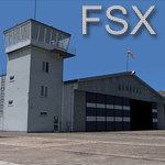
EPGO Goraszka 2010 - The Airshow Challenge is a freeware, extremely detailed scenery of a general aviation airport located 12nm (20km) south-east of Warsaw downtown and Warsaw Frederic Chopin International Airport, Poland. EPGO Goraszka airfield was built in 1994 and currently belongs to General Aviation company, which offers aero-taxi flights, air transport and special flights (air photo, patrol) and airport services. The airport has a 800m-long runway and a lightened helipad, which can be used by helicopters up to 5700kg weight. General Aviation's fleet includes Antonov AN-2, PZL-104 Wilga 80, Bell 407 and 427. Since 1996 the International Air Picnic Goraszka is organized every year by "Polish Eagles" Foundation created on initiative of Zbigniew Niemczycki.
The scenery is equipped with an automatic installer. Currently we support a safe, manual way of adding new sceneries to Scenery Library in Flight Simulator. This is just one thing users need to do for themselves. Detailed instructions will be given during the installation process.
Scenery features:
-Compatible with FSX only
-Highest level of accuracy in geographic positioning, modelling and texturing
-Incredibly high quality photoreal textures of all airport buildings. Textures are based on over 300 real world -photographs made for this project.
-Hundrieds of 3D objects like tents, exhibitions, airport buildings and surrounding buildings
-Life in the airport: people and cars will enchance your feelings
-AI traffic, animations and effects, designed specifically for FSX
-Some buildings include interior (control tower)
-High quality aerial photos of the airport surrondings (5 seasons + night) with autogen and water mask
-Ultra high quality aerial photos of the airport (with seasons)
-Plain airport scenery with no airshow objects available too (details in the manual)
-Product includes manual and airport charts in PDF format
EPGO Goraszka 2010 - The Airshow Challenge scenery is compatible with almost every payware add-on, including Ultimate Terrain Eastern Europe and Warsaw Photo Scenery by Simdesign. Scenery by Drzewiecki Design - www.drzewiecki-design.net .
| Filename: | EPGO_Goraszka_2010__The_Airshow_Challenge.zip |
| License: | Freeware |
| Added: | 16th July 2010, 12:31:42 |
| Downloads: | 4,713 |
| Author: | Drzewiecki Design - Stanislaw Drzewiecki, Jakub Paczek |
| Size: | 237.18 MB |
| Category: Flight Simulator X - Aircraft Repaints, Textures and Modifications | |
| FSX/P3D Thomas Ruth Air Leisure Egypt SU-GBM Airbus A340-212 |
|
Images related to this file:
File Description:

(TEXTURES ONLY)
(ONLY TESTED IN FSX: STEAM EDITION)
This was requested by Ahmed Fouad on the Facebook as well as in Flightsim. This has been requested by him for a while so I decided to do it.
Happy New Years guys! This is my first livery for the year. Sadly, as of writing this, Flightsim just went offline for renovation and may stay like that for who knows how long. Could be days, weeks, or even months.
I used the placards from Joey_C's Dragonair A330-300 Livery for the Bulk Cargo Doors as well as the Cargo Door Levers. He is the same user I asked permission from to use his decals and door placards for my Dragonair Cargo 747-300SF Livery, so thanks to him again for letting me borrow his textures with his permission! You should also check out his page if you like flying with X-Plane!
I spent a few hours on this livery just by doing the logo alone. Since I needed a high quality photo of the tail logo, I used OpenAI's ChatGPT to upscale the logo and it did, though the edges still look very pixelated. So I spent a few hours trying to re-draw every line so it could be the highest quality as possible.
I further spent the entire day trying to find photos of the cargo door placards, specifically the "CARGO DOOR OPERATIONS" Instructions text. In real life, it included both in English and Arabic. I tried looking for a photo of the instructions for hours until I found it on a YouTube Shorts video. Then I used that as a reference which also took me a few hours trying to make lines, outlines, and text for it. I didn't want to spend more time doing the same thing for the Arabic text, so I used ChatGPT to translate all of the text and I just remove the background using DXTBMP.
Instructions and more information are included in the readme file.
| Filename: | FSXP3D_Thomas_Ruth_Air_Leisure_Egypt_SUGBM_Airbus_.zip |
| License: | Freeware |
| Added: | 3rd January 2026, 14:44:37 |
| Downloads: | 37 |
| Author: | Ryubunao |
| Size: | 79.81 MB |
| Category: Flight Simulator 2004 - Scenery | |
| Bethel: Yukon Area |
|
Images related to this file:
File Description:
This presumes you have already installed Bethel PABE, Bethel Local Airfields, and Bethel St Mary's. In the Yukon River area of Alaska to the north of Bethel and to the south around the equally wide (but shorter) Kuskowim River there are small villages, served by flights from both Bethel PABE and St Mary's PASM. These villages are dependent upon fishing for survival, and in this flat and very wet terrain are equally dependent upon the gravel runways that link them to the outside world. There are no surfaced roads, and the rivers and their tributaries wind into the distance and are impractical delivery routes except from nearby places. In an area 300 miles by 200 miles most places cannot be described as "nearby". This post is of the small villages, including those previously posted; I had missed on picking up some terrain conflicts between nighttime grass and town textures. They are corrected here and included along with new airfields. Bethel and St Mary's are also reposted to include the further enlargement of parking for the increased number of small AI aircraft. These smaller airfields vary in quality; some have runway signage but most do not, and while some have two or even three hangars/garages/terminal buildings on the apron there are others who have none at all. The 39 small airfields included here are as listed:
Akiak AKI, Akiakchak Z13, Alakanuk AUK, Anvik PANV, Atmautluak 4A2, Cape Romanzof PACZ, Chefornak PACK, Chevak VAK, Eek EEK, Emmonak PAEM, Goodnews GNU, Grayling KGX, Holy Cross HCA, Hooper Bay PAHP, Kako 9AK2, Kalskag KLG, Kasigluk Z09, Kipnuk PAKI, Kongiganak PADY, Kotlik KOT, Kwethluk KWT, Kwigillingok A85, Marshall MLL, Mountain Village MOU, Napakiak WNA, Napaskiak PKA, Newtok PAEW, Nightmute IGT, Nunapichuk 16A, Pilot Station 0AK, Quinhagak PAQH, Russian Mission RSH, Scammon Bay SCM, Shageluk SHX, Sheldon Point SXP, Toksook Bay OOK, Tuluksak TLT, Tuntutuliak A61, Tununak 4KA.
I am currently going through the airfields again to check if further modifications are required, and I am also adding a few new ones. As I am going to be updating my computer I am posting now, complete or not, and I will post an update later of further additions.
| Filename: | Bethel_Yukon_Area.zip |
| License: | Freeware, limited distribution |
| Added: | 3rd May 2019, 17:20:53 |
| Downloads: | 170 |
| Author: | Roger Wensley |
| Size: | 6.3 MB |


© 2001-2026 AVSIM Online
All Rights Reserved
Privacy Policy |