
Where Flight Simulation Enthusiasts Gather from Around the World!
AVSIM Library - Search Results

| Category: Flight Simulator X - Utilities | |
| FS Earth 5.2 for Google Earth and FSX |

|
Images related to this file:
File Description:
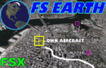
This program acts as a link between Flight Simulator X and Google Earth, letting to follow a flight in real time, over the satellite images generated by Google Earth. Flights can be saved, and many options are available for fine tuning the performance, as well as the map's style (zoom, tilt, orientation). Works on a single computer running FSX and Google Earth all together or, for best experience, can be used on two networked computers running respectively FSX (master) and Google Earth (slave). AI and Multiplayer traffic is also displayed in Google Earth, with course prediction and other information. Requires Flight Simulator X and Google Earth. The program running in trial mode works only around Anchorage, Alaska, (PANC / ANC) for a maximum of five minutes per flight session. Version 5.2 has new aircraft icons & labels and improves the compatibility with Windows Vista. A version for FS2004 is available also.
| Filename: | FS_Earth_52_for_Google_Earth_and_FSX.zip |
| License: | Shareware, time limited |
| Added: | 3rd May 2010, 07:38:23 |
| Downloads: | 2,701 |
| Author: | Luciano Napolitano |
| Size: | 3.46 MB |
| Category: Flight Simulator X - Utilities | |
| FS Earth 4.2 for Google Earth |
|
File Description:
This program acts as an interface between Flight Simulator X and Google Earth, letting to follow a flight in real time, over the satellite images generated by Google Earth. Flights can be saved, and many options are available for fine tuning the performance, as well as the map's style (zoom, tilt, orientation). Works on a single computer running FSX and Google Earth all together or, for best experience, can be used on two networked computers running respectively FSX (master) and Google Earth (slave). AI and Multiplayer traffic is also displayed in Google Earth, with course prediction and other information. Requires Flight Simulator X and Google Earth. The program running in trial mode works only around Anchorage, Alaska, (PANC / ANC) for a maximum of five minutes per flight session. Version 4.2 has improved compatibility with Windows Vista and minor bug fixes. A version for FS2004 is available also. By Luciano Napolitano.
| Filename: | FS_Earth_42_for_Google_Earth.zip |
| License: | Shareware, time limited |
| Added: | 9th March 2007, 13:39:05 |
| Downloads: | 2,213 |
| Author: | Luciano Napolitano |
| Size: | 2.44 MB |
| Category: Flight Simulator 2004 - Original Aircraft | |
| Piaggio PD-808GE |
|
File Description:
NEEDS FS9_pd808rm.ZIP TO WORK. THIS PACKAGE DOES NOT INCLUDE THE NEEDED PANEL, GAUGES AND SOUNDS.
This is a complete simulation of the Piaggio PD-808. It includes advanced engine management, realistic systems, and some failure modeling. The model features a complete 3-D virtual cockpit,and a 2-D panel. The external model features all typical animations plus a load of custom ones. Also incluides all custom special effects, including different selectable floodlights for the virtual cockpit (by simply flicking ON the proper light switch on the cockpit itself). Plus with a fly-on-the-numbers flight dynamics file. Includes full documentation. THIS IS THE FS-2004 RELEASE. IT WILL NOT WORK PROPERLY WITH FS-X. THERE IS ALSO A FS-X RELEASE THAT WILL NOT WORK PROPERLY WITH FS-2004. THis is the "GE" variant of the aircraft and requires the base package "FS9_PD808RM.zip" to work.
| Filename: | Piaggio_PD808GE.zip |
| License: | Freeware |
| Added: | 15th February 2009, 11:53:18 |
| Downloads: | 1,601 |
| Author: | Mario Noriega |
| Size: | 14.19 MB |
| Category: Flight Simulator X - Scenery | |
| Provincetown Municipal Airport (KPVC) |
|
Images related to this file:
File Description:
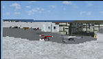
This airport was made using Airport Facilitator X, and Instant Scenery 2. Provincetown Municipal Airport is a small airport located in Provincetown, Massachusetts. Cape Air is the only airline that flies there. I added a more accurate terminal, and an aircraft hangar. I put three fuel trucks on the ramp with a fuel station. I made the taxiways the correct length and width. I also put static aircraft on the ramp and added more gates. I made a parking lot with many cars in it. If you choose to start off from a DOCK gate, you will start off inside the aircraft hanger. Taxiing or starting off inside of the hanger will cause a crash unless you have crashes turned off. This is all based on Google Earth and Bing Maps. Please read the readme for instructions on how to install. This is for Flight Simulator X only.
| Filename: | Provincetown_Municipal_Airport_KPVC.zip |
| License: | Freeware |
| Added: | 21st January 2012, 20:08:09 |
| Downloads: | 607 |
| Author: | Tyler Lawrence |
| Size: | 6.86 MB |
| Category: Prepar3D V1-4 - Scenery | |
| 5M9 - Marion-Crittenden Co. Airport |
|
Images related to this file:
File Description:
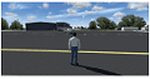
5M9 is a small publicly owned, single runway airport located 1 miles SW of Marion, KY, a small town in Western Kentucky. It has a single asphalt runway measuring 4400 x 75 feet. 100LL and Jet A fuel is available at a self-service pump and tiedowns are available. No other services are available at this airport. 5M9 has a very unique FBO/hanger.
| Filename: | 5M9__MarionCrittenden_Co_Airport.zip |
| License: | Freeware |
| Added: | 11th October 2017, 00:58:05 |
| Downloads: | 172 |
| Author: | Shannan Landreth |
| Size: | 48.62 MB |
| Category: Flight Simulator X - Aircraft Repaints, Textures and Modifications | |
| North American P-51B 325th FG #44 "Milwaukee County / Flossie" |
|
Images related to this file:
File Description:

This file contains a repaint for the Warbirdsim P-51B Fighter Leader X package, in the colors of North American P-51C-10-NT Mustang, #42-103596 Milwaukee County / Flossie II #44, flown by Lt. Paul Dowd, 318th FS, 325th FG, 15th AF, Italy, April 1944. The aircraft crash landed on 2 february 1945, with Lt Dowd walking away. Repaint by Jan Kees Blom.
| Filename: | North_American_P51B_325th_FG_44_Milwaukee_County__.zip |
| License: | Freeware |
| Added: | 2nd August 2018, 14:17:15 |
| Downloads: | 92 |
| Author: | Jan Kees Blom |
| Size: | 11.6 MB |
| Category: Flight Simulator X - Aircraft Repaints, Textures and Modifications | |
| North American P-51B RCAF 441 Sqn 9G-L |
|
Images related to this file:
File Description:
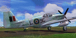
This file contains a repaint for the Warbirdsim P-51B Fighter Leader X package, in the colors of North American Mustang Mk.III, HB876 9G-L, which flew with RCAF 441 'silver fox' squadron between may and july 1945. HB876 was stripped of paint and thus was one of the few bare metal Mustangs of 441 Sqn. Repaint by Jan Kees Blom. Repaint by Jan Kees Blom.
| Filename: | North_American_P51B_RCAF_441_Sqn_9GL.zip |
| License: | Freeware |
| Added: | 2nd August 2018, 15:11:03 |
| Downloads: | 83 |
| Author: | Jan Kees Blom |
| Size: | 11.54 MB |
| Category: Flight Simulator 2004 - Panels | |
| Boeing 777 with Night Lighting |
|
File Description:
This panel incorporates night lighting which can be switched off to reveal a day textured panel. It also includes a comprehensive overhead panel with passenger sign switches, runway turnoff lights switch, engine starters, de-ice control, fuel x-feed, etc.. Uses default FS2004 gauges. Very frame-rate friendly. Reads well in both 1024x768 and 800x600 resolutions. All panel textures were created by the author.
| Filename: | Boeing_777_with_Night_Lighting.zip |
| License: | Freeware |
| Added: | 8th December 2004, 22:40:29 |
| Downloads: | 5,527 |
| Author: | Gabriel Gutierrez |
| Size: | 2.33 MB |
| Category: Flight Simulator X - Scenery | |
| CYNA Canada, Quebec, Natashquan |
|
Images related to this file:
File Description:
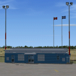
This scenery represents as much as possible the airport of Natashquan (CYNA). However, certain frontages of the buildings can farier, not having had the authorization to take photographs on the ground. This scene was built with FSDS and it is compatible for FS-X. Natashquan is located at Quebec, Canada on banks of the St-Laurent river. It is a small village of the Cote-Nord.
| Filename: | CYNA_Canada_Quebec_Natashquan.zip |
| License: | Freeware |
| Added: | 31st December 2009, 04:53:21 |
| Downloads: | 1,250 |
| Author: | Regis Dassylva |
| Size: | 4.53 MB |
| Category: Prepar3D V1-4 - Scenery | |
| LOGI-Airport |
|
Images related to this file:
File Description:
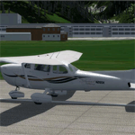
The airfield Trieben (LOGI) is certainly one of the best starting points for distance
flights in the Eastern Alps. Above all, the haul flights always made with more than 12
hours flight time and many flights over 1000km.
This airfield is transfered, with kind permission from Mr. Gerhard Scholz, from his x-plane Version with ADE.
have a look on his homepage http://www.x-plane.at.
| Filename: | LOGIAirport.zip |
| License: | Freeware |
| Added: | 4th October 2017, 03:30:45 |
| Downloads: | 457 |
| Author: | Karl Malle |
| Size: | 5.79 MB |


© 2001-2026 AVSIM Online
All Rights Reserved
Privacy Policy |