
Where Flight Simulation Enthusiasts Gather from Around the World!
AVSIM Library - Search Results

| Category: Flight Simulator 2004 - Scenery | |
| Hope Field near Ottawa Ontario, Canada |

|
Images related to this file:
File Description:
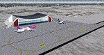
The field is newly included in the Canada Flight Supplement. Unusually for a grass field the runway has the numbers marked out in white; given that this is a private airfield that does not invite unexpected guests and has only one plane based there, and presuming that the owner can remember his own runway headings, it is unlikely that these will still be there in a year's time. There is no hangar as yet. To the west is highway 416 and to the east is the Rideau River, both of which run north-south. Lke Rockcliffe (which is to the north) the airfield is right on the edge of the Ottawa control zone, so you should already be below 1,500 feet ASL when approaching from the south and talking to Ottawa tower when arriving from the north. The runway is 07/25 and 2,800 feet long, which should be enough for almost anybody, and the field is at 315 feet ASL. Manotick is a mile to the north east on the Rideau River and the Rideau Valley Airpark CPL3 is six miles south in the bend of the Rideau where it turns west.
| Filename: | Hope_Field_near_Ottawa_Ontario_Canada.zip |
| License: | Freeware, limited distribution |
| Added: | 10th July 2010, 19:34:51 |
| Downloads: | 200 |
| Author: | Roger Wensley |
| Size: | 3.15 MB |
| Category: Flight Simulator X - Aircraft Repaints, Textures and Modifications | |
| 10th Anniversary 9/11 Tribute Boeing 747-8i |
|
Images related to this file:
File Description:
This will only work on the PMDG 747-8X. That means you must first own the 747-400x and buy the -8 expansion. This is the only aircraft this size and textures allowing this project to succeed so there will not be anymore of this version and it's only for the 747-8x.
This paint took me literally hundreds of hours. It's the hardest yet most rewarding effort I've ever done in a paint. It's the 10th Anniversary 9/11 Tribute. It has EVERY name of all that died that day. The names of the WTC victims are on the fuselage. The names of the Pentagon casualties are on the Right side tail. The engines have the aircraft broken down from flight crew and passengers. Keep in mind there are 4 sides to paint in the kit but 8 sides of a 4 engine plane in the sim. Therefore there are two of each and nothing anyone can do about.
Dedicated to all those that are missing their loved ones, all that died that day (and injured), and all the brave men and women that risked their lives and paid the highest of prices.
| Filename: | 10th_Anniversary_911_Tribute_Boeing_7478i.zip |
| License: | Freeware |
| Added: | 9th September 2011, 09:57:54 |
| Downloads: | 794 |
| Author: | Dan Prunier |
| Size: | 6.87 MB |
| Category: Flight Simulator 2004 - Panels | |
| F16 |
|
File Description:
FS2004 Panel, F16 Air Show Tour. The panel of this jet fighter has been designed for cross country flying to events worldwide. The 2D cockpit is packed with new gauges that complement this high performance, yet docile aircraft. All gauges, lights, etc. are functional, easy to read, and are panel installed except GPS 500. For long distance flights, the panel contains on-demand refueling capabilities for both ground and air operations. A few of the new gauges are; 180-degree scan navigational radar, triple mode interceptor-refueling-terrain radar, refueling gauge with command screen, fuel center with time/distance remaining computer, new Descentometer for Mach-plus aircraft, analog engine gauges including thrust and fuel efficiency, plus a hangar full of warning and indicator lights. The intercept mode of the ai-radar feeds info to the autopilot to assist in the rendezvous with tanker to allow all-weather, day or night air refueling. Digital data for AP, radio, altimeter, timer, and Descentometer is input via a central keypad. Acknowledge ATC instructions using joystick. Designed for use with Kirk Olsson's F16 Viper. Includes 15 page illustrated instructions plus Intercept and Refueling tutorial. By Glenn Copeland
| Filename: | F16.zip |
| License: | Freeware |
| Added: | 12th January 2007, 03:00:43 |
| Downloads: | 5,781 |
| Author: | Glenn Copeland |
| Size: | 1.83 MB |
| Category: Flight Simulator 2004 - Helicopters | |
| Bell UH-1D SAR-71 |
|
File Description:
Texture & Panel
In 1973, the Armed Forces' hospital in Hamburg also got a helicopter for EMS and SAR purposes. Ever since, this has been a Dornier Bell UH-1D aircraft. It's radio callname is ''SAR Hamburg 71'', also known more briefly as ''SAR 71''. For usual EMS purposes, Hamburg's fire brigade and EMS dispatch centre coordinates the helicopter's missions. Whenever an SAR task is to be done, the Air Force's RCC (Rescue Coordination Centre) in Muenster is responsible for ''SAR 71''. SAR missions are quite rare when compared to the number of aeromedical missions in EMS. Yet this is the most important job that ''SAR 71'' is responsible for so SAR missions will always be seen as more important task than medical emergencys."SAR 71" is mostly active in an area that is in no more than 80 kilometers of distance to the helicopter`s homebase. Any place which is located in this area can usually be reached by the aircraft within about 25 minutes of flight.
The SAR 71 has also a own serial on the Second German Televison ( http://www.zdf.de/ZDFde/inhalt/9/0,1872,2061609,00.html )
www.sar71.de
| Filename: | Bell_UH1D_SAR71.zip |
| License: | Freeware |
| Added: | 24th September 2005, 09:58:16 |
| Downloads: | 3,910 |
| Author: | Julian Schuengel |
| Size: | 5.89 MB |
| Category: Flight Simulator X - AFCAD Files | |
| ORBI - Baghdad Intl Airport - Baghdad, Iraq |
|
Images related to this file:
File Description:
ORBI - Baghdad International Airport, Baghdad, Iraq
Slowly but surely the Baghdad international airport comes back to life. Although the airport is quite large, it is not yet used to its maximum. Some aprons still have no real use and thus are empty. Apron V, the presidential apron, is still present but might have been restructured by now.
Airlines like Austrian, Emirates, Etihad, Royal Jordanian and FlyDubai offer regular services to Baghdad.
Using ADEx 1.51 and the IRAQ AIP this AFCAD updates the default airport to what it is now on paper. Google Earth�´s images are too old to offer any help regarding buildings, vegetation and surrounding areas like offices, parkings, roads and apron V.
Gatenumbers have been updated, taxiways added and renamed, ILS 15R/33L has been removed, the military area is more detailed, taxiways are correctly sized and the overall quality of the airport increased.
For those interested, the complete IRAQ AIP is attached. It not only gives complete information about several Iraqi airports, it also holds approach plates of most of them. You will also find plates for ORSU, for which an AFCAD has been uploaded separately.
| Filename: | ORBI__Baghdad_Intl_Airport__Baghdad_Iraq.zip |
| License: | Freeware |
| Added: | 10th August 2012, 16:53:26 |
| Downloads: | 3,241 |
| Author: | Menno C. Robert |
| Size: | 14.54 MB |
| Category: Flight Simulator X - Scenery Design | |
| Airfield Lights Toolbox (AFLT) |
|
File Description:
Airfield Lights Toolbox (or AFLT for short) is a comprehensive utility for the creation of standard airfield lights and light arrays for Microsoft Flight Simulator and Prepare3D v1.4 (collectively referred to as "FlightSim") airports. AFLT includes 3D models for the usual airfield light fixtures (runway/taxiway edge and centerline lights, runway threshold/end split lights, obstruction lights and beacons, PAPI/VASIs, wigwags and various approach light configurations) from which you should be able to create just about any airfield light arrangement. AFLT generates complete approach and threshold light arrays (including strobes) based on simple text configuration files. As well, pilot-control of airfield lighting is fully implemented.
The light sources in AFLT's light models are BGL_LIGHTs. Unfortunately, P3D Version 2 does not (yet) support BGL_LIGHTs and does not provide any alternative. (We had hoped that v2.1 would have fixed this, but "no joy". Hopefully, Lockheed Martin will see fit to rectify this deficiency.) Consequently, AFLT is only "P3Dv2-ready".
ALFT is not a library of airfield lights; it is a utility for creating object libraries and light arrays. A general knowledge of FlightSim scenery file organization and airport design is necessary for its use.
| Filename: | Airfield_Lights_Toolbox_AFLT.zip |
| License: | Freeware, limited distribution |
| Added: | 23rd February 2014, 01:21:14 |
| Downloads: | 1,793 |
| Author: | Don Grovestine |
| Size: | 3.85 MB |
| Category: Flight Simulator 2004 - Scenery | |
| Alaska South Slope 6; Shungnak SHG |
|
Images related to this file:
File Description:
There are four main northwestern Alaska towns which are serviced by Alaska Airlines, and from which local flights spread out. The northernmost is Barrow. Southwest of Barrow is Kotzebue, then Nome, and the furthest south is Bethel (not yet made). This is a continuation of the series for the flights from Kotzebue, 150 miles to the east where Shungnak is on the bank of the Kobuk River. The next addition will be a few miles further east, Kobuk and a strip just to the north of Kobuk. Shungnak is a small village, like Ambler, with a population of around 260 beside the Kobuk River, the river being the reason for the existance of the villages as it served (and still does) as both a source of food and a transport route. The airfield is just beside the village, with a runway around 4,000 feet of lit gravel and aligned 09-27, with PAPI on both ends. There are scheduled flights by Era (now renamed Ravn) and by Bering Air, both of them originating in Kotzebue and routing east to Ambler, Shungnak, Kobuk, and then back again. The AI includes these flights along with Everts Air and GA.
| Filename: | Alaska_South_Slope_6_Shungnak_SHG.zip |
| License: | Freeware, limited distribution |
| Added: | 12th October 2016, 23:18:32 |
| Downloads: | 210 |
| Author: | Roger Wensley |
| Size: | 1.99 MB |
| Category: Prepar3D V1-4 - Scenery | |
| EDJA Allgäu Memmingen (DE) - V1 |
|
Images related to this file:
File Description:
Airport: Allgäu (DE) EDJA V1
Release: January 2018
Simulation: P3D v4.1
This scenery is an update of the stock Airport (ICAO code: EDJA).
"Memmingen Airport (IATA: FMM, ICAO: EDJA), also known as Allgäu-Airport Memmingen, is an international airport in the town of Memmingerberg near Memmingen, in the Swabia region of Germany. It is the smallest of the three commercial airports in Bavaria after Munich Airport and Nuremberg Airport and has the highest altitude of any commercial airport in Germany. It is operated by Allgäu Airport GmbH & Co. KG, a limited partnership of 71 mostly local, medium-sized companies with only minor public shares.
Located about 3.8 km (2.4 mi) from the centre of Memmingen and 110 km (68 mi) from the city centre of Munich, it serves Memmingen and the Allgäu area and also provides a low-cost alternative to Munich Airport and therefore is sometimes referred to as Memmingen/Munich-West Airport or similar by some low-cost airlines, despite the fact that it is 110 kilometres from the centre of Munich. It mostly features flights to European leisure and some metropolitan destinations and handled nearly 1,18 million passengers in 2017."
Source: Wikipedia, the free encyclopedia
Link: https://en.wikipedia.org/wiki/Memmingen_Airport
What to expect?
The entire airport has been updated with correct RWY, Taxiways, APRON's, COMM's (ATIS, GND, TWR), markings and some objects. RWY 24 got it's ILS and go arround information acc. to the charts. The main Terminal is a custom building with custom day and night textures. Also all ground textures are custom made. Other objects INCLUDING the tower are from stock ADE!
In time I will add more custom buildings to further releases of this airport. Currently I have already started to work on the Tower building.
Ground textures will not receive shadows unless you turn "Buildings" receieve shadows to ON!
General:
I'm not a proffessional scenery builder or texture artist but I did try to do my best to update the stock Airport and offer it as freeware to the simming community. I have tested the scenery and did not find any issues with it. GSX services work, AI traffic with Ultimate Traffic Live works, COMM's work, APPR on ILS24 does work, and so on.
Entire work and object placing has been done using a photo overlay image from Google Earth, yet don't expect a photoreal scenery. The used background image has been removed due to Google's copyright policy.
Big thanks to the guys from FS Developer (Don, Arno) who I have kept busy during the birth of the scenery and those who offered the tools to build it (ADE, MCX, Sketchup, Gimp,...).
| Filename: | EDJA_Allgu_Memmingen_DE__V1.zip |
| License: | Freeware |
| Added: | 21st January 2018, 17:07:14 |
| Downloads: | 1,623 |
| Author: | Gerald Krutsch |
| Size: | 19.08 MB |
| Category: Flight Simulator 2002 - Helicopters | |
| Bell 47 G2 w/ Skids |
|
File Description:
This model was designed using GMAX, textures with DXTBmp. This model of the Bell 47 consists of more than 24.000 polygons and 35.000 vertices !!
It makes use of all the new technologies offered by the new flight simulator program FS2002.
6 liveries are now available,
More than 80 animated parts, full pilot movements, 4 axes for the main rotor; all animated controls levers and actuators...
Rotors animated aspect improved,
Reflecting glass and paints
And many others improvements
6 liveries available representing existing helicopters in France: F-BXXJ, F-BIEH, F-BUIG, F-BVFR,FMBDM and F-MAMB. They are all included in this package.
Sound:
The sounds were taken from a real Bell 47 flown by Air Action. My thanks to Max, Xavier and Vincent !
Photos:
Photos used for the pictures... a BIG Thank You to Max !
Specifications:
Height 2.84 m
Length 12.6 m
Width 2.88 m
Rotor diameter 10.70 m
Cruising speed : 70 Kts.
Maximum speed : 87 Kts
Speed at minimum power settings : 45 Kts
Maximum flying time : 2 hours 30 min.
Ceiling : 1500 m
Maximum weight : 1130 kg
Empty weight : 860 kg
Maximum cargo : 270 kg
Enginer : Lycoming VO 435
Power : 265 hp.
| Filename: | Bell_47_G2_w_Skids.zip |
| License: | Freeware |
| Added: | 20th November 2002, 13:13:37 |
| Downloads: | 5,659 |
| Author: | Jean-Marie MERMAZ |
| Size: | 11.17 MB |
| Category: Flight Simulator X - Aircraft Repaints, Textures and Modifications | |
| B-24 USAAF 801st PG "Black Zombie" |
|
File Description:
Wherever they were to be seen, the glossy black Consolidated B-24s of the 801st Provisional Group, based at Harrington in Great Britain, stood out like big full stops. The squadrons of this group dropped supplies and agents for the French Underground. They were known by the name 'Carpetbaggers'. This illustration is a machine of the 406th BS, one of the squadrons of the group.
This B-24H-15-CF, originally 'The Loretta Ann' of the 850th BS, 490th BG coded 'N-', transferred on 6th June 1944 to 391st BS, 34th BG coded 'I', and further transferred on 18th January 1945 to the 492nd BG 856th BS who sent it on detached service to the 406th BS(NL), NL being Night Leaflet. It survived the war and returned to the US, arriving on 11th July 1945. It was stored at Albuquerque from 10th August 1945 where it was later cut up for scrap. This particular aircraft was not a Carpetbagger per se and obviously wasn't engaged in agent or supply dropping but leaflet distribution over the Continent as the war ran down. Repaint for the Alphasim B-24 Liberator by Jan Kees Blom
| Filename: | B24_USAAF_801st_PG_Black_Zombie.zip |
| License: | Freeware |
| Added: | 21st September 2008, 22:24:49 |
| Downloads: | 331 |
| Author: | Jan Kees Blom |
| Size: | 7.92 MB |


© 2001-2026 AVSIM Online
All Rights Reserved
Privacy Policy |